September 25th, 2025. Rogers Pass, BC.
Round Trip: 10 Hours, 15km, Elevation Gain: 1600m
Difficult Scramble via Southwest Ridge
Further reading: David P. Jones (2012) Rogers Pass Alpine Guide
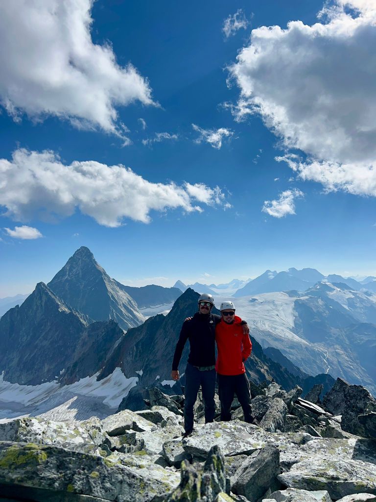
Tore, who had joined us up Mount Noyes the previous week, had completed an ascent of Avalanche Mountain via the 4th class rated Southwest Ridge earlier that season and highly recommended the route us. Bri was away hiking around Robson Provincial Park that week so I teamed up with our buddy Nathan for this one. Initially our plan was to ascend the 3rd class rated south face, we ended up somewhere between the south face and southwest ridge, nearer to the ridge but remained under the crest a fair distance to the climber’s right until near the summit where the terrain tapers back into the south ridge. As a result our route ended up being a mixture of 3rd and 4th class scrambling and to reflect that I’ve assigned the trip a difficult scrambling rating.
Our day started with Nathan experiencing some car troubles in Golden, which no doubt made for a stressful start to his day. Luckily he found a spot to park for the day and car pooled with me to the Illecillewaet campground. We were chasing a weather window with heavy rains and potential snow forecasted for the early evening hours, so knew that we would have keep up a brisk steady pace to avoid wet terrain on the return journey. Turns out quite a few people were also chasing this weather window as the Illecillewaet carpark was jammed pack and we were lucky to snag a spot.
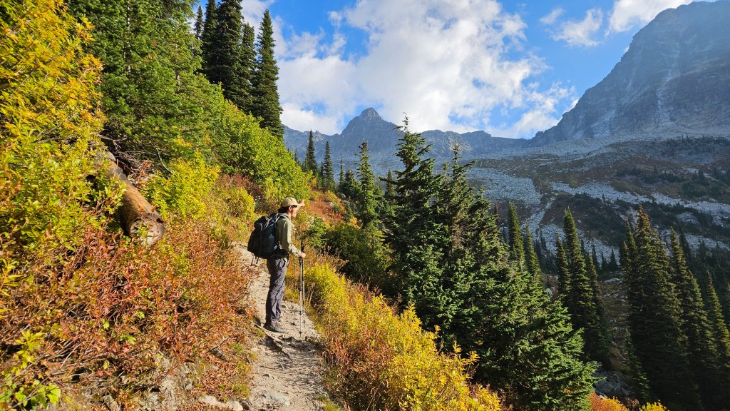
Despite Nathan’s car troubles in Golden we still managed to start the Avalanche Crest trail by 7:50am and made a rapid ascent of that hike. I had previously been to this southern part of Rogers Pass on numerous occasions but this was my first time hiking Avalanche Crest and it felt like a whole new corner of the Pass to me. No signs of inclement weather yet that morning and the temperatures were ideal for fast-paced hiking.
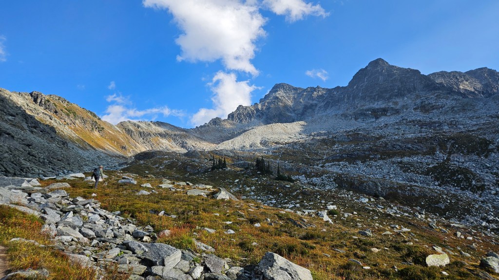
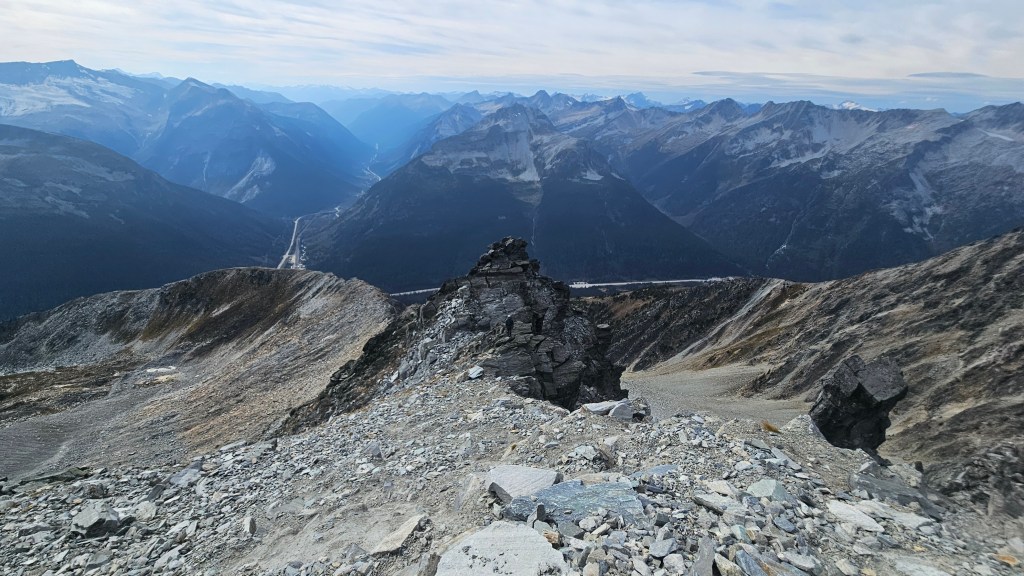
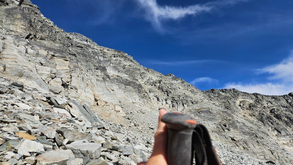
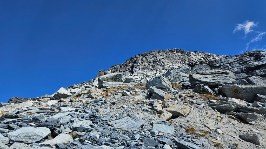
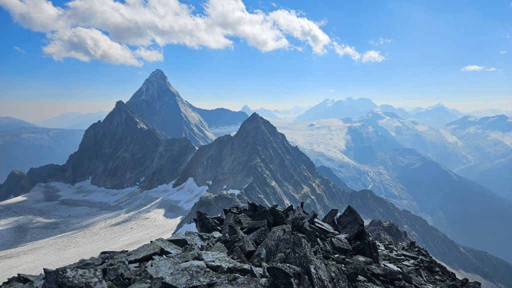
Once the moraine came into view we abandoned the crest trail and hiked across the tundra towards the south face. We took a decent break at the toe of the moraine and observed the various options for ascending Avalanche Mountain. Of note, the route was very foreshortened from the moraine and the summit a long way off above us. While the south face had been our original game plan, we ended up traversing across the lower moraine closer to the southwest ridge but stayed well below the ridge crest itself. We followed along a rubbly ledge under the crest up and across a steep gully towards a blocky set of grassy ledges. These ledges offer some variation for an ascent and can be potentially tackled straight up. We often were able to side skirt around to the climber’s right to avoided the steeper sections which kept the scrambling at a moderate level. Some route finding was involved as we didn’t see any cairns after leaving the ridge until later at the crux section.
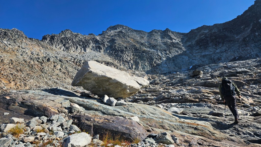
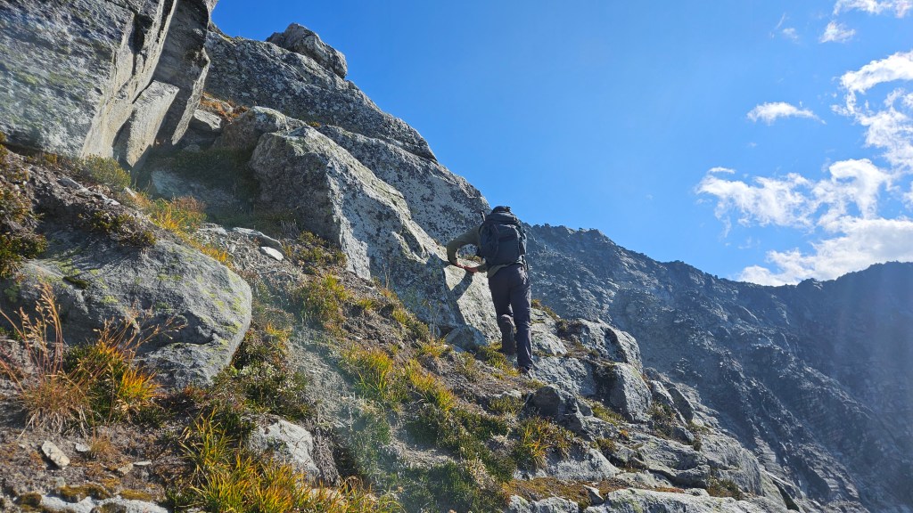
The further up we scrambled the more exposed these ledges became and we could see the need to trend to the climber’s left. Things became increasing more hands-on and a few ledges presented difficult scrambling moves. Above the grassy ledges the terrain became much more steeper and sustained in difficulty as we trended back to the southwest ridge into 4th class scrambling terrain. As with most routes in Rogers Pass, the rock quality is comparably better compared to peaks in the Rockies, and indeed remained good throughout our ascent. At some point along the way I thought I could hear a party behind us but any time we glanced back the only other people in our view were tiny specks on Avalanche Crest.
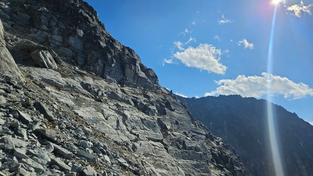
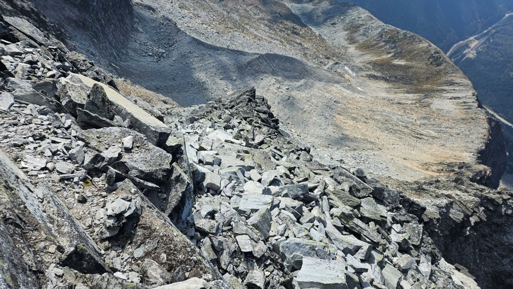
The crux for us ended up being an exposed ledge roughly twenty minutes beneath the summit where our route had nearly rejoined the southwest ridge crest. The only distinguishing feature of it for us was a cairn a the top of said ledge, and the ledge itself feeling very much 4th class for a couple meters. Above the “crux” we followed cairns for the remainder of the way to the summit. Again, somewhere near the “crux” I thought I could hear another party behind us but we still couldn’t see anyone and both brushed it off as the wind carrying sound from afar. On the note of the wind, it was picking up towards the top and brought a lot of dust up from the lower slopes with it. We often had to mask up with our buffs to keep the grit out of our teeth and nose.
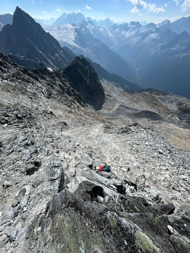
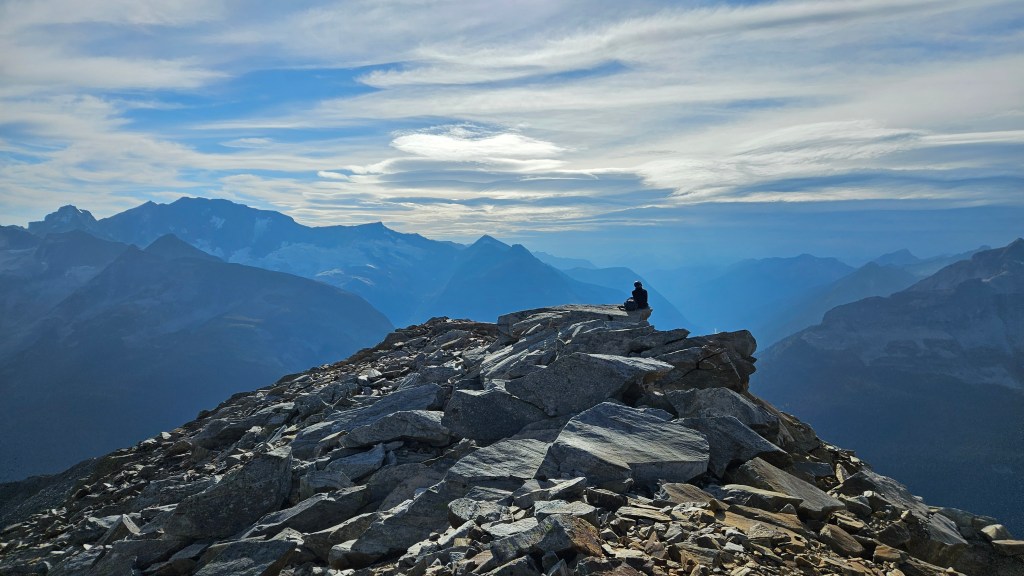
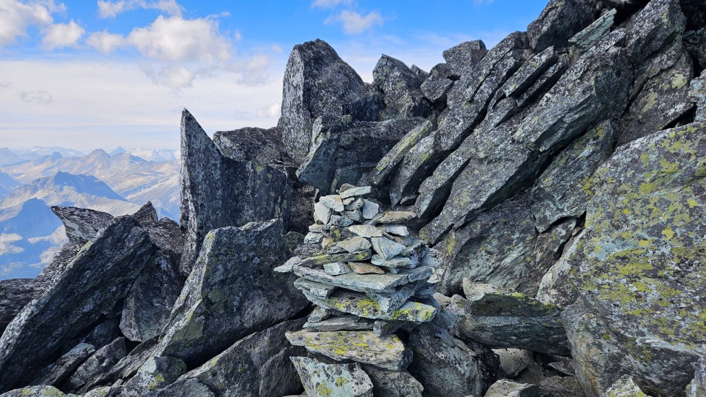
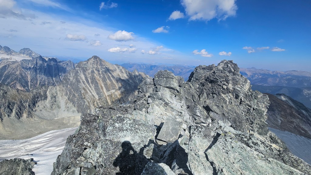
The summit itself felt like a crown of pointed boulders and was too narrow for both us to stand on at the same time, so we opted to take our break in a shelter nook under the summit’s southeast corner which is where the summit register is stored. It would appear that the Eastern Summit of Avalanche Mountain is a bit higher but extremely difficult to reach, so we signed the register and with that counted it as a completed ascent. I would later read that the eastern summit has an entirely different approach involving glacier travel. Our ascent had taken around 5 hours from the car and including breaks a little less than 5 hours to complete the return journey. As they say, only 50% of mountaineering is uphill…
On the return journey we stuck closer to the southwest ridge, only deviating back towards the grassy ledges as to avoid the more exposed sections of the ridge itself. Somewhere along the way we spotted what looked like a freshly forgotten Nalgene bottle which was both eerie and comical, as it seemed to indicate that I had in fact been hearing another group! We still hadn’t spotted said group… but had noticed some minor rock fall from above and until then had assumed it was from our own travel. We left the bottle where it was but made it more obvious to spot in case its owner came back for it.
We eventually trended to our left towards the grassy ledges for a portion of the descent until back to the slab-gully mentioned earlier. Once across this gully we returned the ridge again for our descent to Avalanche Crest. While we had avoided the more technical portions of the ridge, this last stretch proved quite tedious with boulder hopping and it was a massive relief to reach the broader solid footing of the Avalanche Crest. We had made our weather window, and were off the technical terrain as the winds picked up and the temperatures dropped. A dark cloud burst seemed to be lingering above the north end of Rogers Pass so we took few breaks on the hike back to car. As we descended off the last stretch of Avalanche Crest back to the main hiking trail we finally caught our first and only glimpse of the group behind us. Glad to see that they were okay and likewise on their return journey, and so odd that we hadn’t caught sight of them earlier in the day. We hustled back to the car as the temperatures continued to drop and could feel the atmosphere getting damper, thankfully the rain held off till the drive home! A great scramble for the Rogers Pass area.