September 15th, 2024. Gorman Lake, BC.
Round Trip: 8.5 Hours, Elevation Gain: 1300m.
Difficult Scramble via East Ridge
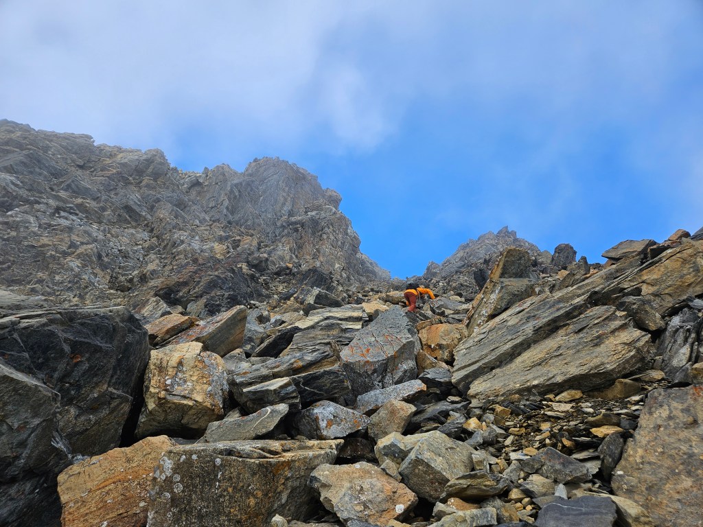
Another excellent local outing with Scotty, whom had previously explored this east ridge solo. It’s very possible that this was a first ascent of the route, or at the very least we are amongst a seldom few to have gone up this way. No cairns, no garbage, and no disturbances other than natural rockfall. Above the more difficult areas I have left a couple cairns for the final leg to the summit ridge in case anyone wants to try heading up this route. Definitely wear a helmet as the rock was unpredictably loose and the ledges quite steep. Prepare for tedious moments of route finding and perhaps it won’t seem so bad.
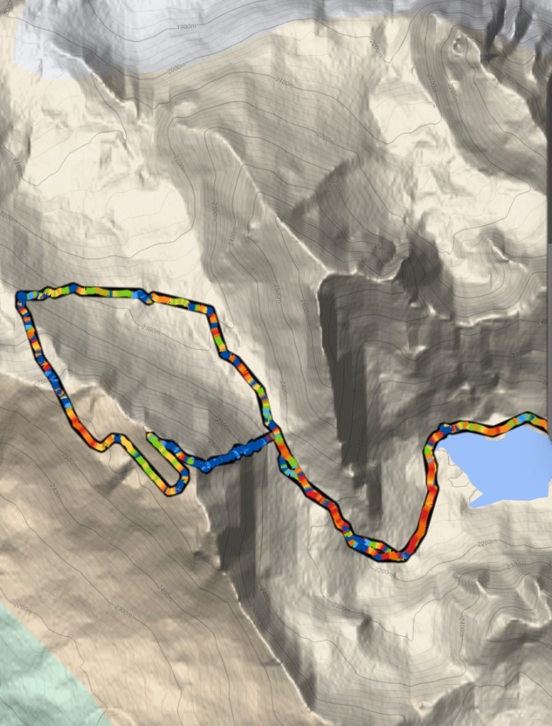
For clarification, there is already an established route up Bokor Peak, which is excellently reported by Golden Scrambles. This longer, moderate scrambling route involves approaching towards the Lang valley and then ascending up a rubbly northeast slope, staying just south of a pocket glacier, and finally traversing south towards the peak’s summit. We used this route for our descent. See the map at the end of this report. For further reference points, I’ve found PeakVisor is one of the few online sources that labels the local peaks around Gorman and provides their summit heights.
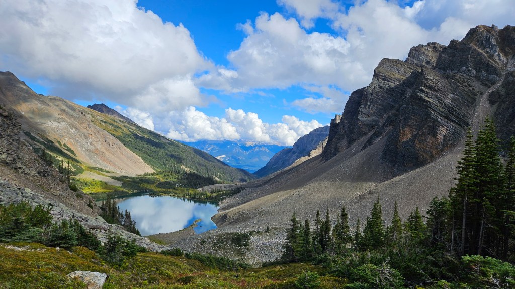
This was actually my first time up to Gorman Lake despite living in Golden for nearly four years. The road is infamously rough on vehicles, though both Scotty and I noted that it was actually in pretty decent shape on this trip. We parked at the end of the road, wrapped the truck in chicken wire, and started the Gorman Lake Trail hike at 7:45am. There was a lot of lingering ground fog and low level cloud that morning, so views were limited at the lake.
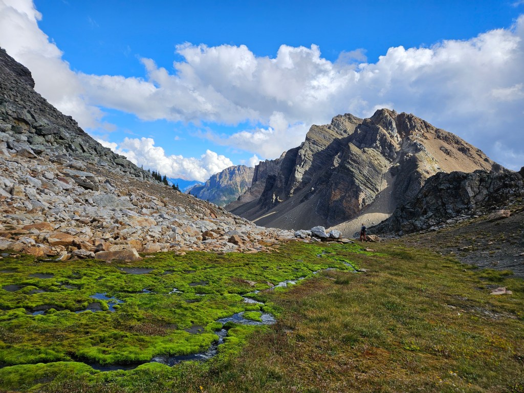
From Gorman Lake, we hiked along the north shoreline, following a trail behind the lake that travels southwest before switching northwest towards the Bokor-Zombie col. We reached the col around 10am and took a break before tackling the scrambling route above us. It look impenetrable from the col, and though Scotty had been previously, a lot of route finding awaited us.
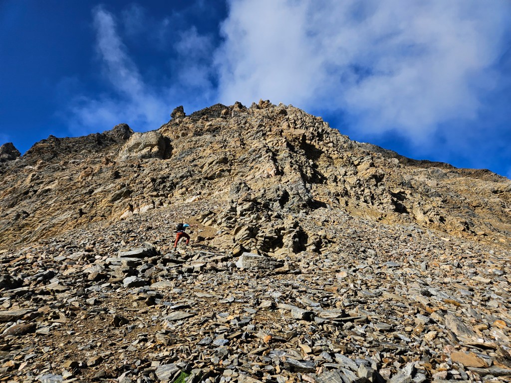
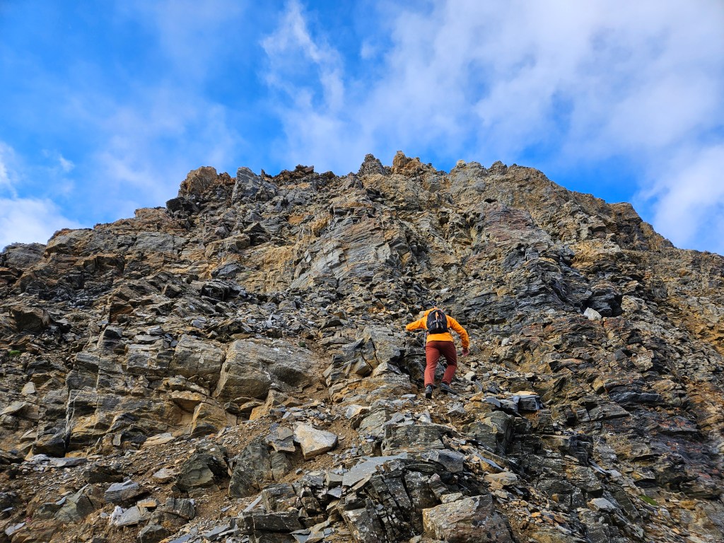
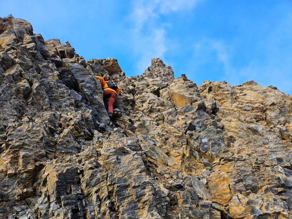
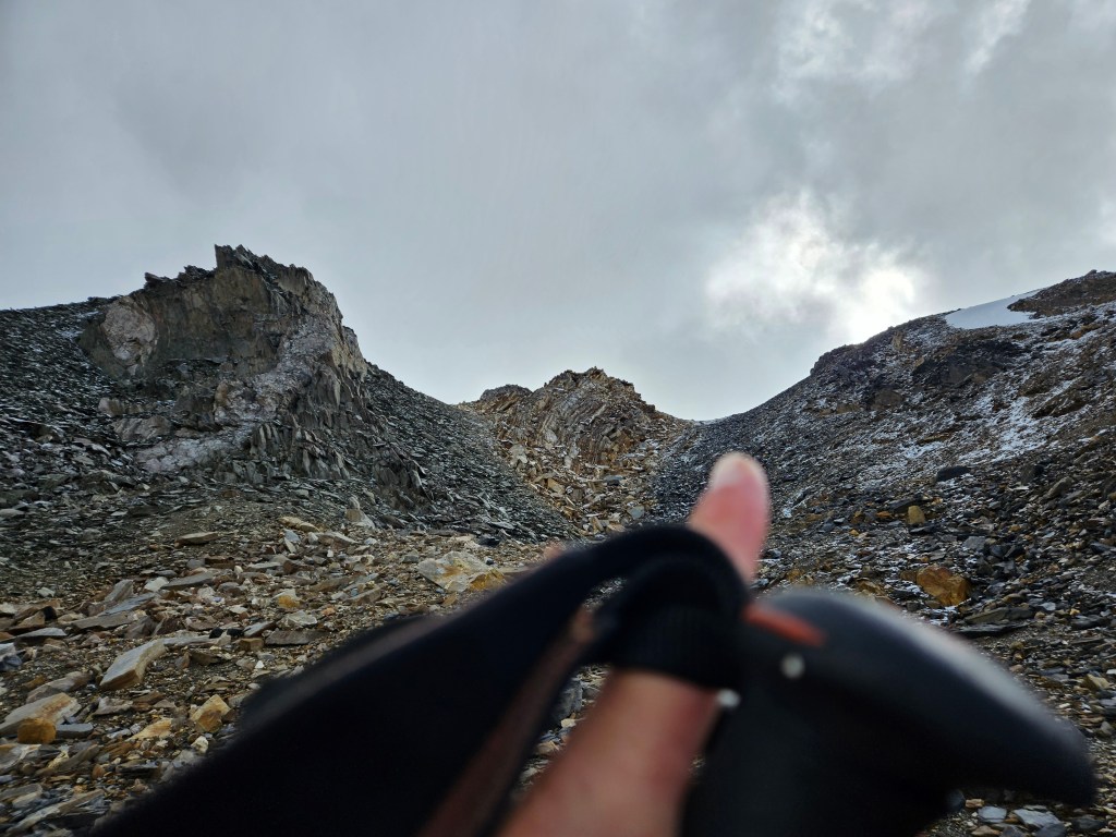
In total the East Ridge took us two hours to scramble up to ridgeline, with a brief few minutes ridge walk to the peak’s summit. The first hour twenty minutes saw us zig-zagging up a series of steep crumbly ledges with several exposed sections. A fall from this route would be crippling, if not fatal. We took our time, carefully testing the holds before committing, and waiting for each other to be clear of rock fall zones.
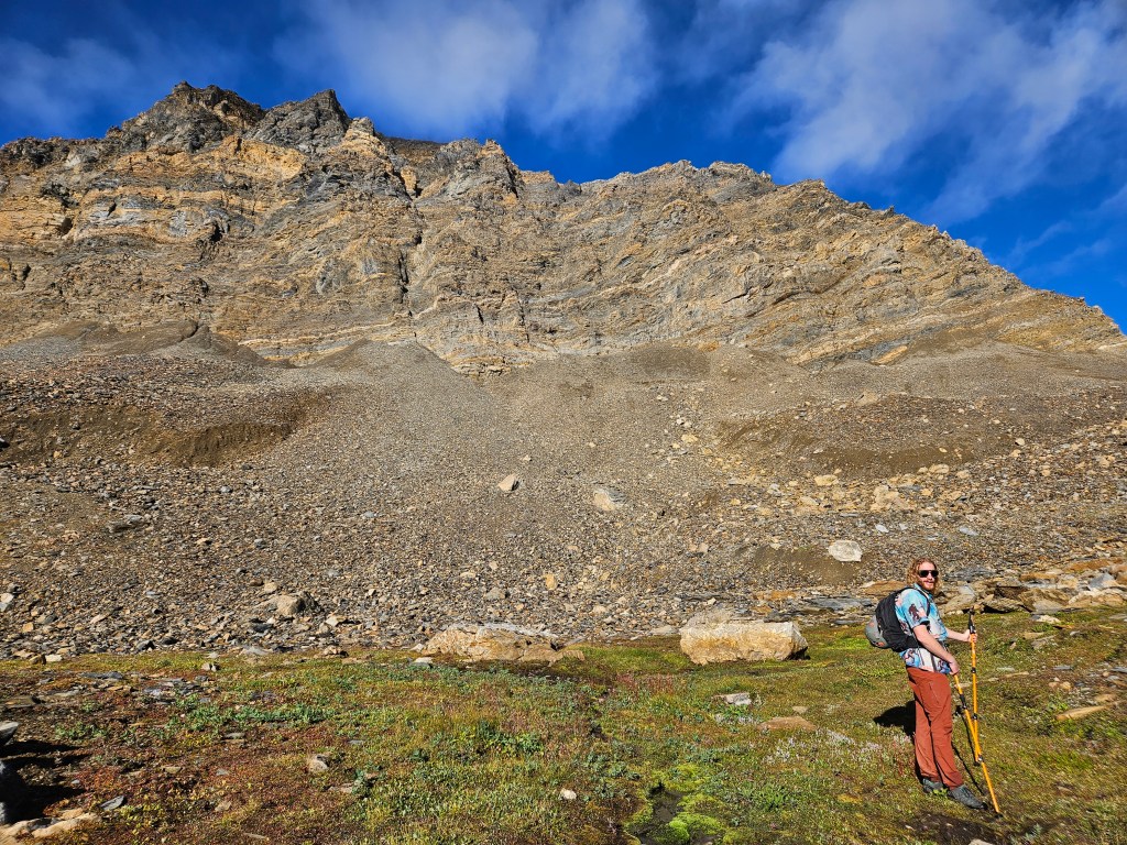
Around 11:26am we cleared the steeper ledges and found ourselves slogging up a moderate talus slope. I constructed a couple cairns here as there was flat enough ledges to support them. Until those went up, we hadn’t seen any cairns whatsoever, which had us pondering if anyone else has been up this way before. Above the talus slope the route resumed its crumbly-ledge nature, though this last section felt less exposed and more of a moderate scramble. Having said that, we were still route finding and evermore cautious as we encountered the freezing line. A recent dusting of snow made these upper sections mildly icy in spots, though not enough to warrant crampons.
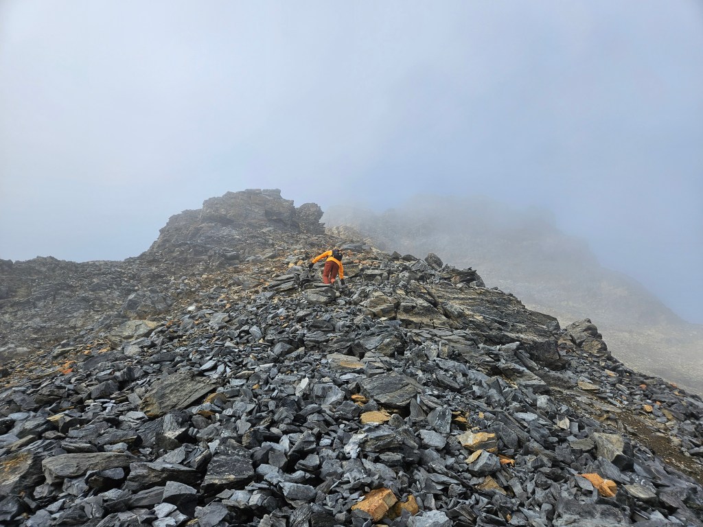
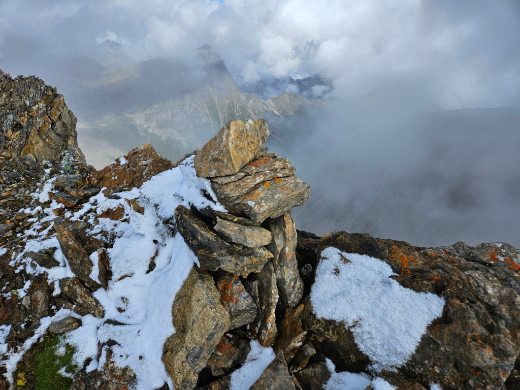
The summit itself was somewhat underwhelming compared to the route we had scrambled up, being a mere bump along a gentle broad ridgeline. We summited around noon, and while we found the summit cairn there was seemingly no register within (dang it, could have brought one up!). The winds were brisk, lifting some of the cloud cover to the west and north. Excellent views even with partial cloud cover. I had decided earlier on that I was not keen to downclimb back down that east ridge, so we decided to route find our way to the longer easier route described on Golden Scrambles.
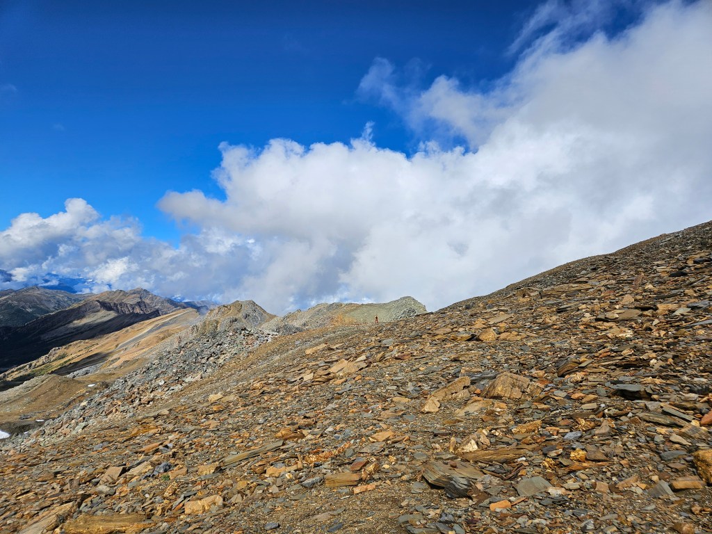
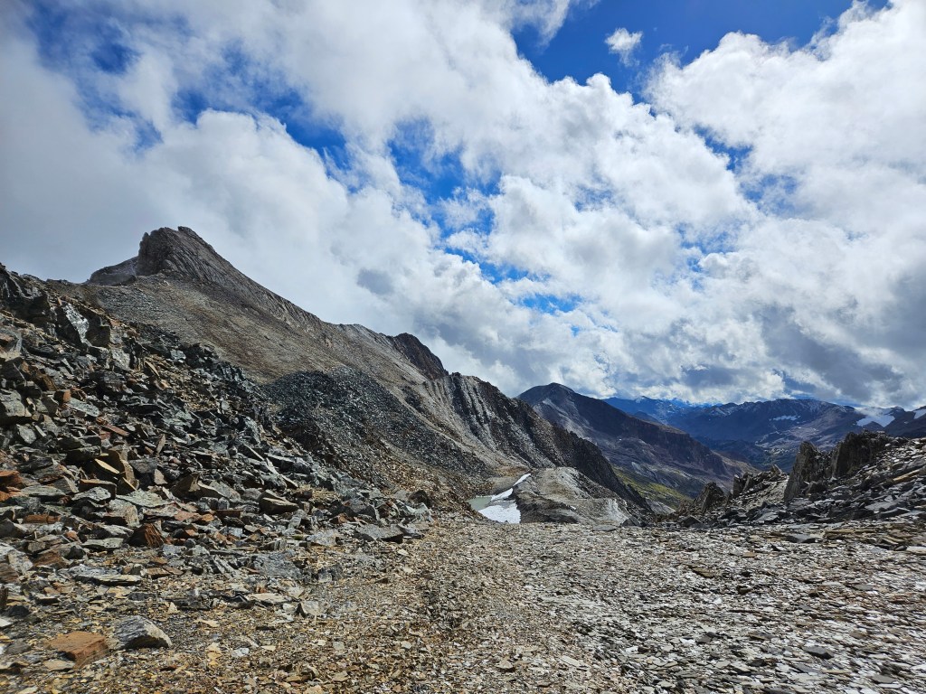
At first we tried following the ridge directly north from the summit but were soon cliffed out and had to back track south past the summit to circumnavigate these. Some mild route finding was required as to not down-climb the western slope too far before resuming our traverse north. Once under and past the cliff bands, it became quite obvious where to go and we even encountered some cairns. These lead us to a shallow bowl feature, and from there we dropped onto to a northeastern slope staying south (looker’s right) of a small pocket glacier. We angled south back towards the Bokor-Zombie col, side hilling above the moraine, though there were several opportunities to fully descend into the valley bottom. In side hilling across we minimized the amount of elevation loss before having to drop into the moraine and hike back up to the col. It was on the way out of the moraine that we encountered two hunters, whom were the only two other people we saw that day past the lake.
The clouds finally lifted as we hiked over the Bokor-Zombie col and we were able enjoy the scenery on the way back to Gorman. Although the sun had come out, the winds shifted and it was a raw chilly hike back to the car. Scotty pointed out nearby Eos Peak on the hike out and noted it as another peak to add to my list. Perhaps next summer!
Overall a great adventure and an interesting scramble. The longer route up the northeastern slope would be a slog to ascend and I’m not sure I’d recommend it given how quickly we ascended from the Bokor-Zombie Col. Having said that, I would only recommend our route to experienced scramblers with proven route-finding skills, and have assigned this East Ridge a difficult scramble rating.