July 27th, 2021. Rogers Pass, Glacier National Park.
Round Trip: 9 hours, Elevation Gain: 1200m
A long Easy-Moderate Scramble via the West Ridge
Further Reading: Selkirks North (2004) by David P. Jones.
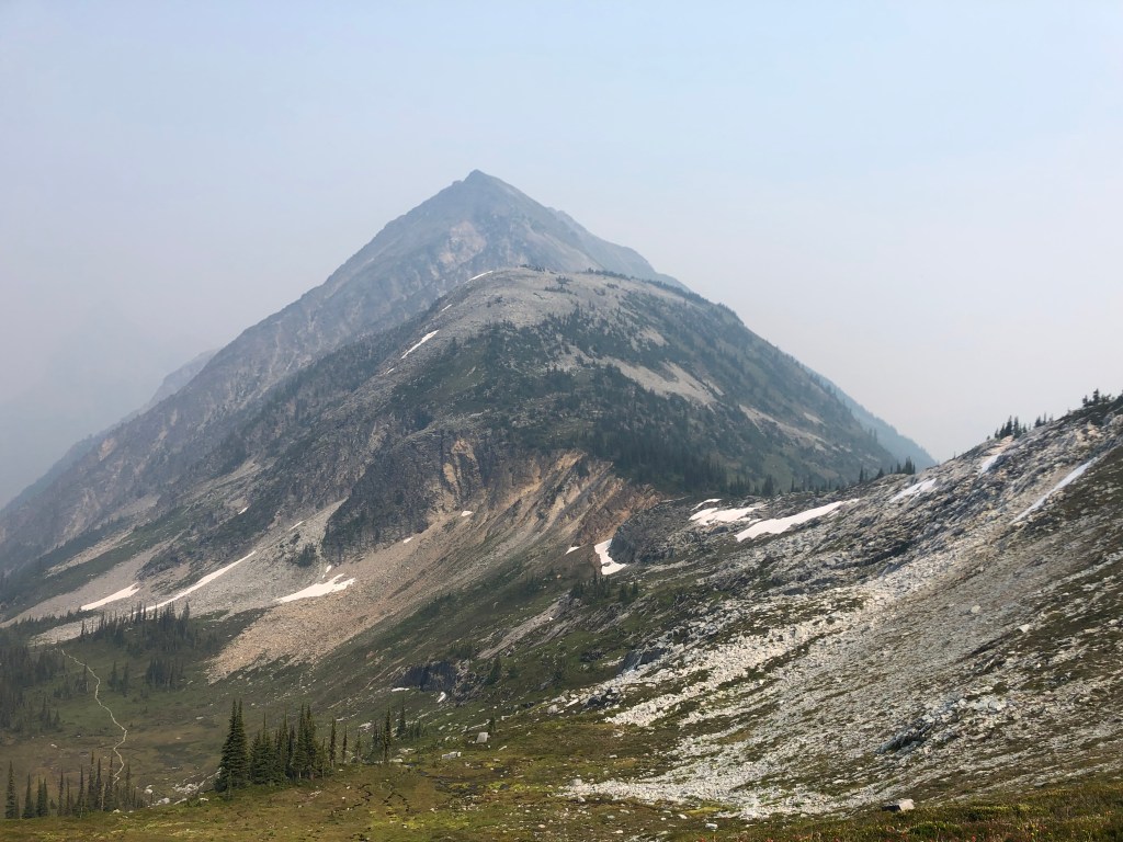
It’s worth mentioning that are numerous different heights listed for Cheops Mountain, the most consistent I’ve come across is a height of 2581m. I have also seen heights of 2570m and 2606m listed. Adding to the mess, the compass in my phone recorded a height of 2590m…. until editing this trip report, I had no idea that there were inconsistencies with the summit height. Anyway side note aside, I will continue onwards assuming the height of 2581m, as listed on the Go Trekkers (2020) topographical map of Glacier National Park.
Although there is plenty of written and online material for this route, we went primarily off of first-hand beta from our buddy Scott who lead this trip. Scott had previously scrambled Cheops and was eager to take Bri and I up. We decided to chance the smoky skies in late July during a bad wildfire season in 2021, and by comparison to the skies around Golden, Rogers Pass was in much better shape. We had Tash and Jon join us too, which was good as the trail to Belu Pass required a minimum group of four due to grizzly bear activity.
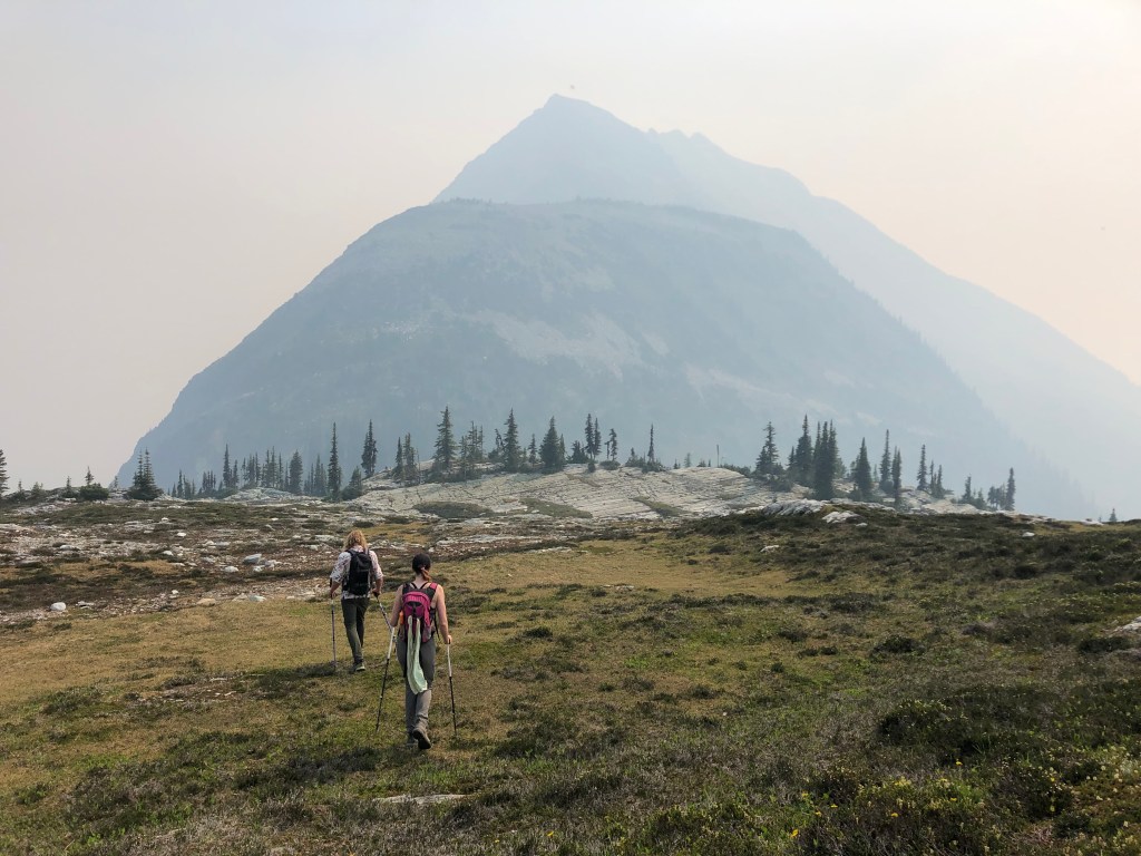
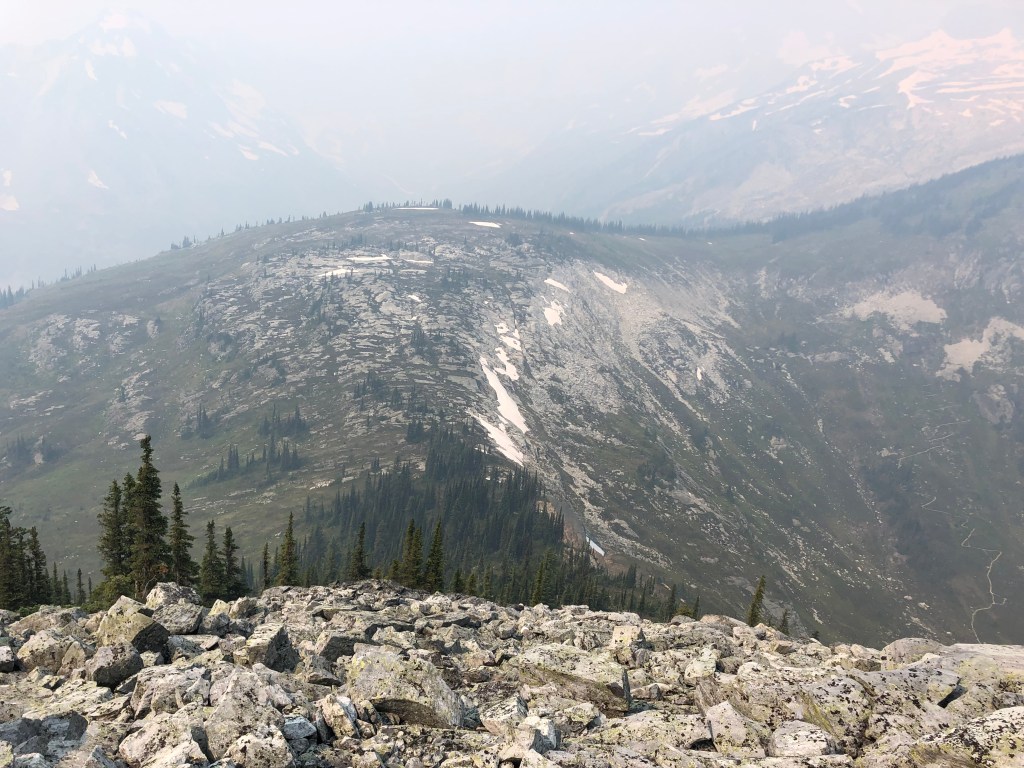
The ascent begins with the Parks Canada hike from the Rogers Pass Discovery Centre parking lot to Belu Pass, a modest 6.4km approach. From the Pass, there is a well travelled foot path heading east, that hooks down through an alpine swamp into a cliffy ‘dip’ and then ascends through vegetated cliff bands up onto the west ridge of Cheops. The Ridge itself is a fun easy-moderate scramble across good quality rock albeit passes over numerous exposed spots.
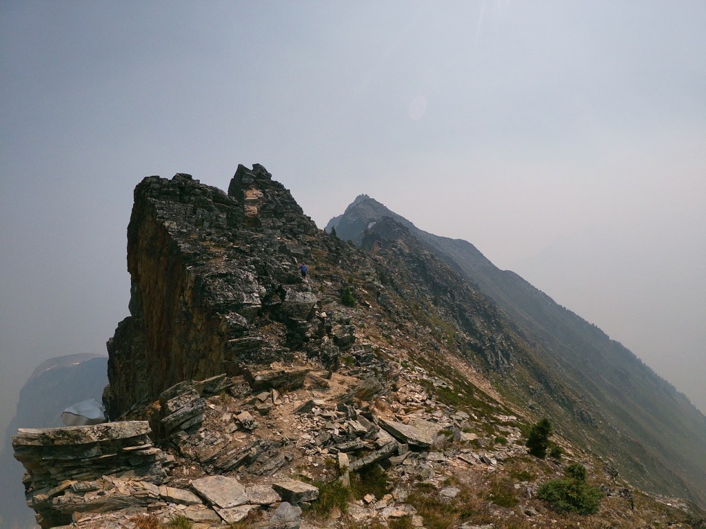
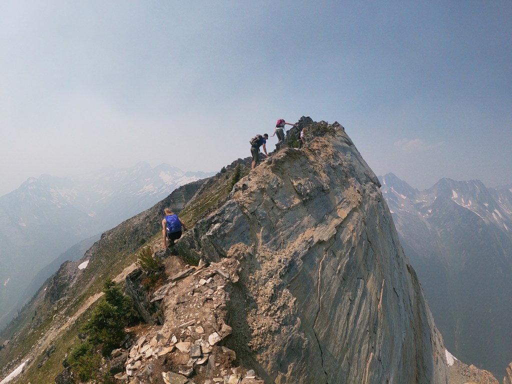
We lost fair chunk of elevation hiking down through the “dip” in order to gain the lower slopes of Cheops’ western ridge, losing at least a hundred metres. When the uphill journey resumed we found ourselves ascending through mixed terrain of trees and boulders. For the most part we stayed to a distinct footpath, occasionally scrambling over the larger boulders. As the trees disappeared the boulder field steepened up Cheops’ western slope eventually tapering towards the ridge crest. On a technical level the slope leading up from the “dip” to the ridge was easy, however this section was nothing short of a slog fest. The actual ridge was foreshortened by the smoky haze and more than once we as a group thought we had crested onto the ridge only discover yet more talus slope above.
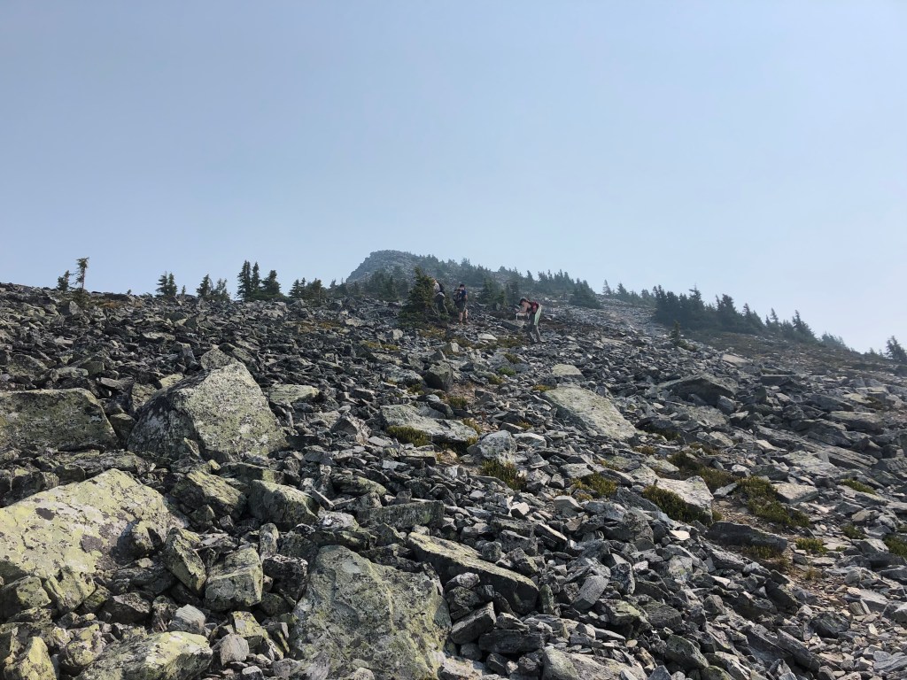
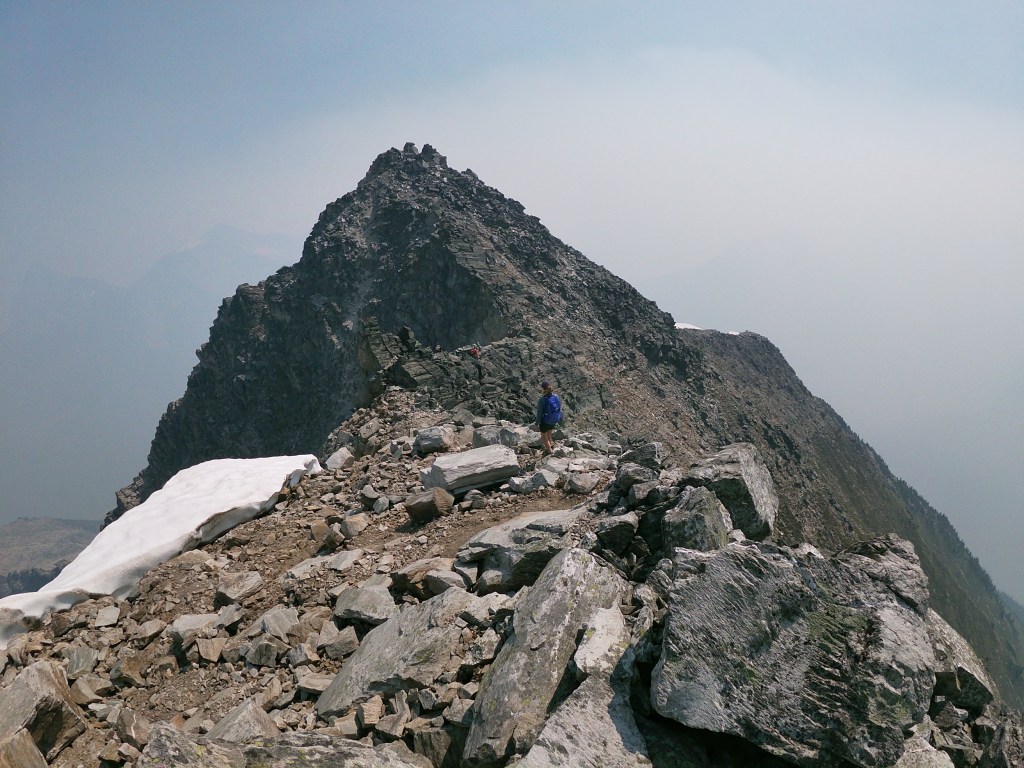
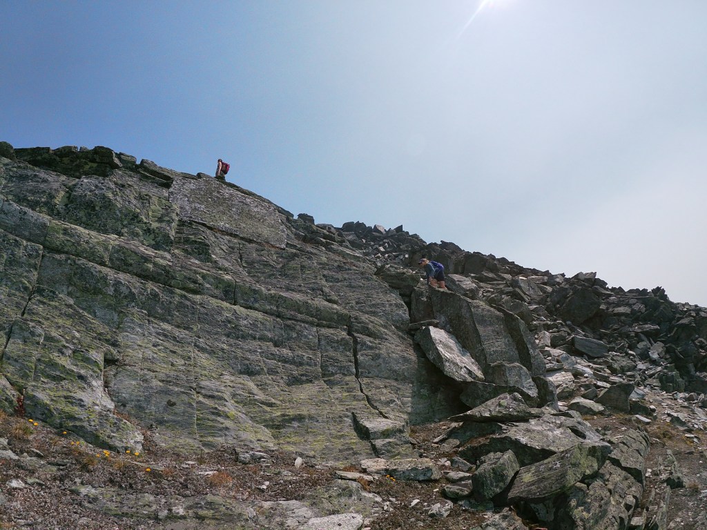
Once above the slopes and actually crested onto the western ridge, the scrambling became much more sustained. For the most part it was easy hands on scrambling, and quite exposed on the northside. Some route finding was required for avoiding the more exposed areas, which often meant briefly dipping south below the ridge crest. As the ridge ascended towards the summit block, the scrambling became more moderate in technical rating as we climbed over larger boulders. All in all, the ridge itself was the most fun section of the day!
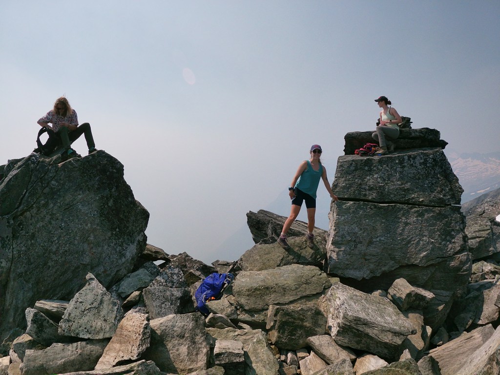
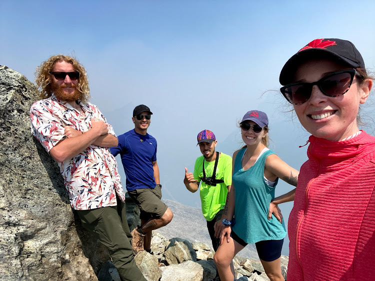
We reached the summit around 12:50pm, taking our team 4.5 hours from the carpark to top out. The summit was composed of several ‘pillars’ which made for a neat yet tight break spot. The smoke was still quite hazy and our best view was looking back towards Belu Pass, the rest of the Rogers Pass area too hazy to observe. The journey back down across the ridge was as hands on as the ascent, with the exposure off the northside of the ridge much more apparent when facing downhill. We had almost forgotten about the ‘dip’ and loathed the slog back up to Belu Pass, but otherwise the team remained in high spirits most of the journey down. Summit back to car, including breaks, was also 4.5 hours making for a long 9 hour day. It was a great day out with great company, and we will eventually revisit for a scramble up Belu Peak.