August 13th, 2023. Bow Lake, AB
Round Trip: 10.5 Hours, Elevation Gain: 1100m
Easy Scramble / Mostly Hiking
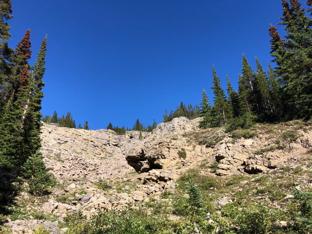
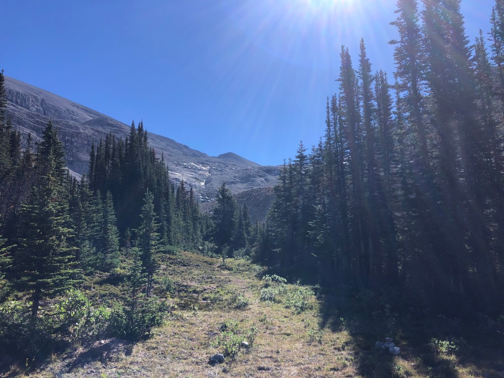
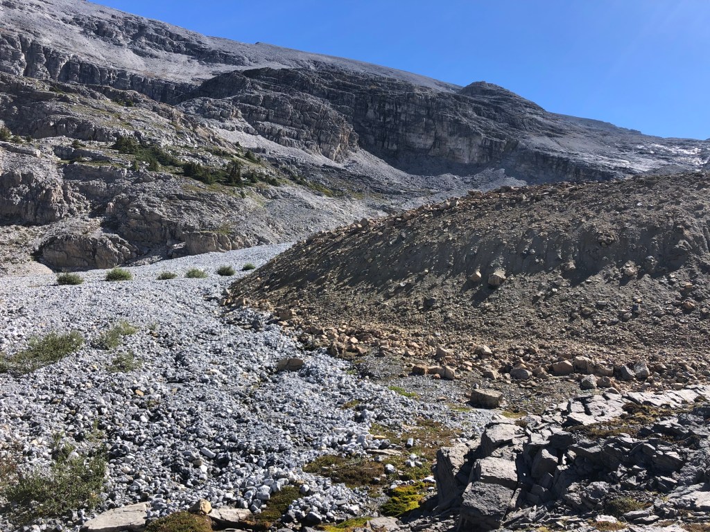
We teamed up with our colleague and now friend Neil for this outing, and as a pleasant surprise only bumped into one other party (several times) that was headed for Crowfoot. We followed Bob Spirko’s trip report for this outing, more or less sticking to the map he posted at the end of his report. I highly recommend giving his report a thorough reading before setting out. While rated an “easy” scramble, there is nearly 22km of distance covered in the round trip starting from Bow Lake Lodge. Following the Bow Falls trail, continue left at the sign for Bow Hut, and continue along this trail towards the hut. Shortly after treeline there is a notable creek crossing with a faint footpath travelling east, a cairn marks this spot and this is where we left the main trail. The footpath follows up through trees and meadow, eventually leading out to a moraine and glacial scarring area. Above those is a small glacier on Crowfoot’s western slope, and beyond that still is the slope leading to the long summit ridge. Expect a long day as we did.
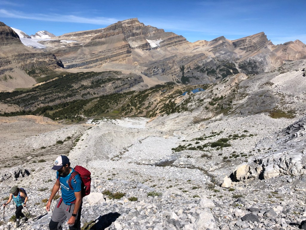
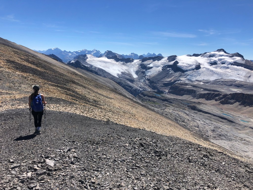
There isn’t much to report on from this trip other that how utterly amazed we all were by the views on this route. The journey itself is predominately hiking – the only scrambling sections being through the glacial scarring leading to the glacier’s toe, and somewhat while slogging up the western slope. Both areas are easy in technical terms, however the footing is notably poor on this mountain. The talus is perfect ankle-roller size, and is a thin layer on top of smooth down-sloped slabs. It is a tedious grind up these slopes to the ridge crest. Once the ridgeline is obtained, the remaining traverse to the summit proper feels like a leisurely stroll.
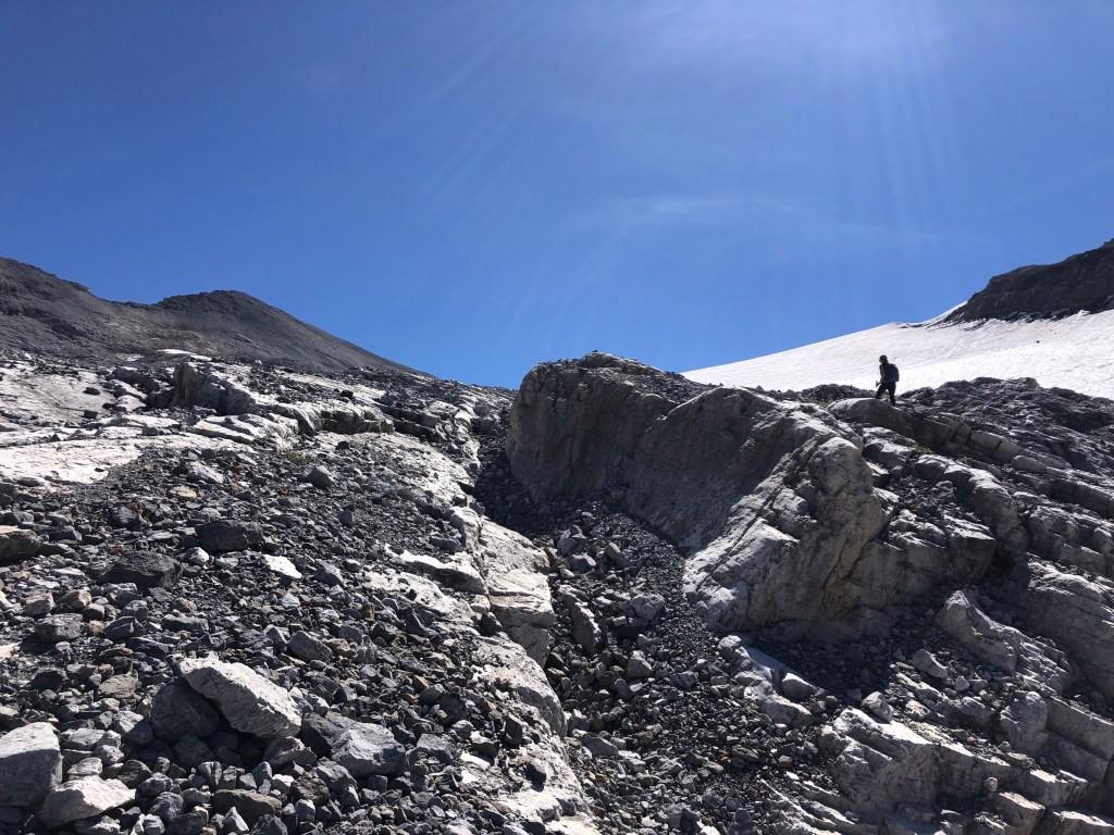
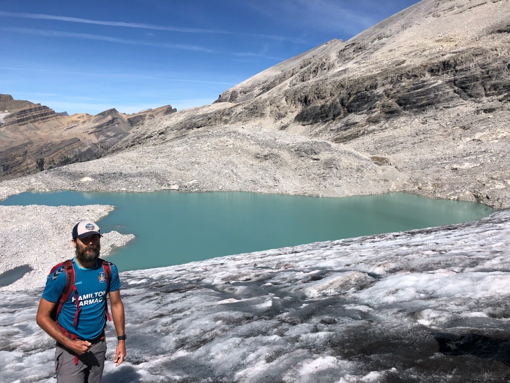
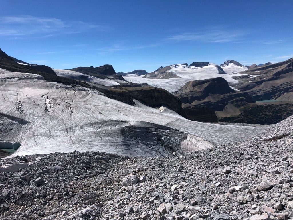
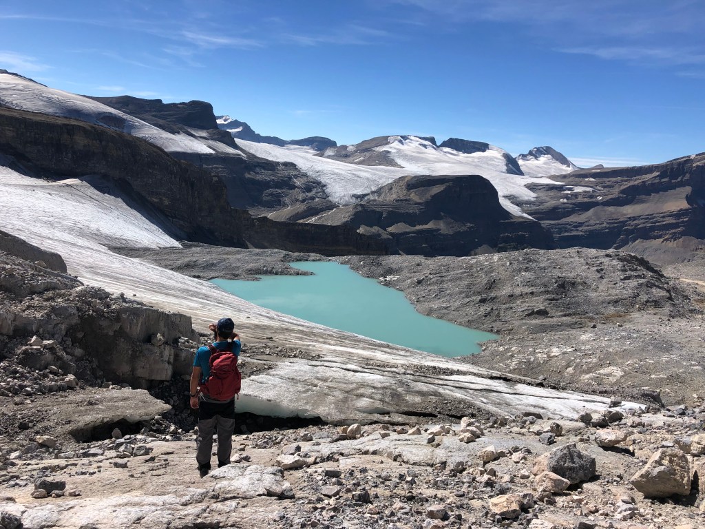
We risked crossing the toe of the glacier past a large caved-in basin feature, staying close to rock on Crowfoot’s western slopes. It is worth noting that the ice was in perfect condition for non-technical travel that day. The surface ice was crusted and abrasive allowing our hiking boots to adequately grip, the crevasses were highly visible and a long way off from us, and the slope was a gentle grade. Having said that we were well aware that this was an extra risk – especially if one had slipped down towards the meltwater lake. Once past the basin feature, we resumed traversing south along the talus and diagonally began ascending towards the summit. The true summit is a long way off, the vast ridgeline peaked with several high bumps along the way and some of the best views I’ve yet seen in the Canadian Rockies.
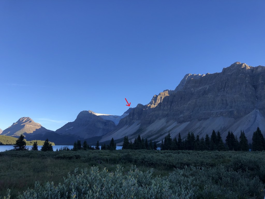
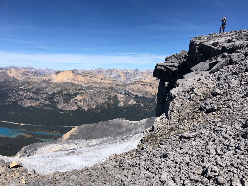
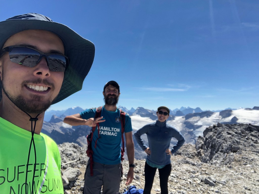
While a steady-graded slope flanks Crowfoot’s western side, the eastern side features drastic wall towering over the Crowfoot Glacier, as seen from the Icefields Parkway. The summit proper is merely the highest bump at the southern end of the ridge. A large cairn with a sealed register were very reassuring that we had reached the end of a long effort. Fun side note: the sealed register bears Alan Kane’s name etched into the tube’s side… meaning this has been sealed shut for a while! Needless to say, we spent a long while on that summit taking photos before eventually returning along the ridge. While descending the western slope we decided to see how things would go if we stuck to the rock instead of taking the glacier back.
We confirmed that it is feasible to avoid the glacier entirely, albeit the rock along the eastern edge of the glacier is horrendous, all the same talus from the ridge slopes but even looser. Just before reaching the meltwater lake, we actually gave up on the rock and cut across the glacier’s toe. In the heat of the afternoon the ice was loosing its favourable texture from earlier in the day, a stark reminder of how fast conditions can change.

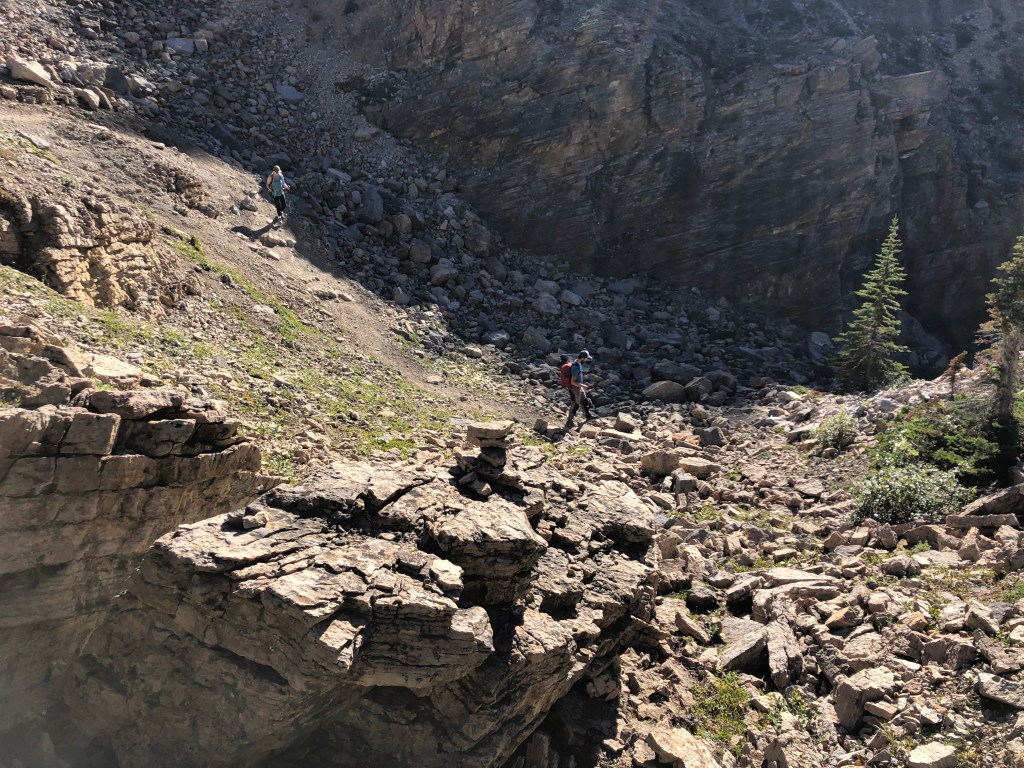
Based on how long it took us to travel this section I would estimate that avoiding the glacier via going around the meltwater lake would add 30-45 minutes ascent time. We late observed via the other group’s travels that there is lots of room for route variation through the glacial scarring back down to the meadow. From the meadow we ended up taking a slightly different drainage back to the Bow Hut trail that involved some brief easy-moderate scrambling. It threw us off that we somehow missed the creek from earlier, but remained stress-free as this drainage was well cairned and lead us back to the Bow Hut trail.
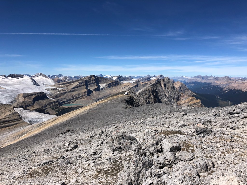
Overall Comments: I cannot understate the scenery on this one, having done around 115 peaks at the time of the trip, Crowfoot ranks in my top 3. One of the party members in the other group, who boasted a much higher peak count, likewise agreed that the views from Crowfoot topped his list. The scramble itself however… it’s a long, long grind. There’s no sugar coating that aspect. But oh, the views!