October 5th – 7th, 2020. Temagami Cluster, Ontario.
Round Trip: 12 hours, 30km. Elevation Gain: 300m from Scarecrow Lake
Category: Trekking, moderate-difficult.
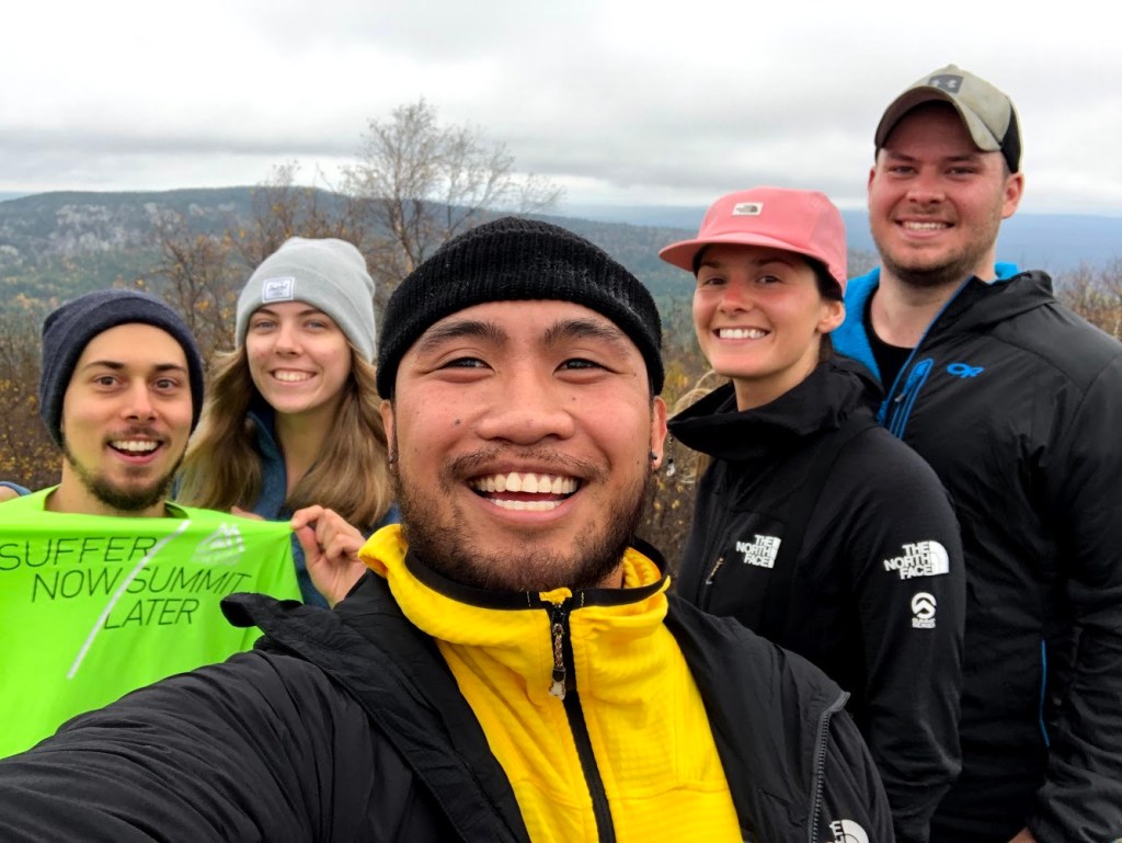
Ishpatina Ridge’s Tower Summit at 693m is Ontario’s highest point, and is situated in the western fringes of Lady Evelyn-Smoothwater Provincial Park. Mike and I had considered this as a winter snow shoeing effort in January 2018, but lacking a proper vehicle for the logging roads settled on a trip to Killarney instead. With covid-19 keeping many adventurers at home this year interest in Ishpatina resurfaced amongst our network of outdoor friends and by October we had an eager group of five ready to tackle the provincial highpoint.
A few points to clarify. The ridge is entirely contained within Evelyn-Smoothwater but requires trekking across Sturgeon River Provincial Park and Crown Lands, thus I’ve assigned its location as part of the Temagami Cluster. While a three day trip, the actual hike itself was completed in a single day. Lastly, this report is for the Capreol over-land route.
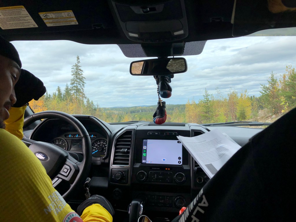
I cannot stress enough to readers the importance of researching into this area before setting out. Our trip took 3 days in total, two of those days being driving days to and from the GTA. The logging roads leading out from Capreol are optimal in dry conditions: at the very minimum you should be driving a vehicle with All Wheel Drive . Ideally though, you should be attempting these roads with either a high clearance pick-up truck or a jeep. Equally important – at the time of our trip in Oct 2020 – these are still very active logging roads, and you need to pay attention (and yield) to oncoming logging traffic.
For more details on the driving instructions and precise access point, please refer to http://www.ontariohighpoints.com/ishpatina-ridge-overland/ . This is an older trip report but perhaps the most detailed description our team could source online. The report available through that link was our primary resource for the trip, paired with an updated map sourced from the All Trails Pro app.
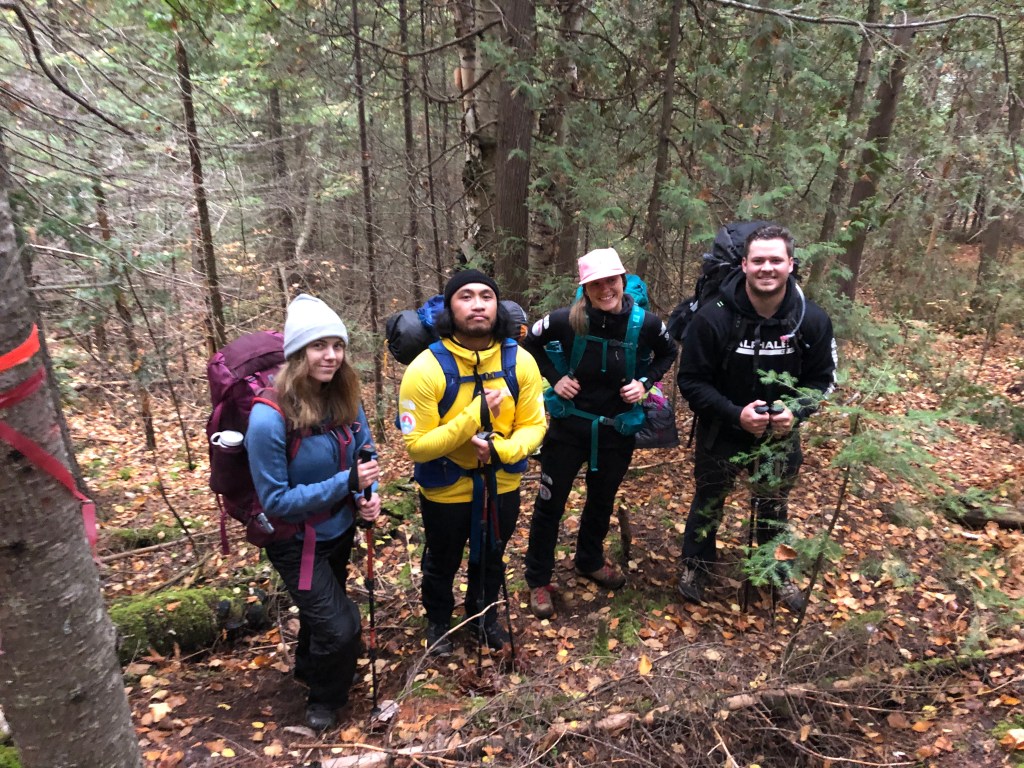
Our team comprised of Bri, Mike and I from the Durham Region plus Mark and Emily from Bradford. We regrouped in Bradford and did the remainder of the drive all in one truck. Starting initially from Whitby it was a full 8 hour drive to the access point, 2 of those 8 hours spent specifically on the forestry roads. The forestry roads are not to be underestimated, they are rough! The Wanapitei River east-bank section proved the most rugged in terms of potholes and washouts, and ironically was also the most scenic stretch of the forestry roads.

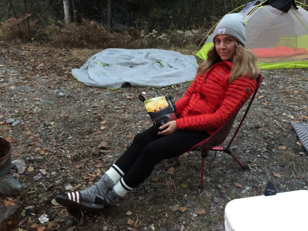
After a long day on the road we opted to set-up camp by the truck and have a relaxed evening by the river. We had organized backcountry access permits online prior to the trip and I believe these were necessary for camping at the end of the road as the area is part of Sturgeon River Provincial Park. The permits are needed also for camping at the base of the ridge, which was originally considered in our itinerary.
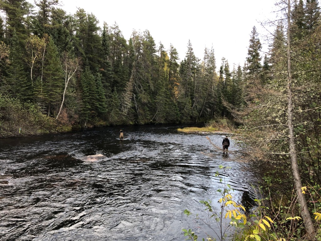
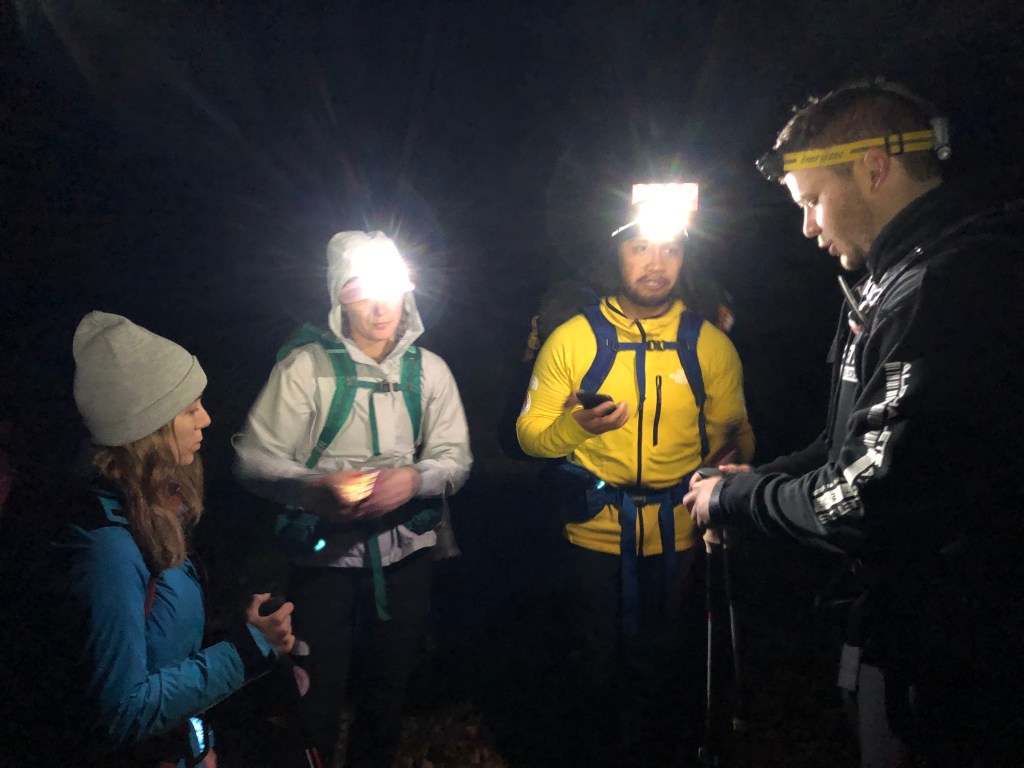
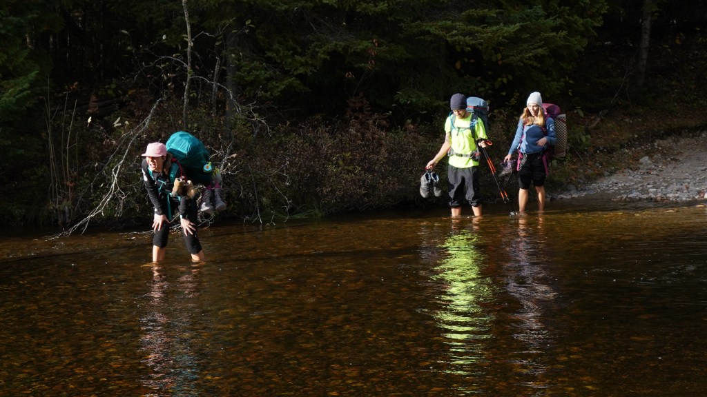
Having arrived with a couple hours of daylight left, Mike and Mark geared up with waders and tested the depth of the Sturgeon River in preparation for the next morning’s crossing. The water was thigh deep in some spots, so the lads configured a path that veered right (south) then left (north) like a boomerang shape, in which the water was generally at knee depth. We intended on a 5am wake-up and 6am river crossing with headlamps – an ‘Ontario’ alpine start if you will, so the entire team was in bed by a modest 8pm.
The whole team surprisingly woke up as planned right at 5am and quickly set about breakfast, coffee and packing up for the day. While we intended on this being a long day trip, we decided to bring our full camping packs in case of a trail emergency or fatigue on the return journey. It was a light freezing drizzle but so far the 10mm of forecasted rain had held off. In good spirits we found ourselves starting the river crossing at 6am. Still on schedule!
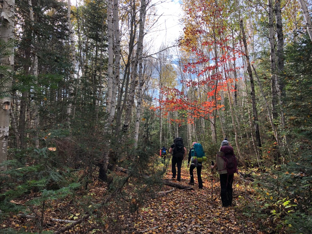
We officially started the clock for this hike at 6:37am after successfully shuttling the team across the Sturgeon River. River Shuttle you ask? Mark waded back and forth with Mike’s hip waders as a spare pair for the next team member to wear and cross in. It was admittedly more time consuming than we had anticipated but no one on the team wanted to start a 30km soaking wet. Once across we had a last map check and started along a wide-spread ATV path.
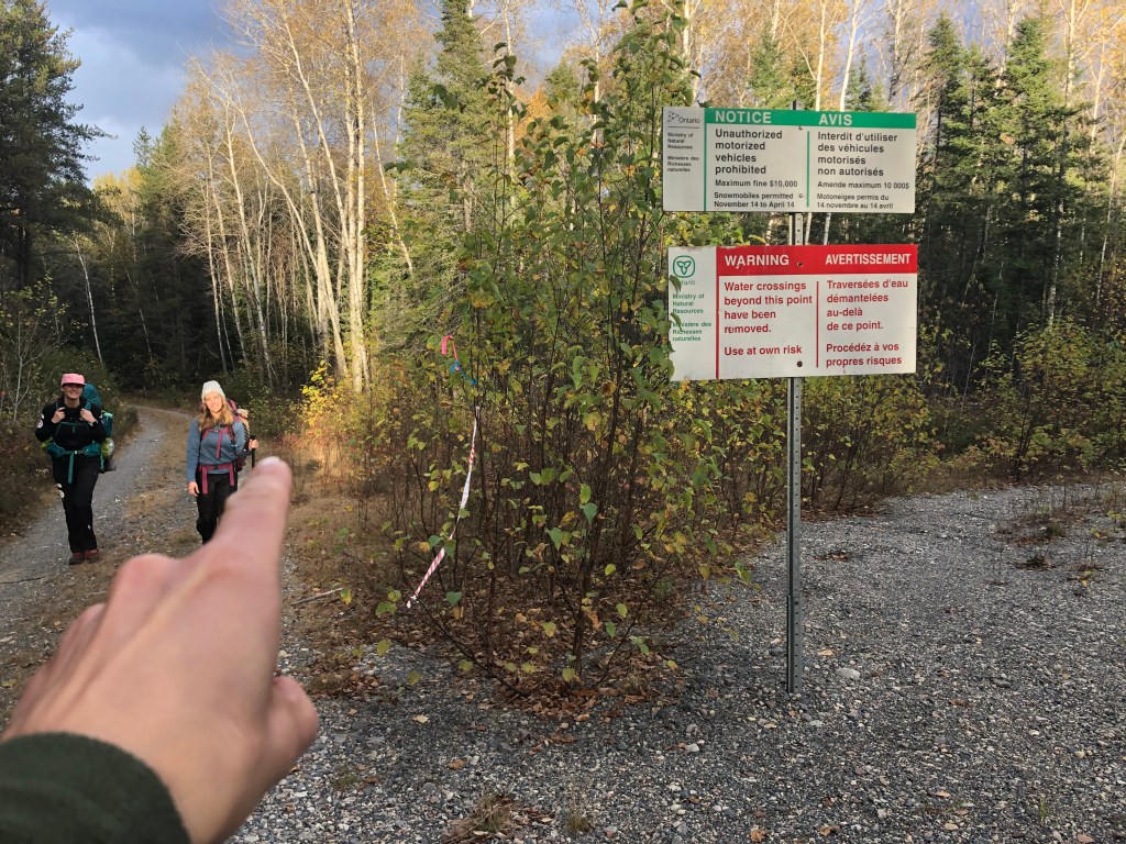
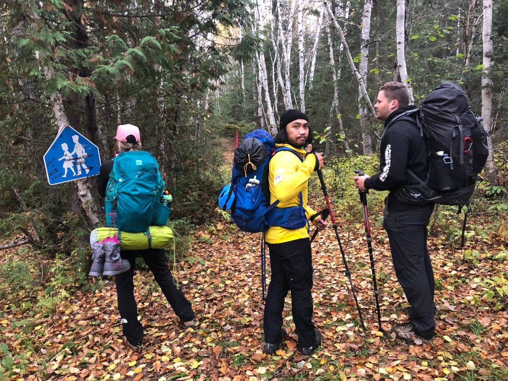
First landmark is an old hunting cabin which pops up almost right away on the left side of the path. Shortly after there is a provincial warning sign indicating that bridges up ahead have been removed. While the wider path veers to the right, the route we were after continued straight (to the sign’s left side). We didn’t notice in the dark that morning but there is an excessive amount of flagging tape to the sign’s left indicating the correct way forward. After some debate and checking the All Trails Map, Mark led us the correct way and was reassured in his decision with the ample flagging tape that highlighted the route forward. The next stretch of ATV path remained consistently wide and generally well maintained. Other than our own excitement and having to side skirt a couple wide puddles, the first 6-7km were relatively uneventful.
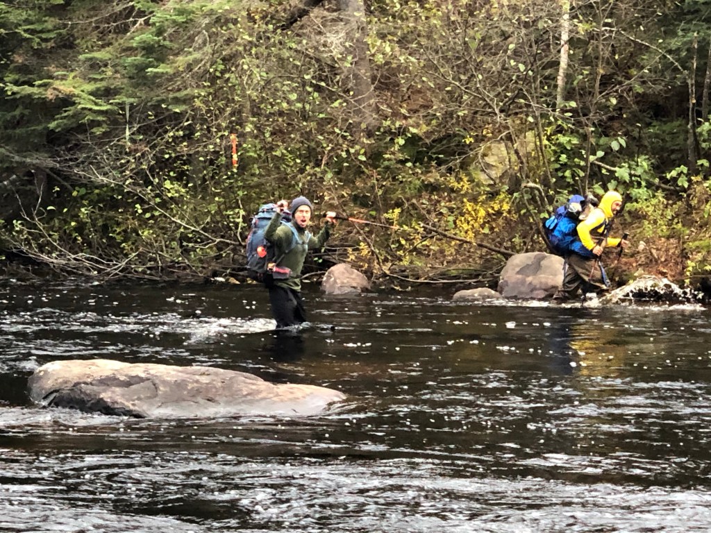
Eventually there is a second creek crossing which we encountered at 7:52am. This was both narrower and shallower than the Sturgeon River crossing. We had stashed the waders back at Sturgeon, so opted to cross this creek bare foot. If the coffee hadn’t fully woken up part of the team, then this crossing sure did! Water was only mid-shin but it sure was brisk that morning. Luckily we all had warm dry merino socks and dry boots once safely across to the other bank.
The gentle ATV path portion ends with the next landmark which is a School Crossing sign that someone has nailed to a tree. We reached this at 8:34am, took a quick photo break and braced ourselves for the harder sections ahead. At this point we turned to the right. If in doubt, there is a massive arrow on the sign telling you to do so, and the flagging tape also continues in this direction.
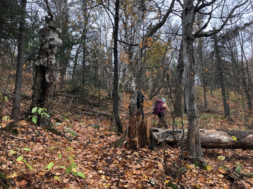
From here on out the trail increases in difficulty and ruggedness. There are at least two bog crossings with semi-reliable logs to balance across and some light bushwhacking areas to navigate. All are heavily flagged enough that we only used the map to double check our progress every so often. This section lasts approximately 2-3km.
The Scarecrow lake section proved to be the most intense part of the day, in terms of navigating through the branches and downed trees. The rule of thumb was to follow the shoreline until intercepting a more formalized trail leading to Tower Summit. Luckily, despite how thick the bush became, the route was well flagged throughout.
For context of how rough this section was: it took us the same time (2 hours) to complete this section as it did the 7km ATV section. The difference? That the Scarecrow Lake section is half the distance of the ATV section! In conjunction with poor footing and branch dodging, the grade through here drops and regains elevation in several spots.
Around 10:20am we came across a large campsite, somewhere towards the northwestern shoreline of Scarecrow Lake. It had ample space for us to set up camp should we need it, so made a note of it and continued along the path. The bushwhacking became gradually easier past this point, and soon we were steadily gaining elevation. From Scarecrow Lake it is roughly a 300m gain from lake to summit.

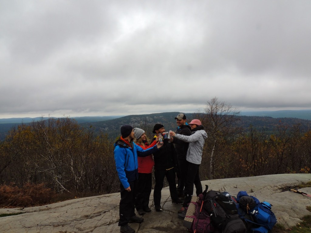
The final stretch lead up and away from Scarecrow Lake, and opened up into a more recognizable path. The route travels up the shoulder of the ridge passing a couple smaller lakes before tapering into a distinct ridge (which we dubbed as a false summit). It was only then that we finally caught a glimpse of the infamous watch tower that marks the summit. Mark and Emily had utilized a second wind of energy, likely the rush of peak fever, and made it to the top a few minutes earlier than the rest of us. As a reunited team, we completed the ascent of Tower Summit at 11:43am under overcast but dry skies.
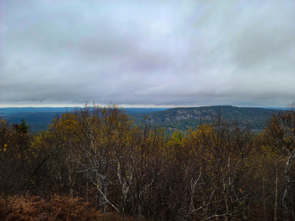
We celebrated with obligatory summit beers and enjoyed the highest available natural view in Ontario. In total we spent an hour resting and photographing the vistas, enjoying the remoteness and raw natural beauty. It would appear though that this remote high point is frequently visited in summer – two Nalgene water canisters were stuffed to the brim with soggy scraps of paper intended as summit registers.
We ended our brief stay at summit around 1pm and began the long return journey. As a team we decided that we wanted to camp at the truck again that night and return with at least some day light left. Other than waning energy levels during the Scarecrow bushwhacking sections, the return journey was relatively uneventful. Until we hit the stream crossing near the school sign. That water had not warmed up a bit and the rough stones were not exactly a welcomed feeling on our raw feet (see earlier photo of Emily’s reaction to the stream crossing).
A rewarding moment appeared half way back from the ridge when the overcast clouds broke and the sun greeted us for the first time that day. It was hard remaining motivated at times knowing that the best of the trip was physically behind us but we were still clung on to our summit hype! That hype and the excitement of returning to camp were enough that I forwent the hip waders and smashed through the Sturgeon Crossing fully clothed and boots still on. It was a refreshing end to the long day. We had completed our mission and better yet the rain had held off the entire day till later on in the night. Excellent trip with an excellent team!
In summary: while this could have been done with lighter packs, the sheer remoteness of the area warranted full packs in case of a survival scenario. While we didn’t encounter any other hiking parties the route showed signs of semi regular use and was well flagged throughout the trail system. In the sense of navigation it was easier than we had anticipated but still kept us on our toes with frequent map checks and is not an appropriate trip for novice hikers. Between the remoteness, bushwhacking areas and rugged footing, this is by all standards a moderately-difficult trekking route.