July 11th 2025. Gorman Lake, BC.
Round Trip: 10-12 Hours, Elevation Gain: +1850m
Easy Scramble; a very long hike
A spectacular local outing boasting some of the best views we’ve had from the Dogtooth Range. This one is hardly a scramble but is indeed a very long day with 24km round trip distance and nearly 1900m of vertical. Even for the fittest member of our party the round trip still added up to 10 hours. Alternative approaches can likely be taken from either Quartz Creek or Lang Creek. We chose the Gorman Lake approach as I had seen the route from Bokor Peak the previous September. While a long approach, the Gorman approach it is relatively straight forward and the scenery rewarding throughout. For further reading, goldenscrambles.com follows the same route albeit is a much older trip report. Additionally, most of the local peak and location names are listed on Bivouac.com.
The real kicker with this route isn’t so much the distance but the incredible amount of elevation loss/gain in taking the Bokor-Zombie col. Nearly two-thirds of the day’s vertical is spent ascending, descending, and re-ascending this col. It was an ambitious effort on our part given that we had a large group that day, including two novices. Fortunately for July we had cool temperatures start to the with frost on the trail and thus minimal mosquitos around Gorman Lake.
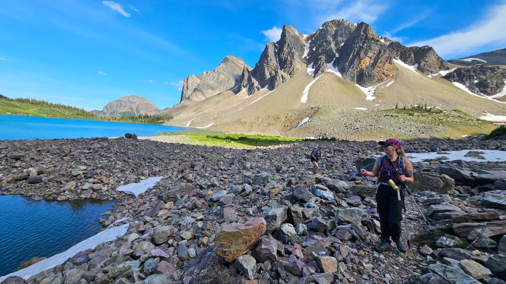
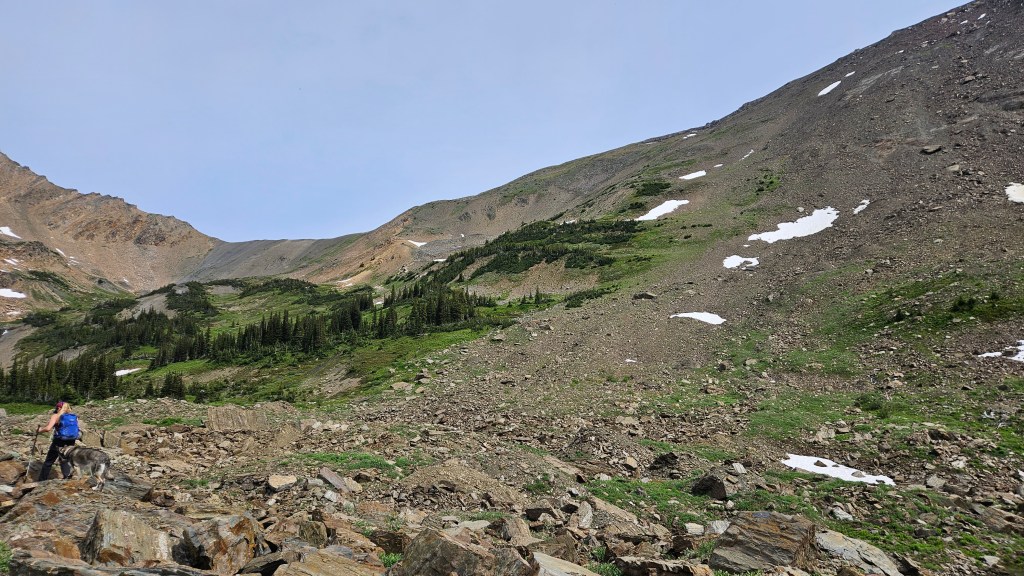
Between 3 vehicles we were a group of 7 plus one dog. Our group had an interesting mix of varying experience levels which in theory would make for a well-balanced crew. Gorman Lake’s FSR was in great shape at the end of the 2024 summer season and was still in decent condition that morning (most years 4×4 and high clearance is needed). Our group more or less all showed up on time and after chicken-wire-wrapping our vehicles kicked off the hike at 7:15am. Morale was high and this hike doubled as a scouting mission to assess the condition of the other Dogtooth peaks. With that in mind, we opted to take the south-shore trail around Gorman Lake to get a closer look at the ascent route for nearby Eos Peak. The trail was easy to follow though did involve a little bit of elevation gain/loss over and across a talus boulders towards the west end of the lake.
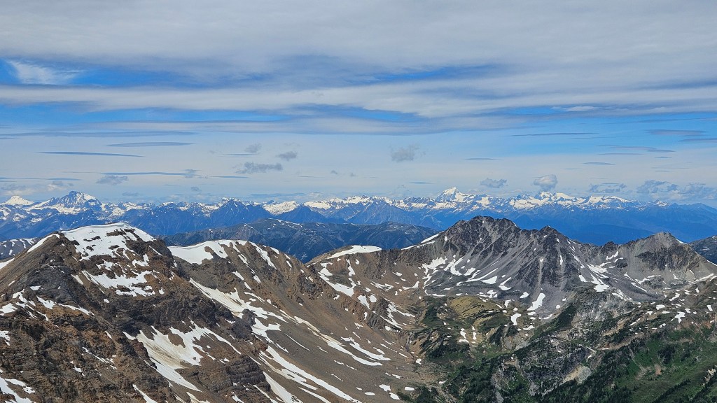
Past Gorman Lake the footpath continued west and eventually crosses a creek veering north towards the Bokor-Zombie Col. Heading up a meadowed green slope, a distinct slide path provided a direct route up. The weather had warmed up but was still pleasantly cool for the time of year, and it was a blue-bird day, we could not have asked for better hiking conditions! We followed my GPS track from the previous year and reached the saddle of the Bokor-Zombie col around 9:30am. We had already gained 600m vertical since the trailhead and everyone felt it. The views from the col were already worth the morning’s effort and now the first time the group could see Kingpin Peak in the distance.
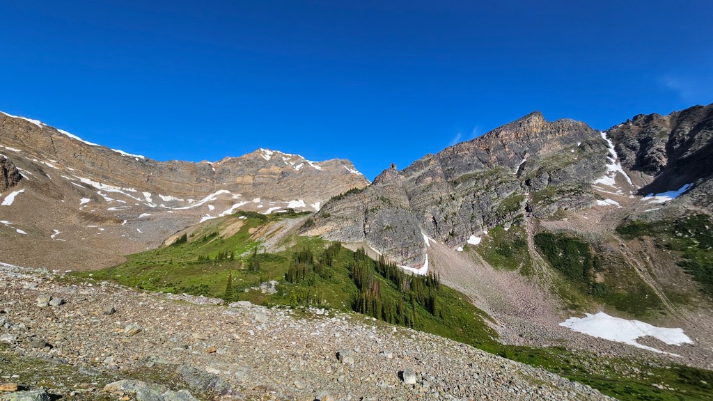
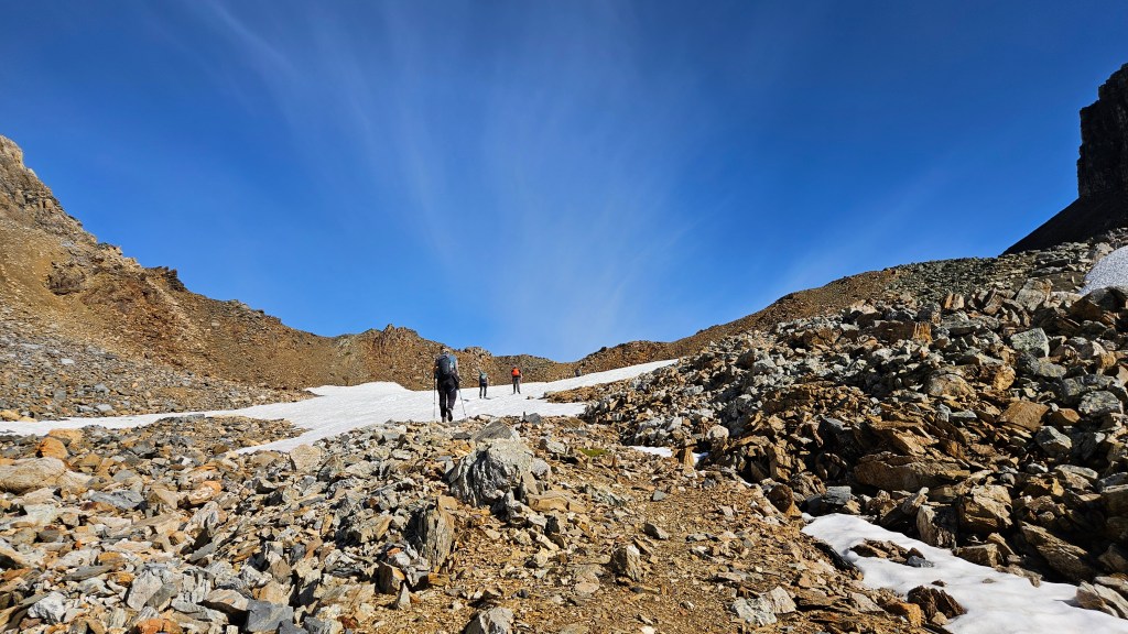
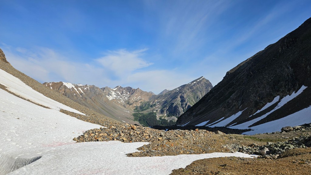
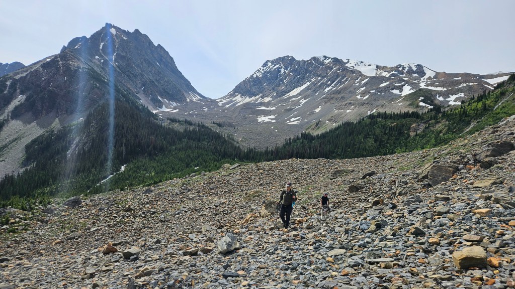
From the col, we were only halfway into our approach and were now faced with a long tedious descent through the moraine outstretched before us. I think this view doubled as a wake-up call for some in our group, now realizing how long our day was going to be. We kept the photo break short and hiked down the moraine. At first the moraine section wasn’t too bad, naturally broad ridges offered footpaths along an enjoyable modest gradient. However, these ridges were inconsistent and all too often would “run-out” into each other, meaning we would have to scramble down one pocket and back up another. By no means was this technical, just tedious given the poor footing and inconsistent terrain of hard pack debris versus soft scree. Foreshortening was another major element at play as the moraine felt like it was never ending. At least it was downhill travel, and the views kept getting better as we edged closer to the Lang Valley. After an hour of plodding down the moraine we reached a massive signpost at the toe of the moraine pointing the ways to Cirque and Quartz Creek.

It was now heating up in the late morning sun and the bugs were waking up. We took a 10 minute breather to recharge and plan our approach across Lang Creek towards the base of Kingpin’s western slope. We could see most of the route to Kingpin and noted a rocky slope immediately (north) behind the nearest forest section. The creek itself appeared to veer east before linking up with Lang Creek’s northern fork; the creek’s banks were heavily forested and following them would undoubtedly lead to further elevation loss/regain. So, we decided to only follow the creek as far as lining ourselves up with the rocky slope on the northern side of the treed section, then cut straight across towards Lang Lake staying above the creek.
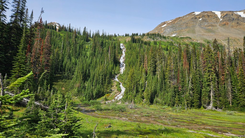
A little bit of route finding was necessary as we descended from the moraine and briefly followed the creek before cutting into the bush. I left some flagging tape but it wasn’t necessary. There was tons of rubbish in the area and weaknesses through the trees likely left behind from winter sledders. We hiked past a waterfall and then picked our way between a few more trees before reaching the open slope that we had noted from the signpost.
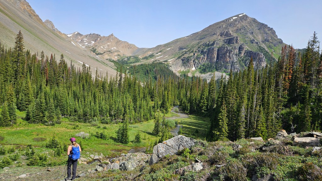
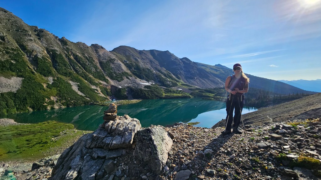
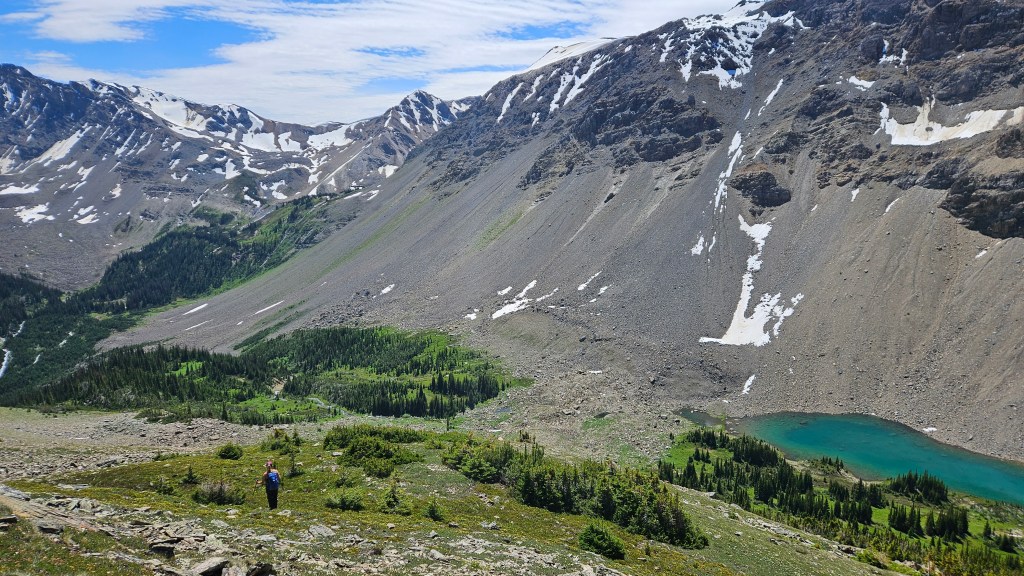
Once out of the trees we were able to resume a good pace and hiked directly northwards across the talus, avoiding most of the wooded area. Eventually the slope dropped down to the north fork creek, to our surprise a defined trail followed along the left (west) bank. We followed this north until the creek forked again, and decided to cross it here (east) as this would bring us closer to Kingpin’s western slope base. Both forks are outflows of nearby Lang Lake, which is worth the side trip. We straddled the terrain between the two creek forks until nearer Lang Lake. The route up Kingpin’s western slope was very obvious from here and appeared no more than a steep walk to the top. Our buddy Kels decided to call it quits at Lang Lake and wasn’t fussed with reaching the summit. Lang Lake itself was already reward enough and indeed, as its own hiking objective is worth the effort.
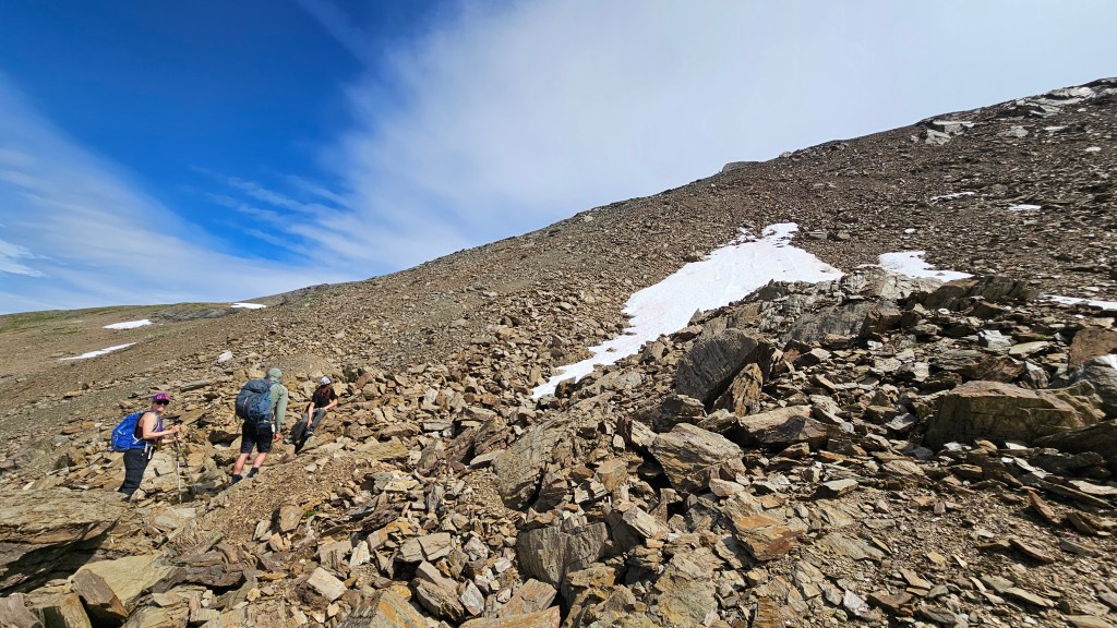
The rest of us started up the slope. It was now pushing 11:30am and the group was beginning to spread out with varying energy levels. Initially the slope was carpeted with alpine vegetation and meadow, with numerous summer flowers in full bloom. The meadows later gave way for classic talus and rubble, remaining non-technical in nature. Another plod for the books! One party member however strayed to the climber’s right into some very crumbly hands-on debris, oblivious to the deteriorating slope he stubbornly committed to it (moderate scrambling). The rest of us enjoyed the scenic walk to the summit with minimal difficulty.

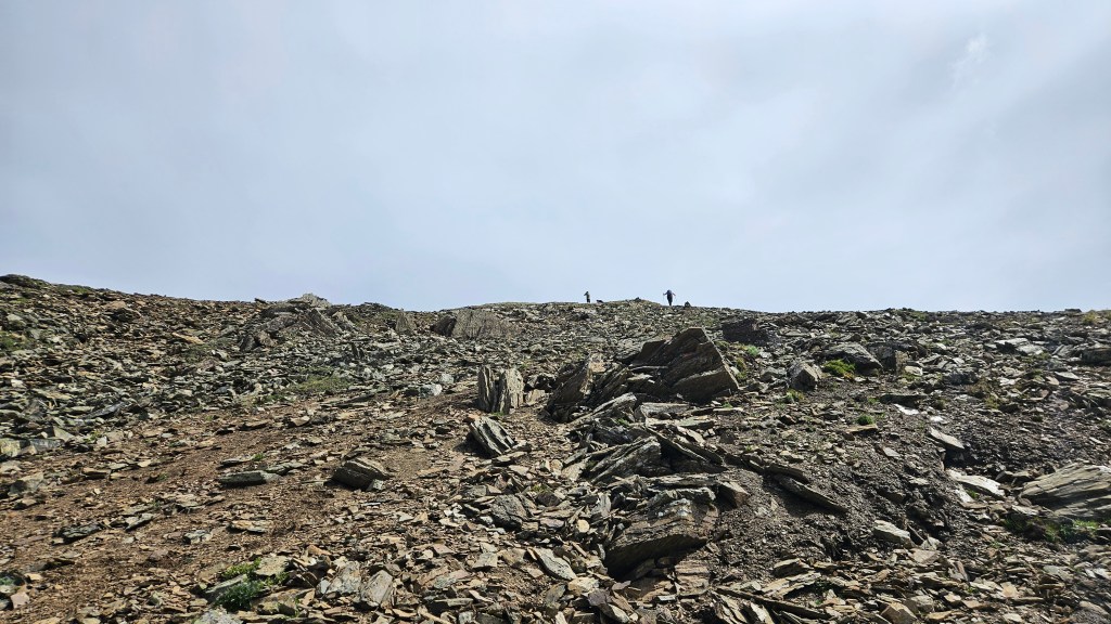
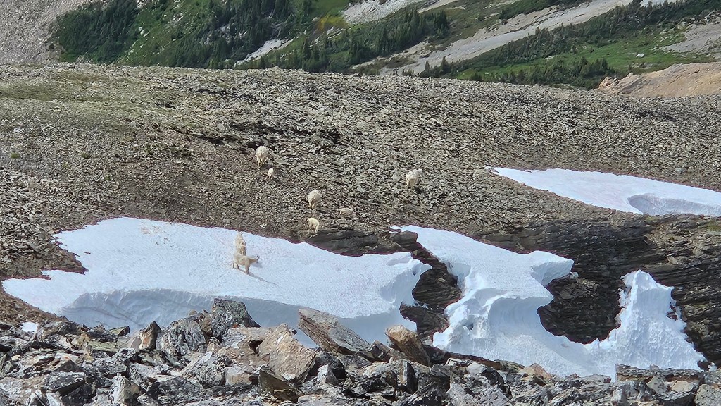
Most of our group made the summit around 1:10pm. And WOW what a summit indeed! Golden’s local peaks offer a lot of spectacular views but this may be the best we’ve seen yet. Views of the Northern Selkirks, Sir Sanford, Rogers Pass, Blackwater Range, Van Horne Range and beyond greeted us at the summit. The morning’s blue bird conditions held with the only minor obstruction being a patch of wildfire haze to the far south. While waiting for the the last two members of our summit party to catch up, the four of us watched a large family of mountain goats lapping up snow melt just below the main summit’s northern slope. In terms of summit views, this might be my favorite from the 2025 season and there were many grand views that summer!

While enjoying the views, time briefly slipped away from us. It took a while for the last two members of our party to catch up and summit, and unfortunately they were limited to a brief visit. We had a long way to back track, including re-ascending the Bokor-Zombie Col which would add at least another 300m or more of vertical later into our day. We returned down to Lang Lake and fully regrouped one last time before splintering off into smaller groups for the return hike. It was here that the mood shifted and the stoke levels simmered down as everyone knew it was going to be a slog back up the moraine. And indeed, it was a slog.
Navigating back to the moraine was straight forward enough, I had tracked our steps with my Garmin watch and had left flagging tape along the way. Although the group had split up we could still hear and call back to each other, which was very reassuring while in the trees. At the signpost we caught our last visual of the slower group and continued on our way. The toe of the moraine proved to be the “crux” of our day, being the steepest and shittiest section. Sharp talus and deteriorating silt made for troublesome footing and along the way our friend’s dog ended up with very bloody paws. We did managed to save ourselves some trouble and paw pain by boot packing up along the remaining snow patches to complete our ascent of the col.
My group reached the Bokor-Zombie col around 4pm having fallen behind the faster group, and when we turned around realized we had likewise lost sight of the slower group. The wind had picked up into a brisk steady breeze, with the col acting as a wind tunnel. It made it impossible to listen for the other group and we anxiously waited an hour at the col to visually confirm if the slower group was still on route. Eventually Kels caught sight of them and with our minds somewhat at ease we hurried back to Gorman Lake. We made it back to the trailhead around 7:30pm making for a +12 hour day.
Luckily everyone made it back home that evening and our friend’s dog ended up being okay too but has since been retired from scrambling. Our group even made it back to Whitetooth Brewery in time to enjoy the patio that evening!