August 12th 2015. Kananaskis, AB
Round Trip 8 hours – Elevation Gain 1100m
Moderate Scramble
*Updated Jan 2026* For years I referred to this unofficially named peak along Mount Galatea simply as “Middle Galatea” having seen the name “Little Galatea” already applied to some maps to describe a lower point that we passed by on this trip. In 2026 I discovered on Peak Visor that “Middle Galatea” is also named “Galatea SW 1.3” and lists a height of 2980m. If you are able to spot Little Galatea on a map in relation to the main summit, then my old name of Middle Galatea still makes sense so have left in this old report as is. I was actually quite pleased to finally find an online map with this route marked on it, so strongly recommend looking this peak up on Peak Visor before heading out.
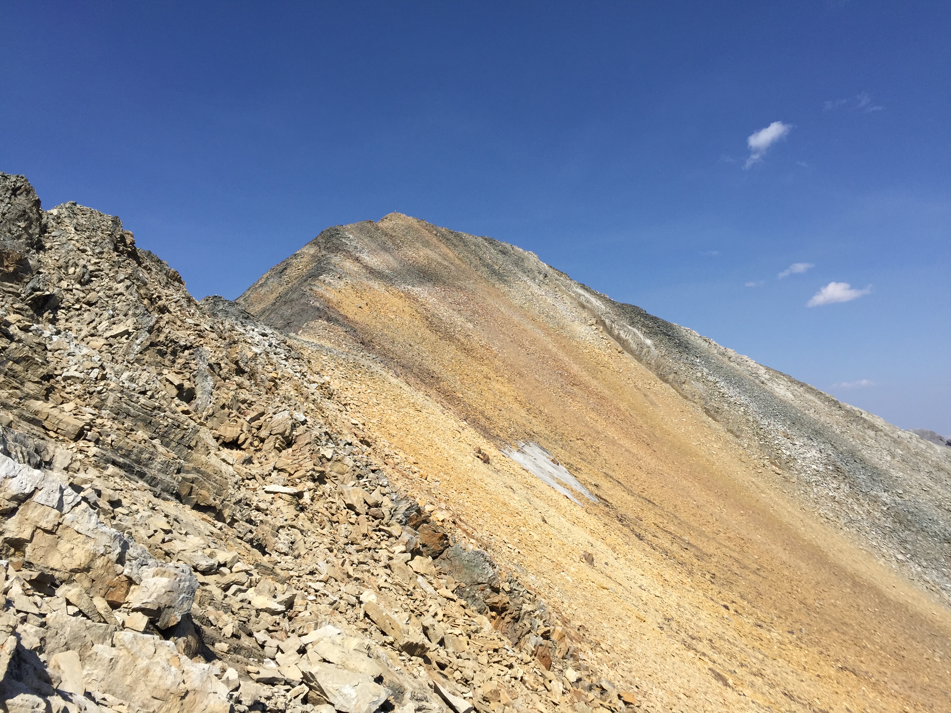
Southwest of Mount Galatea’s proper summit, this Middle peak stands out from its parent peak and lower sibling peak. Its a straight forward scramble up shale slopes from Chester Lake but as we discovered on the descent, steep cliff bands can complicate things underneath the summit’s lower slopes. The approach follows the popular hiking trail to Chester Lake. From the lake, continue northwards on a faint foot path that leads towards Mount Galatea. On the west side of the valley the ridge line of Little and Middle Galatea appears upwards on the climber’s left as a distinct orange peak. This is “Middle” Galatea.
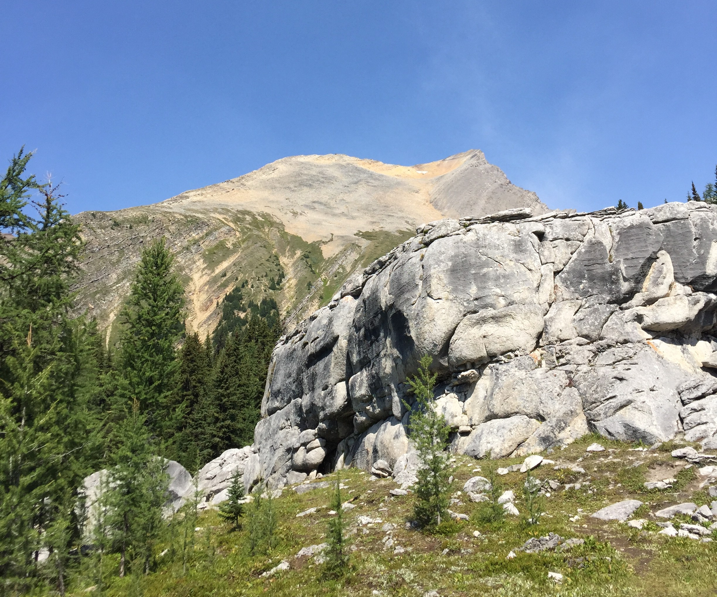
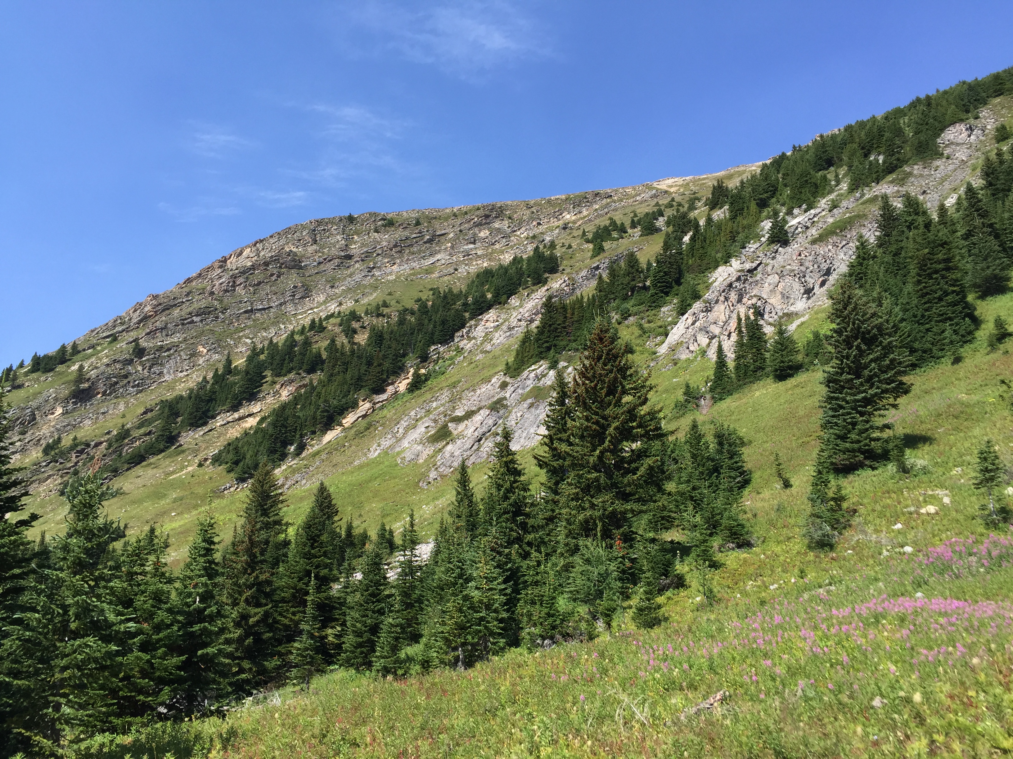
Continue along until the vegetation fades out into rock; from here one can easily gain the slope. If one continues too far there are cliff bands that will offer very challenging steep scrambling. We followed along the slope until an obvious weakness presented itself. The sooner you gain the ridge from the lake, the easier the scrambling will be. Once you have cleared the cliff bands (moderate scrambling) the ridge mellows out into a simple walk across beds of colourful shale.
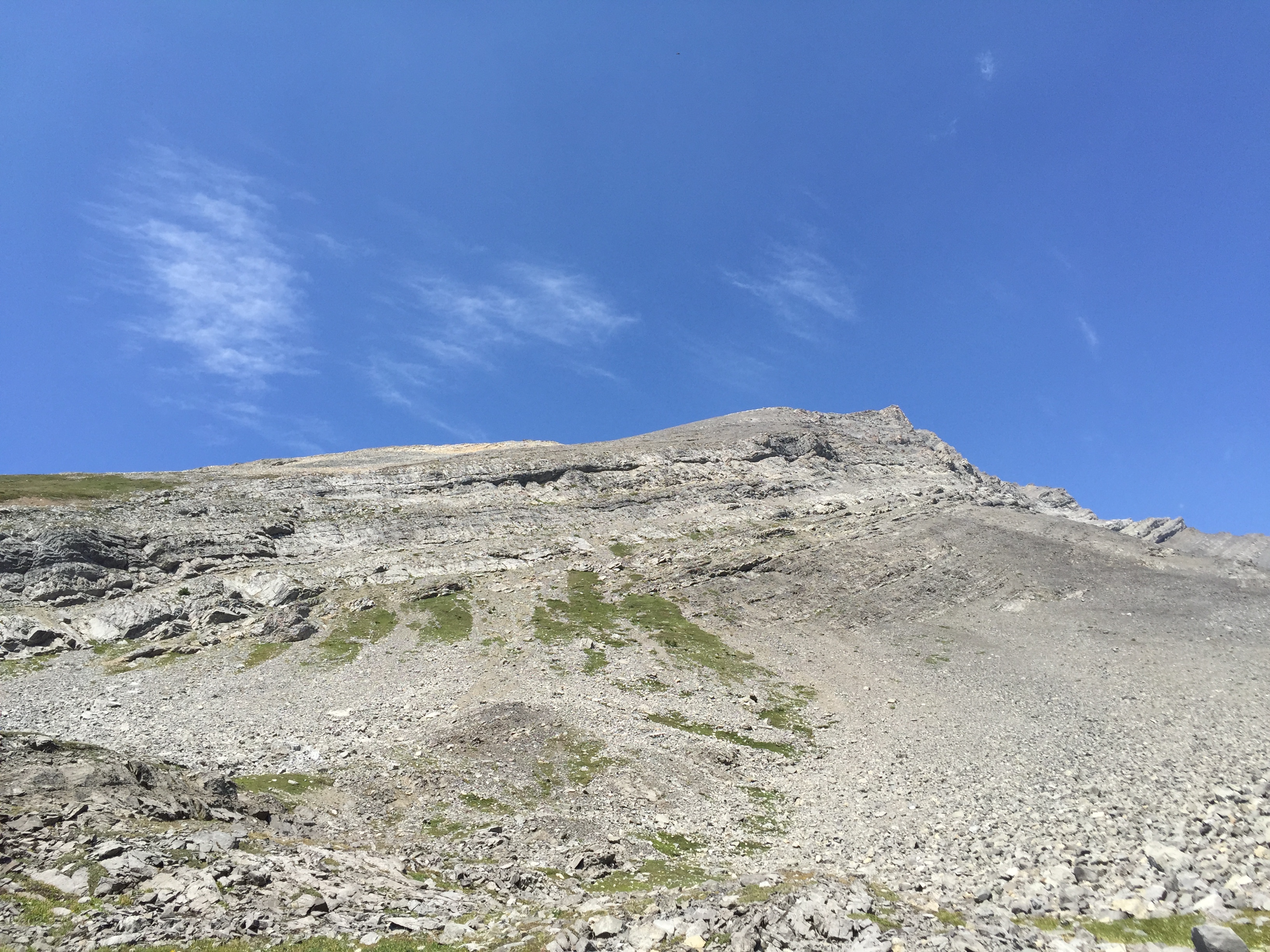
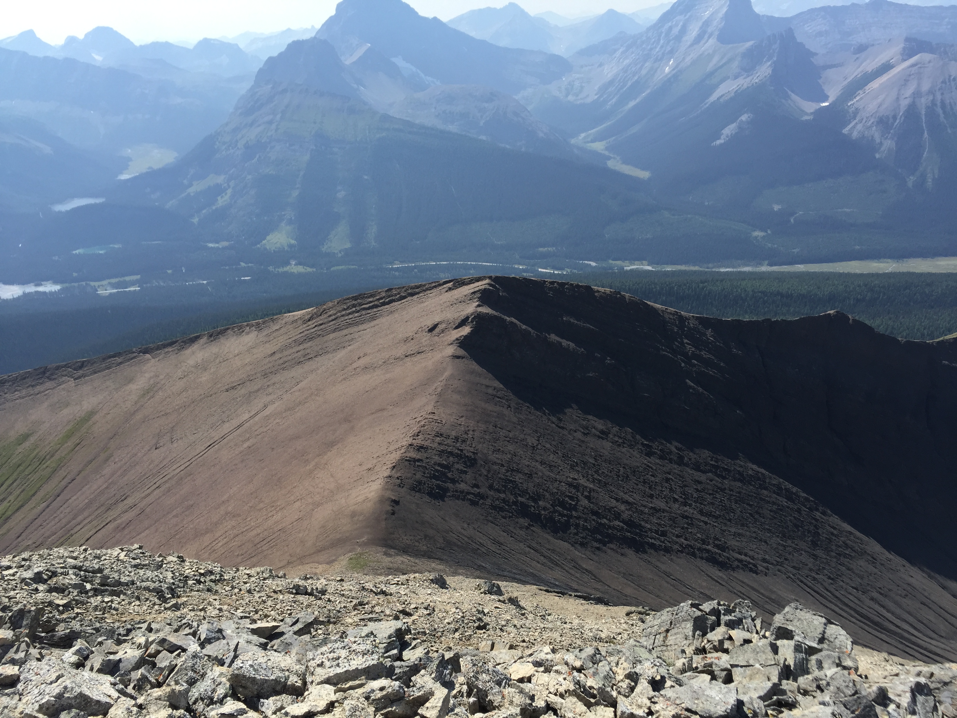
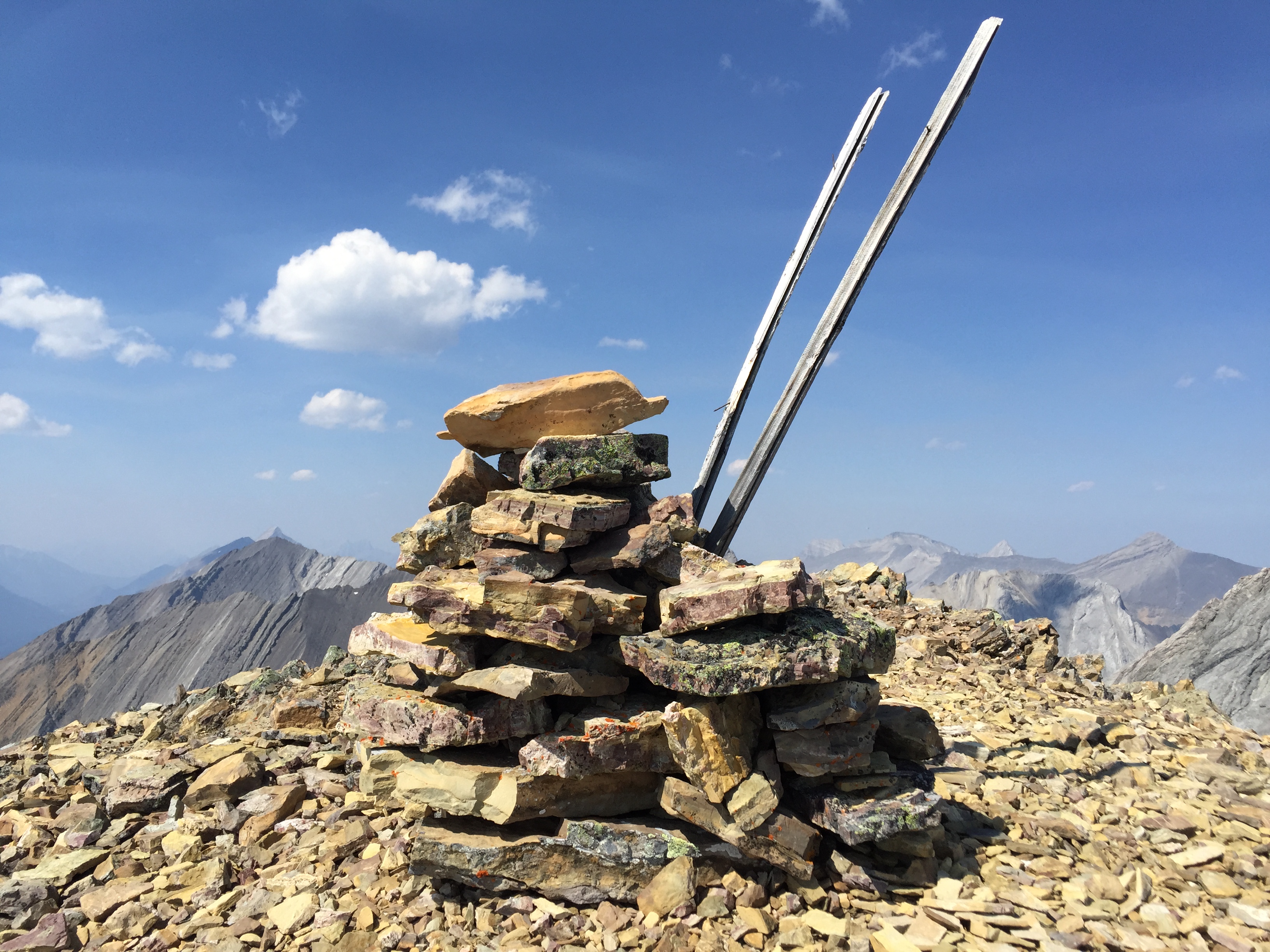
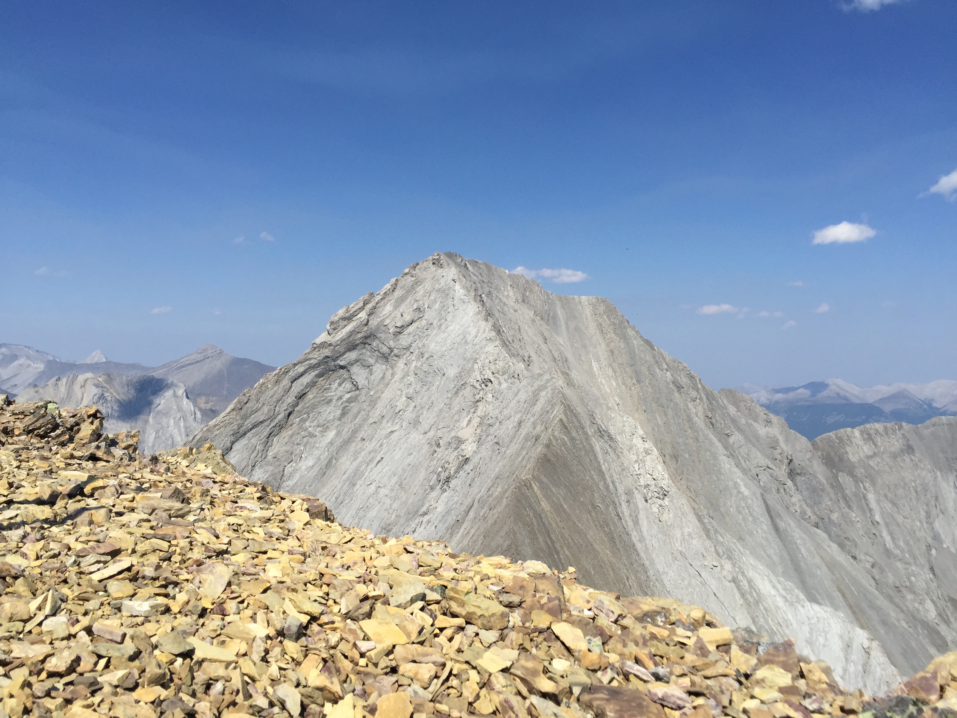
The ridge walk remains a relatively easy scramble until around the last 200m. The top of the ridge steepens in exposure and the scrambling becomes more moderate. From here the shale shifts to an obvious orange-yellow colour and the summit is now within striking distance. Rather than staying true to the ridge we opted to side cliff the last section across a small lingering snow patch. From the snow patch we directly slogged our way up to the summit which is marked with a large cairn with two large sticks. Our GPS indicated that the summit was approx. at the 3000m mark. From here the proper summit of Galatea looms above but would require SUBSTAINTUAL elevation loss to traverse – and potentially would be more than a scramble!
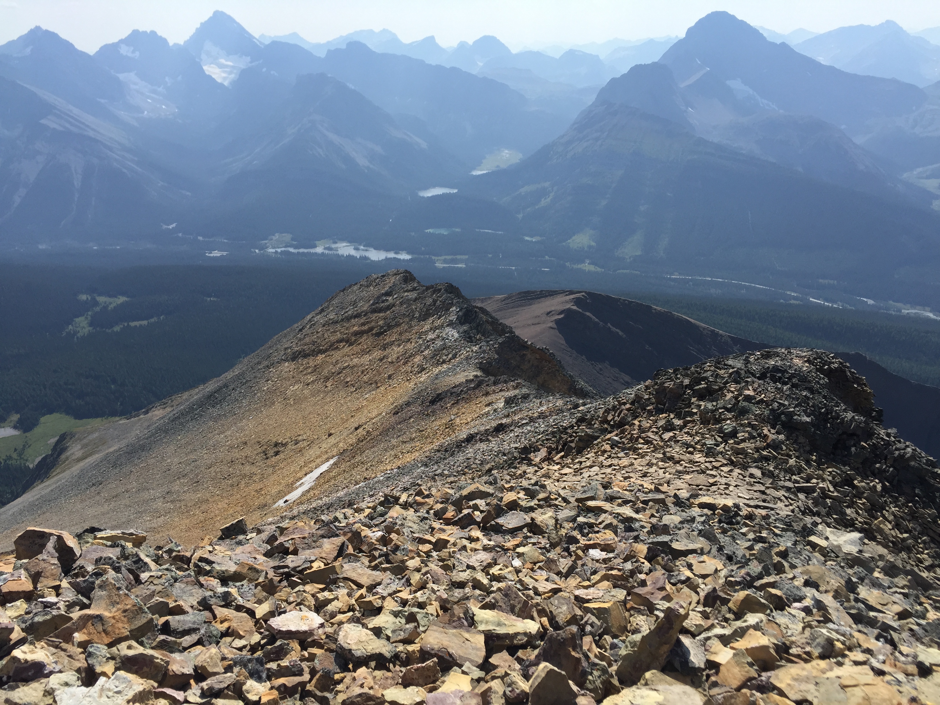
On the route down we attempted to descend directly back into the valley below without re-traversing the ridge. This was a poor error on our team’s part as we encountered difficult scrambling through the cliff bands mentioned earlier. Steep enough that (major rookie mistake) I opted to toss my pack down as to gain extra balance. I never got it back and we had to find a different way down altogether. As my friend Jules summarized for us later on at The Wood in Canmore, three lessons were hard learnt that day. 1) Don’t toss your pack, 2) Don’t down climb stuff that makes you want to toss your pack off, and 3) this was Not Mount Chester!