
July 13th, 2021. Rogers Pass, Glacier National Park
Round Trip: 10 Hours, Elevation Gained: 1320m
Moderate Scramble via NW Ridge
Further Reading: see my trip report for Mount Abbott which shares the same approach
Mount Afton at 2553m is the larger of the two peaks at the southern end of Abbott Ridge, a strenuous yet rewarding hike near Rogers Pass. I had previously teamed up with Ben and Scott in 2018 for Mount Abbott and had attempted the traverse across and up Mount Afton, however Ben and I quickly felt in over our heads and turned back. Scott however completed the traverse, concurring that it was a difficult scramble and opted to descent down the Northwest Ridge, which he reported back to us was a much more moderate route of boulder hopping. I had been since itching to revisit this area and tackle the NW Ridge with Bri for a second shot at Afton. In Summer 2021, we got our chance having at the time recently moved to Golden, BC.
Again, to clarify, this trip report is for the longer and technically easier route up the NW Ridge, not for the standard route which is a much more difficult scramble via the East Ridge. The East Ridge is a steep and difficult scramble route directly traversed from Mt Abbott. For the Northwest Ridge route then:
Follow the popular Parks Canada hiking trail up Abbott Ridge, some 4.9km via switch backs through old growth interior rainforest and eventually past Marion Lake into alpine meadow. The trail switches back several more times eventually leading you past the shoulder (looker’s) right and onto the start of Abbott Ridge. Allow 2 – 2.5 hours for this initial approach from parking lot to the Parks Canada trail marker indicting that the trail has ended. Continue past the Trail Ends sign and traverse the ridge south towards the summit of Mount Abbott, an easy/moderate scramble. You are no longer on the official Parks Canada trail and are now into easy scrambling terrain with sustained but manageable exposure.
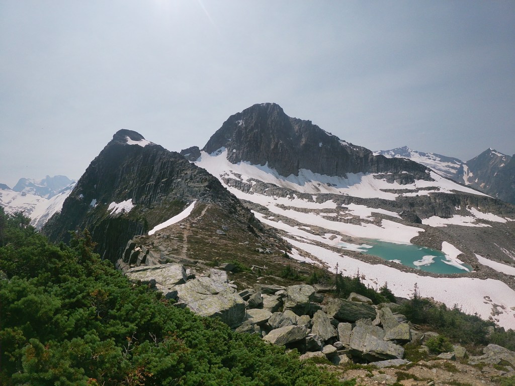
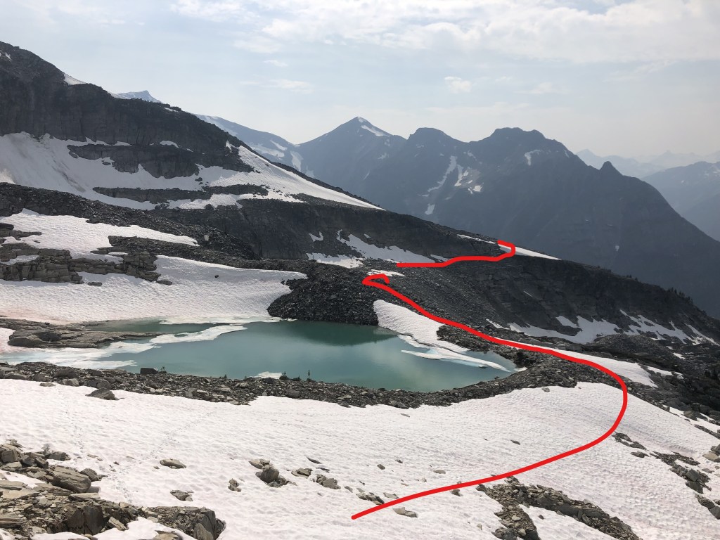
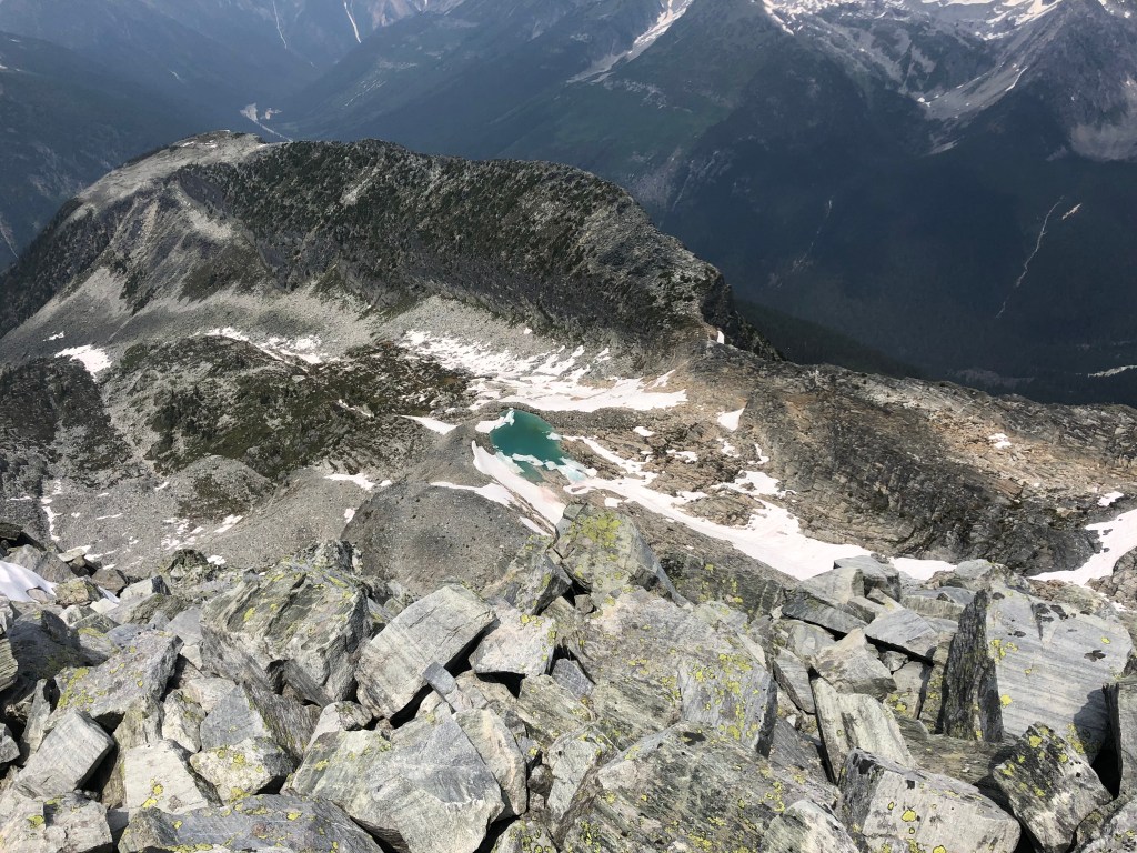
Continuing along Abbott Ridge towards the summit of Mount Abbott, there is a distinct dip in the ridgeline. As you descend into this dip, the tarn under Mount Afton is only minutes beneath you on the looker’s right (west) side. Descend from the dip and proceed to the north (valley) side of the tarn. In 2018 it was an ugly silt colour, in 2021 it was a brilliant turquoise. Spend some time at the tarn and observe the route towards Afton’s northern shoulder. The route takes you across and down the moraine, then back up through a brief set of ledges and up onto the shoulder. It looked steep from the tarn but when we approached it close up it was barely a scramble through the ledges. We went low as to avoid the heavier snow patches, in drier conditions the higher ledge may be feasible but the lower ledge would still be ideal. From the tarn you will lose several metres before regaining them amongst the ledges. Admittedly you do lose a fair bit of elevation descending from Abbott Ridge on your way past the tarn and up to the shoulder.
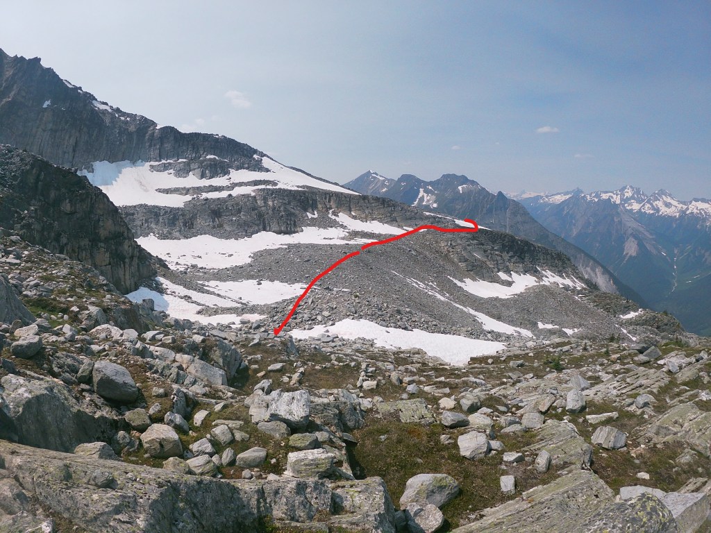
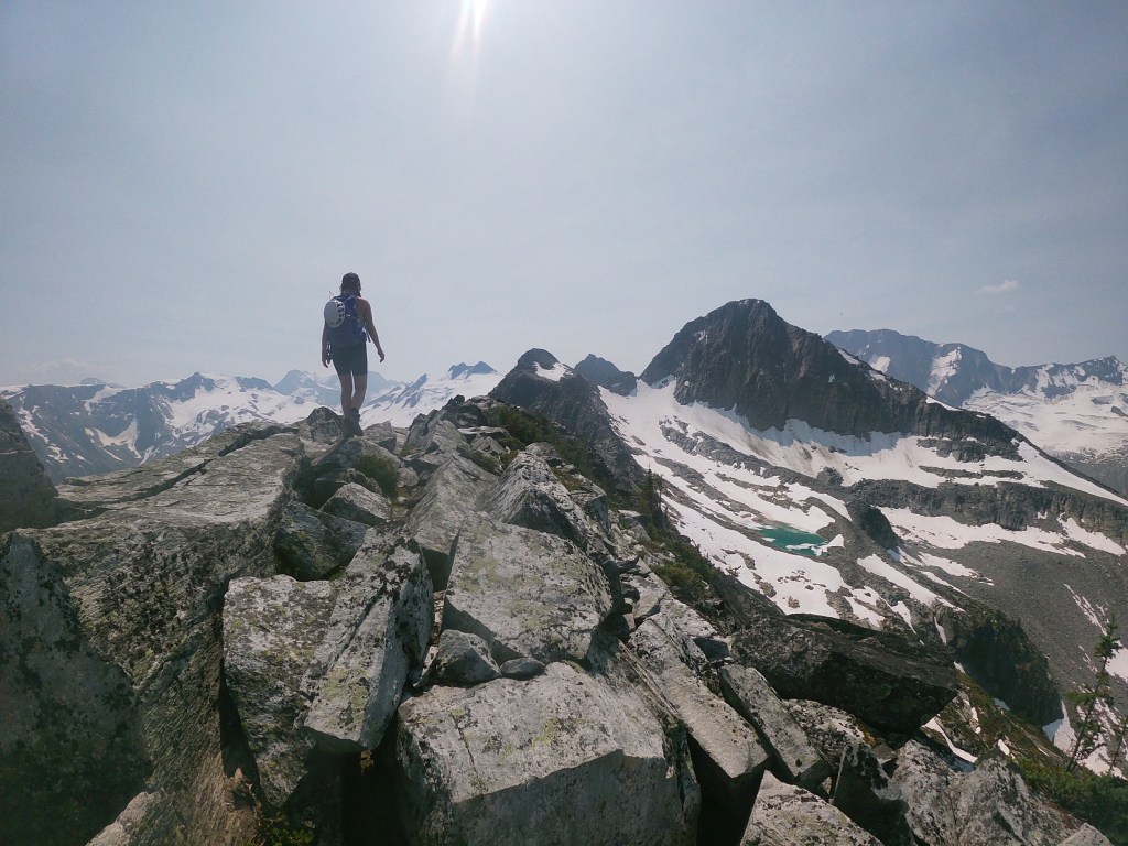
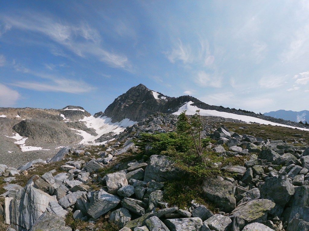
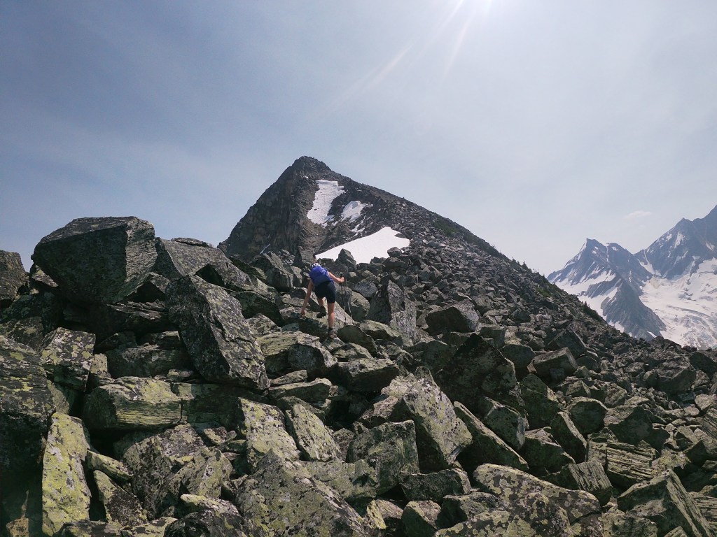
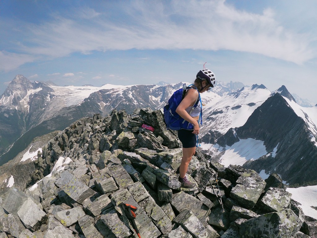
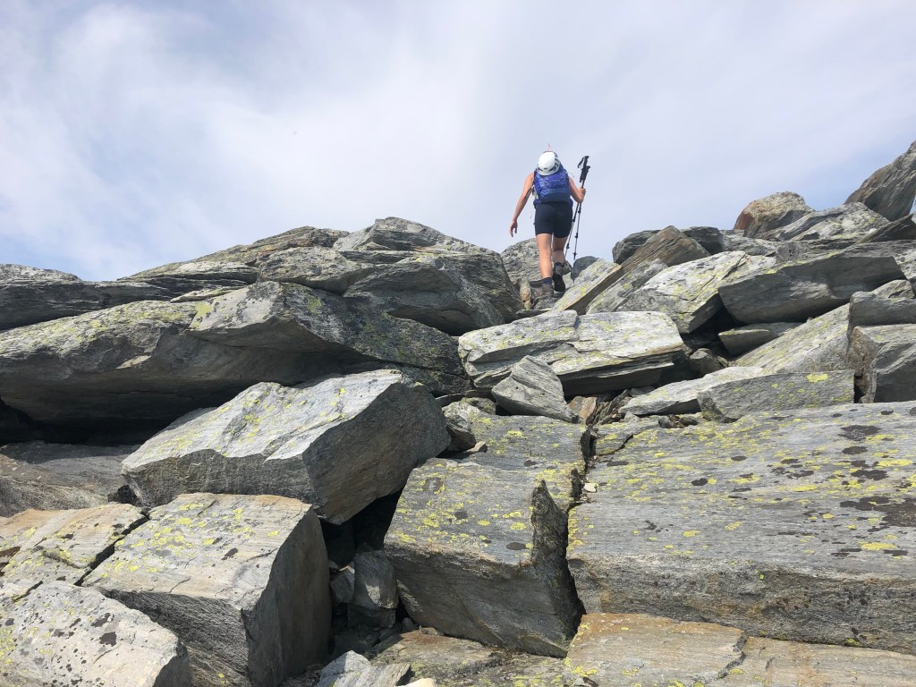
Once you’ve gained the shoulder above the ledge, work your away up the ridge crest, gradually working your way to the climber’s right hand (southwest) side as to avoid the more exposed sections. Several of the boulders along the ridge crest balance over deep air pockets through here so mind your step and don’t drop anything in (including yourself)! Expect sustained moderate scrambling as you gain elevation, though most of the hands on parts are in the form of boulder hopping. Continue along the ridge crest until approx. 80m beneath the summit when you’ll want to venture slightly to the climber’s right to avoid the more exposed sections, slogging up hard packed scree sections between boulder patches.
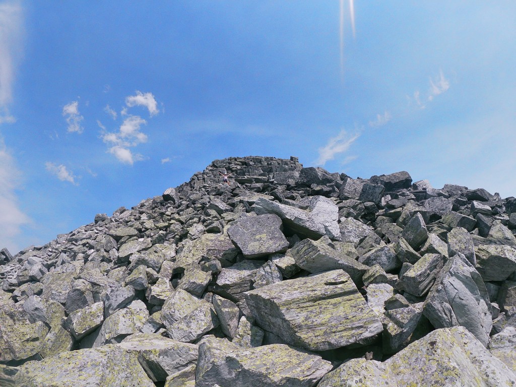
The last section is the most hands on part of the day but is no more technical than moderate levelled scrambling as encountered on the route. Bri lead the charge more or less straight up the block, whereas I contoured slightly to the climber’s right, taking me to a ledge on the southwestern corner of the lower summit block; from there it was a straight push upwards on solid but exposed rock. Bri’s way was the faster of the two.
We stuck to the same route for our descent. For the descent aim slightly to the skier’s left (west) as to avoid the more exposed sections of the ridge crest until you reach the bottom north shoulder above the tarn. You have to complete a natural switch back from the grassier section of the shoulder and switch onto a gentle graded ledge, this will lead you back towards the moraine that sits below the tarn. A brief 25-30m scramble up easy boulders will bring you back to the tarn itself, from there you can easily ascend back to Abbott Ridge. For those wanting both peaks, Mount Abbott is only a few more minutes away scrambling south over large blocky boulders. Otherwise, head back north along Abbott Ridge until you’ve returned to the formal Parks Canada trail.
One final note, when we went in mid July of 2021, there had been a lot of bear activity on nearby trails, with a sighting per trail everyday in the two weeks prior to our trip. We did not encounter any, thankfully, but nonetheless carried bear spray. Despite Parks’ “difficult” hiking rating assigned to the trail, on both trips the trail was quite popular with a fair number of other hikers around. And, despite going the long way, Bri and I eagerly reflect back on this trip has being one of our favourite scrambles out there!
