August 22nd 2025. Banff National Park, AB.
Round Trip: 11 Hours, +26km, Elevation Gain: 1230m
Moderate Scramble
Further Reading: Alan Kane’s (2016) Scrambles in the Canadian Rockies 3rd Edition
Another classic from Scrambles (2016) that had been on my radar for a few years. Encouraged by our successful trip up Mount Ethelbert the previous week, Bri and I decided to give Mt Bell a go given its moderate rating. Scott had previously gone up the ridge directly from Taylor Lake, as did our buddy Nathan the previous day, both assigning the route as a moderate to difficult 4th class scramble on decent rock. Still recovering from my shoulder injury in July we decided to stick to Kane’s route involving a longer approach via Lake O’Brien and a moderate rated scramble. While this proved to be the safer option so-to-speak, it made for a very long day with tedious talus/scree treading aggravating my injury enough that Bri and I regretted not taking the more technical route.
Sadly my Garmin watch glitched hard at the start of this hike by miscalculating our elevation at the trailhead to that of Golden’s, which gave us an insanely overestimated elevation gain between the carpark and Taylor Like. Luckily the times and recorded distances were correct so I was able to note our 7:30am start time. It took us 90 minutes to reach Taylor Lake, where I restarted the watch and acquired an accurate elevation reading. After the reset the remainder of the day was recorded with fair accuracy. From Taylor Lake to Mt Bell’s summit was approximately a 1000m elevation gain, and we had barely done a quarter of the day’s total kilometer distance. We wasted little time at the Taylor Lake junction and continued on at a steady pace for Lake O’Brien.
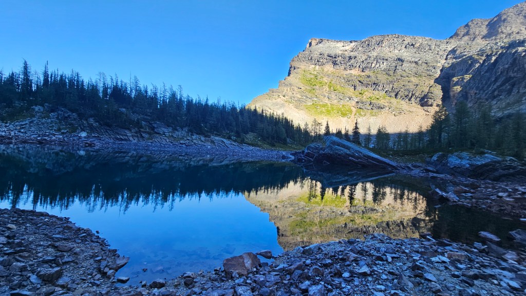
The hike in to Taylor Lake is honestly pretty dull but at least follows a wide well-groomed Parks trail. The connector trail to Lake O’Brien by contrast is much for rugged and less maintained. To our surprise this trail drops and regains a decent bit of elevation along the way, which was quite frustrating at the end of the day. A lot of good sized ankle rolling roots along this connector trail too. Arriving at Lake O’Brien the forest opens up and the trail appears to contour around the lake’s south side. However, for our route we needed to cross the lake’s eastern outflow creek in order to connect to the Scrambles approach route.
Crossing the outflow creek of Lake O’Brien proved to be the navigational challenge of the day as the connector trails through here were almost non-existent. Perhaps they had been washed out by the rainy summer season. It took several tries to find a relatively shallow cut-through of the swampy outflow of Lake O’Brien, and once to the other side (north) we did briefly regain a defined trail. This was a misnomer however as the trail quickly deteriorated into wet mud and swamp hidden between the trees. Once fully into the trees the trail all but vanished up a steep embankment and we resorted to good old bush thrashing. Past the forested section our ascent took us towards a series of tarns that are neatly stacked in tiers along the toe of a long moraine.
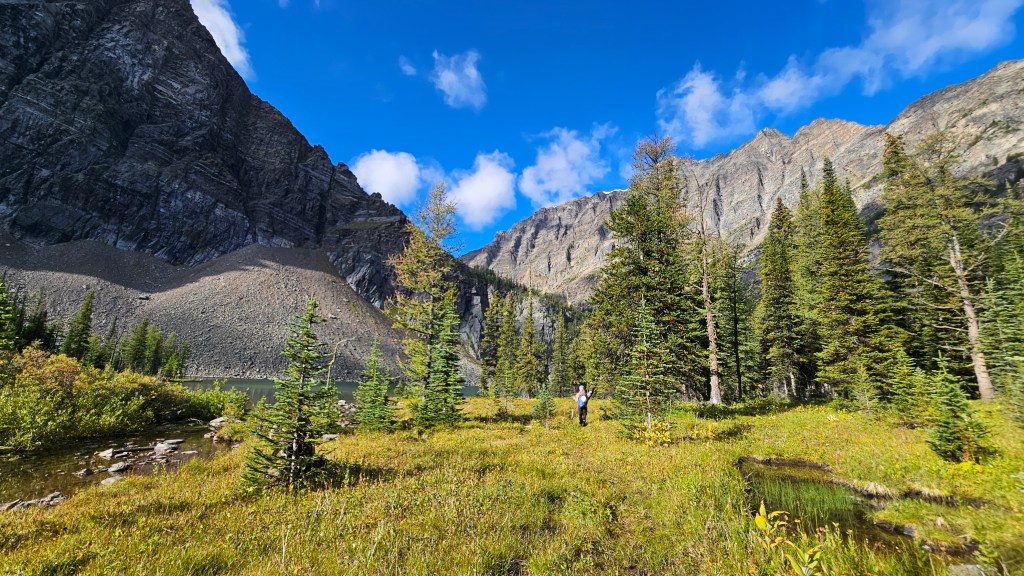
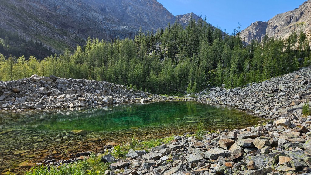
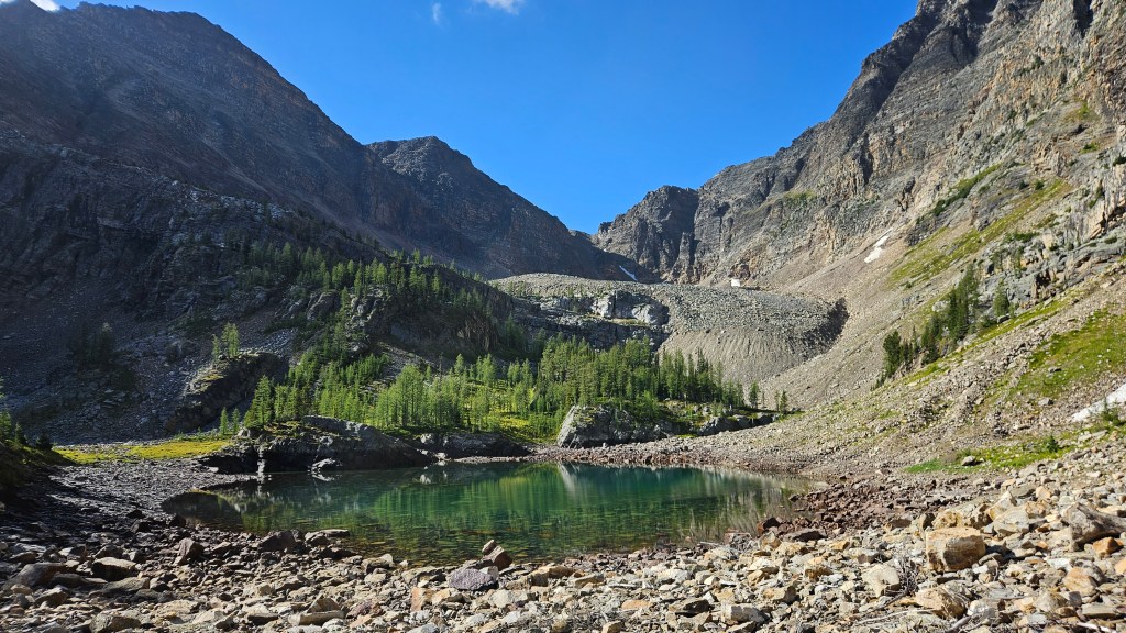
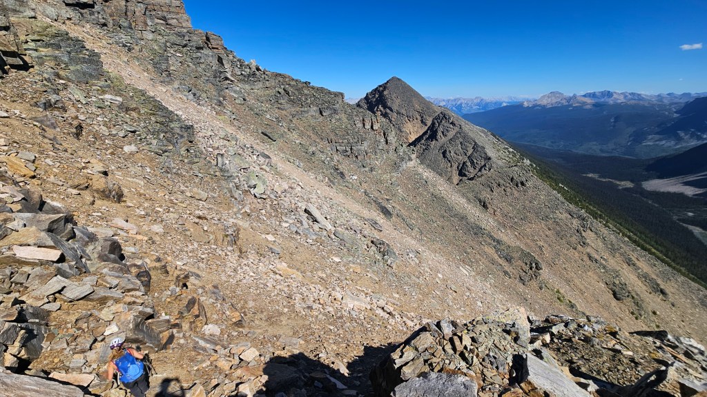
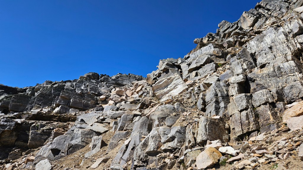
Once out of the trees the terrain became a little easier to navigate as we scurried north past most of the tarns. This ended up being one of the few picturesque spots along the approach but unfortunately one of the buggiest sections of the day. Mosquito nets on, we continued into the moraine following the base of several talus slopes which skirt past several cliff bands. Numerous cairns dotted the way keeping us on route. As the elevation picked up we could see the couloir needed for intercepting Mount Bell’s long south ridge. We aimed slightly for the climber’s right staying left of a long sliver shaped snow patch. This section was the textbook definition of a slog and became fully sun exposed during our ascent with zero wind. The treadmill scree would later provide some fun boot-skiing on return.
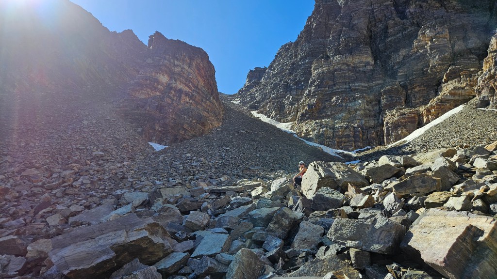
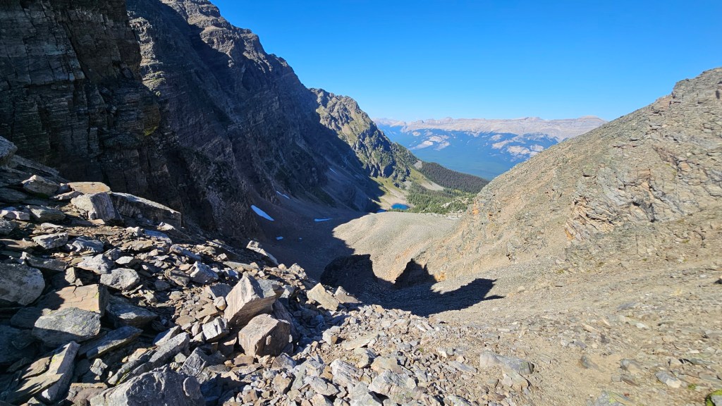
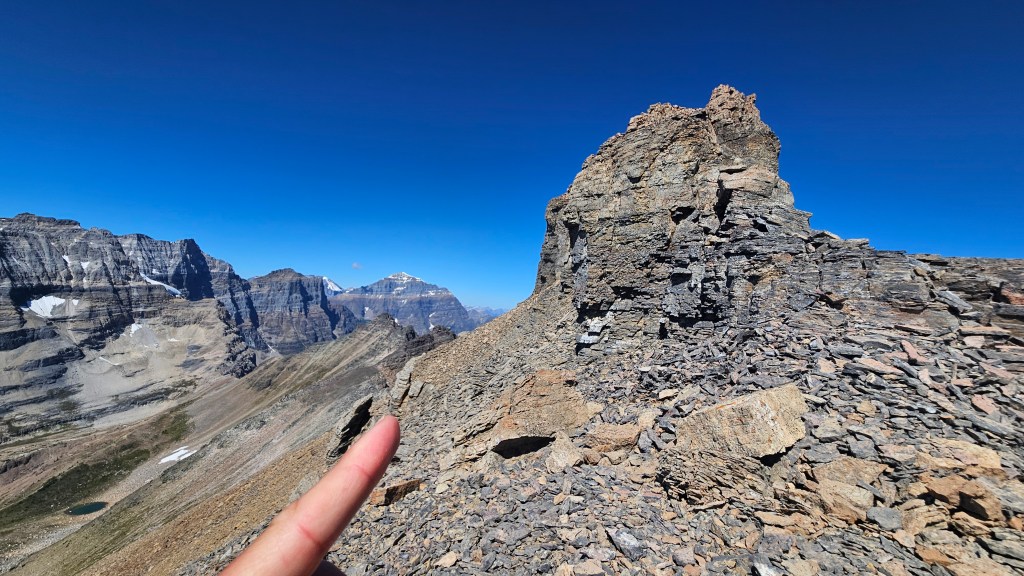
From the first tarn it took us 90 minutes to reach the top of the col. Ascending the col in-of-itself felt like an achievement and we took a long break up here to enjoy some hard-won views of both valleys. We still had a fair distance to reach the summit and to our delight there was now a visible footpath cutting through the scree. By sticking to the Boom Lake side of the slope, we managed to avoid most of the technical sections under the ridge crest. After a brief dip in elevation, we encountered broken blocky ledges and slowly picked our way back up towards the ridge crest. Moderate scrambling and occasional large boulder hopping encountered along the way. l managed to keep the injury aggravations to a minimum which was very encouraging… just made for slow overly cautious travel.
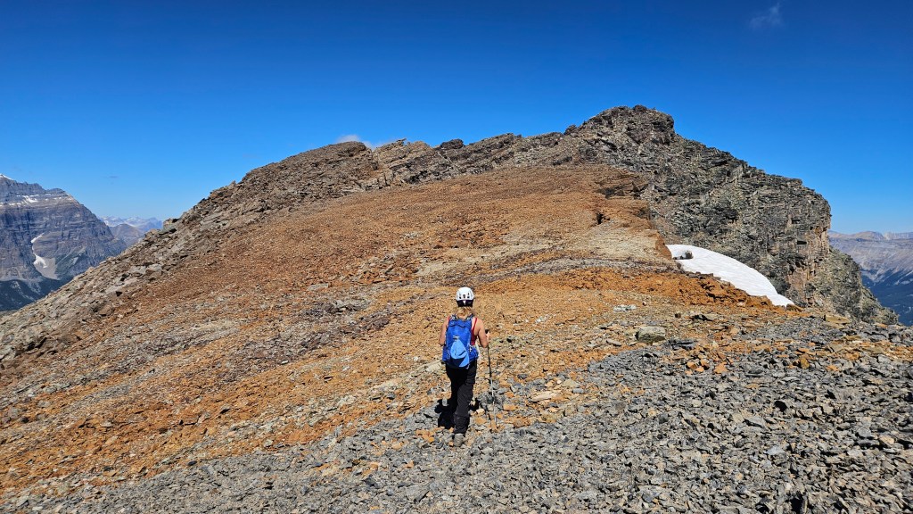
As we traversed along northward we noted several direct accesses from Boom Lake and wondered out loud if that approach would have been better… it certainly was more scenic than we had expected. Picking our way through broken ledges we eventually crested the long summit ridge, following several cairns throughout. A faint footpath bypassed around a false summit from which the final push was a mere stroll across a relatively flat section. From the false summit it was nearly half an hour before we topped out.
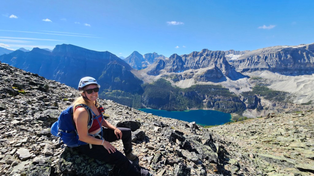
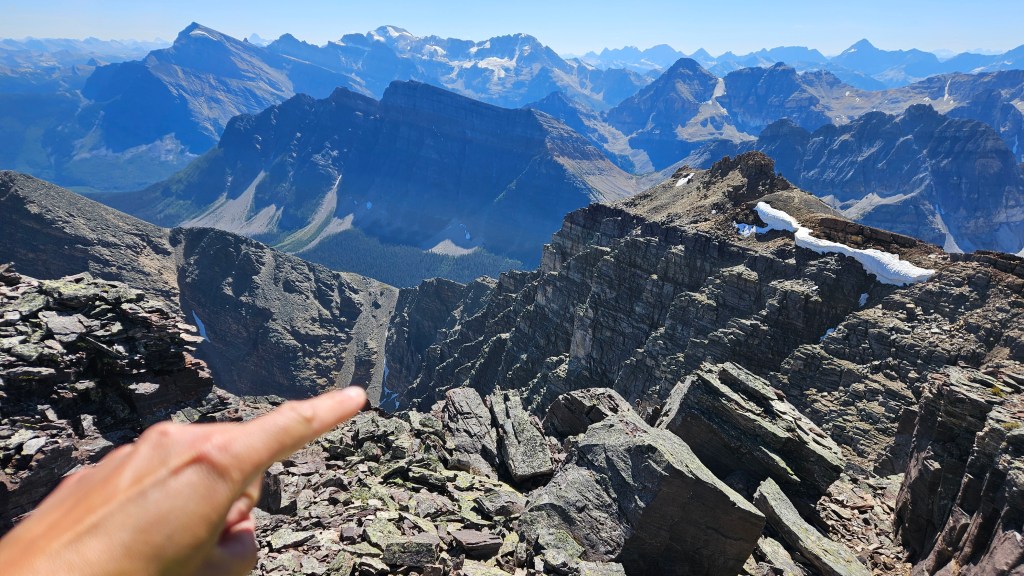
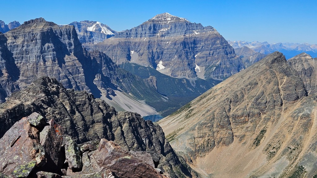
We reached the summit around 1:45pm making for a +6 hour ascent time from the car. From the top of the col it had taken us 2 hours to scramble across to the summit and the views were worth the plod-fest up. Very stoked to have crossed this one off-of the list though we did question our decision in taking this longer route now faced with having to return along it. We pondered out loud if my shoulder could have handled the more direct technical route from Taylor Lake, as it seemed to be more aggravated by scree bashing versus hands-on scrambling. Oh well, we savored the views for a while before making our way back down. Having worked at Moraine Lake years earlier, it was awesome to see the south side of Consolation Pass for the first time. We could see a large summit cairn up top of Mount Bell’s NW summit 2810m, and scouted out the likely ascent route from Consolation Pass. Likewise could see the southern summit of Panorama Ridge. Perhaps new objectives for our list!
On the return journey we initially stuck closer to the ridge crest and again stayed high when returning to the “dip” section, following a more distinctive footpath. The last push back to the col we somehow dropped a little far down the south side slope but managed to catch the error earlier enough to avoid too much unnecessary elevation loss. Back at the col, it was a straightforward descent back to the tarns section, the treadmill scree that dogged us earlier made for a fun boot-ski descent. Beneath the col it was straight back across the moraine past the tarns and into the forest section. We somewhat followed our approach from earlier and noted a grown-in side trail through the swampy section that may have bypassed Lake O’Brien… we were too tired to risk getting lost so stuck with the main trails to complete our return hike to the car. All-in-all, a very long day and a contender for “plod of the year” award.