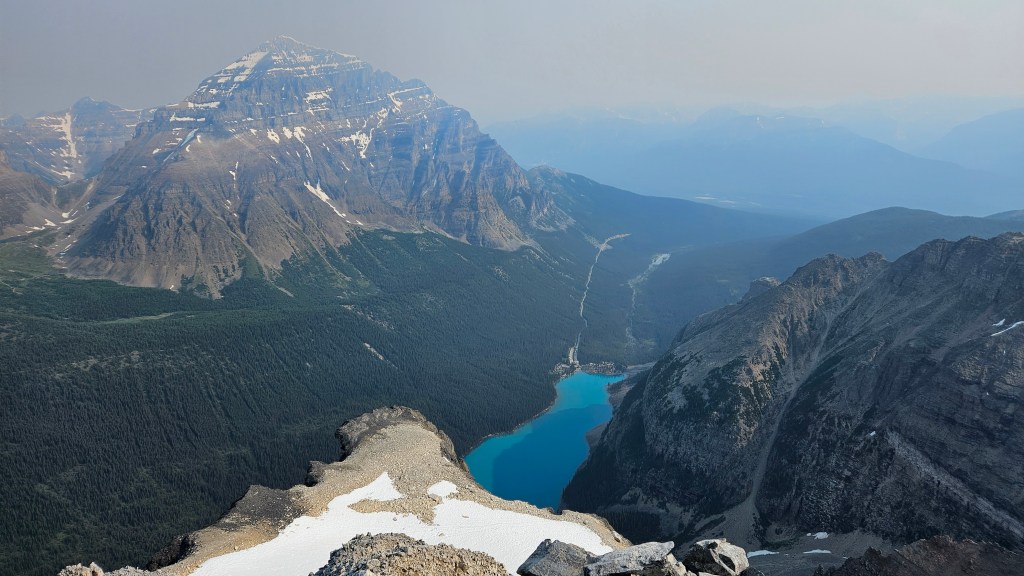
July 21st, 2024. Moraine Lake, AB
Round Trip: 3 Days, Elevation Gain: 1200m
Difficult Scramble via Schiesser Ledges
Easy Scramble up Mt Bowlen from Neil Colgan Hut
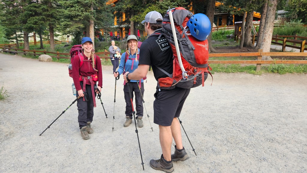
After 2023’s failed attempt at hiking to the Neil Colgan Hut via Tokumm Creek, this trip was a long time coming. Especially for our good buddy Mike who had driven all the way from Victoria to join us on both trips. For the 2024 trip we opted for the more direct approach via the Schiesser Ledges, or Ledges Routes for short. We booked ourselves two nights at the Neil Colgan Hut with a 6:20am shuttle from the Lake Louise Ski Hill to Moraine Lake. We left Golden at 4:30am to make said shuttle, so had a very early start to our day. Our friend Ashley also joined for this adventure making it a four-person team, which was very reassuring for the roped glacier travel. This report covers the Schiesser Ledges route (day 1), the brief scramble up Mount Bowlen (day 2), as well as a few notes from our descent down the Perren Route (day 3).
I had previously been this way a few times over the years. In 2015 I teamed up with Jules and Blake for Mount Bowlen via Tokumm Valley, back when the trail was still somewhat maintained. 2016 Blake and I returned to the hut via the Schiesser Ledges blasting up from Moraine Lake to the Hut in five hours. We would summit Mounts Fay, Little, Tonsa and Perren on that trip. 2017 I led a group up the Schiesser Ledges route with the intent of summiting Mount Bowlen as a day trip however our pace was too slow and I forced the team to turn back at Peak 3-4. And finally in 2023, Mike joined Bri and I for an unsuccessful approach via Tokumm Creek (old Fay Hut route), which was far more rugged versus the 2015 trip. We were dogged by dead fall and horrendous air quality so ended up turning back only a few hours into the approach. 2024 was very much a redemption trip!
We officially began the on-foot segment of our journey at 7:05am hiking Moraine Lake’s lakeside trail. At that trail’s end we followed along the right-hand side of the the creek feeding into the lake. The path along the creek was fainter than I recalled from the 2017 trip and a bit more grown in but nonetheless still traceable. The trail lead us through the forest to a swampy meadow with flagging indicating the correct way into the next band of trees. This second round of trees involved minor bushwhacking through to the moraine basin. Numerous cairns led us across the moraine’s hardpacked ridgeline, wrapping around towards the Ledges route. It was already getting very hot and muggy that morning, and the mosquitos were waking up as we hiked the moraine portion. It took us approximately 90 minutes from the trailhead to reach the end of the moraine’s ridge to the first series of ledges.
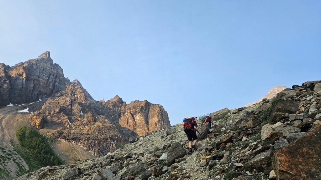
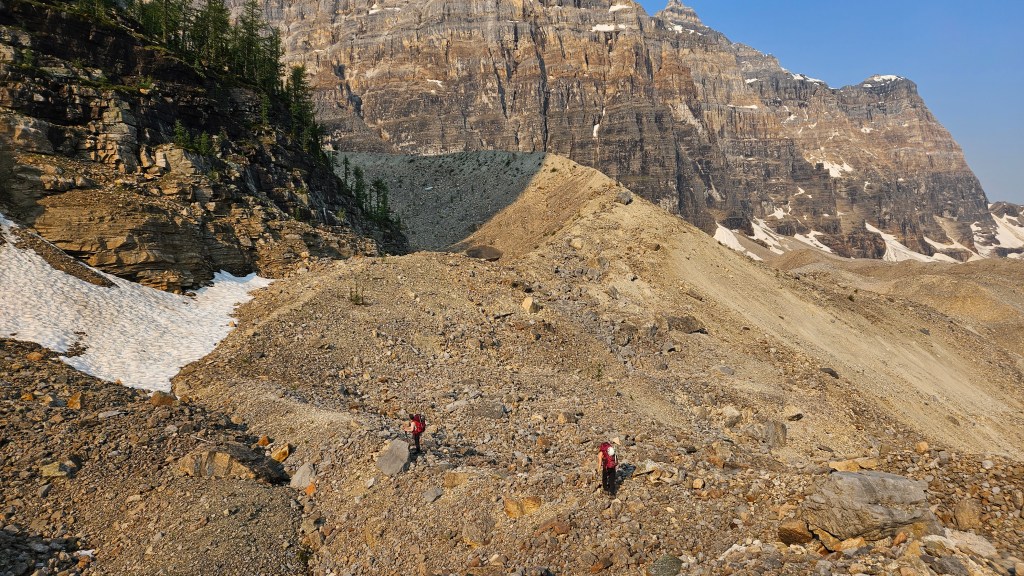
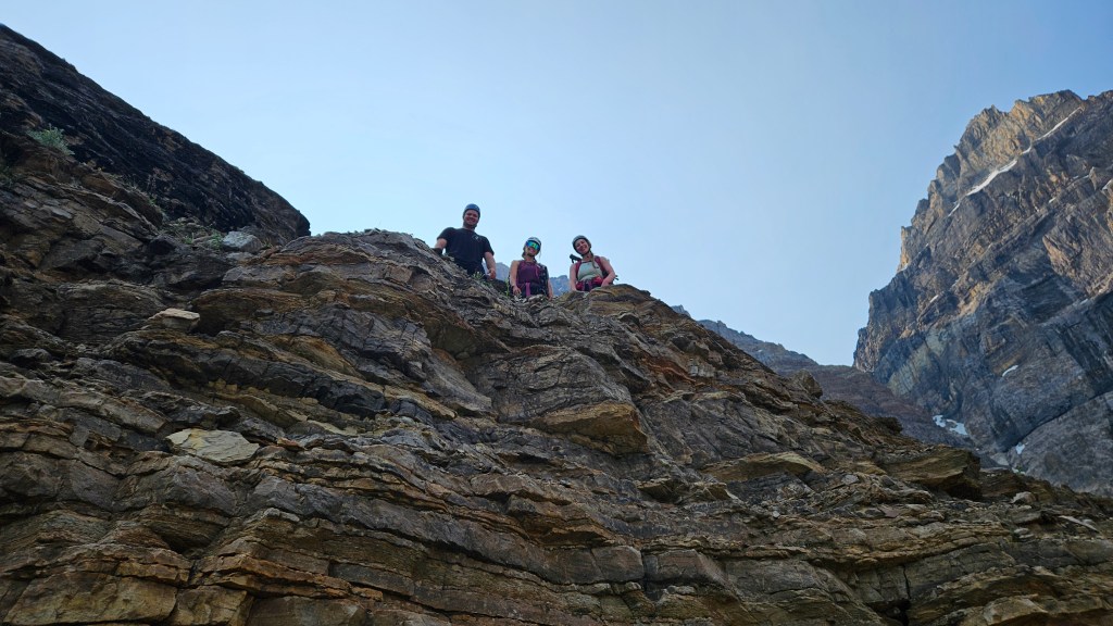
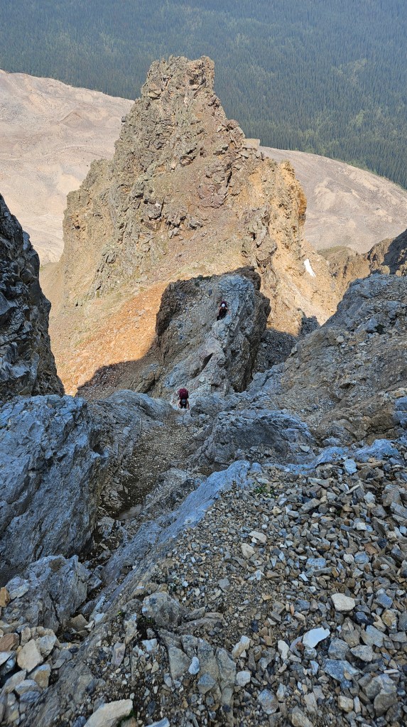
Some route finding was required to pin-point the exact start of the Schiesser Ledges route. In 2017 my group had followed up the moraine too high into the gulley and were pelted by rockfall, so this time around we left the moraine earlier (climber’s left) scrambling up a set lower ledges. Around 45 minutes into the terrain we finally noticed the first few cairns leading to the infamous pink spray-painted dots marking the route. The dots were quite faded and harder to follow versus past years, and in some sections appeared to be missing altogether. Likely due to rock fall and erosion of the route over the years. The route finding slowed us down a bit and while we mostly got along as a team, there was some indecisiveness when picking which ledge to scramble next.
A pinnacle feature I had landmarked in 2016/17 helped guide us up the lower ledges of the route but later proved a friction point when we reached said pinnacle. We were meant to side-hill traverse to the climber’s right as this spot but instead scrambled up right next to this pinnacle and gained the ridge too early. This shortly led into some very spicy terrain and was clearly not the correct way. We backtracked slightly and stubbornly tried another ledge underneath the ridge which was likewise not the right way either. Up until this point in the route the pink dots had become more consistent and we hadn’t seen any in this area, so after an hour wasted around the pinnacle we backtracked to the last painted dot and had a proper sit-down. In doing so we caught our breath and spotted a large cairn off to the climber’s right and which led us back on trail.
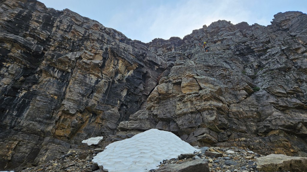
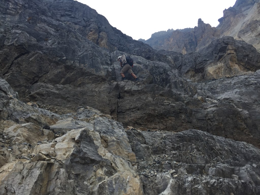
We reached the first crux around 12:30pm, roughly 45 minutes since finding the correct route underneath the landmark pinnacle. Up until that point, while on route, the scrambling had been mostly at a moderate rating. The last few ledges up the crux were becoming more hands on and more exposed, with the crux itself sitting above a narrow knife-edge like shelf. For some reason, in my memory I had forgotten about this exposed little shelf under the infamous chain section, and actually felt a bit of vertigo! As a result I went up first.
This first crux has a fixed chain, and it seemed sturdy enough, so I used it as an assist-railing and tried to rely on the rock itself. Its worth noting that the chain had been there back in 2016 and even back then appeared quite old. Hard to believe that on my first trip I had scrambled up this section without using the chain at all. The confidence of youth, I suppose. If you skip the chain this gully is teetering into low 5th class and should be treated as a climber’s scramble. Unknowingly I kicked a rock down while midway up the chain section and Mike was very grateful for his new helmet. Asides from that, we took the area in turn and everyone was stoked to have cleared the harder of the two cruxes.
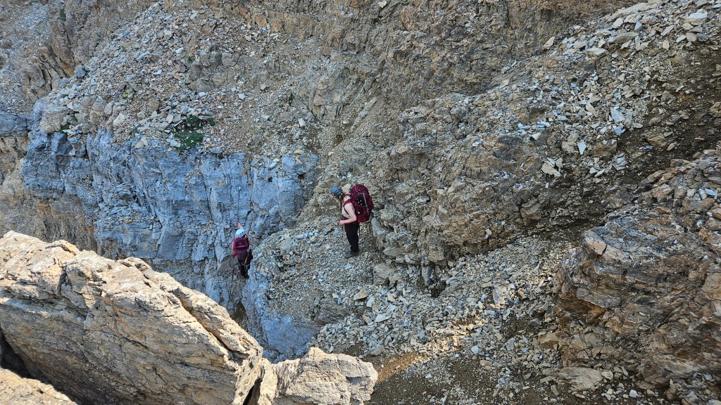
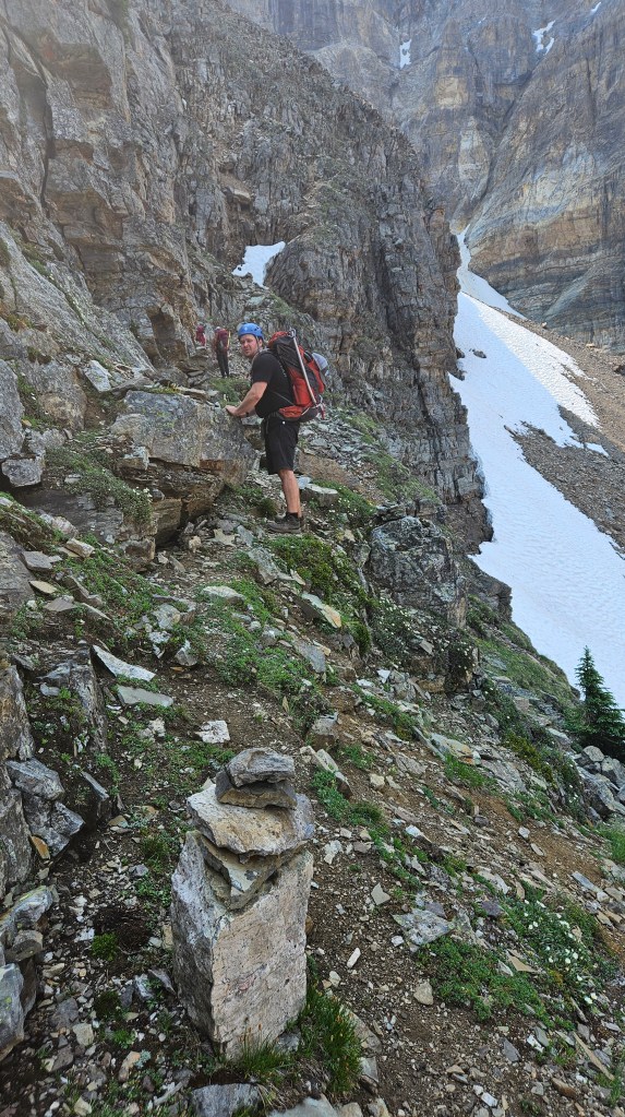
From the top of the chain section, we continued following the pink dots around a photogenic corner and exposed ledge. Around this corner we encountered our second crux some twenty minutes from the first. In 2016 there had been another chain left here, in 2017 the chain had been removed but there were anchor stations to tie into, so on that trip we roped up. In 2024, it looked utterly unfamiliar to me and this caused quite the stir within our group. In part, I recognized the correct rock feature as the second crux, however the chains and climbing bolts had been replaced and it looked totally different to me. We as a group were already exhausted at this point and opted for a longer break before attempting the scramble up. Though its not quite as exposed as the first crux, the second crux involves a few committing hands-on moves especially with the weight of large overnight packs.
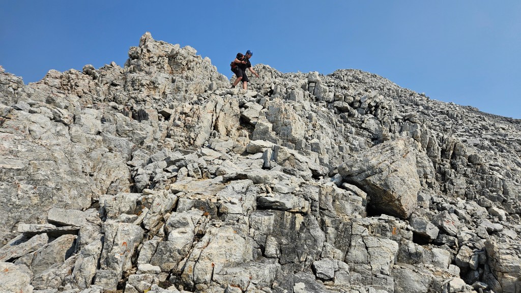
Bri and I attempted skirting around to the looker’s left of the crux which led to a sketchy gully, where I eyed some crumbly ledges to the climber’s right that may work as a bypass but aren’t much better than the crux itself. During that time Ashley managed to climb up the correct route and was eager to push onwards, calling us over to regroup. After some debate, the rest of us decided that Ashley’s direct way up was correct and we slowly convinced ourselves to scramble up this section un-roped. Mostly 4th class with a few low-5th class moves at the start. It looked worse from below and once committed wasn’t as bad as expected, the holds were decent.
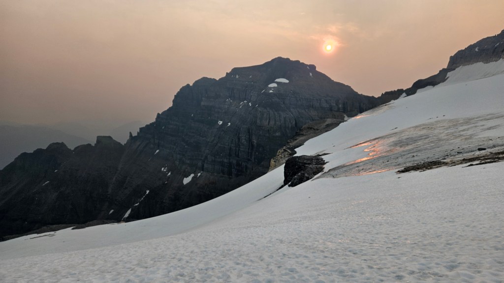
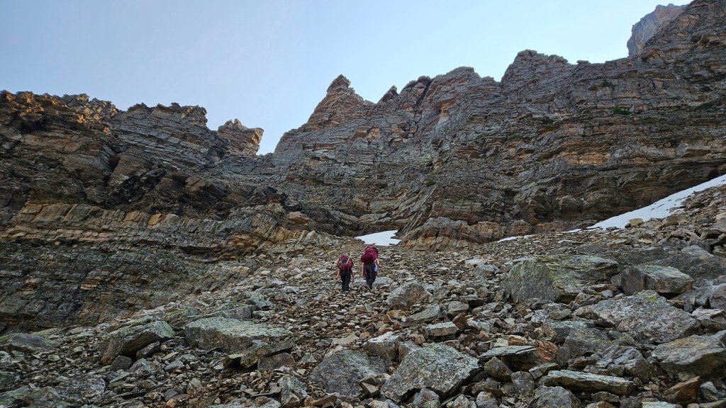
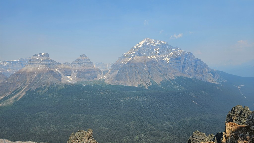
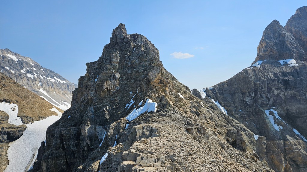
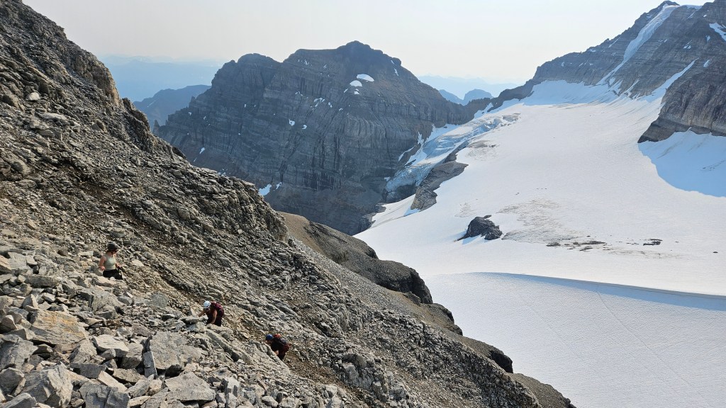
Around 4pm we cleared the top of the ledges route and could see the final stretch leading to the glacier. We briefly considered scrambling up Peak 3-4, which in theory would have only taken a few extra minutes but collectively decided to conserve our energy for the glacier traverse to the hut. We were all pretty knackered at this point and had been in the shade most of the day up until then. The late afternoon sun was now fully over us and it was a scorcher of a day, the same heat wave that contributed to the Jasper wildfires. Even at our height it felt like the temperatures were pushing into the low 30Cs.
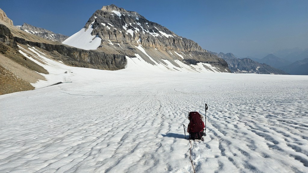
Another long break was taken at the top of the ledges route before hiking past Peak 3-4 (climber’s right) to the glacier’s edge. We took our time gearing up and crossing the glacier as everyone adjusted to using crampons. For more experienced parties this crossing should only take 20-30 minutes pending on surface conditions. Ashley had recently taken a mountaineering course and I had done a handful of mountaineering trips in past years so we worked together on ensuring Mike and Bri were glacier ready. Given that we spent some extra time on skills, it took us around 45 minutes to cross the glacier and another 20 minutes to scramble up the last slope to the hut. That last slog up off the glacier was by far the worst stint of the day, some of most rotten treadmill scree I’ve ever ascended. It was also very hot on the ice with temperatures climbing well above 30C.
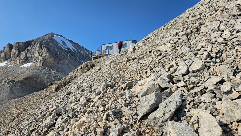
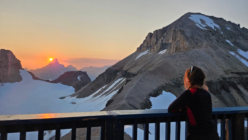
We reached the hut’s front porch by 6:15pm clocking in an eleven hour day and to our pleasant surprise discovered that we had the hut all to ourselves. Plus the outhouse barrel appeared recently changed! Absolute luxury. Of my three stays at the Neil Colgan hut this was by far the best in terms of visibility, sunset was epic that first night (well, both nights!) and other than finding a mouse-sized spider in the bunks we had a pleasant evening. There was brief talk of scrambling up Mount Bowlen that same evening but energy levels waned after dinner so we saved it for the next day.
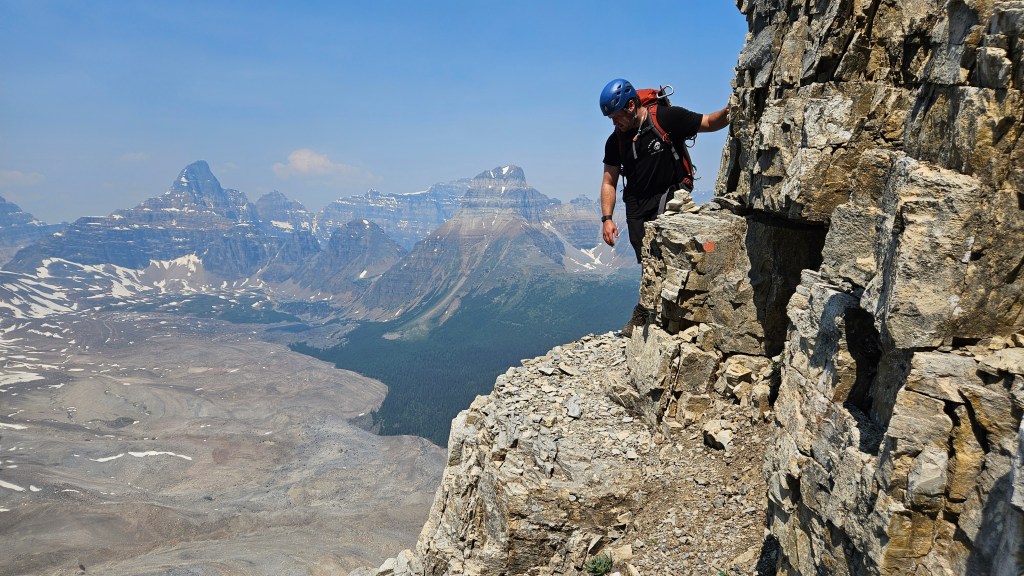
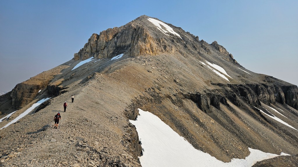
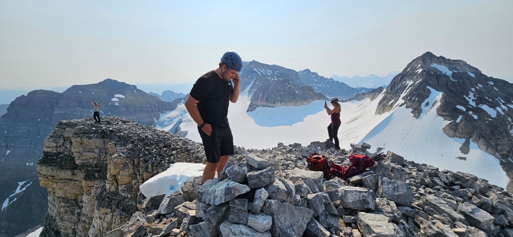
We treated ourselves to a very slow start the next day and decided on tackling Mount Bowlen first with the prospect of either Mount Little or Mount Babel after. From the Neil Colgan Hut the ascent up Mount Bowlen is a super straightforward scramble that is well cairned and viewable from the hut’s front porch. By comparison to the Schiesser Ledges, the rubbly southwest slope of Mount Bowlen is a much easier scramble and the easiest ascent of the Ten Peaks behind Moraine Lake.
From the hut we followed across the bench between the two icefields, heading up the southwest corner of Mount Bowlen mostly along a defined footpath. A few hands on ledges are optional to the climber’s left but if one wishes to keep this ascent at a non-technical level, stick more to the climber’s right where its a straight up slog to the top. We reached the summit in 28 minutes from the hut, gaining around 300m in the effort. It was an extraordinary moment up there standing above Moraine Lake – where Mike, Bri and I had all worked many years ago and had all first met. The skies were increasingly hazy and it was warming up fast even at 3000m. I was pleasantly shocked to see the same register from 2015 was still in use with lots of space remaining in its pages!
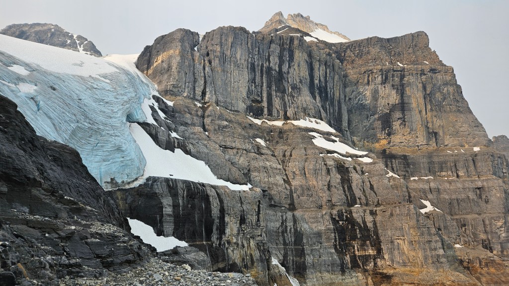
We enjoyed a long visit up top before returning to the hut, and setting out for Mount Little. I had previously been up Little in 2016 and recalled kicking steps up the glacier to intercept the 3rd class scrambling route so we briefly attempted that way again. We didn’t get far up the slope before turning back due to slushy isothermal snow over the grey ice. We prodded around the rock route directly behind the hut but didn’t get much further with that either (very rotten loose rock), so after an hour gave up and opted for a relaxing afternoon at the hut. Everyone seemed content with that option so we kept things light and enjoyed the scenery.
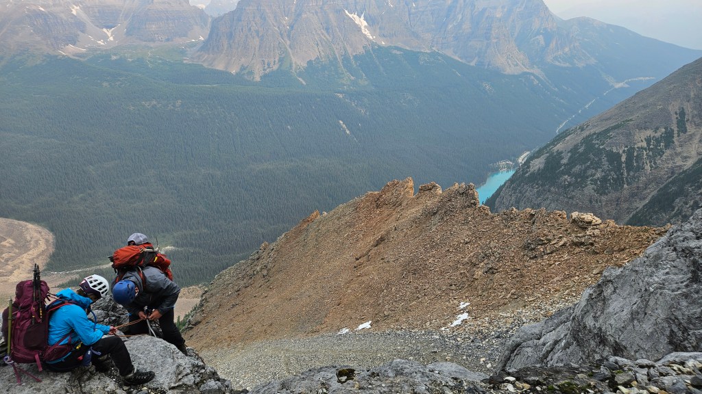
The next day we left the hut under eerie skies as the wildfire smoke was billowing into the valley casting an amber sunrise. We had previosly decided that we would rappel down the Perren Route for our return journey. The hut contained several old print-outs of the rappel stations and Perren Route overview, so we studied those the night before leaving. Given our experience attempting Mount Little the previous day, we had also ruled out the side-quest of summitting Mount Babel.
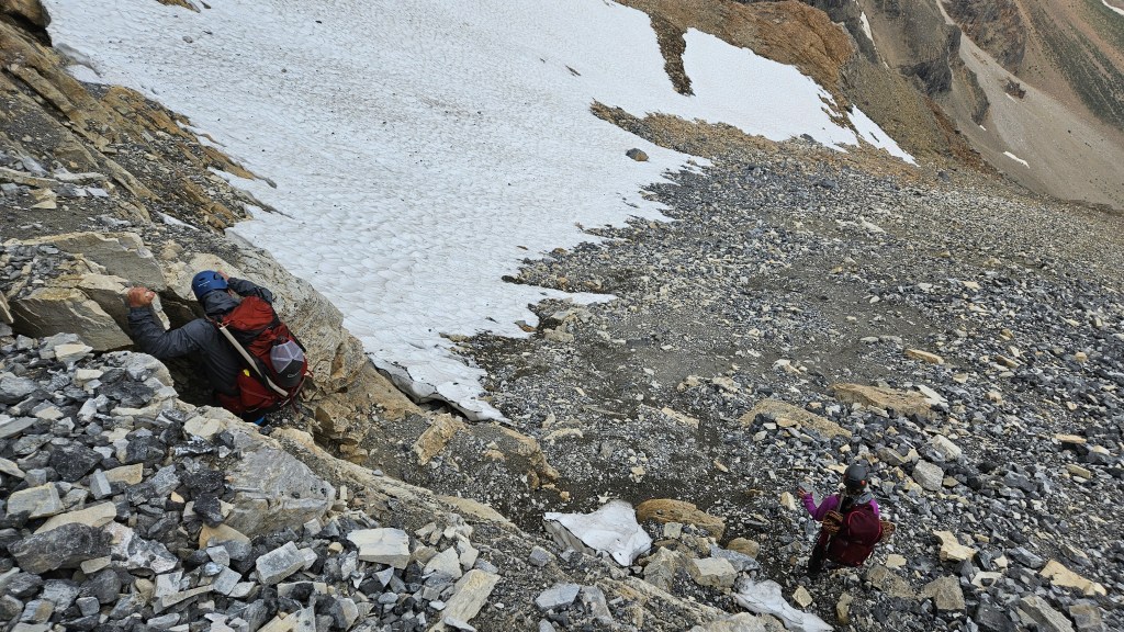
We kitted back up and were on the glacier by 7am. It took us around an hour to traverse from the hut to the first rap station. I had much more climbing experience heading into this trip since the 2016 trip, so had a lot more confidence with the rappels on this route. All the raps went super smoothly with a few moderate-hands on scrambling bits between stations. The third rap ended being a two-part descent so arguably its 4 rappels total. It was at this third final rap that we encountered the next group due to check in at the hut. Luckily the ascent line doesn’t fully overlap with the rappels so there was plenty of space for both groups to pass each other. It was a little bit surreal that we hadn’t seen anyone else in 48 hours despite being directly over one of the busiest tourist destinations in all of Canada.
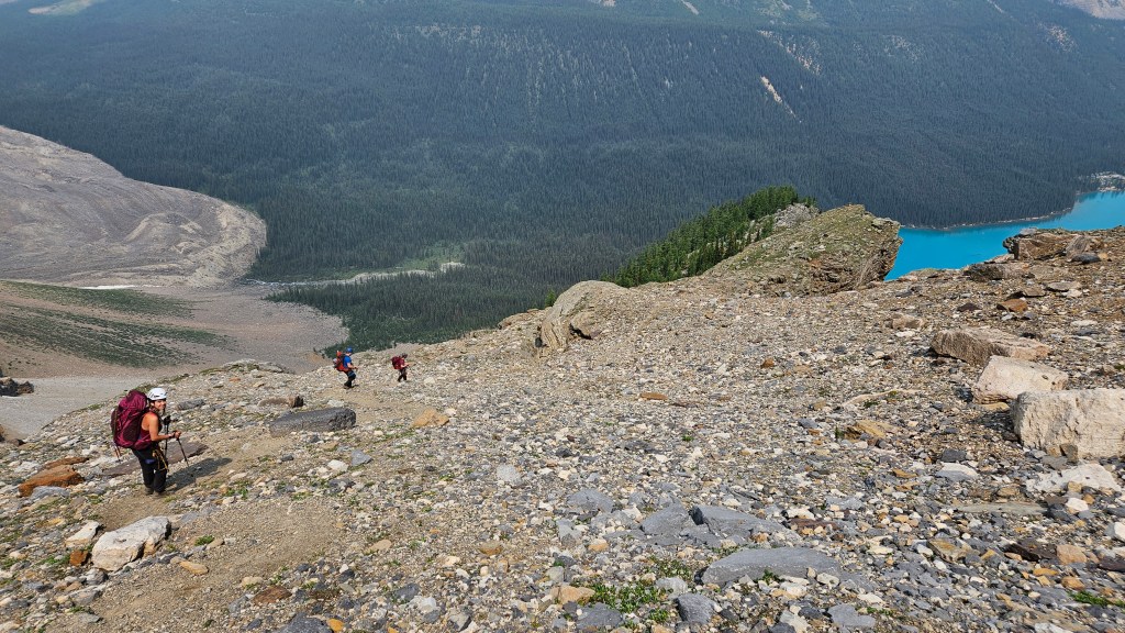
Even though the raps were quite time consuming as a group of 4, we were hours ahead of schedule. After the last rappel the trail was well defined and it was mostly a hike back to Moraine Lake, save for one small downclimb a little ways past the final rap (moderate scramble). The trail works its way through the moraine (some boulder hopping) and just shy of linking up with lakeshore trail a wide creek crossing. I seem to recall getting my feet wet mid crossing… very cold but ah so refreshing. We made it back to the trailhead near the canoe docks around 2:20pm and luckily grabbed an earlier shuttle back to Lake Louise. All in all, a grand outing that everyone looks back on fondly!