August 9th, 2021. Yoho National Park.
Round Trip: 11 Hours, Elevation Gain: 1740m
Moderate-Difficult Scramble
Further Reading: Scrambles in the Canadian Rockies 3rd Edition (2016) by Alan Kane.
Mount Carnarvon towers over Hamilton Lake, and stands well above its neighbors Top Hat Peak and Emerald Peak. When driving eastbound into the heart of Yoho National Park, Carnarvon’s steep almost-pyramid-like summit is unmistakable. Given the direct access from Emerald Lake, it is a popular scramble, and in my opinion a good entry-level to the “difficult” scrambling category. However, with the popularity comes an over-abundance of cairns and as such the ascent still requires a fair amount of route finding, particularly in the final 200m below the summit.
The route is best described in Kane’s 3rd Edition of Scrambles. As our friends Ben & Scott had reported back to us in previous years, the original crux from Kane’s (2016) description is easily avoidable by traversing left. There still a lies a crux section in taking this slight detour, containing a 10 minute pitch of sustained difficult scrambling, but this area is somewhat more protected versus the original crux along the ridge. Overall, expect a long day of mostly moderate scrambling and hopefully clearer skies than what we had! 2021 was a bad wildfire smoke season so we were really just stoked to get up into the alpine without choking on ash.
First, one must endure the two hours worth of switchbacks leading up from the Emerald Lake parking lot to Hamilton Lake. There is no real trick to these other than determination and energy, and Hamilton Lake itself provides a good spot for a much-needed breather. On this particular visit, I noticed that the water levels were substantially lower compared to my previous visits in 2015 and 2018. Likely this was due to the extremely hot summer in 2021. We managed to time this trip with when the wildfire smoke briefly clearing from the area, though the summit remained in a cloud for the entirety of our trip. This outing had already been postponed by our group multiple times that summer, so on August 9th we decided to go for it despite the low likelihood of a summit view.
Tash, Bri and I teamed up for this venture, and given the nightly road closure of Highway 1 east of Golden, still managed a timely start of 8:40am. We reached Hamilton Lake in 1 hour 50 minutes, and took a much needed brunch break there.
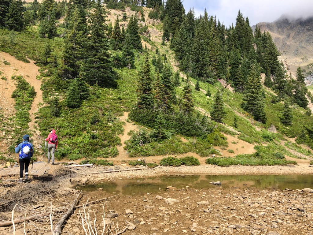
There is a narrow but distinct trail that follows Hamilton Lake’s western shoreline, which I had previously used to hike up to the Carnarvon-Top Hat Col at the back of the lake in 2015. There was one other party of two slightly ahead of us, from what we could tell they were route finding their way up a scree slope and ledges to access the mountain’s lower south shoulder. We more or less followed them, with the occasional deviation. Loosely we back tracked southward as to gain gentler graded ledges, zig-zagging our way up to the lower ridge. A steeper direct route up a narrow slide path is available south of Hamilton Lake, which we took on the return journey. Neither holds an advantage to the other: the slide path is slick with greenery and silt, while the west shore of Hamilton Lake is a slog up talus and scree, both top out above tree-line on the bench between Hamilton Spur and Carnarvon’s southern sloped ridge.
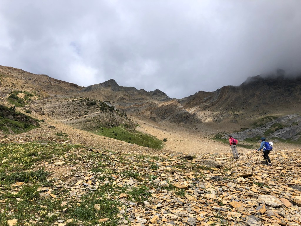
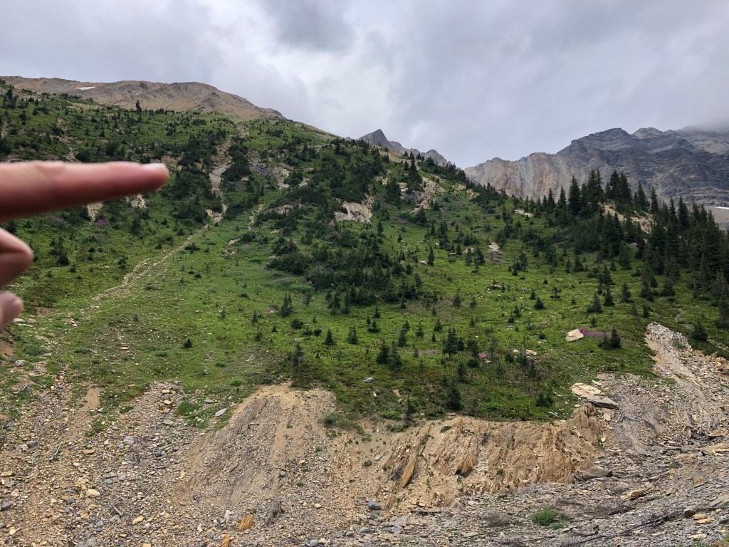
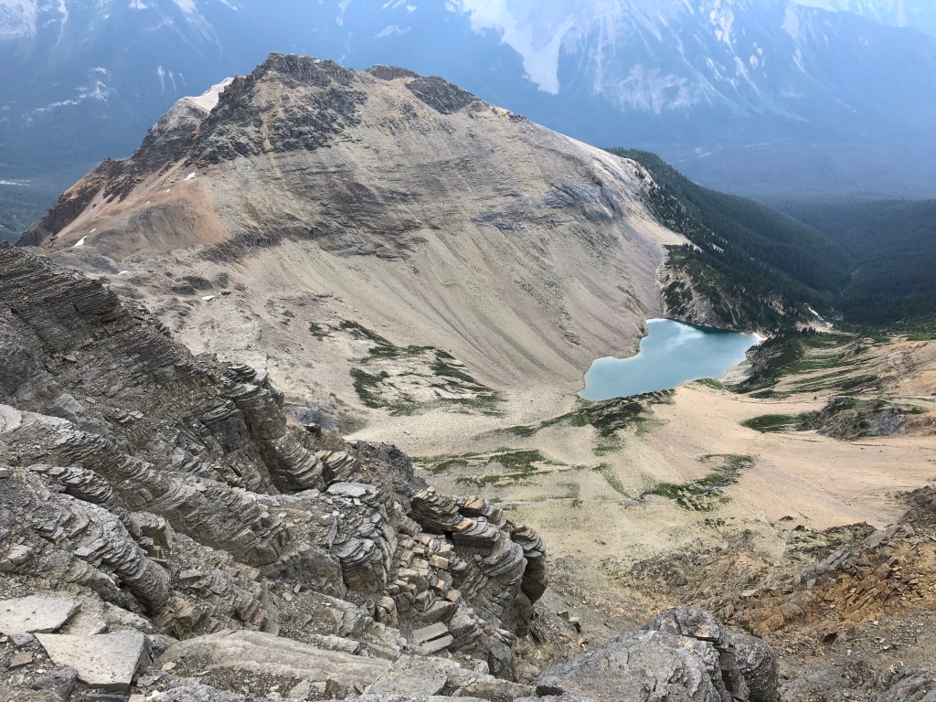
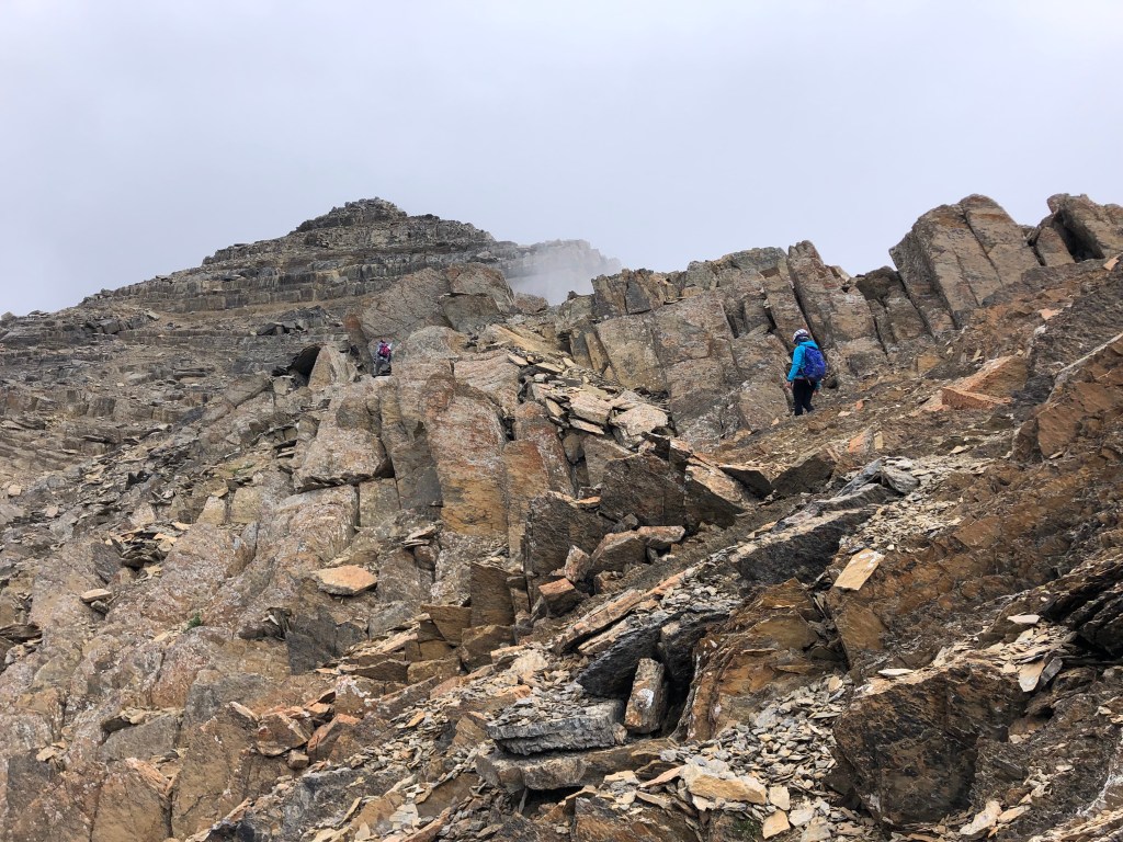
It took us exactly an hour to scramble onto the shoulder of the ridge, where we rewarded with an aerial view of Hamilton Lake, Top-Hat Peak, and Emerald Peak. With the prevalent cloud cover enshrouding the summit, this section of the mountain ended up being the best view of the day. Continuing north, the narrows and ascends into a blocky ridge crest. The rock is surprisingly sturdy given the rotten consistency of most shale-based peaks in the area, and the initial scrambling most enjoyable.
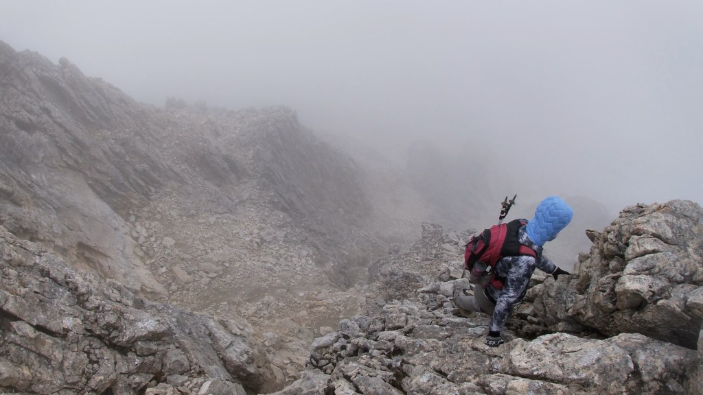
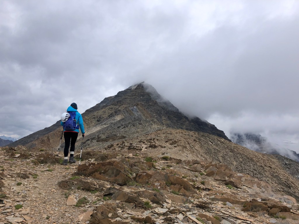
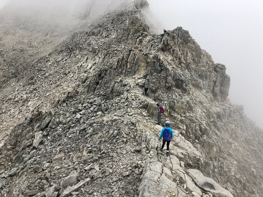
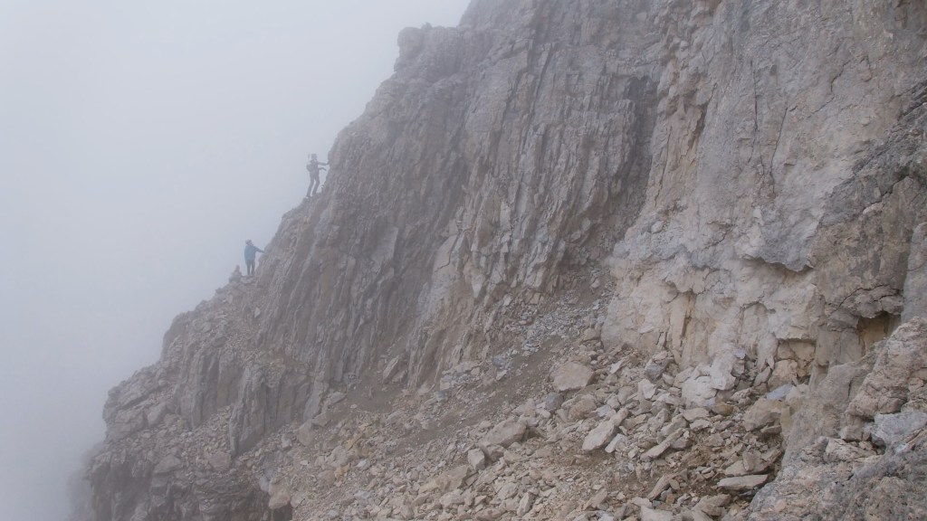
We encountered easy to moderate hands-on sections with select moments of exposure. Generally we stuck to the ridge itself, though on several occasions had to detour to the climber’s left and scramble up littered ledges. More than once we prematurely assumed we had reached the crux, a lingering cloud over the summit obscuring our view of the route above. For the final 300m of the ascent we were truly in the fog and visibility limited to about 10-15m in spots.
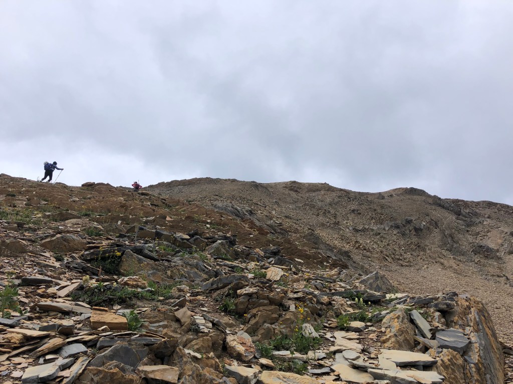
Somewhere between 2750m and 2900m we all noticed that the scrambling was becoming more sustained and teetering towards difficult category. Our route returned us onto the ridge facing another steep block – again we incorrectly assumed this as the crux – but had already approached it from the left. Tash scrambled up the first block to discover the next was even steeper, so we scrambled to the east side (climber’s right), which bypassed the steeper and narrower block face. This lead us through an awesome crystal quartz deposit. Above the gully we were returned onto the main ridge yet again and briefly scrambling staircase-like ledges in decreasing visibility.
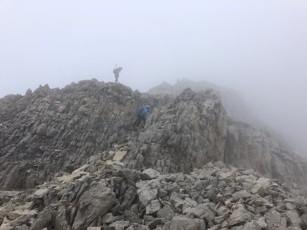
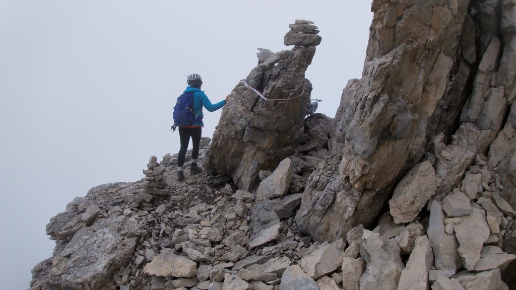
Shortly after taking a height and time check at 2900m we encountered the actual crux that Kane (2016) was referring to and this was notably steeper than the previous spots we had mistaken as the crux lower down the mountain. In higher visibility we may have considered going directly up this way, it was quite exposed, though the rock looked solid. Not wanting to take unnecessary risk, we stuck to our original plan of bypassing this section by travelling along a ledge to the climber’s left. It helps that I just managed to spot an overly large cairn at the fringe of the cloudbank.
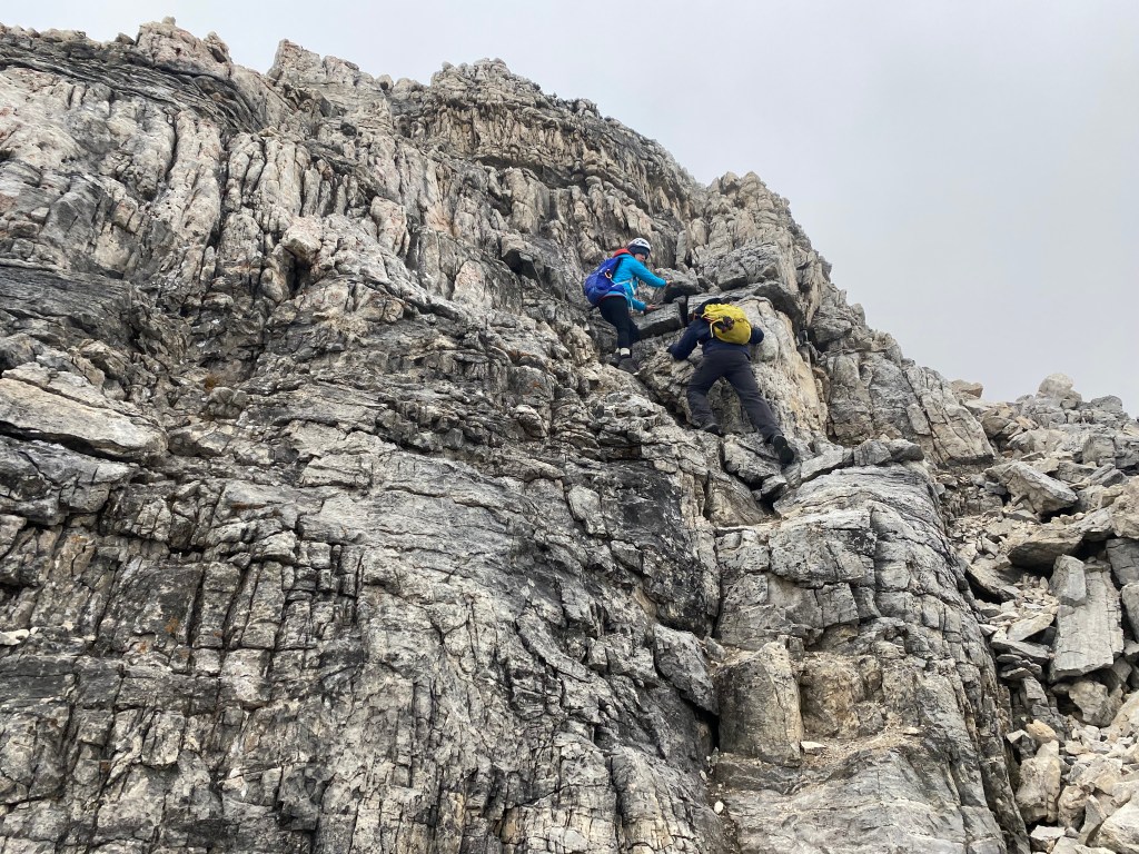
Having spotted the large cairn and flagging tape, we traversed left (west) away from the crux listed in Kane’s description by 8 minutes across a narrow ledge, rounding two ‘corners’ if you will. This alternative approach still proved to be the crux of our route, involving sustained route finding up difficult exposed ledges. From the large cairn and flagging there were at least two ascent options from what I could see, both being around the corner further left along the same ledge. Tash and Bri traversed to furthest corner (two corners beyond the flagging) and found a suitable route up marked with another large cairn.
I had briefly attempted toiling up a steep pitch immediately left of the flagging, following a different set of cairns. The route I went less then ideal: while the angled grade was gentler, the ledges above me were extremely narrow and heavily littered with shale. Tash and Bri’s route was steeper by comparison but looked cleaner. I had to briefly downclimb the area I had attempted and traverse over a narrow exposed ledge to catch up to where the girls had chosen to ascend.
The Crux itself appeared as a sharp corner jutting out from the ledges, it seemed mellow on the initial approach (and admittedly in still-shots from my GoPro looked tame), but after reviewing the video footage it was indeed very exposed through this section and deceivingly steep. The trade-off was that this steep corner of rock provided numerous holds for the scramble up. Make no mistake, this is definitely a no-fall-zone, and the rock quality is questionable in spots. I slipped at least twice off of loose holds.
Above the corner, the ledges resume their staircase-like nature similar to earlier sections of the route, and it is still a difficult scramble upwards with somewhat less steep exposure. Still got the heart pumping! To the left of these ledges there is an even steeper scree gully, which contained the loosest rock of the mountain. Tash tried bashing up this but eventually returned to the ledges that Bri and I had stuck with; these ledges topping back out on the ridge crest.
Once above the worst of it, we examined the route back down making notes for the return journey. We kicked down a few of the unnecessary cairns here, as there were far too many in this area, most being false leads to wickedly steep ledges. It definitely reminded me of the upper sections on Mount Whyte in Lake Louise. The cloud coverage, if anything, helped hide the very real exposure of this area giving us a confidence boost with the up-climb.
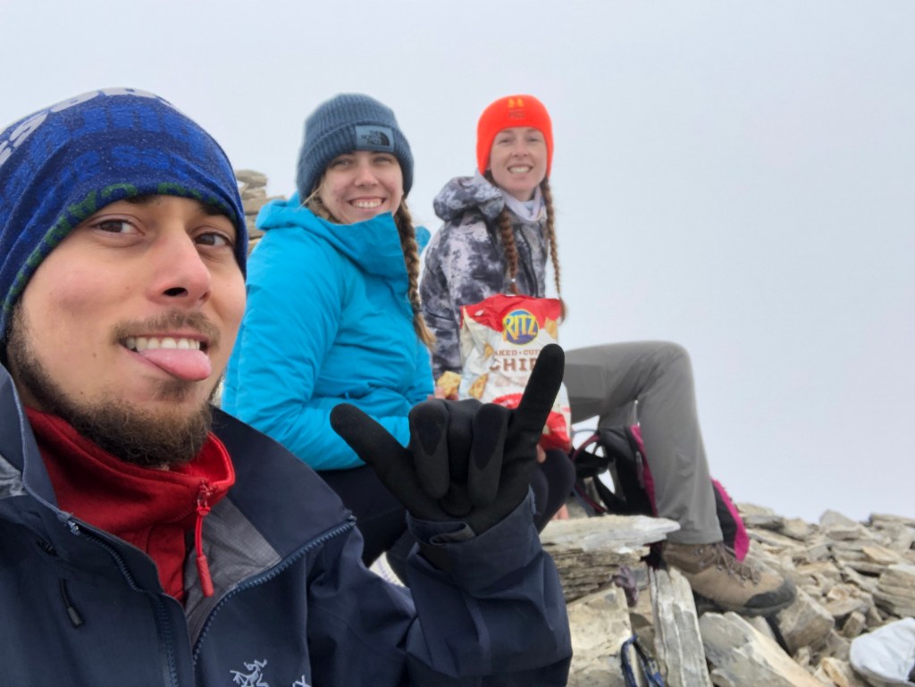
It took our team approximately 10 minutes total of sustained difficult scrambling to clear the crux section. Once we were back on the ridge crest with stuck with it for the final summit push. It was challenging to assess the exposure given the thickened cloud and lingering summit snow patch, the ridge’s width fluctuating as we scrambled over the last few sections of rock before reaching flat summit totally socked in by cloud. Our summit time was recorded at 2:15pm. Total bummer on the lack of views, but we were at least partly stoked to have completed a difficult scramble from Kane’s book!
The downclimb back through the crux and clouds was as spicy as on the way up, requiring a team effort to see everyone back on solid ground. The same cloud coverage that had blissfully hidden the exposure on the way up now on the downclimb exemplified the exposure, adding an eerie and ominous vibe. Tash lead the way down while I took the middle and Bri the rear, each giving each over plenty of space. We more or less stuck to the same route, problem solving our way down until back at the flagging. The scrambling in some sections along the ridge between 2900m and 2750m felt more challenging on the down climb, it was during the downclimb that I began to agree with Kane (2016) that this is a difficult scrambling route.
While downclimbing some of the steeper ledges of the ridge around 2750-2700m Bri slipped off a ledge, thankfully she avoided any serious injuries and was able to continue unassisted after a brief break. Having knocked down some false-lead-cairns earlier on the way up, our downclimb was somewhat more straightforward in terms of route finding. Once below the clouds things sped up and once back to the shoulder above Hamilton Lake, we decided to hike down a narrow slide path previously spotted on the hike to Hamilton Lake. I’m not convinced it saved us any time, but in taking this alternative route we spotted a mountain goat and picked up some rubbish left behind by past scramblers.
The entire ascent from car to summit ended up being 5 hours 40 minutes including breaks, the return journey only being 40 minutes shorter making for an 11 hour round trip. Granted we did stop for numerous photos and marveled over some interesting geology finds at around 2800m. All-in-all, the scramble itself was a great experience, and we were certainly feeling that +1700m elevation gain by the time we made it back to the car. Highly recommend this one as an entry-point into Difficult scrambling category.