August 9th, 2017. Yoho National Park, British Columbia.
Round Trip: 13.5 hours. Elevation Gain: 1530m
Difficult Scramble
Mount Daly is a full day mission. It’s glaciated ledges can be seen from the Trans Canada Highway when driving west towards Field from Lake Louise. Kane’s description of the scrambling route in the 3rd edition of Scrambles is a vital piece of information. I highly recommend reading that before setting out.
I set out with Bri and Scott for this one. We stayed mostly true to Kane’s description however we managed to completely avoid the crux mentioned by venturing as far to the climber’s right as safely possible. This kept scrambling at a high moderate level – make no mistake this is a Difficult scramble once above the pyramid feature. Lastly, Scott and I found that the ridge line connecting the false summit to the real summit to be much more difficult than what is suggested in Kane’s book.
The approach for Mount Daly is initially the same as for Mount Niles. We left the Sherbrooke Creek parking lot at 6:45am for this one. I would suggest that you don’t start too early in the morning as this area is known for bear activity. Follow the now de-commissioned route past Sherbrooke Lake towards Niles Meadow. From the Meadow we followed up an obvious slope to gain the eastern ridge above the meadow.

We followed the ridge towards Mount Niles from here. A faint path marked with Cairns appeared to work its way up Mount Niles but as far as we know this is NOT A SCRAMBLING route! Mount Niles is accessed from the west not the east. Anyways moving forward!
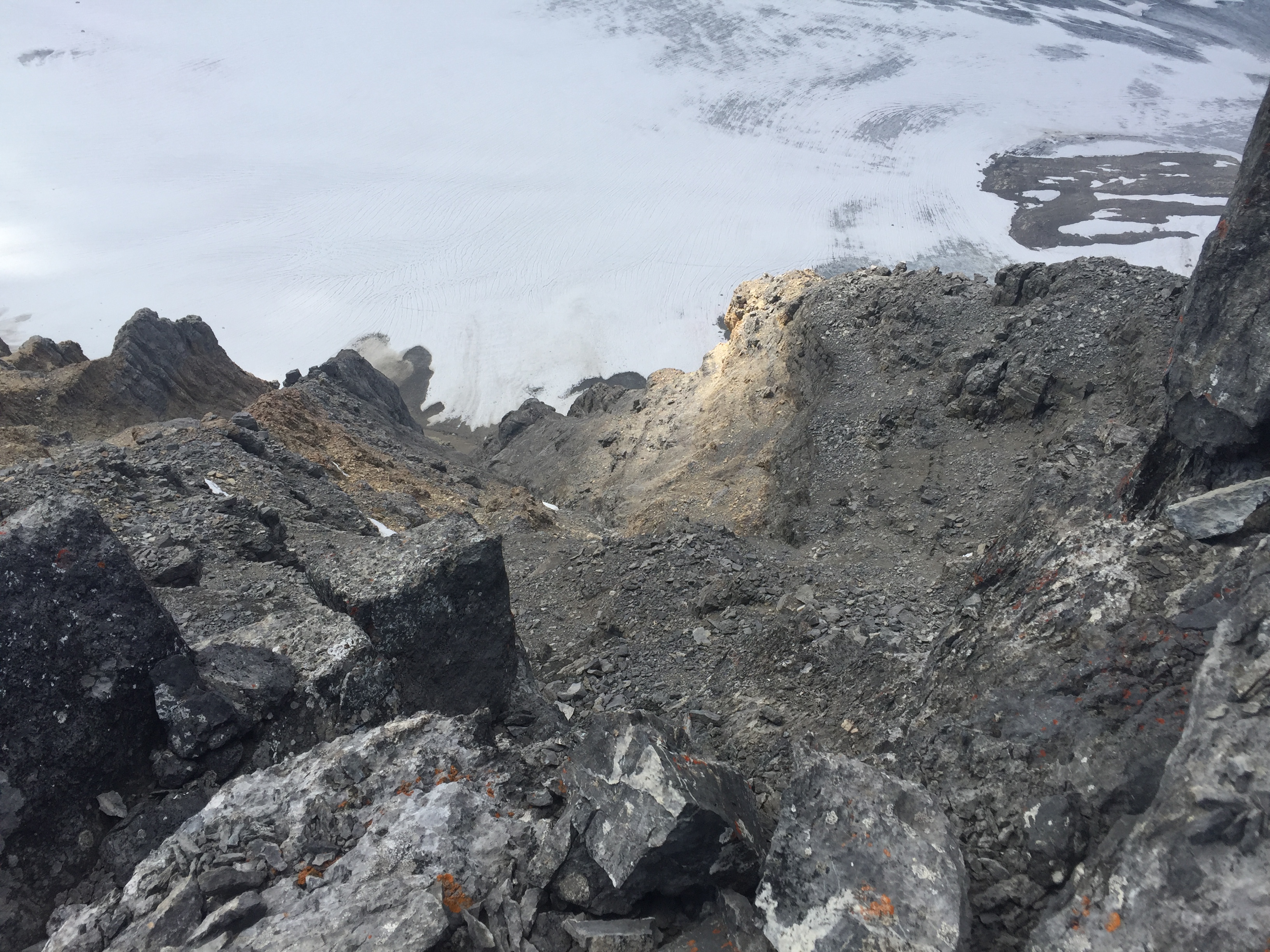
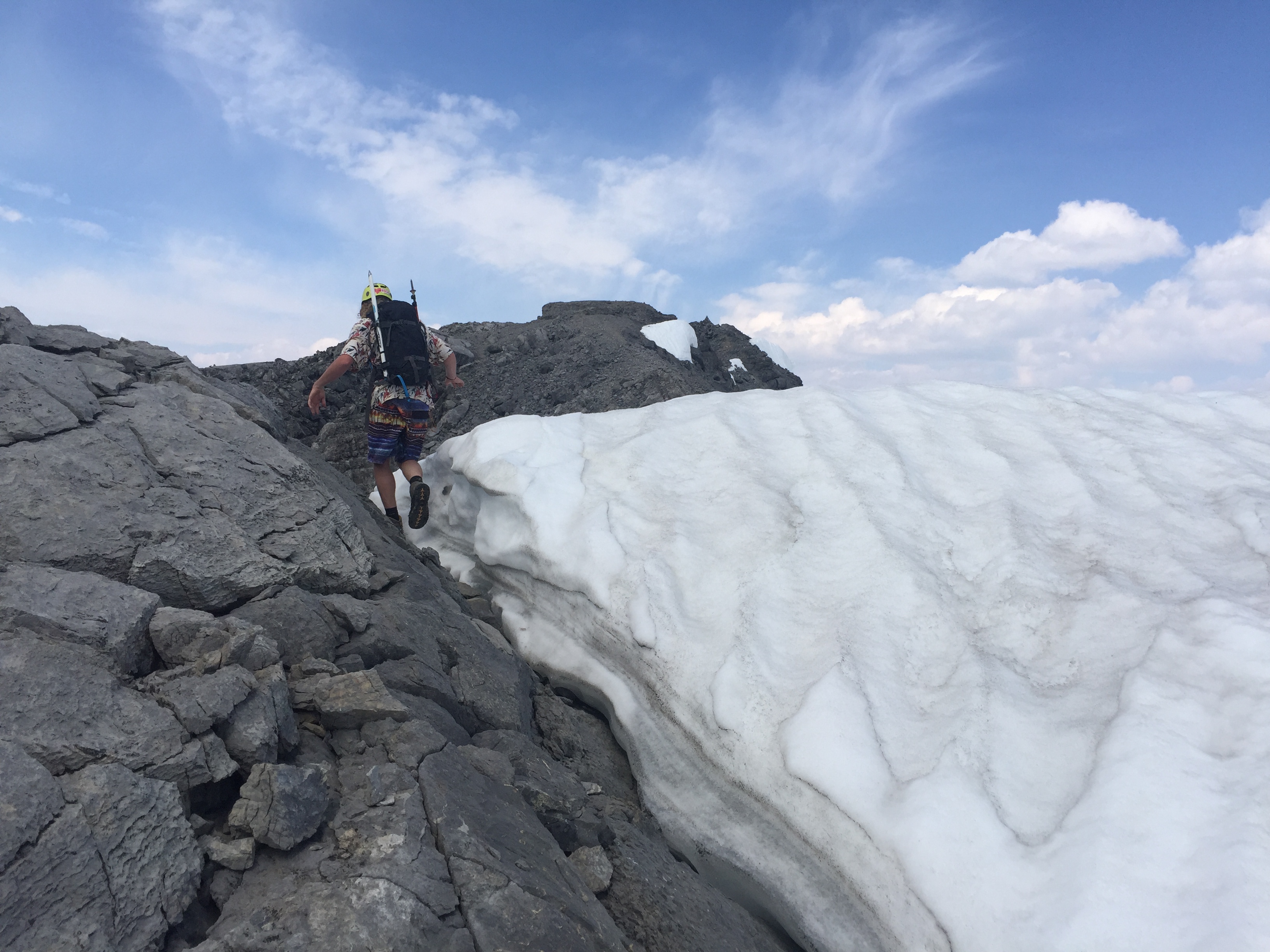
From the ridge you really only have 1 or 2 options. If you’re experienced with glacier travel you can cut across the sad remains of the Niles Glacier. This will save you time and save you some hard won elevation loss. We did not bring crampons nor ice axes for this trip so we went the long way (suggested in Kane’s book) by dipping down the ridge and into the moraine. Sustained moderate scrambling until in the basin. From there we toiled across under the edge of the Niles Glacier. While there were crevasses, they appeared quite narrow on that day. Narrow enough that we would have felt safe traversing without a rope. That call is yours to make.
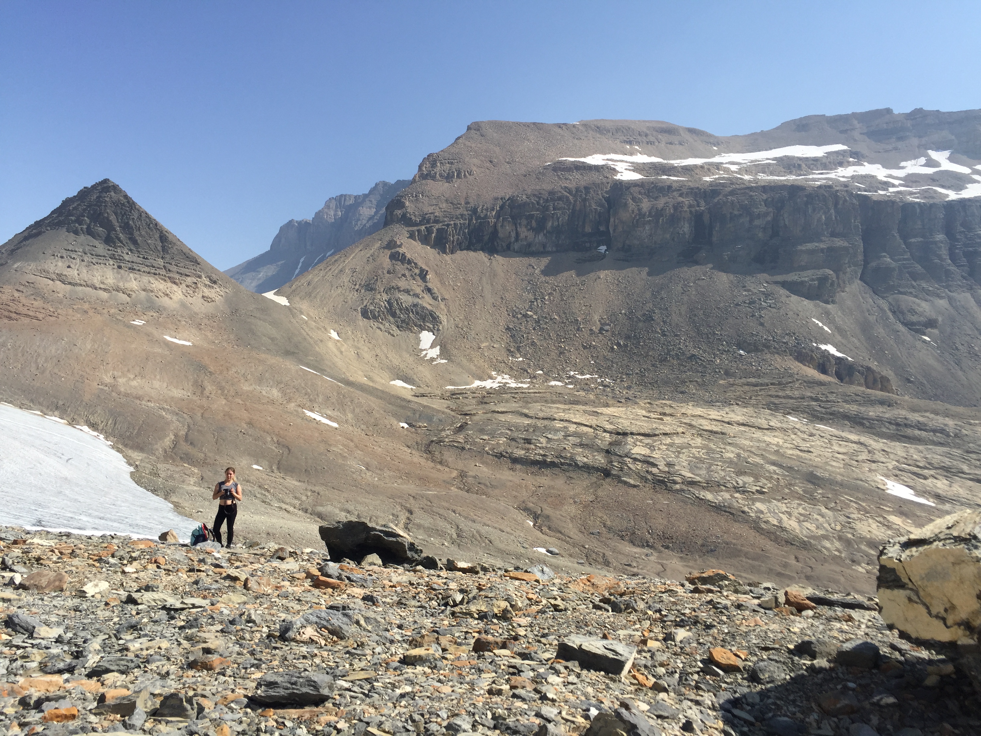
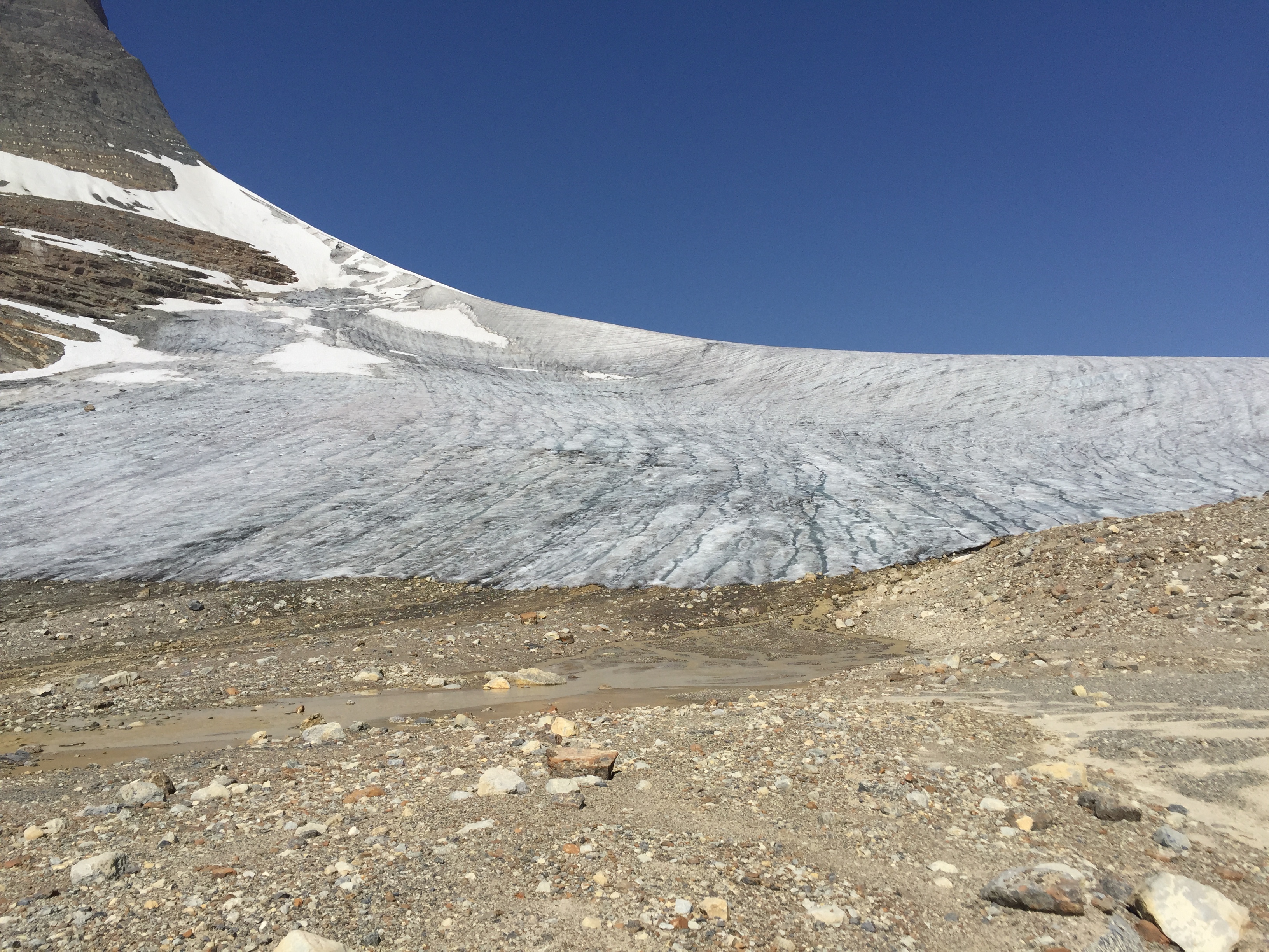
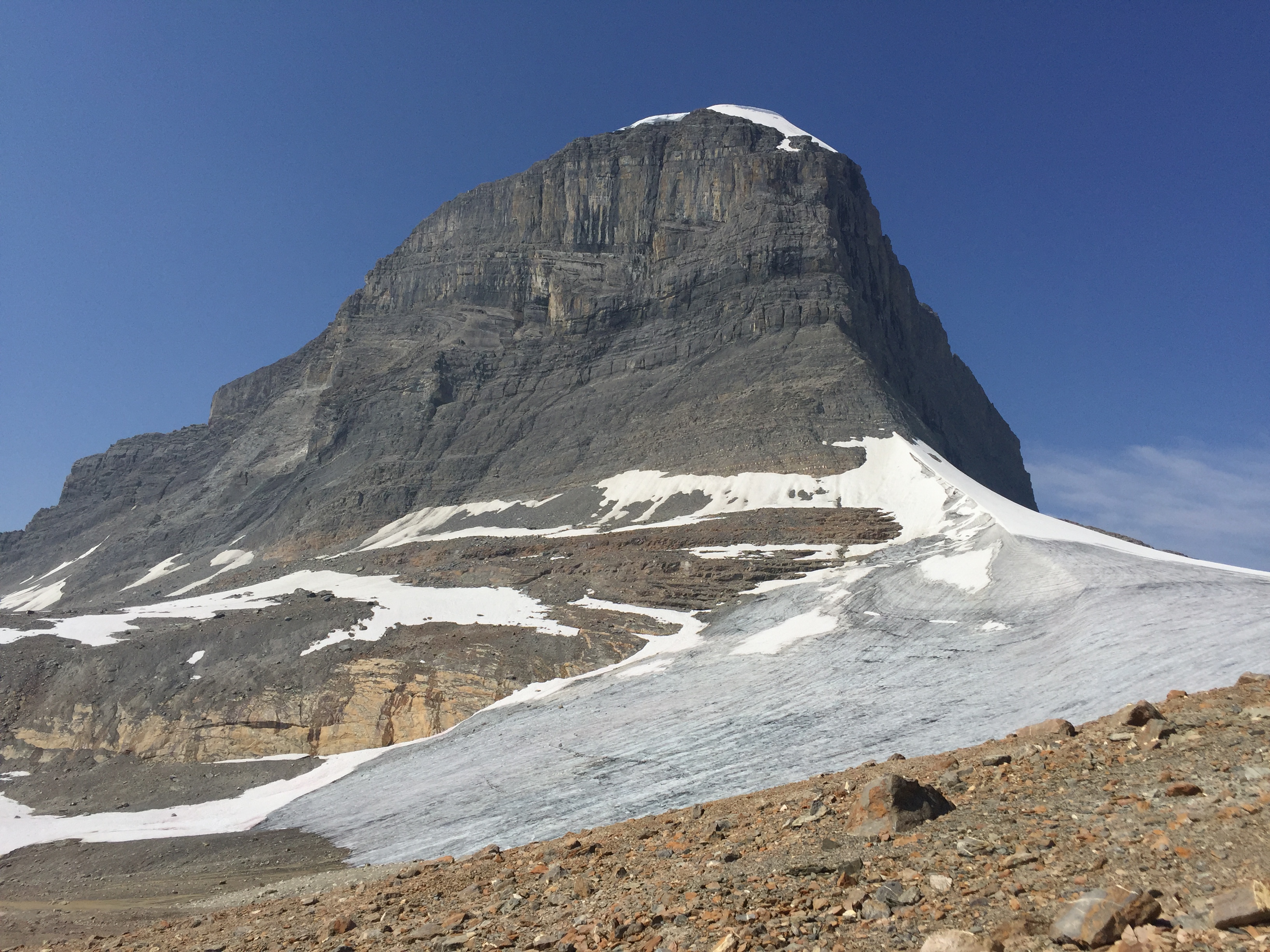
It took our team almost 2 hours with all the photo breaks from the ridge above Niles Meadow to the base of the Pyramid. From here we took a well deserved break before scree bashing up to the first series of steep ledges. Travelling slightly to the north we were able to stomp up the remaining snow pack for the first few dozen metres before hitting the scree and talus slope.
Remember that the general rule of thumb is to stay to the right. If following too directly up from the Pyramid you will encounter steep and exposed ledges – and presumably the crux mentioned in Kane’s book. We managed to bypass the crux entirely but still found it to be a high level moderate / low end difficult scramble. There are few cairns but those that are there are well placed!
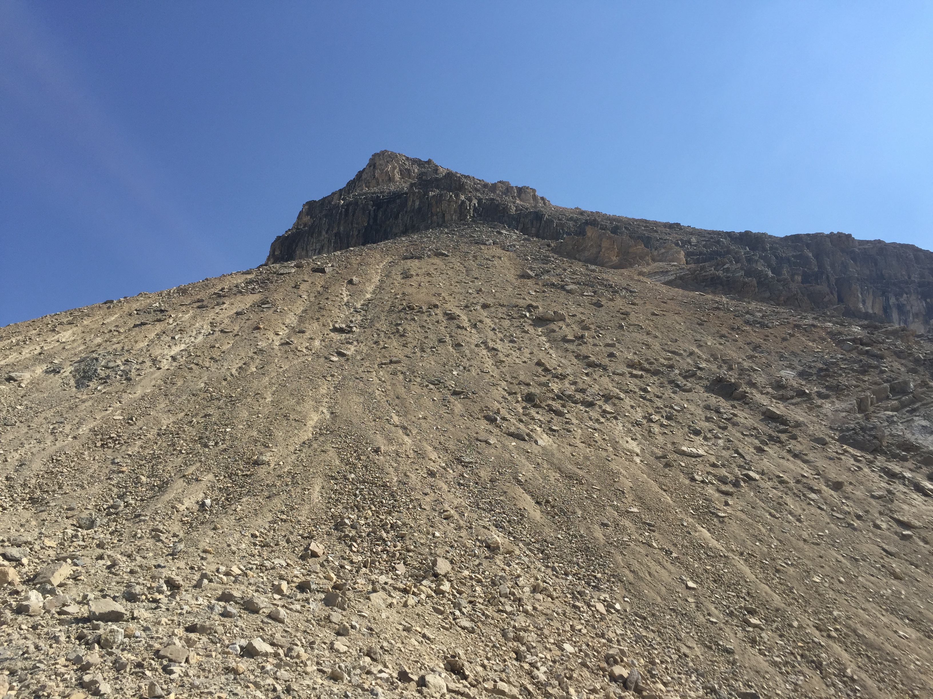
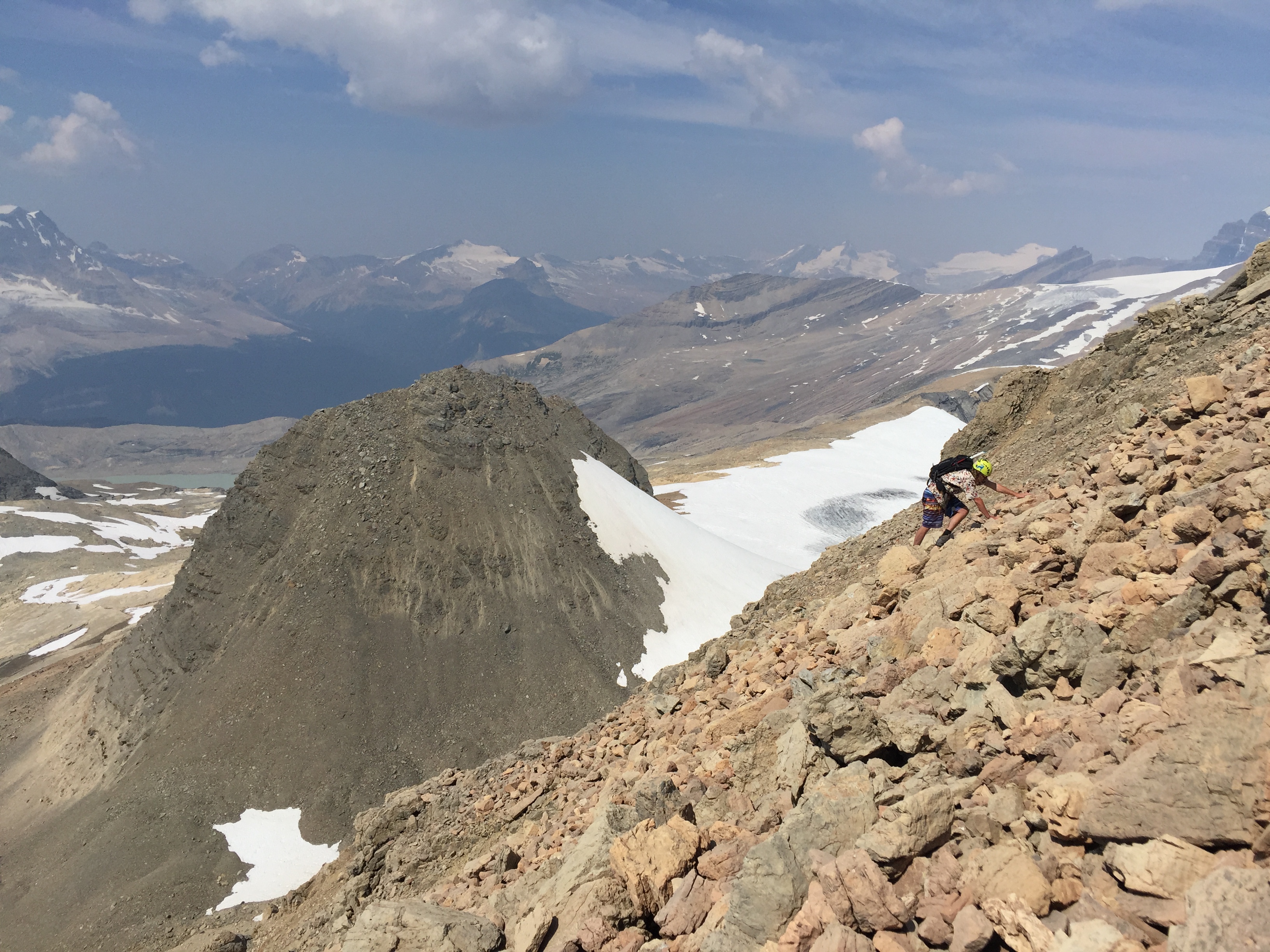
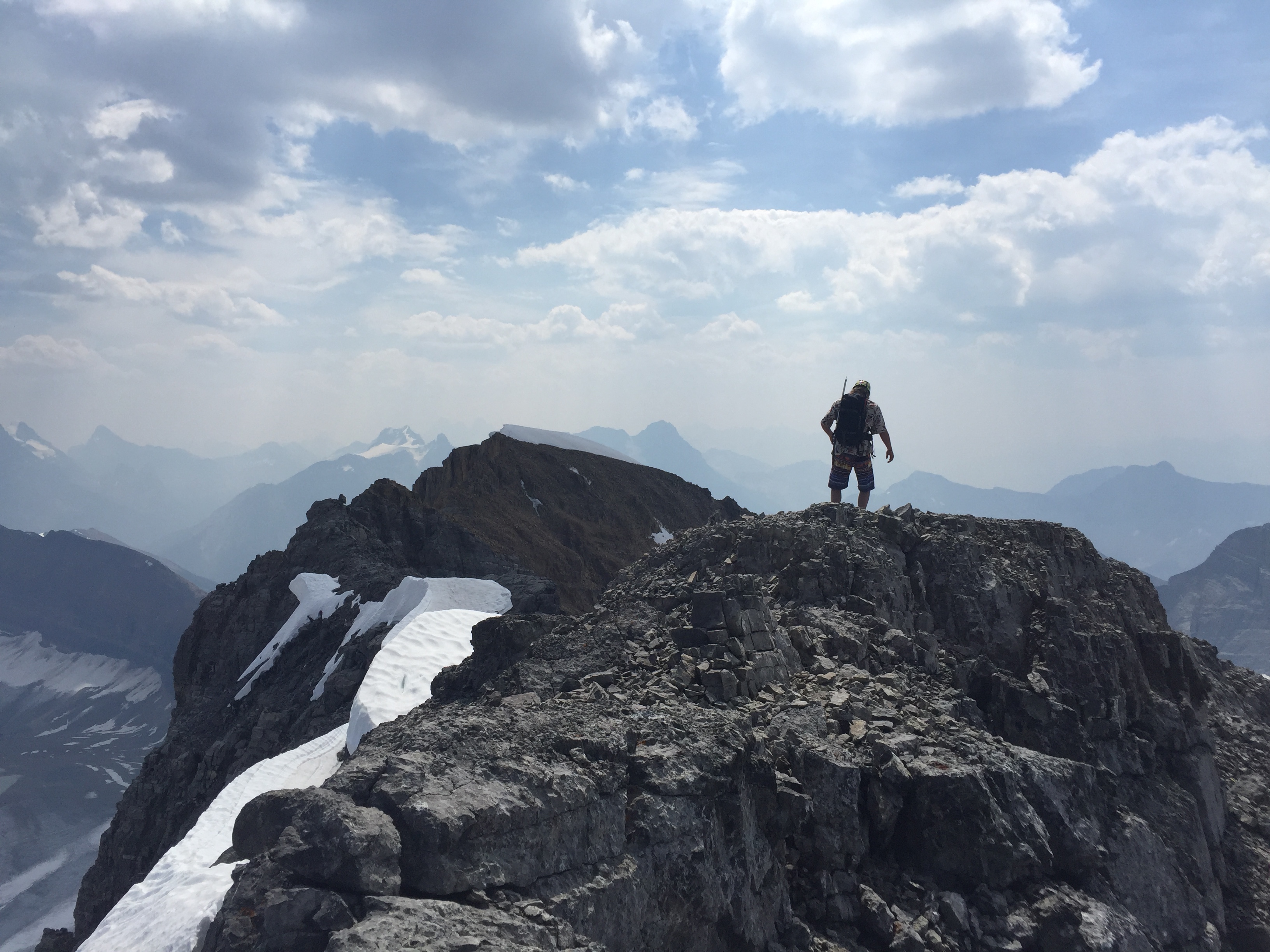
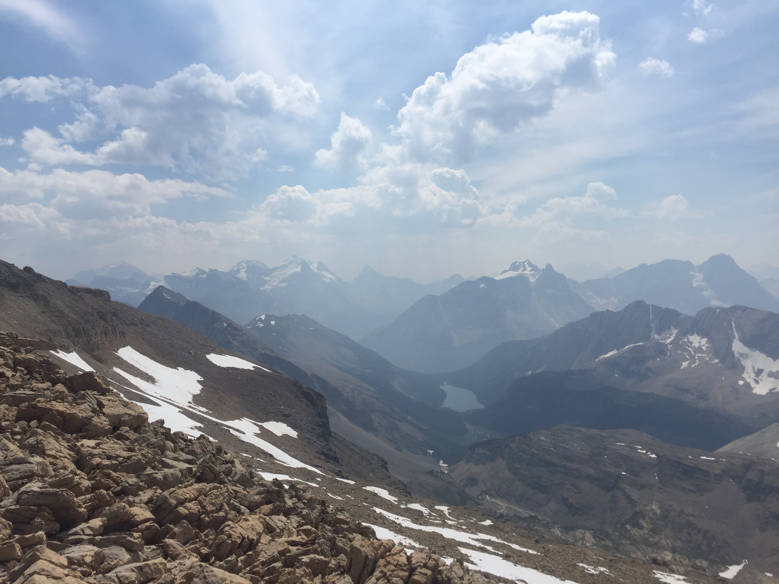
Eventually we topped out of the slope and hit the mountain’s south shoulder. The views from this point were incredible! From the shoulder we had to start traversing north (climber’s left). While the hands on scrambling had eased away from difficult there is still a fair bit of exposure in traversing the shoulder. There was a minor gap crossing along the way. Once across its a leisurely stroll to the false summit. Continue reading if attempting the traverse over to the true summit.
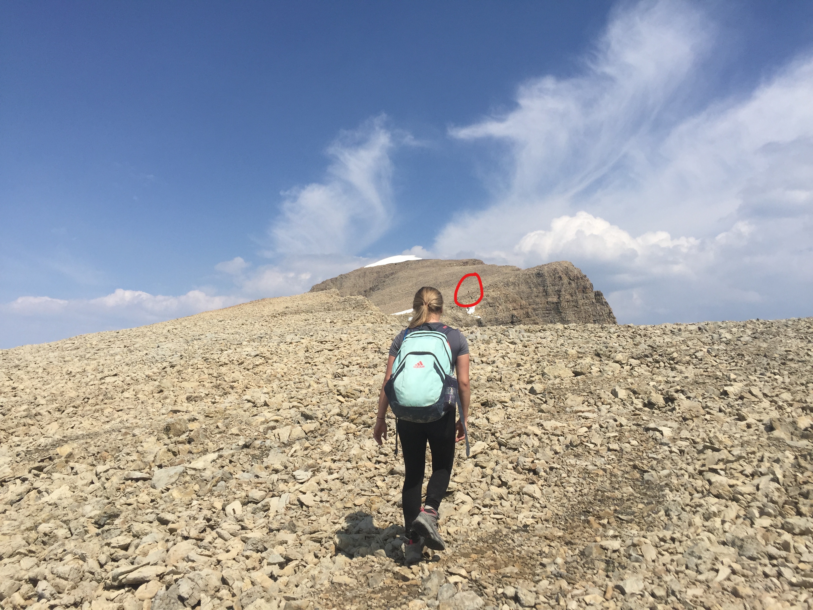
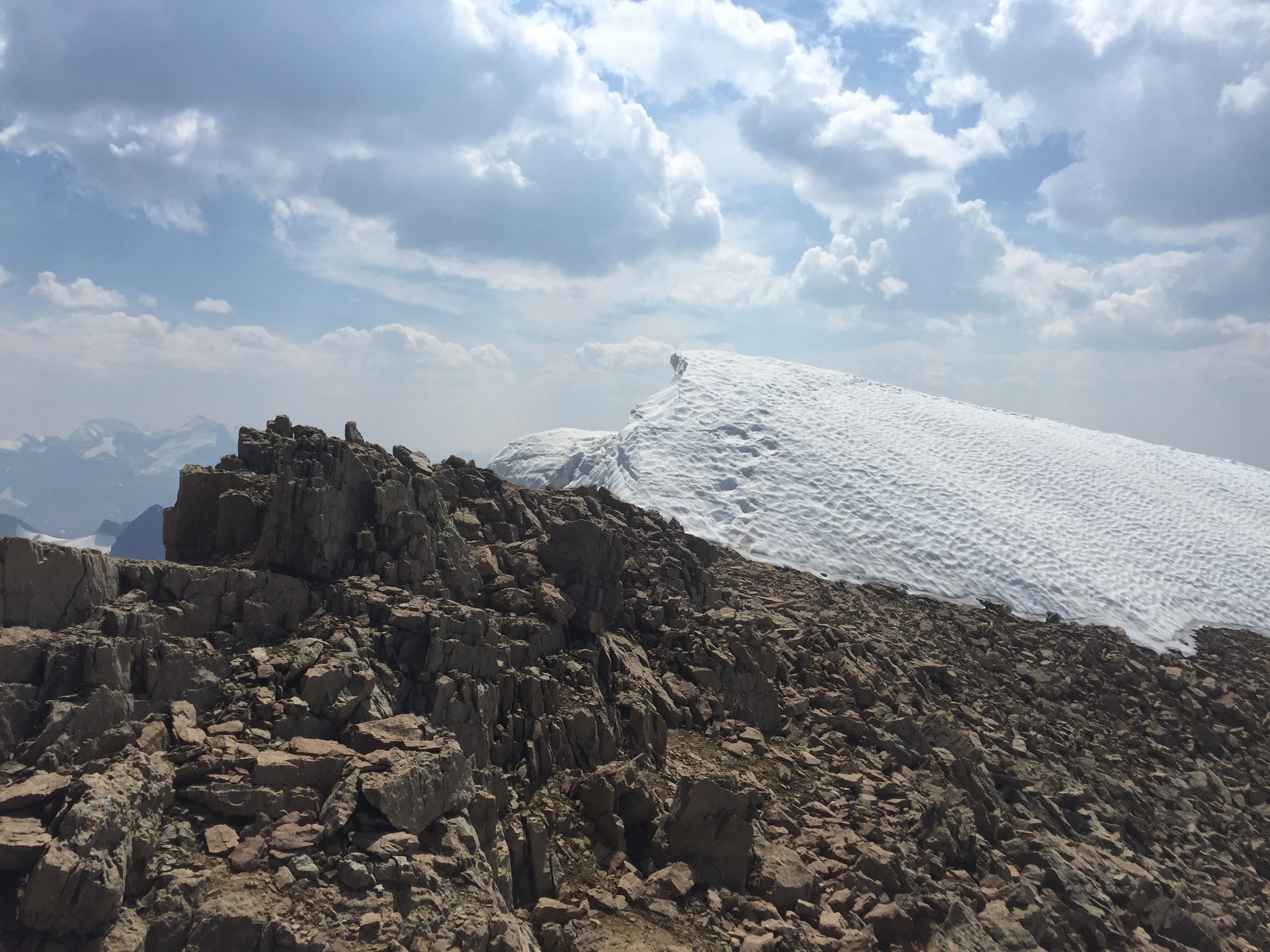
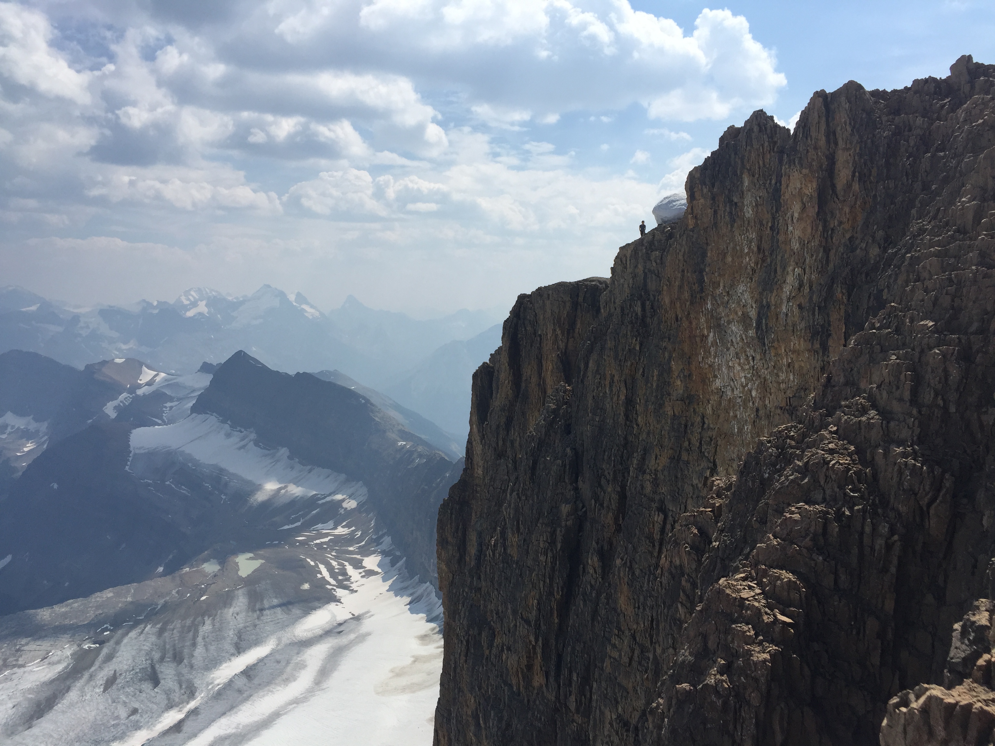
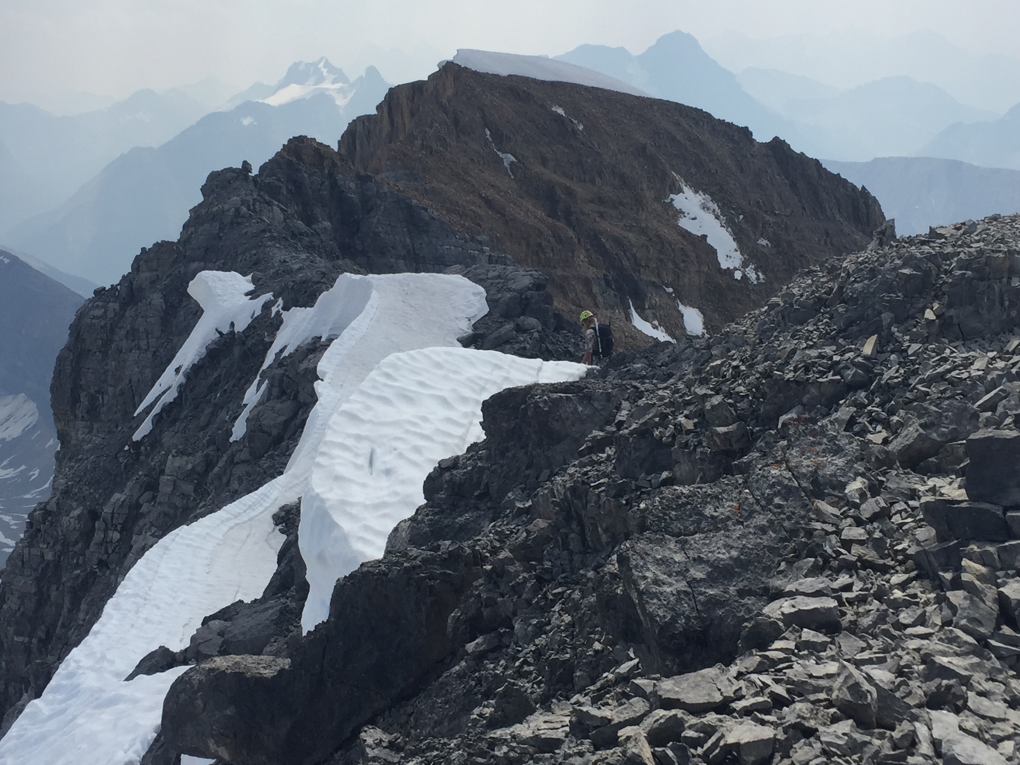
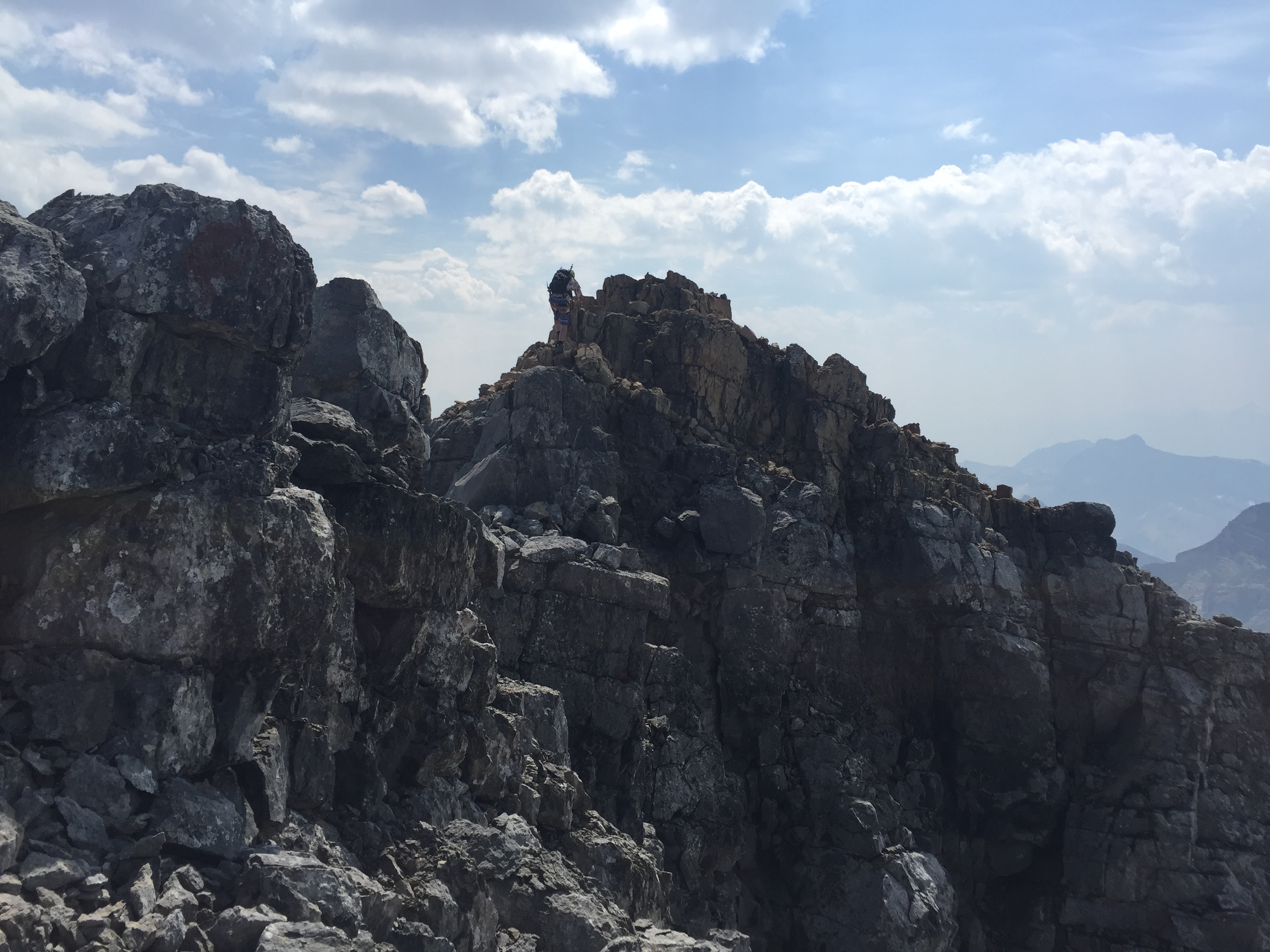
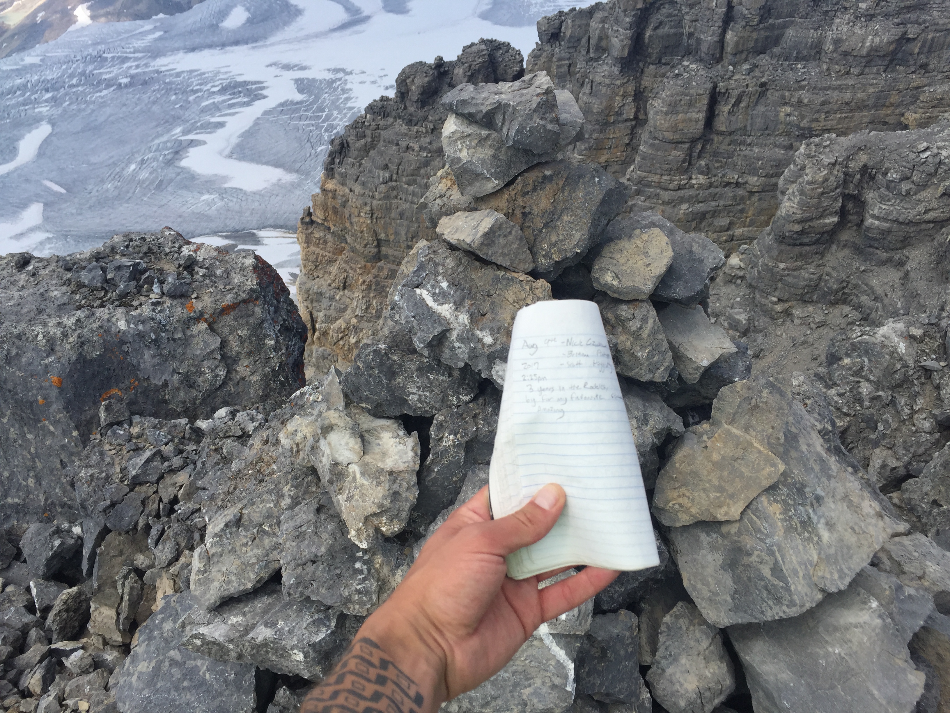
The false summit is snow capped with a cornice seen in the photo above. We reached the false summit around 1:30pm. The summit register however is placed at the true summit, which is roughly 30 minutes north of the snow cap. To get there involved traversing a crumbly ridge-line. While it wasn’t quite a knife edge per se, it involved very Difficult scrambling across less than solid rock.
A fall from this ridge would most likely be fatal. One move in particular involved a down climbing step into a concave foot hold followed by lunging across a short gap in the ridge. There is no room for error during this move – Scott and I both agree that is was certainly the real crux of the day, and at that point in time the scariest scramble move either of us had done.
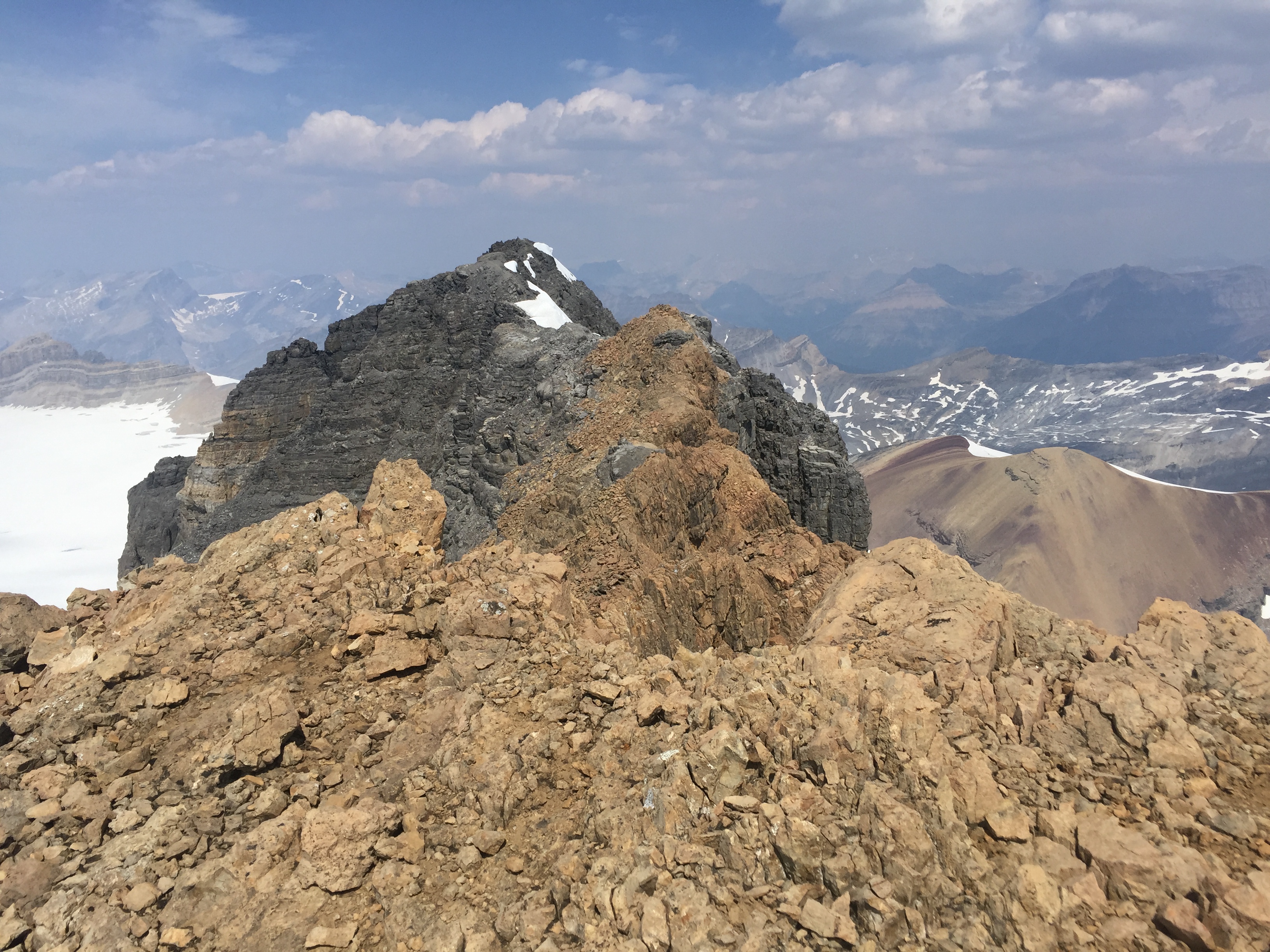
The crux was by far the worst of the ridge however the only relief moving further across is an increase in holds. Our GPS indicated that the true summit was 3160m. We gladly signed the register and took numerous photos of the Waptiuk Icefields stretching out far to the north. The return journey across the ridge was somewhat easier in that there was less down climbing. The crux in particular was much easier on return in that we were lunging upwards into a block with more holds.
Another thing to note – and this is also mentioned in Scrambles – pending on the time of year and the previous winter’s snow pack… this ridge can hold cornices late into the season. We encountered a couple snow patches under the true summit but lucky for us they were lingering on the broadest section of the ridge. If this ridge is snow covered don’t bother attempting it! There is little to no protection for setting ropes.
Scott & I started our traverse back from the true summit at 2:30pm. The ridge was much more manageable on the return as more holds presented themselves when travelling south. Given that most of the ascent route up Mt Daly was a talus slope the down climb was much faster. It would take us 4 hours from the true summit to return back to the waterfall behind Sherbrooke Lake. We finally made it back to the car around 8:15pm making for a massive 13.5 hour day.
If you have the time and resources to do so (and bivy permits), I would highly recommend doing a bivy above Niles Meadow for a two day trip as to bag the Pyramid (short steep scree bash) and Mount Niles in the same outing.
We unfortunately only had the one day off with Scott and would later repeat the long access in 2018 to scramble up Mount Niles. Lesson learned. Having said that for the views and adrenaline from the ridge traverse. Mount Daly has become one of my favourite scrambles of all time!