August 14th 2025. Bugaboo Creek / Brisco, BC.
Round Trip: 10.5 Hours, 18km, Elevation Gain: 1534m
Easy Scramble
Further Reading: Stefanie McLellan & Corinna Strauss (2022) Hikes Around the Columbia Valley
This one had been on Bri and I’s list for a long while – at least since moving to Golden in 2021. Our buddy Scott had of course sold us on it, and each year we added it to our list but never got around to it. A large factor being my reluctance to drive along the FSRs leading to the Templeton Lake trailhead, and indeed, this access involves a fair amount of rugged backroads travel. I highly recommend bringing a backroads map book and pairing it with the description listed in McLellan & Strauss’s (2022) guidebook. Despite Scott having previously done this trip a few times, we did get turned around once or twice along those backroads… more so from us second guessing ourselves at various intersections. Eventually we did find the correct way, which was both narrow and grown in, and I’m very thankful that Scott drove us with his truck that day.
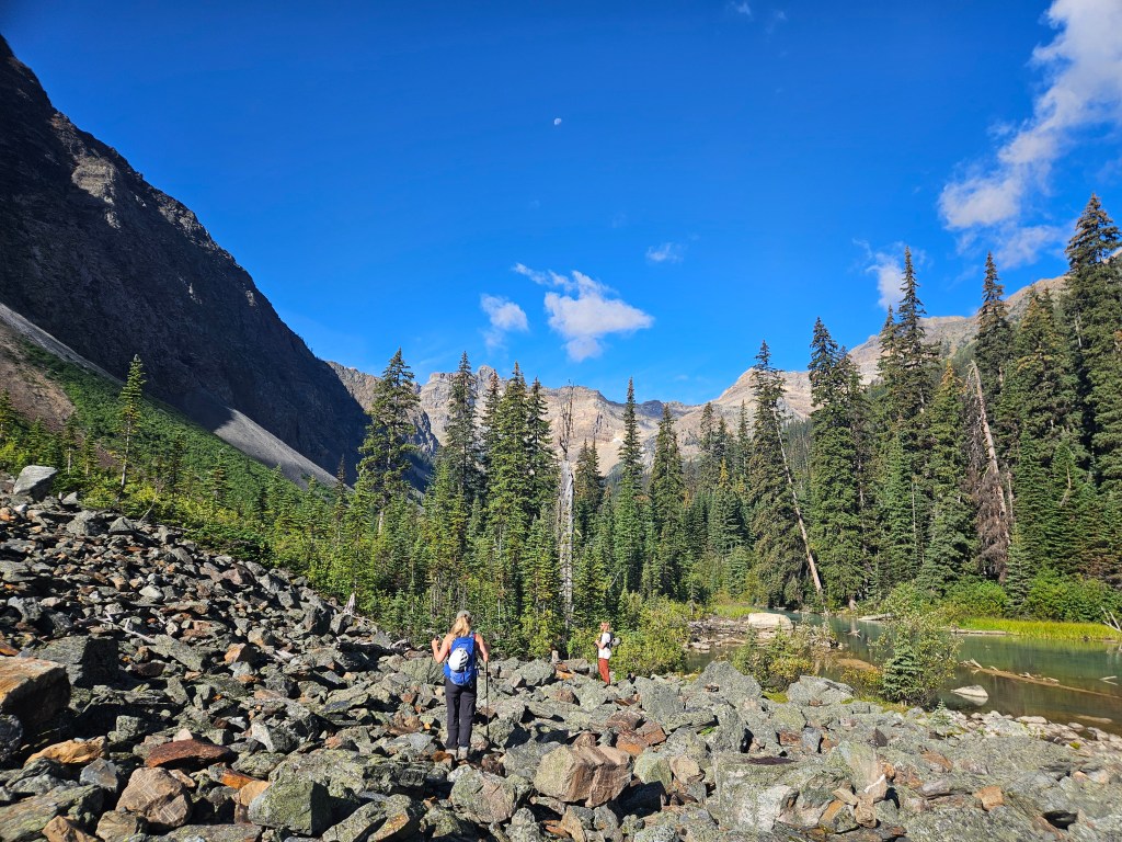
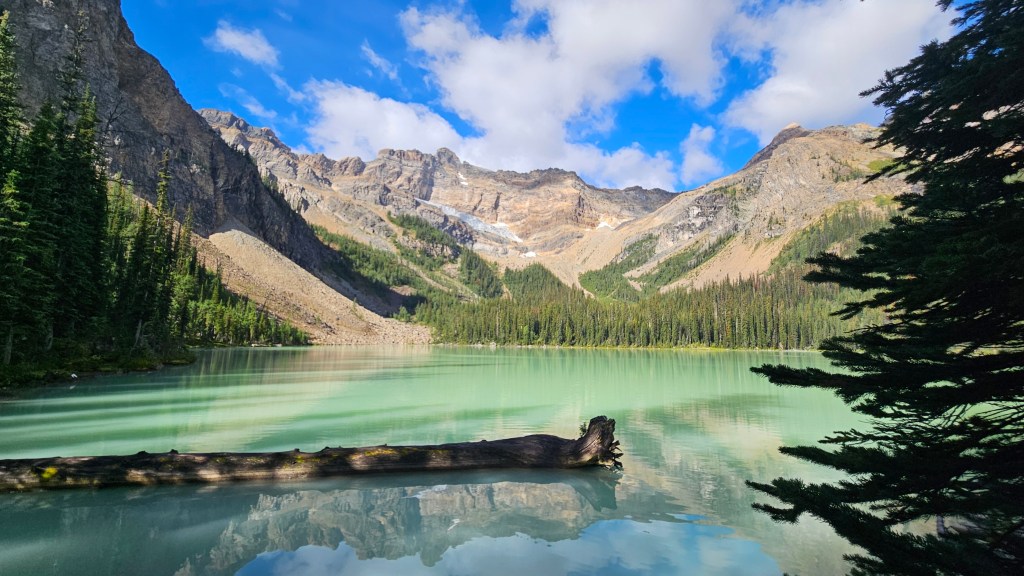
Once parked at the trailhead around 9am we quickly geared up and the hike commenced. While clear conditions, it had been raining earlier that week so the underbrush was quite sodden during the initial approach. Having said that, the trail to Templeton Lake was in surprisingly good shape given the rugged remote driving access, and quite straightforward to hike along. The trail follows a narrow valley towards Templeton Lake and shortly before the lake a series of bright blue tarns. We made good timing and reached the lake around 10:40am. This was only my second outing since my shoulder injury on Mt Kerr, so we were out testing what I could and couldn’t do terrain-wise.
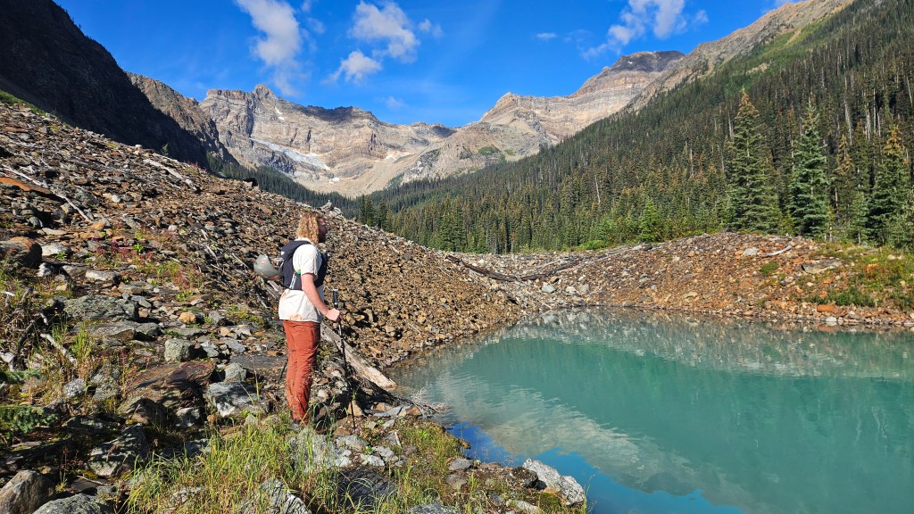
As previously mentioned, Scott had been up here a few times before, so we followed his lead up from Templeton Lake. Its worth mentioning now that our route does not follow McLellan & Strauss’s route to Shangri La Pass which then drops significant elevation before starting back up Mt Ethelbert. The slope used in their route is accessed from the southwest corner of the lake, whereas our route took us southeast of the lake up a significantly wider slope. Scott’s route was more-or-less a direct line to the summit and involved zero elevation loss along the way. A select few cairns dot the way so it would appear other parties have used this same route.
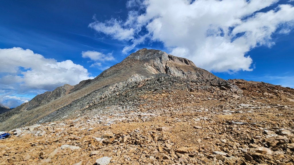
After arriving at Templeton Lake we briefly hiked along the south shore until a rubbly slope interrupted the trees. We left the trail and ascended this slope, a brief tedious scramble, travelling in a southeasterly direction. This broad rubbly cliff band continues eastward circumnavigating under an unnamed sub-peak. We plodded along this steep gradient for around 25-30 minutes before the terrain opened up into a wider moraine. From there the moraine rises up towards a saddle between a smaller sharp sub peak (climber’s right) and Ethelbert’s lower summit slope (climber’s left; east).

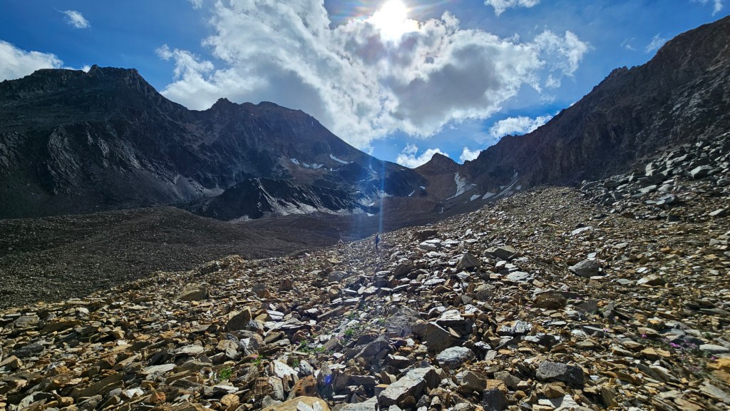
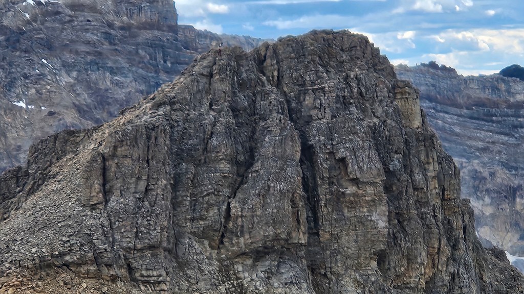
Our route would take us up the slope in-between a long vertical snow/ice patch and a “dark cube” shaped cliff band. If in the future that snow patch doesn’t exist anymore, aim for the climber’s right of the dark cube feature where the slope naturally provides a switchback. We had a direct sight-line of the route from the base of the moraine, though from afar looked intimidating. Once closer it proved to be on par with everything we had hiked up so we continued plodding upwards and onwards. Above the dark-cube cliff band, we veered to the climber’s left avoiding the fin-shaped sub-peak above us (lots of rock fall). While this area was quite steep, the exposure was minimal and the scrambling up to the saddle still within an easy rating.
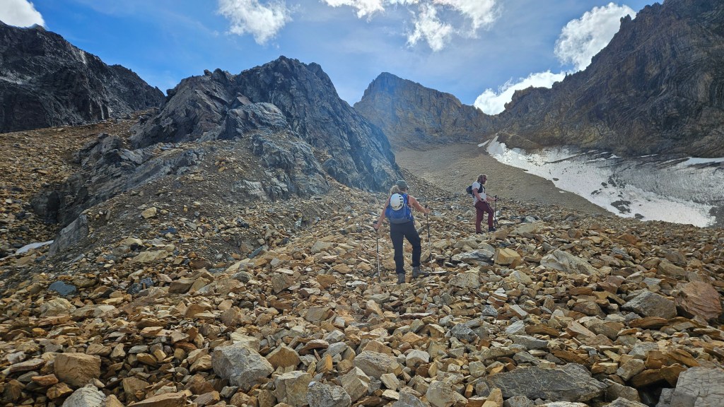
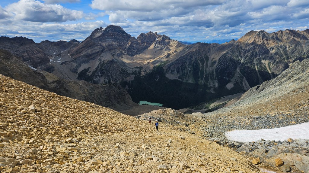
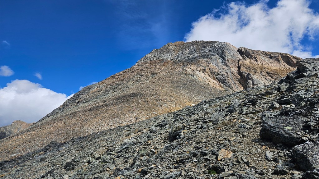
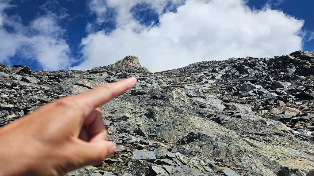
We took a brief break at the saddle, overlooking the spectacular Shangri La valley and neighbouring Horeb Mountain. From here our route intercepted the standard scrambling route complete with a faint footpath. It was straight up Mt Ethelbert from here and we still had several hundred metres to gain before reach the summit. A distinctive light grey band of rock provided some easy hands-on scrambling, otherwise most of the ascent remained a tedious slog. A nipple shaped pinnacle in the grey-band section provided a landmark for the ascent, which we aimed for and then passed on the climber’s right. In total, it took us just over an hour to reach the summit from the saddle.
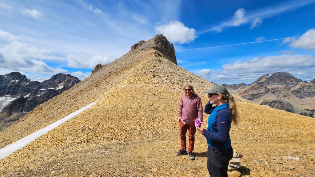
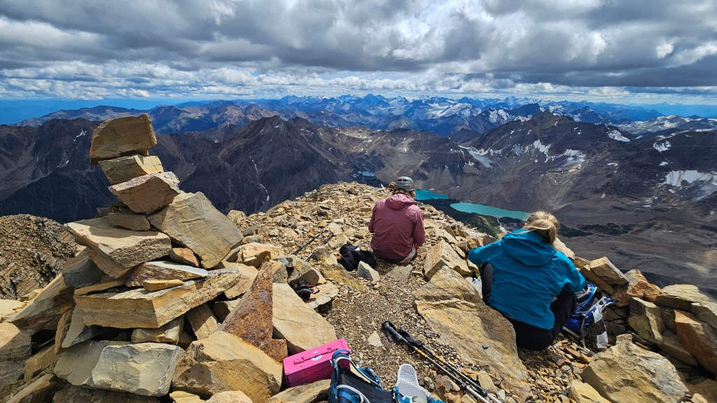
Turns out Ethelbert has a double summit, according to Scott the height difference between the two is insignificant as both look higher than each other when viewed from the opposite. We stuck with the first one as it held the summit register and offered the bird’s eye view of the Shangri La lakes. It was a brisk afternoon for mid August we had to layer up for the extended summit visit. Like most peaks from the 2025 season this was a super scenic summit view and I can’t imagine doing it in lesser conditions. And at 3176m, Ethelbert ended up being our highest peak of the summer season!
The return journey proved to be the real limit-tester in terms of my shoulder injury. This route had more ankle-roller-type talus versus Fossil Mountain the previous trip. Each time I down stepped over lose debris the act of bracing or balancing myself would cause flare ups of joint pain, making for a slower than normal return journey. I did myself double dirty having had my lower leg and knee tattooed the previous week, which was still healing and likewise throbbing from the jarring down hill travel. It took us a little over three hours to hike back down to Templeton Lake, after which the remaining hike out was relatively flatter and easier on my aching joints. We decided that the next adventure could match this one but I wasn’t too keen on one-upping it yet. Car-to-car ended up being 10.5 hours round trip, and if uninjured I imagine that we could have done this trip in 8 or 9 hours.