
July 17th 2025. Yoho National Park, BC
One Way Trip: 6.5 Hours, Elevation Gain: 1270m
Easy-Moderate Scramble
Further Reading: Alan Kane’s (2016) Scrambles in the Canadian Rockies 3rd Edition
This turned into quite the eventful outing, as indicated with the “one way trip” descriptor. Originally, I wasn’t going to add this write-up to Steep Sheep but when drafting the other trip reports from August and September 2025, I often found myself referencing the Mount Kerr incident so decided it was worthwhile to include this one. Fair warning to the reader, this is a long report for an otherwise easy objective. The write up is in two parts: the first being the trip report for ascending Mount Kerr, the second part is my experience of being rescued off the mountain.
My wife Bri and I teamed up with our friend Kels for what was meant to be a three-day weekend based out of the Stanley Mitchell Hut in Yoho. There were several different peaks on our radar for the weekend with Mount Kerr being the easier objective, thus was first. It was meant to serve as our scouting mission to observe the lingering snow levels of the area; these high peaks around the hut are amongst the last to become snow-free in summer.
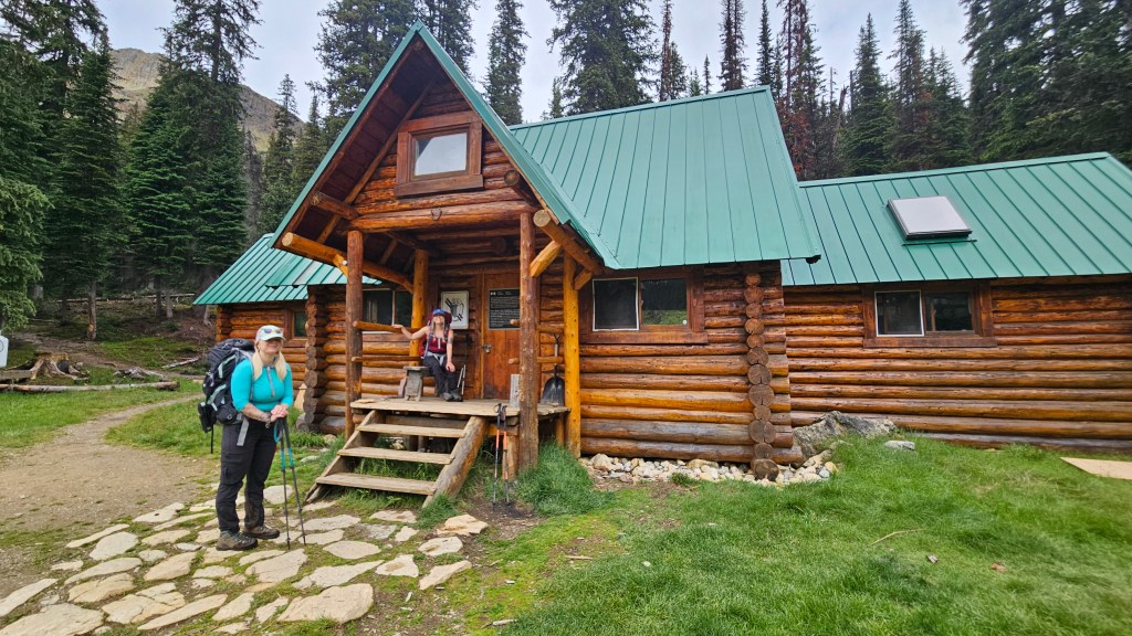
We all drove together to Takakkaw Falls and were trail ready by 9am. It was cool and overcast with a high ceiling, which was ideal weather given that we were carrying larger multiday packs for this trip. It took us around 3 hours to hike from the carpark to the Stanley Mitchel hut where we dropped off our extra gear. We hung around the historic building for an extended lunch break before slowly gearing back up. From the hut we briefly took the wrong trail which took us through a bog, and didn’t match the description from Scrambles. Shortly into that side trail caught a glimpse of the correct path on the other side of the Little Yoho River. We back tracked towards the hut and past the Warden’s Cabin found the correct path where a proper bridge crosses the river.
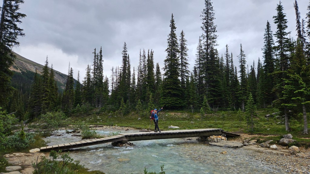
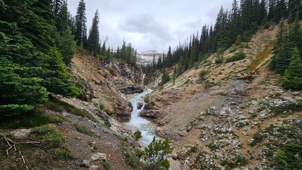
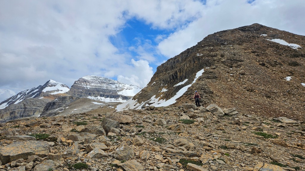
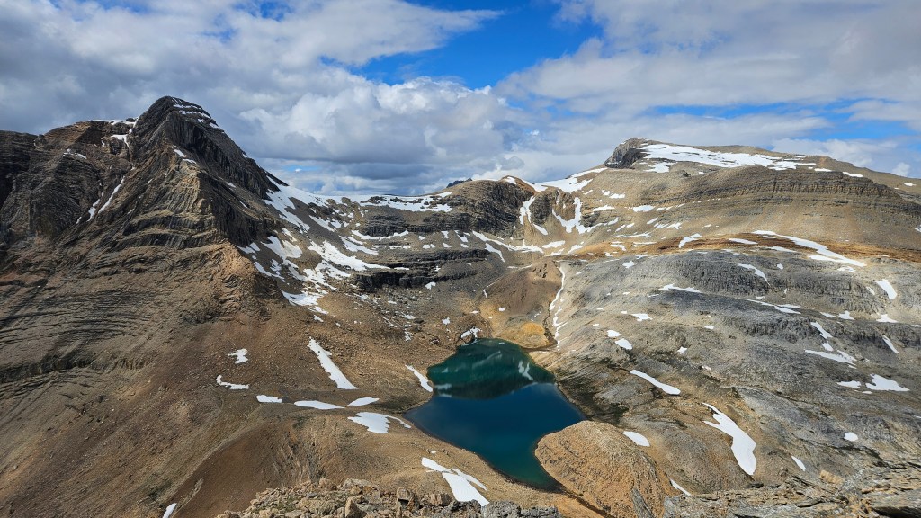
After crossing the river our route followed the right-fork towards Kiwetinok Lake from which we would gain the scrambling route for Mount Kerr. According to my old Gemtrek Map we had roughly 800m of elevation gain from the hut to the summit. The path remained well defined for most of the journey. At first it follows up a slabby ravine with several small waterfalls and then winds through a moraine with numerous melt water creeks. It took us a few minutes to find an easy crossing spot when skirting the moraine, briefly loosing the main trail. Once across, we quickly picked up the main trail again continuing upwards to Kiwetinok Lake. Its worth mentioning that this area had been recently closed due to grizzly bear activity, so it wasn’t overly busy and it’s quite likely the reason we had been able to score a booking with the popular hut.
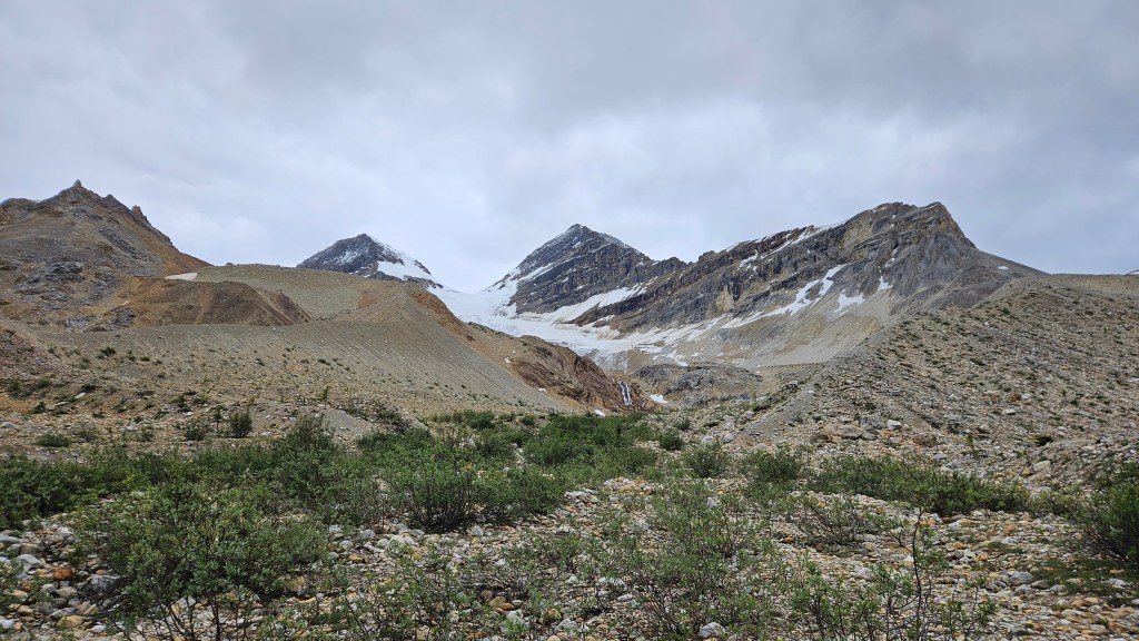

We reached Kiwetinok Lake around 3:30pm and like previous outings in 2025 had selected this area for its stunning scenery. So far so good! From the lake we could see our route up Mount Kerr’s northern side, as well as the routes for nearby Kiwetinok Peak and Mount Pollinger. Wanting to return to the hut in time for dinner, we only briefly visited the lake before continuing up the slope. The trip was admittedly taking longer than expected and I believe in part we had misread Kane’s description of how long the scramble would take. I do believe however that Kane underscored the duration of this one, and likewise underrated the route’s difficulty. By no means a challenging ascent, it was surprisingly hands-on for an “easy” rated scramble.
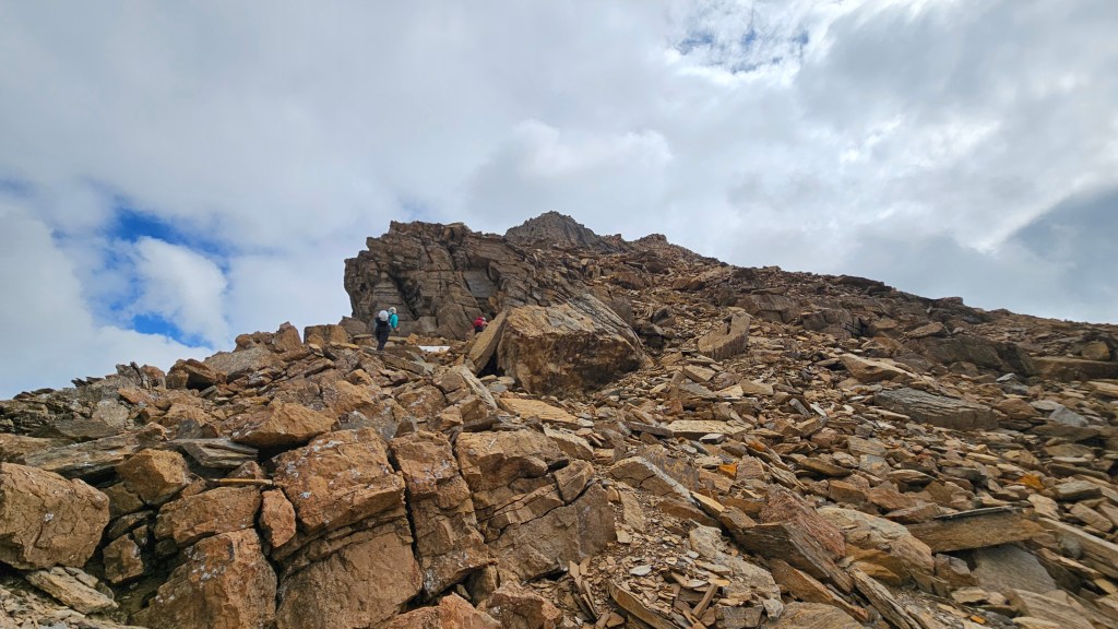
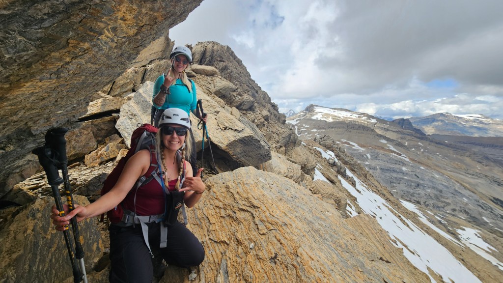
We were loving it! The hands-on nature of the route was a pleasant surprise and the route supported a well-defined footpath most of the way with views to boast. Plus, the views were stunning. Against the bleak overcast skies the surrounding lakes and tarns popped like gemstones in contrast to their dull surroundings. The scrambling itself was enjoyable, numerous small ledges required getting hands-on with minimal fall exposure. Despite the day getting late and the three of us feeling a bit tired, the mood remained light.
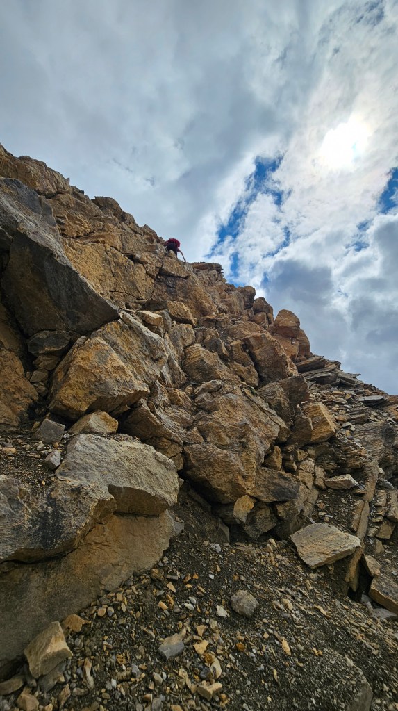
It took around an hour for us to reach Mount Kerr’s lower North Summit, and we were still on cloud nine with gawking over the surrounding views. Another stunner for the books! Being the peak bagger, I was pretty insistent on reaching the higher south summit and was convinced we still had enough daylight to do so. Admittedly though, I lost the trail off the summit and downclimbed into a quickly exposed spot off of the southwest corner of the north summit. I spent maybe 2-3 minutes of trying to spot a route before back tracking. Once on the summit again, we nearly gave up and then I spotted the main route again which follows down the ridgecrest slightly to the southeast side. This was well marked with cairns and was a really fun section to scramble as passed under an overhang.
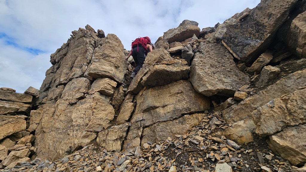
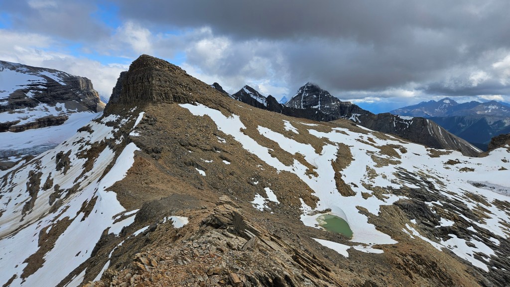
Once down in the saddle between the two summits, it became apparent how close the North Summit was. No more than 20-30 minutes to top out by our estimate. It gave us a second wind and we pushed forward up a rubbly shale-littered slope. I decided to get a photo of Kels approaching a snow patch and planned on that being the last photo before reaching the south summit. Bri was in the lead at this point and had already crossed the snow patch up ahead, beyond which the route intercepts the skyline to the looker’s right and switches back towards the summit. It was 5:03pm…
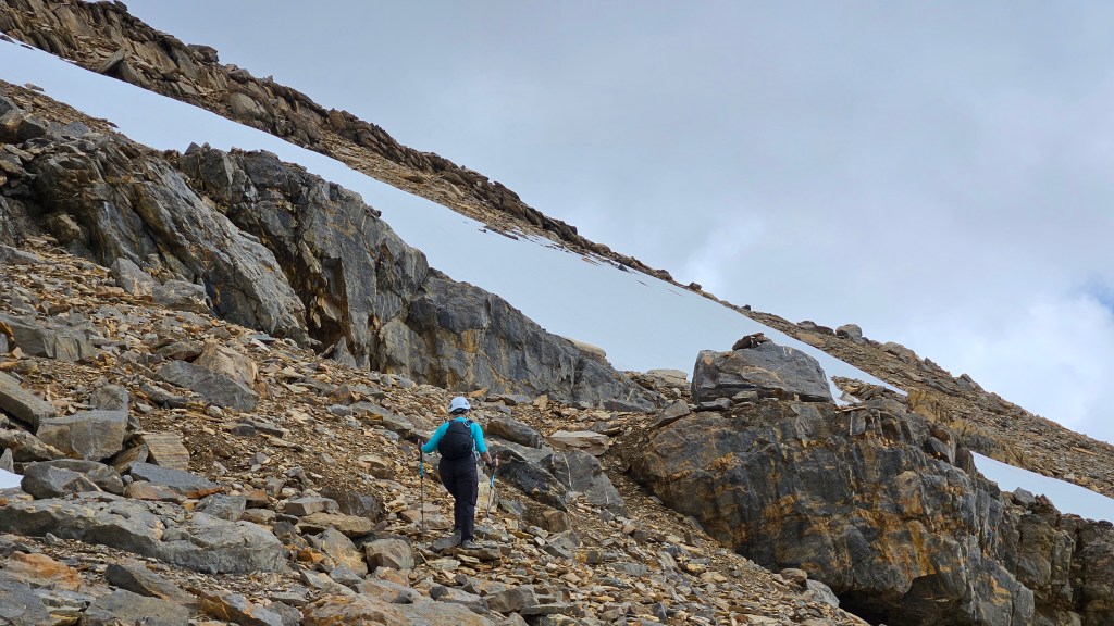
After snapping that last photo of Kels at the snow patch, I tucked my phone away and plodded along. We were all pretty tired at this point, and I personally was heavily leaning into my hiking poles. Just shy of the snow patch (roughly where Kels is in the photo), I felt my right foot slip off of a dinner plate-sized piece of shale. My whole body forcefully slid backwards, hyperextending my arms which were still firmly gripping the hiking poles. It was such a sudden and violent motion that I wretched both shoulders, fully dislocating the left one with a sickening pop noise.
While the motion had been a split second, it took a minute or so for the pain to set in, and when it did it was like hitting a brick wall. I had done my shoulder in (or rather, out) a few times before but it had been five years since the previous dislocation. I had also been very active with climbing leading up to this trip so what had just happened really caught us all off-guard. It hurt to move and we tried in vain to reset the shoulder. Dehydrated from the day’s efforts my shoulder muscles locked up and there was no resetting to be had. We attempted to get an emergency signal on our cellphones with no luck, and at the time did not own an inReach.
We had no choice but to double back to the North Summit in hopes of obtaining a cell signal, Kels slung my arm using my hiking fleece and Bri doubled up on packs for the hike back. Progress was painfully slow (quite literally) as I travelled at a third of my normal hiking speed. I was in agony with each step, the sensation of stepping and balancing on loose rock would send shockwaves of pain into my shoulder, making it hard to regulate my breathing. It was a bad situation and the day was getting late. Downclimbing the hands-on sections beneath the North Summit was a struggle, I had to crab walk one-handed with one of the girls constantly spotting my movements. It sure made an otherwise easy scramble feel incredibly technical! I wasn’t gaining any speed with the downhill travel either, quite the opposite, I was losing speed with each step.
We decided to send Bri out for help, as she was an active trail runner and thus the fastest in our group. She took off like the wind heading back to the Stanley Mitchell hut, while Kels hung back to continue spotting my downhill travel. Somewhere along the way before Kiwetinok Lake I choked on an Ibuprofen and vomitted all over myself, adding insult to injury. I had little concept time during these events was but was told it took over 2 hours to return to the lake. In that time, Bri not only reached the hut but had returned to our location with the aid of a kind stranger named Evan.
Having spotted Bri and Evan in the distance, Kels and I continued downhill from the lake towards the outflow that pours out into the ‘slabby’ waterfall section. This last push proved too painful for me and I was thoroughly exhausted. Evan and Bri caught up to us around 8pm, and in my delirium I mistook Evan as a Park Warden. He offered to contact Parks and organize a helicopter rescue with his inReach but cautioned us it might be too late in the day for a resuce. The thought of having to hike back to the car that night was not a comforting thought but a scenario we had to mentally prepare ourselves for. Fortunately for me, Evan successfully made contact and a heli was on its way.
The helicopter arrived around 8:45pm and given how late it was the crew didn’t have time to provide any medical aid. They quickly flew me back to Takakkaw Falls where an ambulance awaited my transfer. Many friends have since asked me how awesome was the flight, and sadly I don’t remember much of it The remainder of the night is a bit of blur, though I do remember the paramedics being pretty swell to chat with. I made it to Golden Hospital around 10:30pm and had my shoulder reset by midnight. In total it was out of socket for nearly 7 hours.
Bri and Kels ended up returning to the hut that night, where I’m told the other guests were super supportive of them. They had a short overnight rest before hiking back to the car the next morning. While I had been flown out with my pack, most of my gear at been left at the hut prior to hiking Mount Kerr, so the girls definitely hauled extra pack weight on the hike out. They made it back to Golden by 7:30am and the first thing Bri & I did upon returning home was order ourselves an inReach device.
Shockingly, I made a fast recovery and only needed the arm sling for a week or so. I regained much of the arm’s motions within a month and even returned to peak bagging two weeks after the incident. However, lingering problems persist (still in queue for surgery at the time of writing this in Jan 2026) and we had to scale back on the technicality of our scrambles for the remainder of the 2025 summer season. All in all, I consider myself quite lucky and am well aware of how much worse that night could have played out. Needless to say, this was a humbling experience.
Many thanks to all the kind strangers who stayed at the Stanley Mitchell Hut on July 17th 2025 who gave Bri additional first aid supplies for the rescue, and later supported both girls post-rescue. Major thank you to Evan for hiking up with Bri to Kiwetinok Lake (and teaching me how to pronounce that!) and for organizing the rescue helicopter. Huge thank you to the Parks helicopter crew for their prompt rescue response, to the paramedics that transported me to Golden, and the exceptional staff at Golden Hospital. A massive thank you to Kels who stayed behind to assist me down the mountain, and an endless thank you to my wife Bri who ran back to the hut so fast that people thought she had been chased by a bear – she still had her scrambling helmet on that whole time!
