August 19th, 2024. Invermere, BC.
Round Trip: 10.5 Hours, Elevation Gain: 1897m
Moderate Scramble
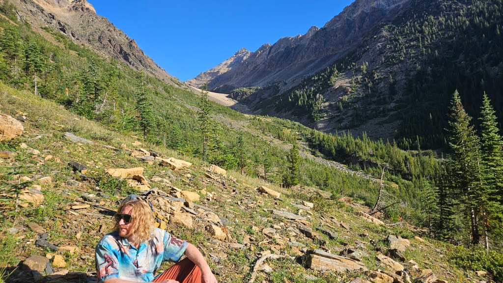
A popular 3300m peak near Invermere, Mount Nelson boasts incredible panoramic views while imposing a daunting 1900m elevation gain to reach the summit. The description from Mclellan & Strauss’s (2022) Hikes Around the Columbia Valley certainly put this peak on our radar last year. Several of our adventure buddies had this on their list too, and by August we gathered a group of six for the outing. Plus, Ben’s summit doggo Rosie. The access for this trail is a few kilometers past Panorama Ski Resort which meant a very early departure from Golden. Our group first met up in Invermere and condensed into Scotty’s bush truck, which proved overkill for the short FSR stint to the trailhead. We arrived at the trailhead around 7am and began shortly after.
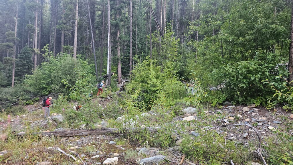
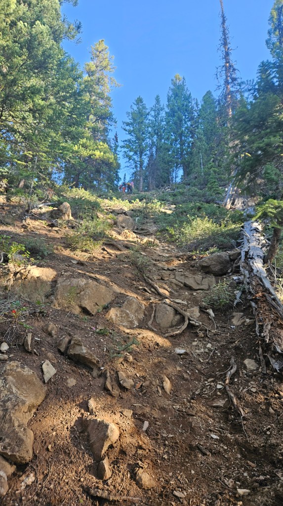
The route up to Mount Nelson was well maintained, well flagged, and started just beyond the parking area on the west side of a creek crossing. Like many of our ascents this past summer, the initial approach trail is wickedly steep, wasting no time with gaining precious meters. We stomped up over 600m vertical in the first hour and had only travelled 1.5km into the forest. Luckily the slope’s gradient flattened soon after recording those stats. Further up ahead the trail veered off to the east, side-hilling towards a lightly shrubbed meadow. At times the trail towards the meadow felt closed in but was otherwise easy enough to follow, especially once at the meadow itself.
Exiting the trees into the meadow marked roughly 1/3 of the journey. The next section or third is the hike across the alpine meadows and north towards a high basin situated below Mount Nelson’s western slope. This is flattest section of the day, with little elevation gained until gaining the basin itself. The footpath through to the basin remained well flagged as it had been through the forest section. Past the meadow approaching alpine we followed a series of cairns along the west side of an outflow steam, with many avenues of side-trip exploration available.
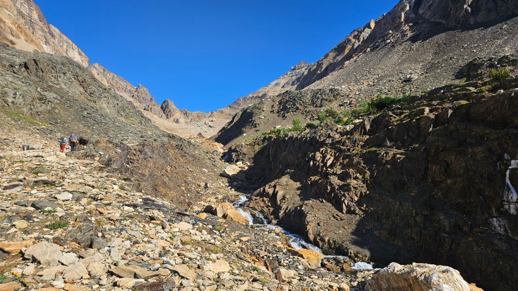
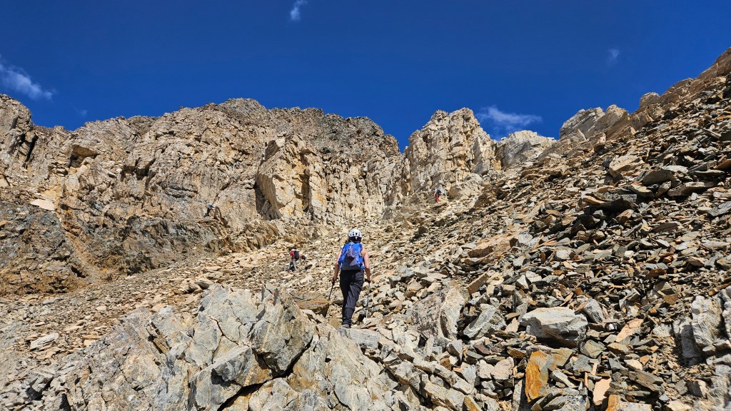
It took us roughly 90 minutes to hike across the meadow and up to the basin’s tarn. By now we noticed several others on the trail up ahead (behind us too), and we grew cautious that the main scrambling route could be congested. Our timeline was also drawing out as one of our party became seemingly ill but insisted they would continue. At the basin we took a prolonged break and assessed the terrain up ahead, preparing our approach for the final third of the journey. Initially our plan was to scramble up the main gully at the back of the basin (northern most gully) as described in Hikes Around the Columbia Valley. However with another six to eight hikers ahead of us, we were wary of the rockfall hazards especially with Rosie.
Scotty and Logan had looked up an alternative route on the Gaia app which involves side-hilling diagonally up from the tarn across the slope towards a series of crumbly ledges. An additional hiking party of two, whom we recognized from Golden, took a break with us and likewise were aiming for this ledges route. We essentially followed their lead skirting the shaded area in the photo below aiming for a weakness in the lower cliffs. From afar a critical eye was needed to first spot the natural weakness in the cliff bands. Once we set out up the slope, it quickly became apparent that this route is as popular as the main gully as we soon found ourselves on a well defined foot path through the shale. Similar to the forest section of trail, this first slope was a steep slog up. Entering the weakness, we regularly encountered cairns which made navigating these crumbly ledges relatively straight forward.

We as a group were all surprised by the number of people on the mountain, notwithstanding our group of six. There were at least six or more people scrambling up the main gully to the north of us, and at a quick glance back another four hikers down near the tarn. The ledges were quite enjoyable, even if a bit rubbly at times. The views looking south of the basin and of the neighboring Sultana Peak behind us were already worth the grind, and the weather remained calm. We had already donned helmets down in the basin, and otherwise encountered minimal difficulties in the first couple hours. The route was still mostly a hike up to this point, only occasionally requiring hands on scrambling.
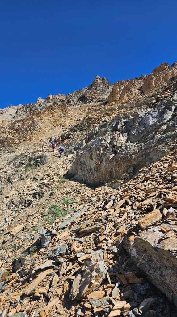
From the initial weakness in the cliffs we spent the next hour zig-zagging our way up broken grey ledges and shale littered gullies. We continued up on a slight northward diagonal. Early into the ledges, our ill party member had to stop again, and was plagued with a few additional pit stops throughout the ascent. With the other scrambling traffic either well above us or still to our left in the main gully, we at first didn’t mind the prolonged stops as the views beyond the basin kept our moral high.
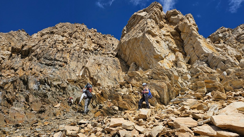
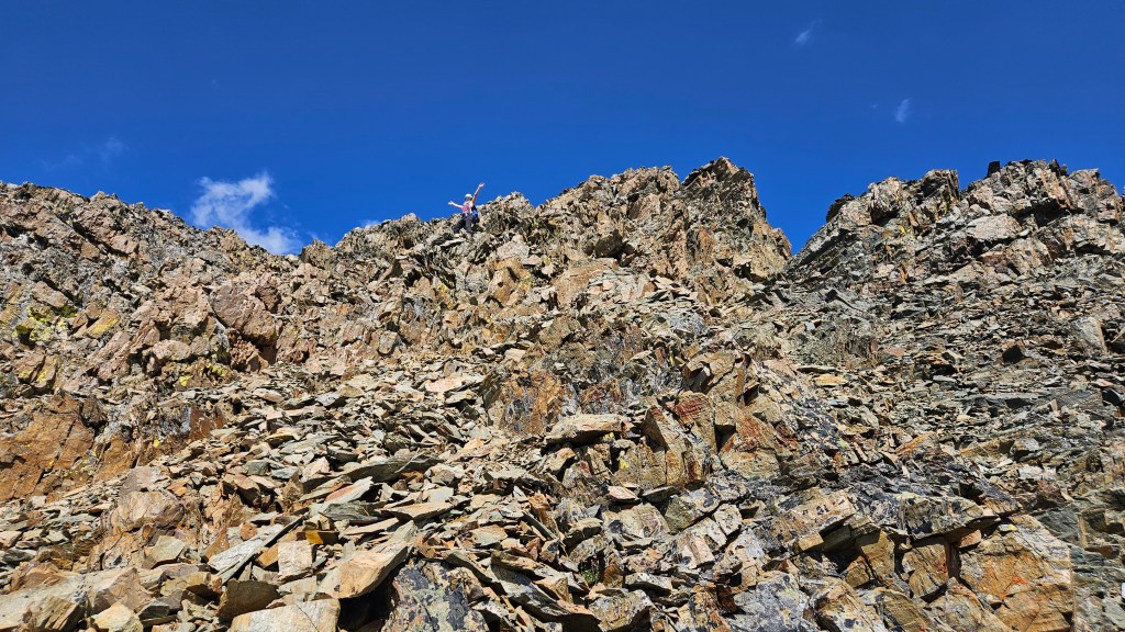
Around noon the upper reaches of the mountain came into view. Until now the scrambling had been minimal and was becoming noticeably more hands-on in places. A couple distinct landmarks are worth noting here. Firstly, we were at that time roughly 45 minutes underneath the summit, and the ledges now conjoined with the main route above the main gully. Second, a cluster of lighter sand-toned towers now loomed above us. We followed cairns slightly to the looker’s right under these tower features before switching back to the looker’s left. Third, on approaching the towers base, there is a distinctive large cube shaped boulder to the climber’s left, precariously balanced on the slope’s far north edge.
Having rejoined the main scrambling route, the footpath through the shale was easy to follow into the towers section. Just past the balanced cube-boulder landmark lies the “crux” of the day, a brief but fun hands-on scramble up a ladder-like gully. We took the precaution of scrambling up this one at a time, as to not kick rocks down on each other. Until now our group had staggered out from each other, Rosie sets a mean uphill pace having four legs. At the crux we briefly regrouped as to help guide each other upwards. Our ill party member had fallen quite behind and we questioned whether or not they should continue. With their blessing we opted to continued in hopes that they would catch up to us towards the summit.
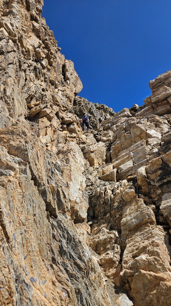
Above the crux is another brief section before reaching the summit. These final sections remained a somewhat moderate scramble up more crumbly ledges. We topped out on a shoulder crest just south the summit proper and were teased with the first views of the Columbia Valley. Staying slightly to the climber’s left (west) proved the easiest way up the final stint of rubble. To our team’s amazement, our ill party member caught up to us here in an epic push but nearly missed the easier approach to the summit.
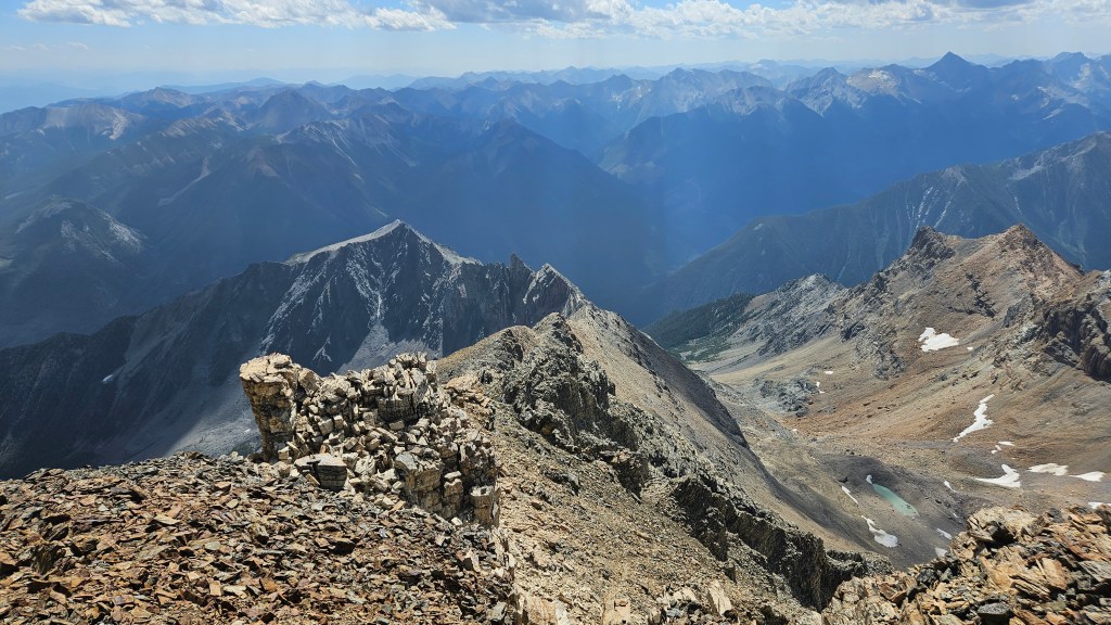
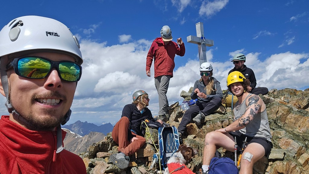
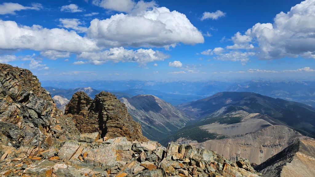
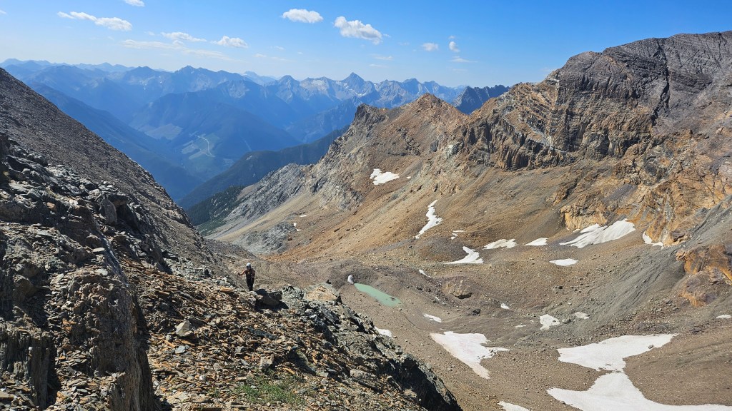
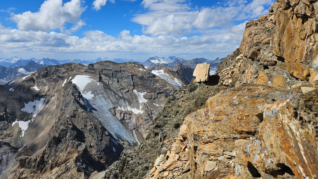
As a full team our summit time was just after 1pm. Including breaks it had taken us a little over 6 hours from car to summit. Sure enough, over a dozen people (including our group) briefly shared the summit. Can’t recall the last time being on such a busy peak! What was more shocking was the number people up there without helmets. We gave them all a very long heads start before our descent, and spent at least twenty minutes taking in the views up top. The views speak for themselves. Towering above the Toby Creek area, we enjoyed high views over the Columbia Valley and of Purcell’s highest peaks.
The journey back to the car took us roughly 4.5 hours as we had to really space ourselves out to avoid tumbling rocks down at each other. We took the main gully down instead of picking our way back through the ledges, which made for a slightly more direct return to the basin. Shockingly, or perhaps not shockingly, a handful of hikers were still plodding up the rubble late into the afternoon. We took less breaks on the return journey, dreading the downhill in the forest section. It was just as grueling downhill as it was the uphill, and we were all feeling quite knackered by the time we returned to the truck. Props to Logan for bringing a cooler bag of beers in the truck for our return!
Overall – an epic day and another big peak off the list. It is fitting of a moderate scramble rating given the near 1900m elevation gain and hands-on scrambling in the final 200m. Expect mild route finding, a full day, and likely other hikers. Helmets are a must for this one. An odd side note, the GPSs in our watches that day were all highly inaccurate which made it hard to gauge our progress during the ascent. Inaccurate enough that Scotty was convinced that the summit was only around 3100m. We later reconfirmed that the summit is just over 3300m, though the last two digits seem up for debate. I pulled 3313m off of Wikipedia.