July 9th, 2023. Yoho, British Columbia.
Round Trip: 10 Hours, Elevation Gain: 1100m
Moderate – Difficult Scramble.
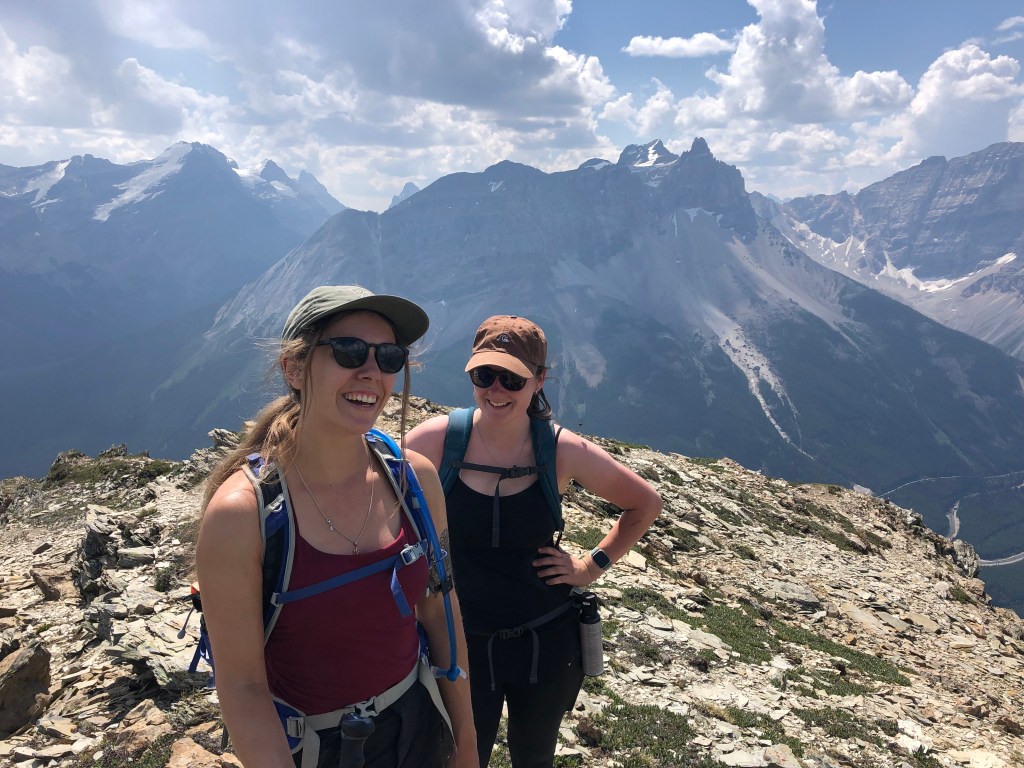
We teamed up with our friends Flo and Aoife for this outing, and are super stoked that Aoife completed this as a first time scrambler! Having said that – I would not recommend this peak for novice parties as some route finding was required and crux under the summit involved very exposed scrambling moves (albeit brief). For experienced scramblers, this is mostly a sustained moderate scramble with the crux pushing the rating into low end difficult.
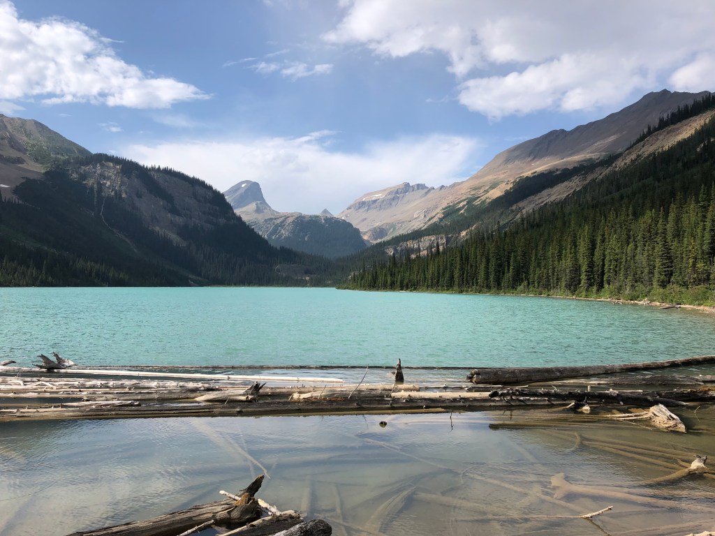
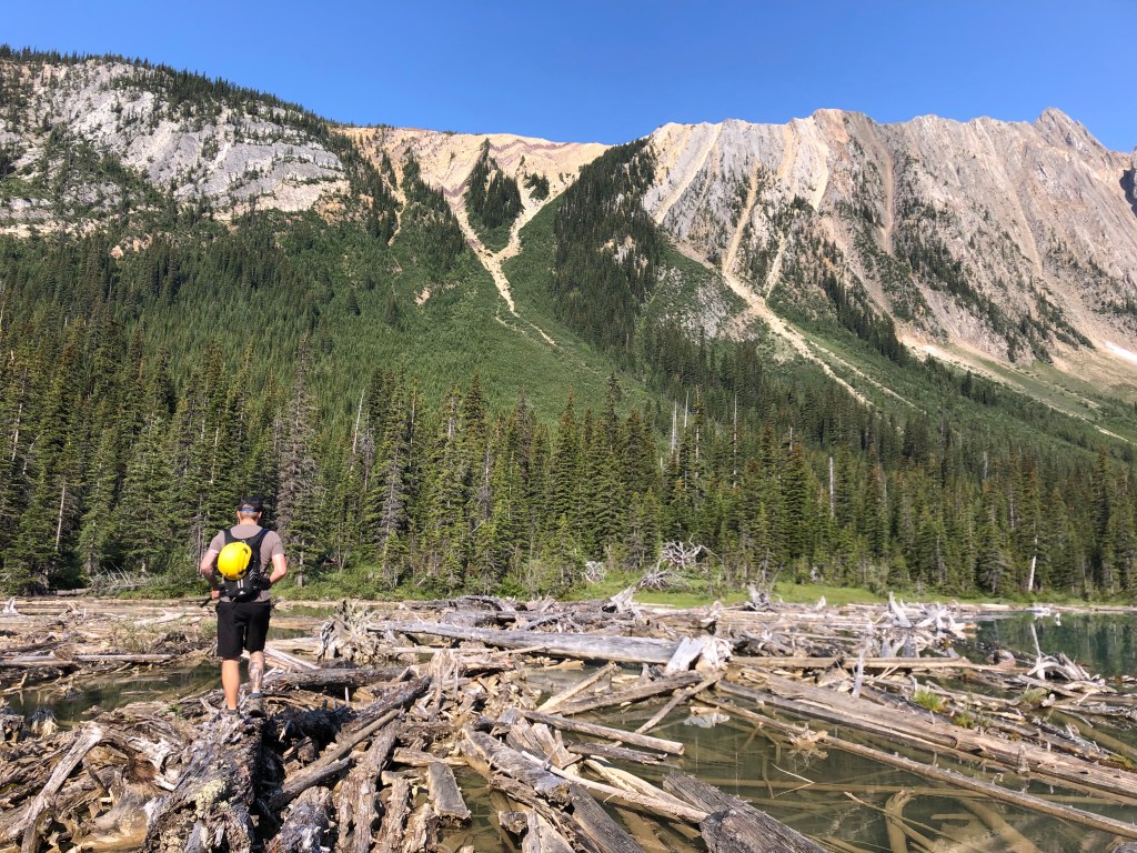
There are two approaches that can be used for this peak, one is directly from the highway (the pull-off is subject to seasonal wildlife closures in spring and early summer), the second is via Sherbrooke Lake. We went the Sherbrooke Lake route, once at the lake we crossed the log jam aiming for a Y shaped avalanche path as per Kane’s (2016) description in Scrambles. The Y shaped gulley is notable for the purple-tinted scree bands rippled across the top of the gullies: we aimed for the upper right arm of the Y. As for the bottom of the Y shape, we decided to bushwhack straight up from the shoreline after spotting a brief clearing.
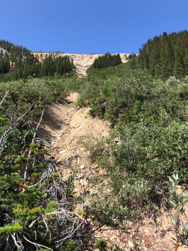
Hind sight is everything, later that day on the return trip we discovered a somewhat distinct path with flagging that lead from the bottom of the Y straight through back to shoreline. We however did not initially travel far enough along the shoreline, fearing that the ground would disappear around the next blind corner so instead we chose a clearing that somewhat lined up to the Y’s bottom and punched through. This proved to be a brutal 45 minutes bushwhacking effort – the regrowth on this slope is THICK! We persisted aiming slightly up and to the looker’s right eventually finding the bottom of the gulley, then the real effort began. The gully is relentlessly steep with poor footing – mostly hard packed silt. Occasional rock bands would offer hands on scrambling, the only relief to an otherwise steep grind uphill.

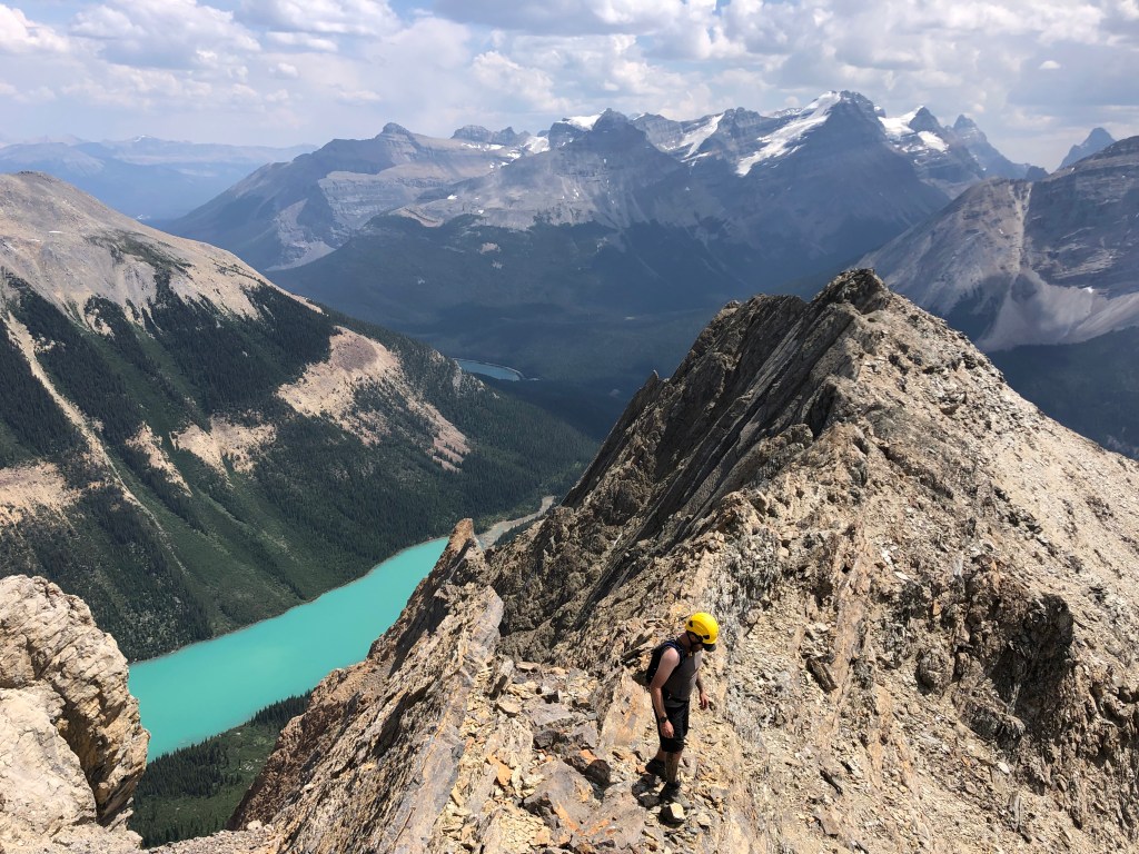
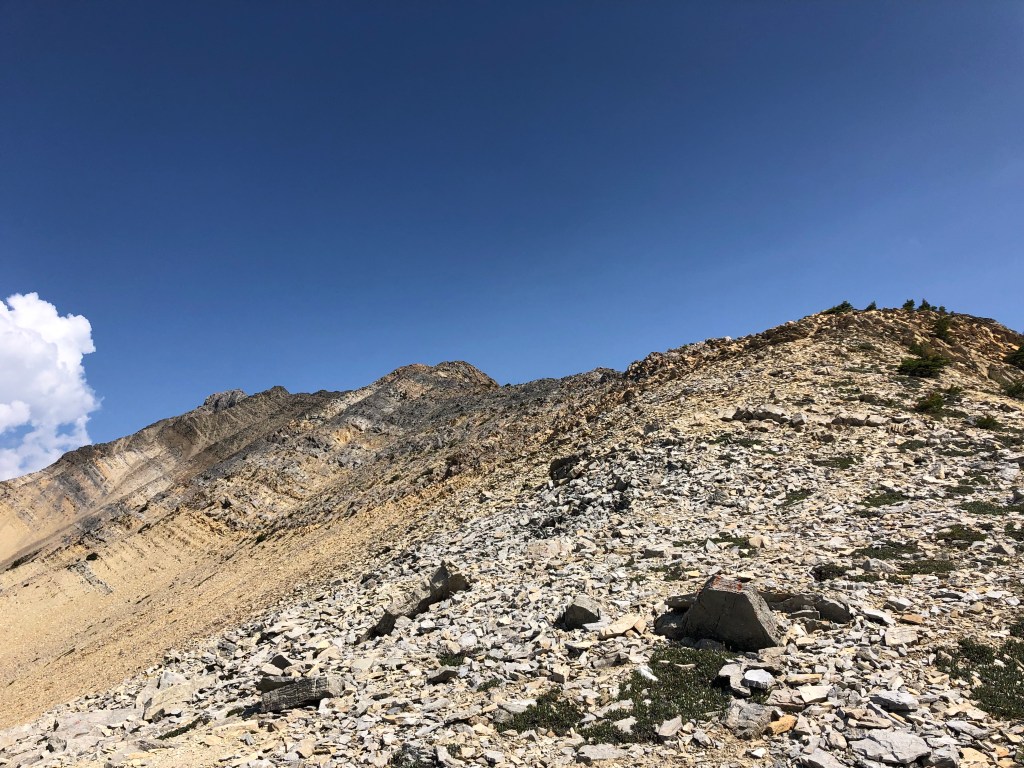
It took us just under 90 minutes to get everyone up through the gully, the connection above onto the ridgeline involved a brief moderate scramble through a section of light grey rock. Once we regrouped it was time for a breather – the views from the ridgeline were already quite impressive and Aoife needed a little moral boast. Admittedly we had dragged her through a rather rough introduction to scrambling, luckily the worst of it was over and the fun parts still lay ahead. A relatively defined footpath lead the way across the ridge, staying close to the ridge crest at first. Further along the path would dip onto the west side of the ridge leading across rubbly ledges, mostly a moderate scramble up until the summit block came close into view.
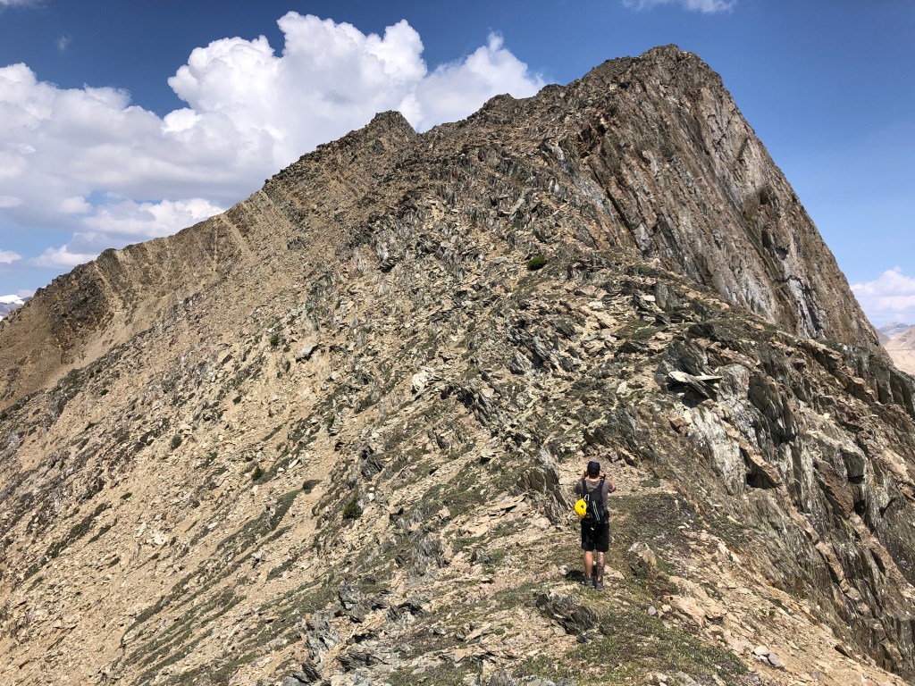
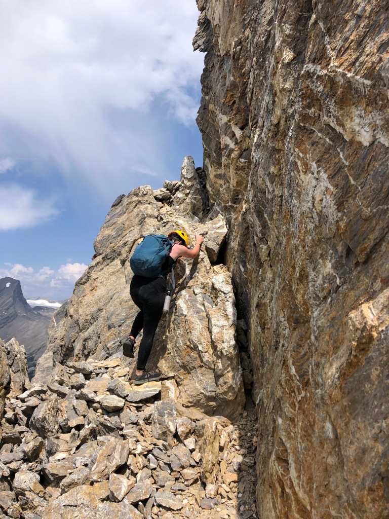
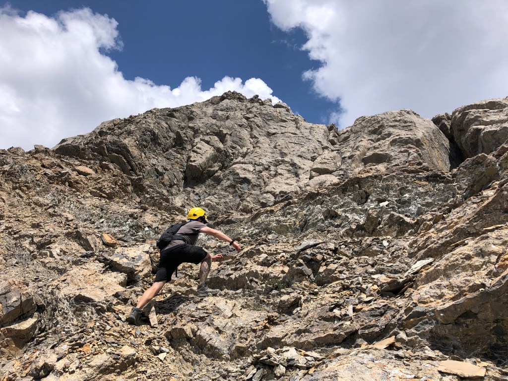
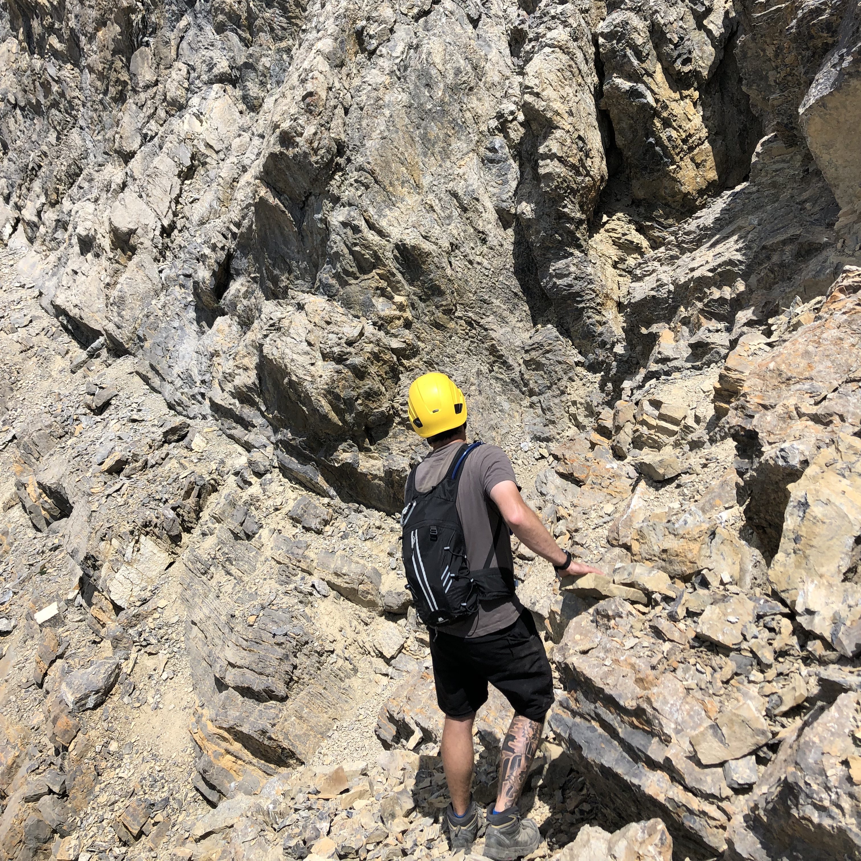
Once the summit block was within grasp, the path lead us briefly down the west side away from the ridge crest across a series of very steep ledges and thin gully’s – the scrambling still felt moderate in nature but we were all very aware of the increased falling exposure. Up until this point there had been a well travelled foot path leading us across the ridge, and while that path had mostly vanished now, there were still a fair few cairns that helped us through. Some route finding was required navigating the summit block, which is where the difficult scrambling began. We scrambled upwards through 3rd class terrain and then wrapped around the back (north) side of the summit block. Here lies the crux. A tight down-sloped ledge that feeds into short but awkward step somewhat resembling an hourglass shape. Holds were plentiful however the exposure through here is scary steep – a fall from here would certainly be fatal. We took our time through here and carefully picked out the sturdier holds ensuing that everyone summited. Above the crux was the flat relief of the spacious summit. We enjoyed a decent break, and like most peaks in 2023 began our downclimb when dark clouds threatened to roll in (thankfully this time, no storms).
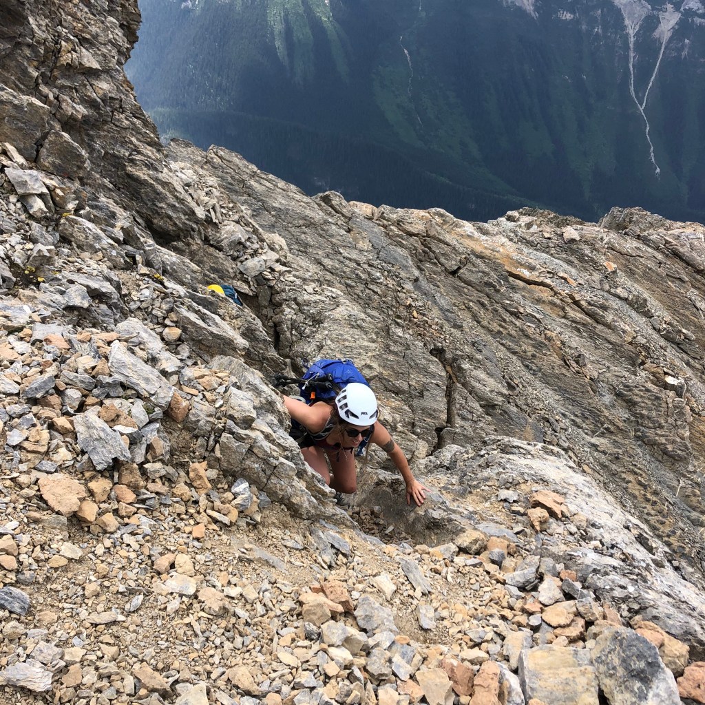

The downclimb of the crux proved a little more daunting as the exposure was much more apparent, and we worked well as a team showing each other the critical steps necessary for safely scrambling back to the more protected ledges on the mountain’s western crest. Once back onto the main ridgeline and the summit block in our rear view, the scrambling mellowed out and the views of Cathedral Mountain and Mount Stephen kept our spirits high as we traversed south back to the Y gully. Another gully just north of the Y shaped one appeared as a possible alternative downwards, we stuck to the original gully and suffered the hardpacked silt on descent. It was too hard to boot-ski down and too steep to run so we plodded and picked our way down – Aoife was less than stoked to be in the gully again.
One silver lining on the downclimb was we travelled the Y gully all the way back to the shoreline, to our delight there was some flagging and minimal bushwhacking compared to what we experienced earlier that day. While hiking back towards the log jam, we noted that while cairned and flagged, this exact entry/exit point is hard to pinpoint from shoreline, and as noted on the way up is around a very blind corner. If one can locate it, one can avoid the nasty bushwhack we did. Another note is Scotty & Benny have done Ogden direct from the highway via a goat path that involves minimal bushwhacking and is well flagged. I vote go up from the highway to those reading this! Had it not been for the bushwhack and Y gully, the ridgeline and summit block portions of the day would qualify Ogden for one of my favourite Yoho scrambles.