December 27th, 2018. Aoraki Mount Cook National Park, New Zealand.
Round Trip: 5 Hours 45 minutes* Elevation Gain: 1180m
Easy/Moderate Scramble
Mount Ollivier is an infamous peak within Aoraki Mt Cook National Park. This was the first major peak of Sir Edmund Hillary’s climbing career. With quick access to the crumbly slopes via the popular Mueller Hut, this peak is regularly ascended. Bri and I decided to trek up after work and see what the fuss was about. We set out from our flat in the village at 2:50pm and were back home around 10pm.
*The round trip time for this report was calculated from the base of the Sealy Tarns stairs
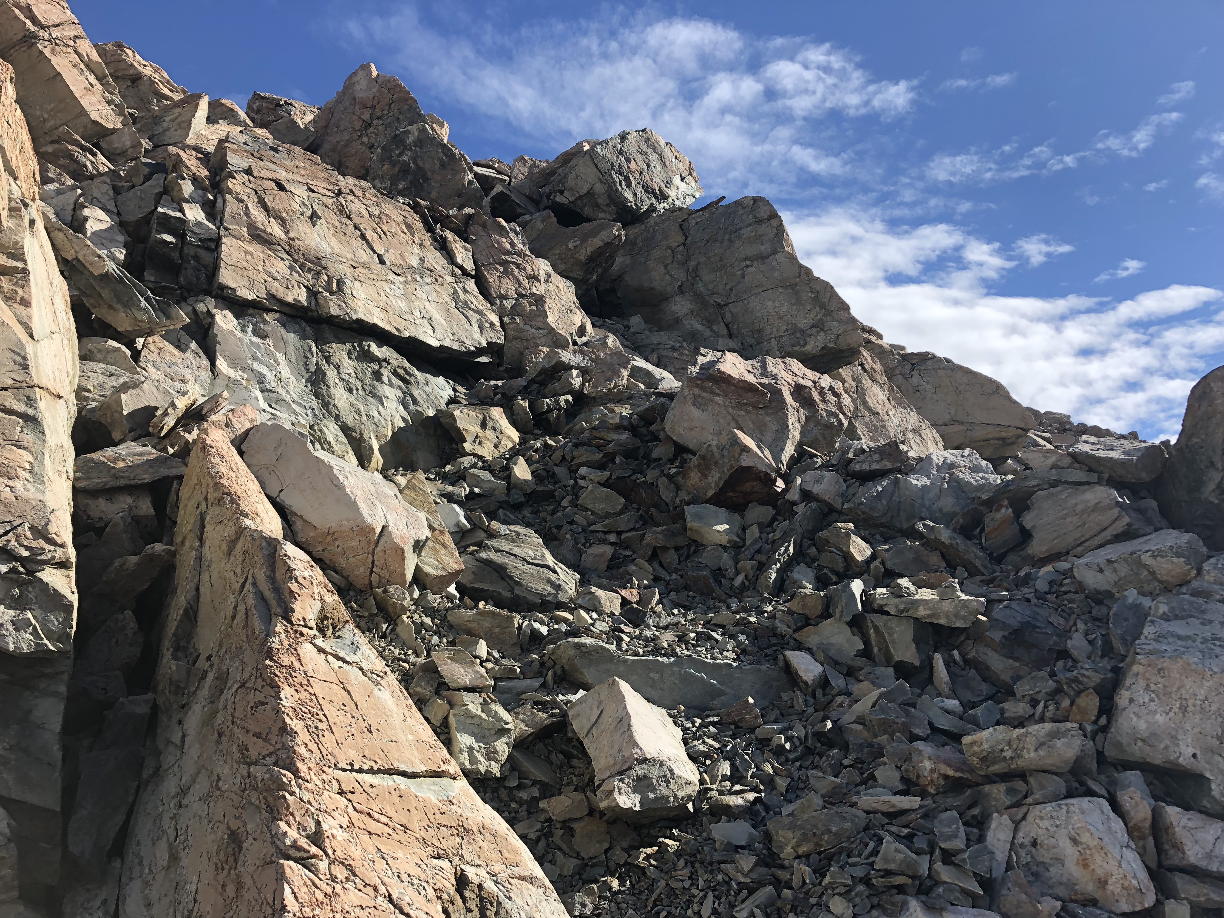
Initially we missed the more worn in foot path behind the hut, and instead stuck to the ridgeline for most of the ascent. This was more fun versus the faint foot path that we followed during the descent – lots of fun moderate scrambling with just enough exposure to tease the adrenaline.
In order to get to up to the Mueller Hut, you will first have to battle the crowds of other tourists up some 1,400 stairs to Sealy Tarns. The views are phenomenal but there is little to no shade – bring lots of water and be prepared to yield every few minutes to other hikers along the stairs.
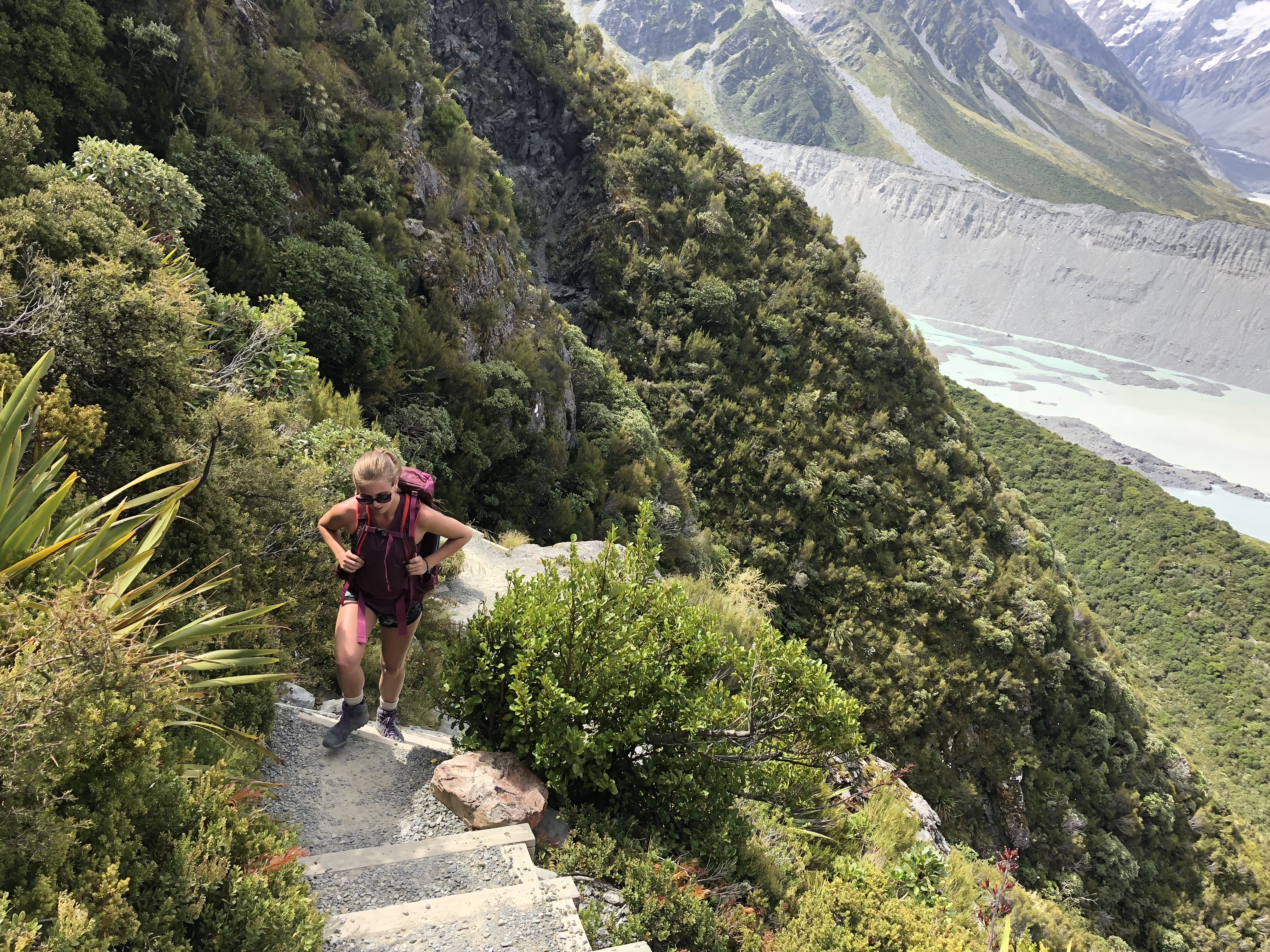
Once above the stairs the path splits to the left and you will now be following a series of orange tipped metal pole markers the rest of the way up. It’s pretty straight forward up through this alpine field. We noticed a few hikers working their way back down which helped with spotting where to go.
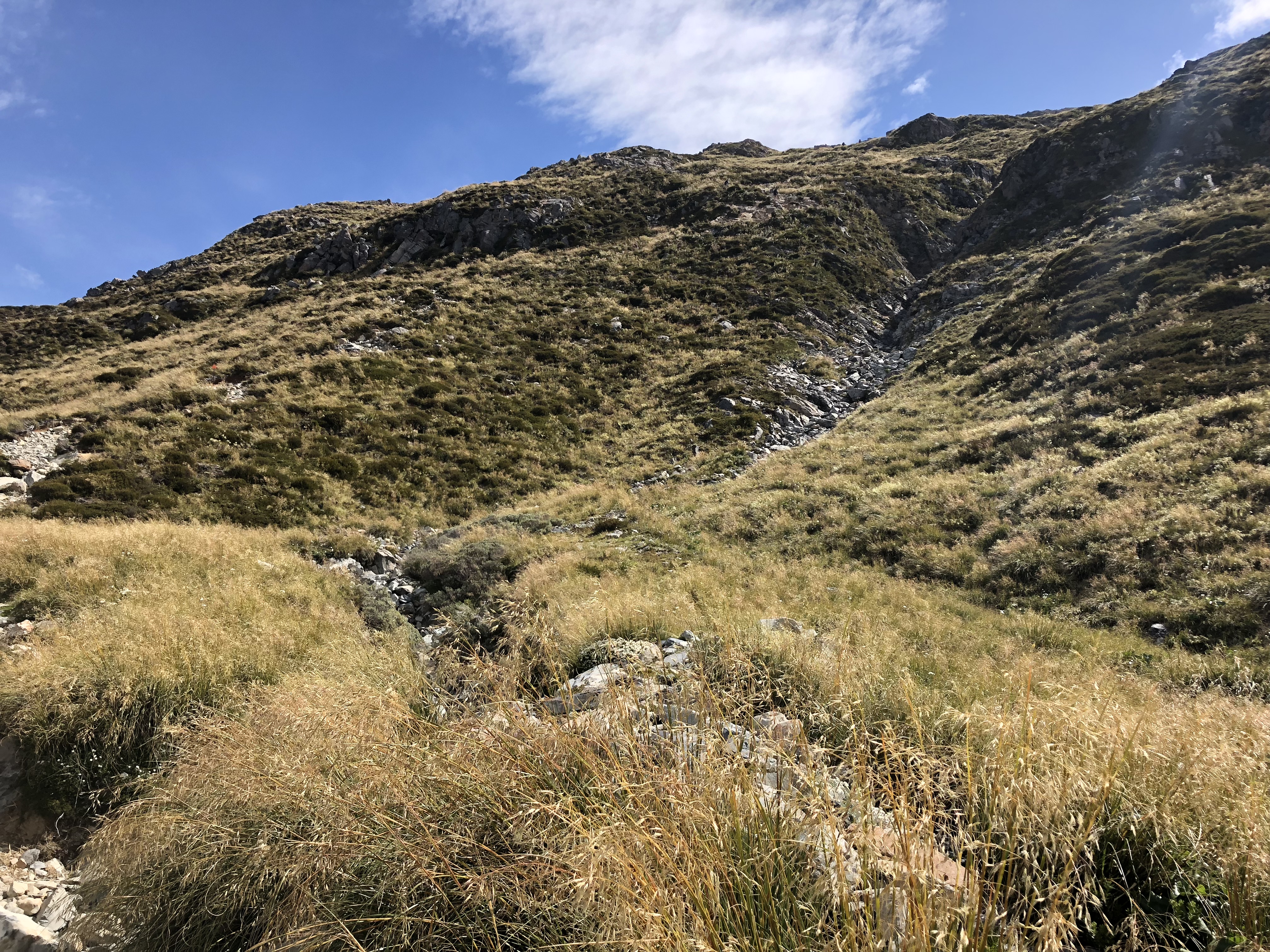
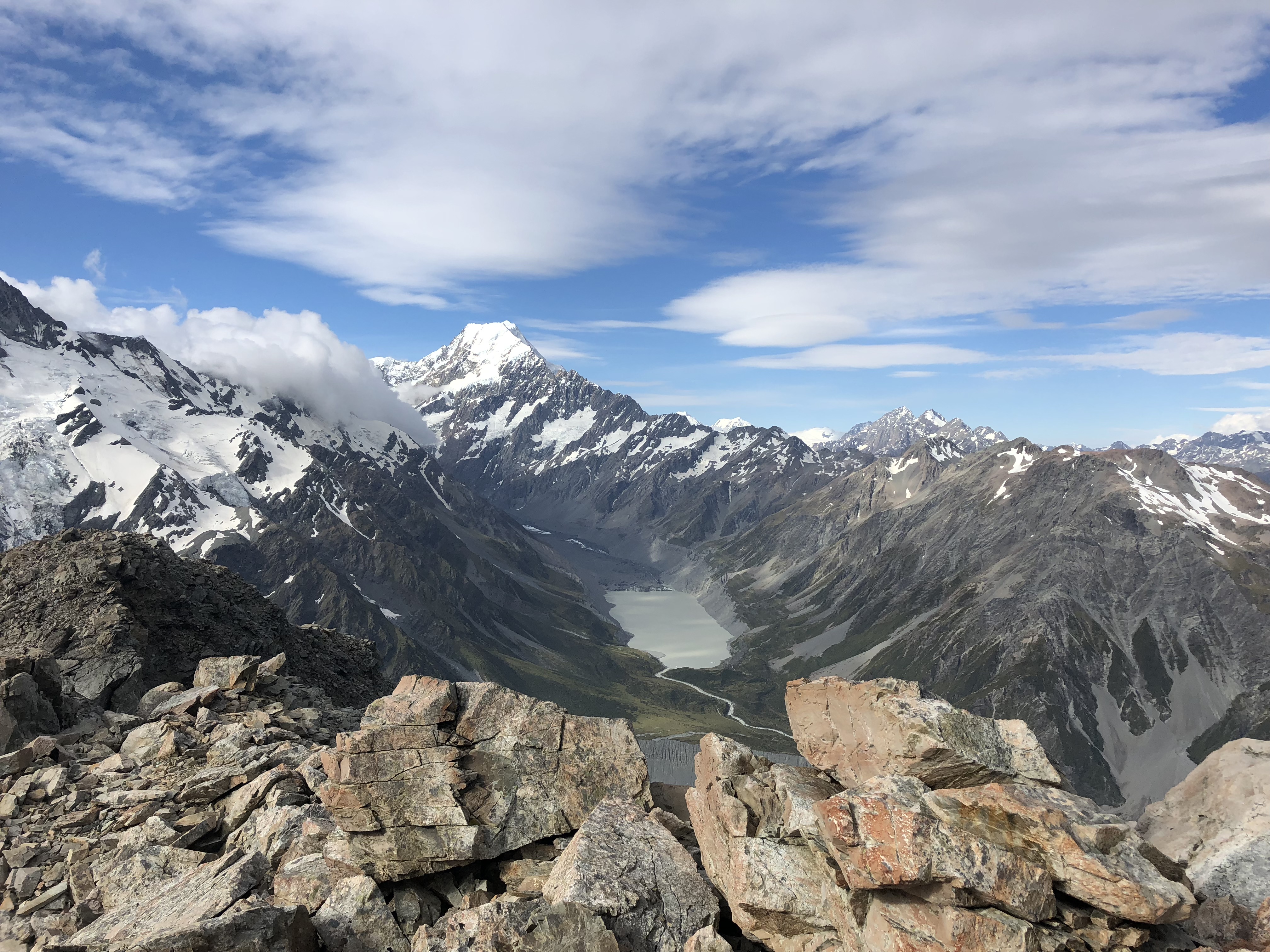
From Sealy Tarns you’ve gained roughly half of the total height for the day. We followed the orange markers until the Mueller Hut came into sight. Rather than visit the iconic hut first we instead opted to stick to the looker’s left by staying close to the ridge line. This kept us off the snow (thus dry feet) and immediately offered some fun boulder hopping.

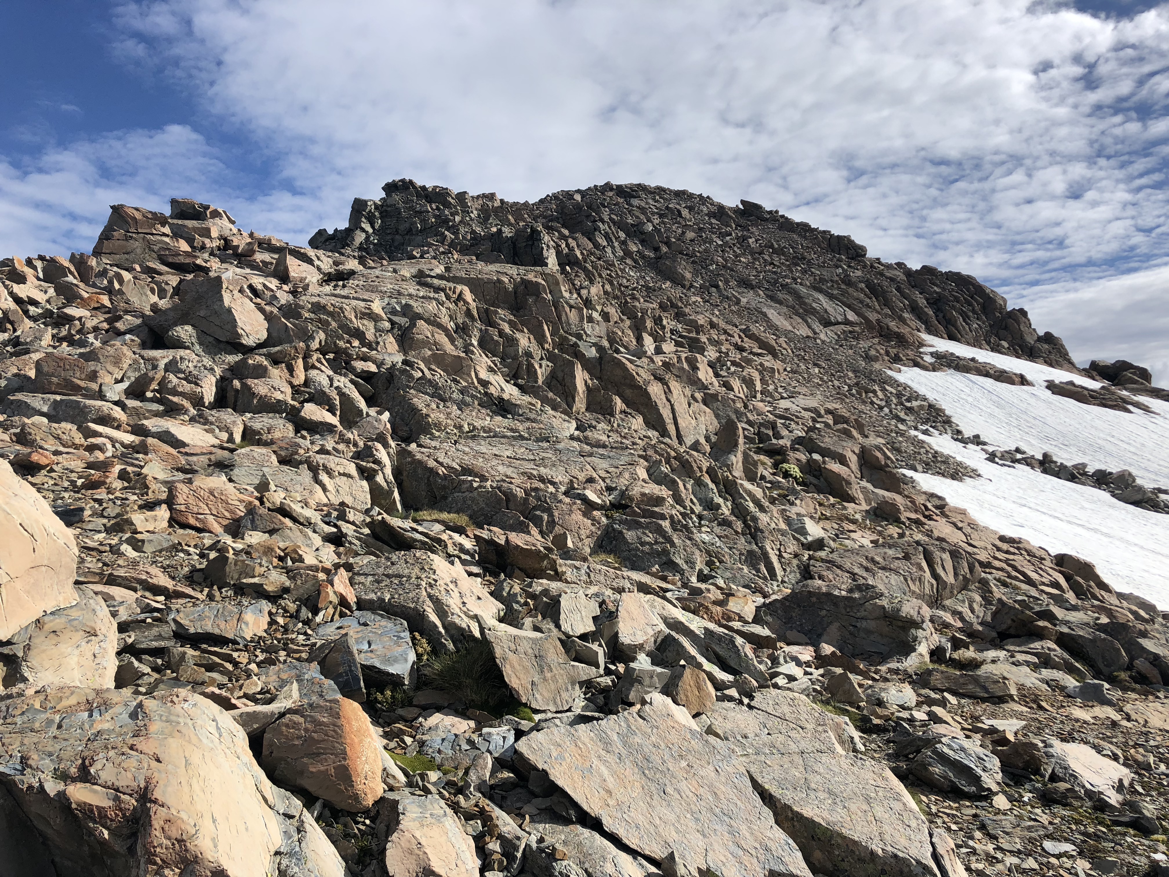
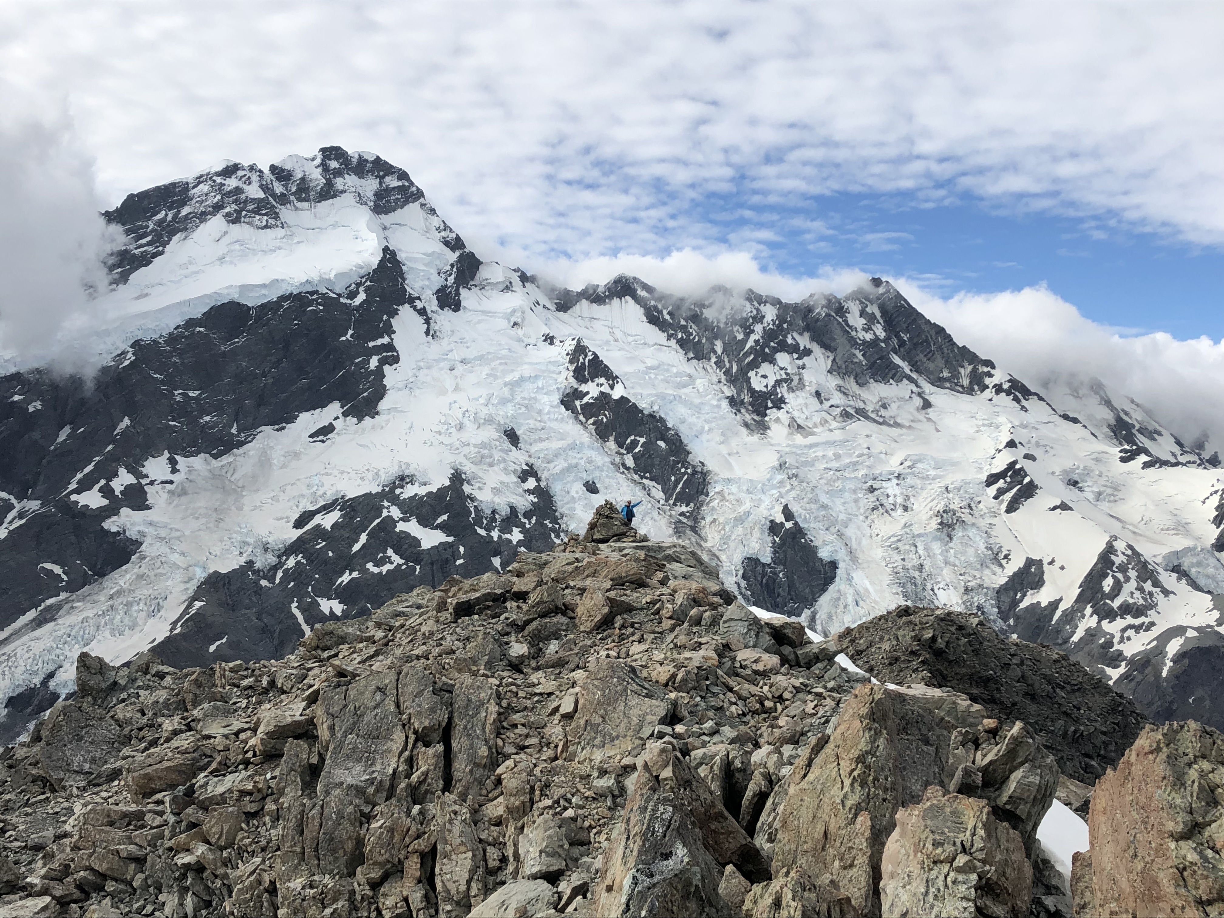
The Ridge line offered a few fun moderate scrambling moves but towards the false summit we hit a couple steep boulders that were out of our comfort level. A quick side-hill detour under this section and within a few minutes we had picked our way over to the commonly used foot path. This lead us directly up to the false summit. From the false summit it was pretty easy to tell that the real summit lay a bit further along the ridge.
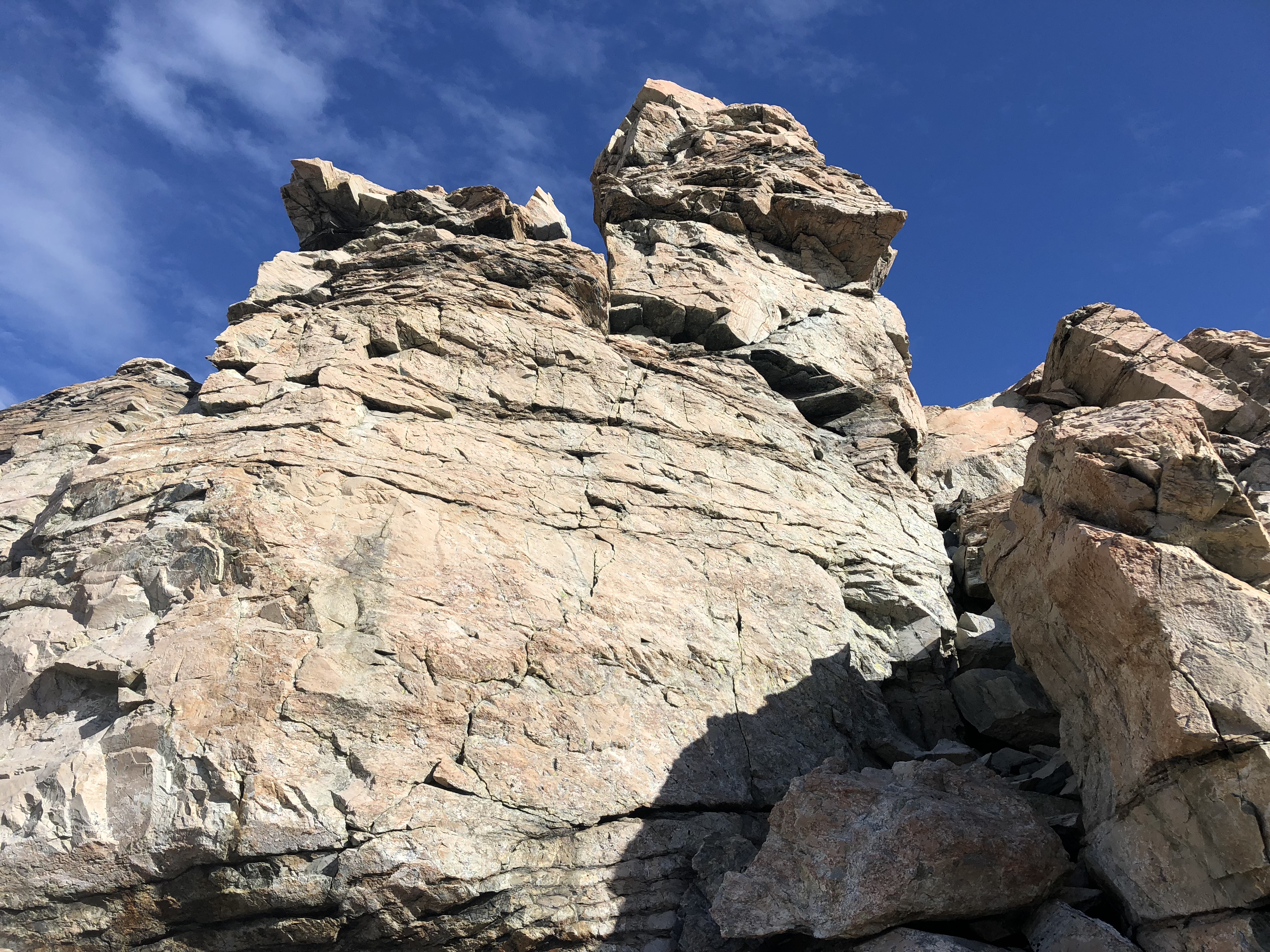
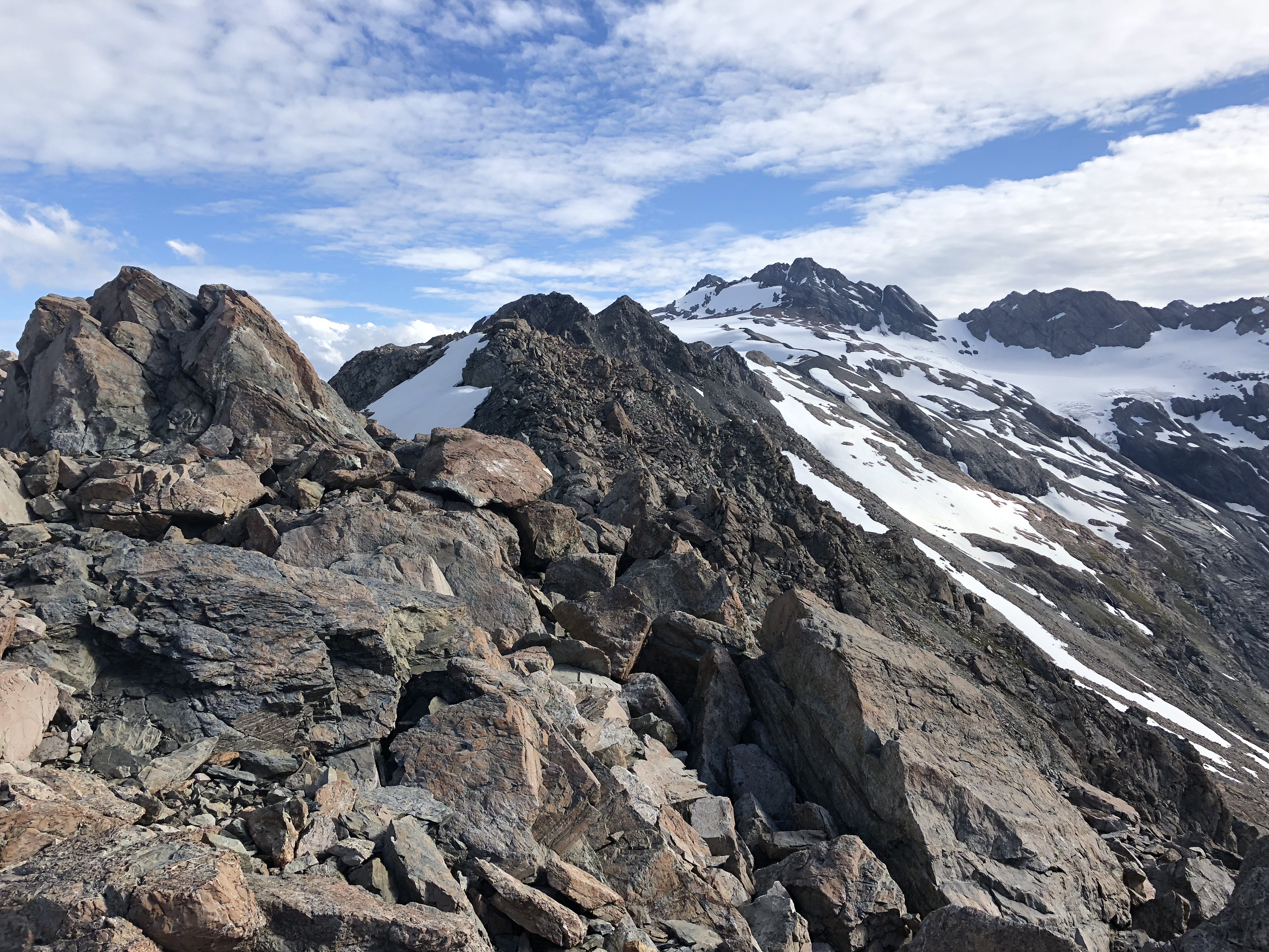
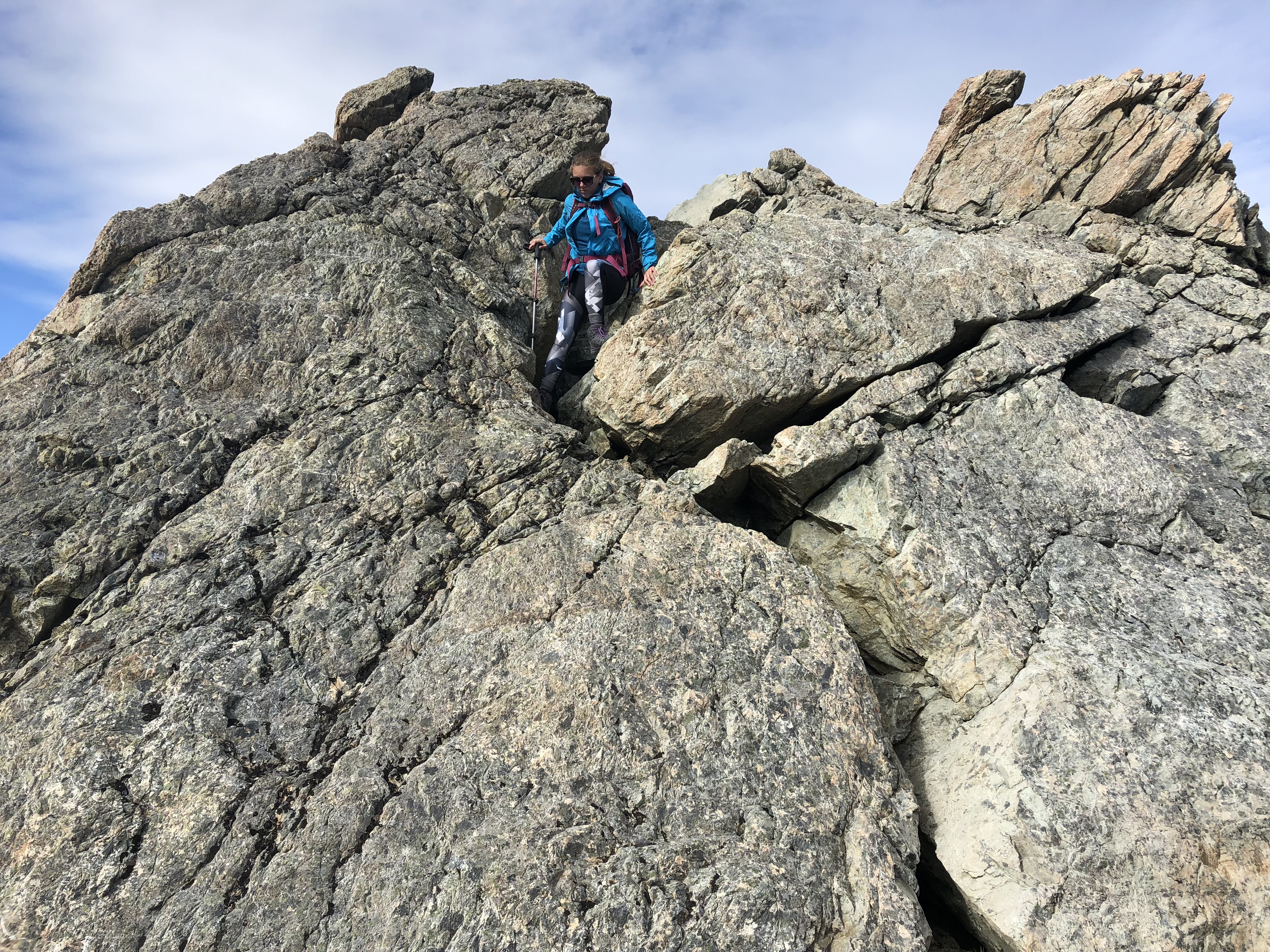
Its only an additional 10-12 minutes from the false summit to the proper summit for Mt Ollivier. It is a proper scramble across from here, with moderate exposure and loads of hands on moves. One particular spot involved a brief down-climb via a crack slab. While it made for a great photo op, the exposure was enough to warrant caution. You could consider this the “crux” of the ridge assuming you took the ridge across between the false and true summits. We discovered on the way back down that this is completely avoidable if instead one side-cliffs along the west side some 6m below the crest.
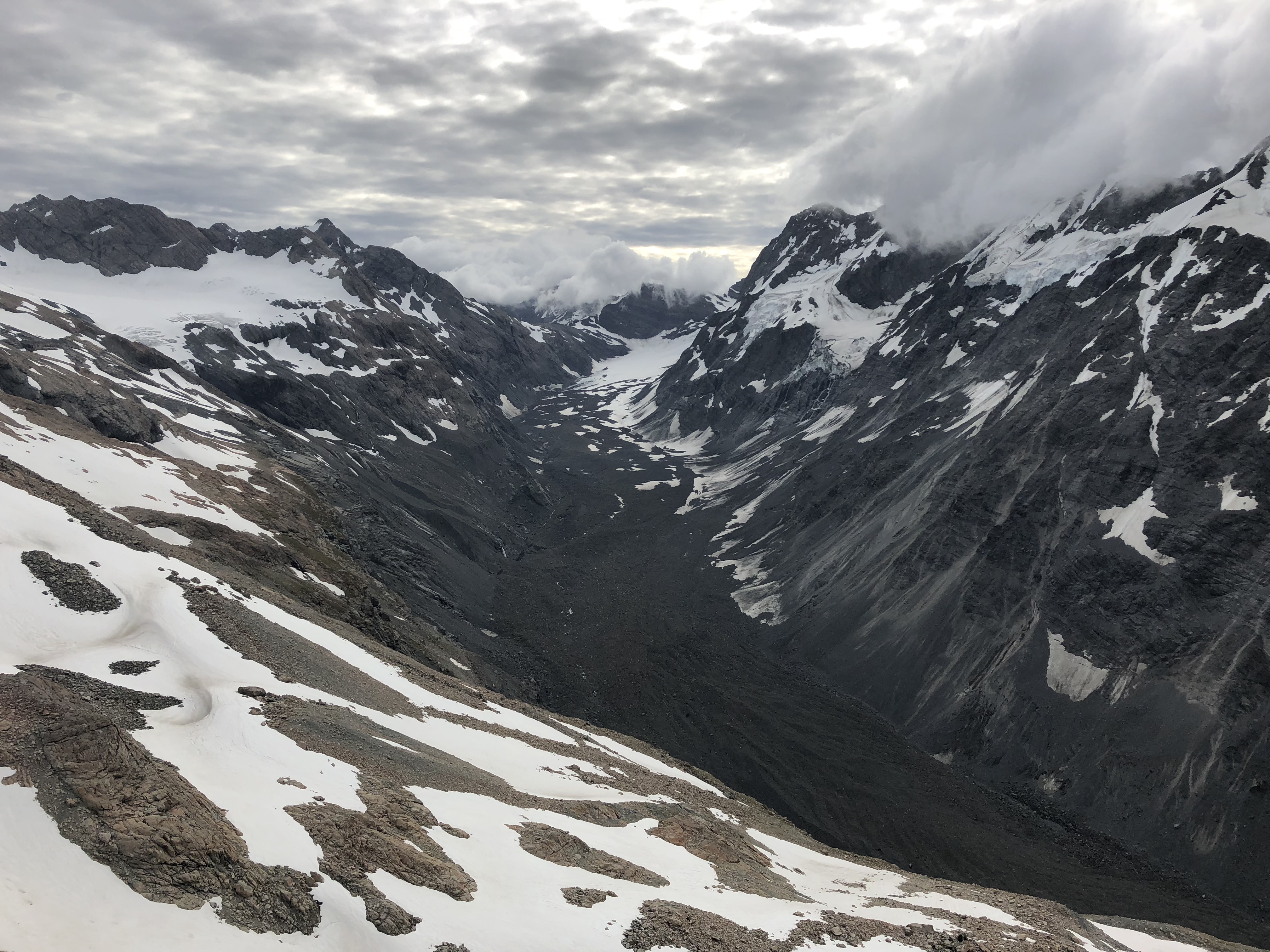
The summit was marked with a large cairn, however the ridge line seems to continue further along towards Mt Kitchener. I could see another cairn further along and found a few more moderate scramble moves along the way, but when I turned around to see Bri she appeared to be standing on the higher spot. Oh well, we were both pretty tired at this point. A few photos later and we were ready to start our way down back to the hut for some more photos.
We avoided the slab from earlier and worked our way down a brief scree slope before side-hilling our way under the false summit. From there we easily traced the foot path from earlier and used this to find our way back to the hut. One word of caution: some of the rocky plates we hiked across behind the hut were lined with deep crevasse-like sections. After a brief photo shoot around the hut we were down to the base of the Sealy Tarn stairs in just under 2 hours.