June 5th, 2025. Fernie, British Columbia.
Round Trip: 8 Hours. Elevation Gain 1500m
Easy Scramble; Mostly Hiking
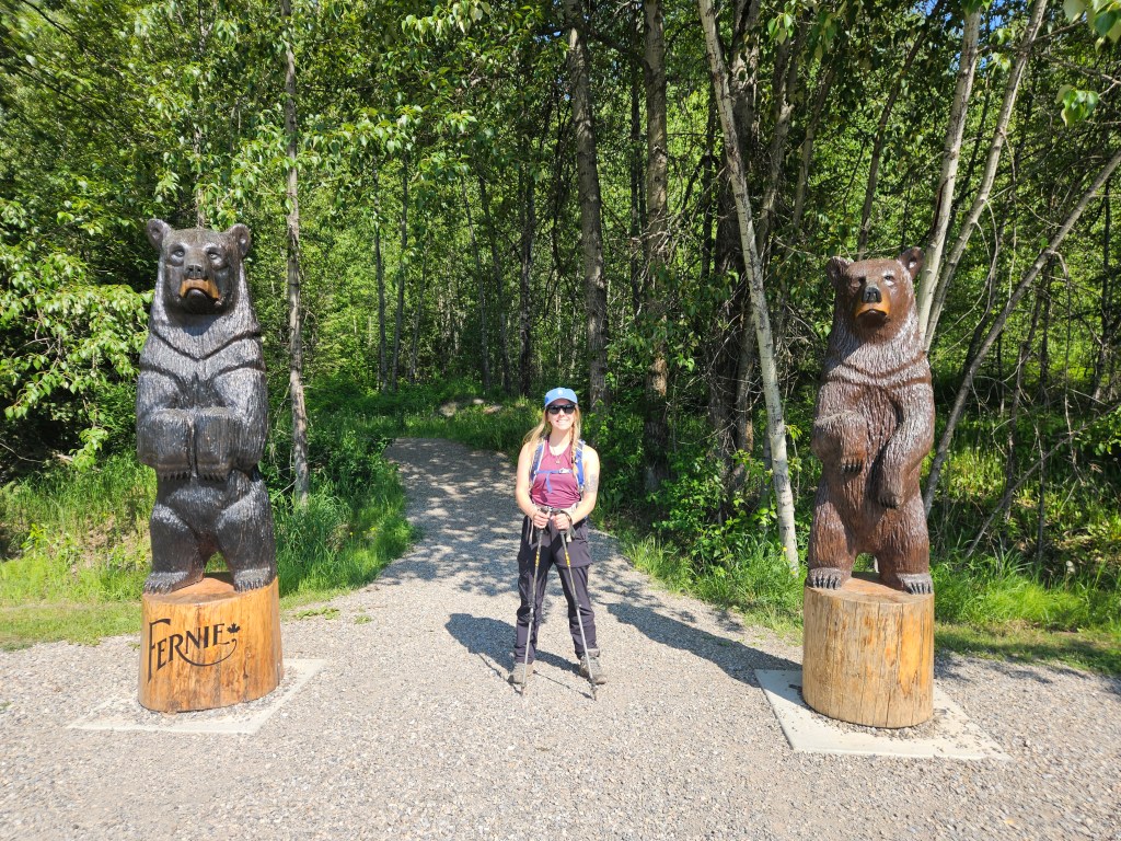
This was a very special outing indeed, as this was the first peak that Bri and I did as newly weds! A popular objective with easy access from the Fernie info centre car park, this 20km loop via Fairy Creek Falls trail made for an excellent full day in early season conditions. Given the ample daylight in early June, and that it was our “mini” honeymoon, we treated ourselves to a very late start time of 10:40am.
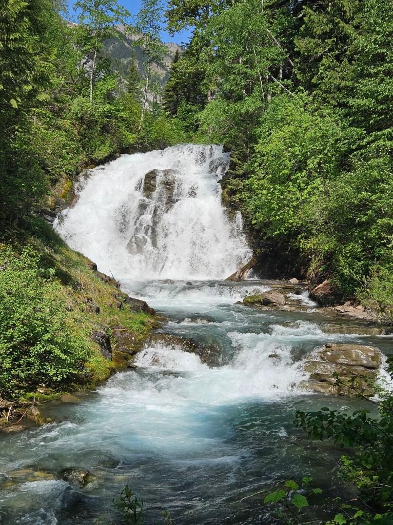
It was very hot and muggy at the start of our hike, even in the shade. Near Fairy Creek Falls, we spotted a rare northern rubber tree boa basking in the warm spring sunlight. It took a moment to recognize it was a snake, and a while longer to figure out what species! Bri may have captured a blurry photo of it… Needless to say it didn’t appreciate us waking it up and took off into the bushes within moments of us spotting it. After the snake sighting we encountered a few other hikers on their trek out, and further past the waterfalls more or less had the trail to ourselves.
The first hour had been relatively flat with modest but gradual elevation gain after the waterfalls. Around 11:45am the grade steepened drastically and the views opened up above us. It was still quite lush and green at this point in the day but as we the trail ascended a slide path we caught our first glimpse of the lingering snow pack above. It wasn’t long before we found ourselves boot-packing a few snow covered sections. At this point the snow wasn’t very deep and thanks to the late spring warmth was grippy enough. We continued onwards and upwards.
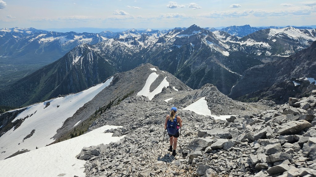
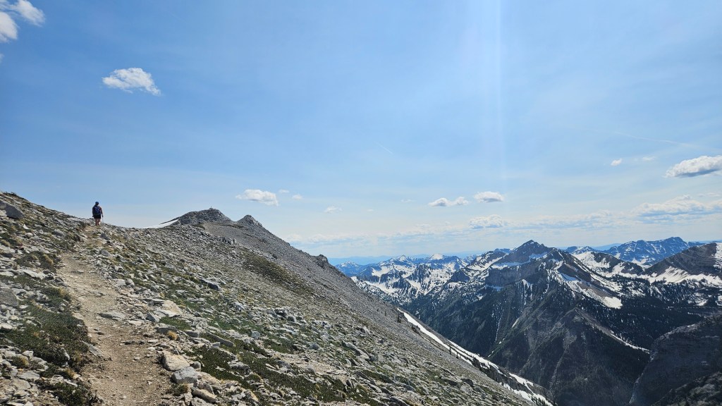
The trail was only partially snow covered heading up the avalanche path and at times still snow free, encouraging us to keep going. As the alpine bowl opened up above, the trail side-hill traversed a ledge and then followed up a gentle rock rib. It was through here that we hit our first deep pocket of snow and where the route finding began.
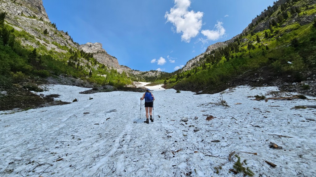

Its worth mentioning here that the trail was well sign posted throughout and seemed somewhat maintained up until the snowline, which we encountered 2 hours into our hike. Even with snow coverage in the alpine, most of the sign posts were easily spotted. However, we did find ourselves post-holing in a few thigh deep sections of snow. Lucky for us the alpine was almost as warm as valley bottom where it had been 30C at the start of our day, making the post-holing tolerable.
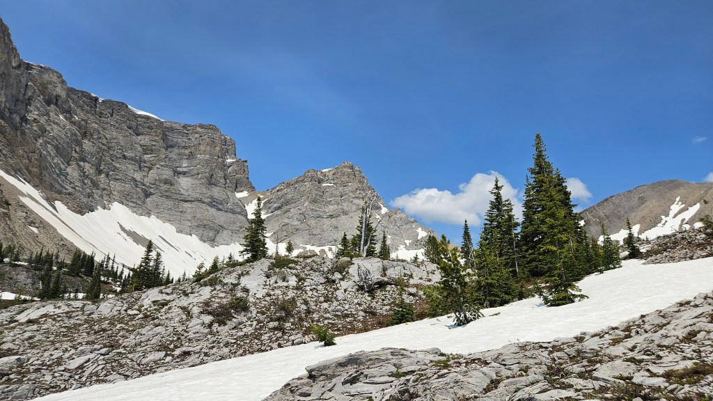
Towards the Procter Tarn we encountered snow drifts several meters high with some of the trail blazers fully buried. We briefly lost the trail and nearly went for one of the three sisters by mistake. Our error had been in following a slope to the ridgeline behind the tarn to the climber’s right, loosely going off our last spotted trail blazer. The way we were headed was steep and in snow-free conditions would be a fun scramble, but with the deep snow coverage was getting a bit hectic! We decided that we had gone the wrong way and could see the correct (and much easier) ridge much further to our right (east). We retraced our steps to the last blazer and decided to stay within the bowl until directly under the correct ridge.
Bri had the route downloaded on Strava and I had a physical map from the info centre, between the two of us we carefully reassessed our position before route finding our way across the snow drifts towards the correct ridgeline. This added an extra 20 minutes or so to our day, but with how scenic it was we weren’t too fussed about the brief detour. Around 2:45pm we had post-holed to the correct ridgeline and started finding trail markers again. From here the remainder of the trek was relatively straight forward and mostly snow-free.
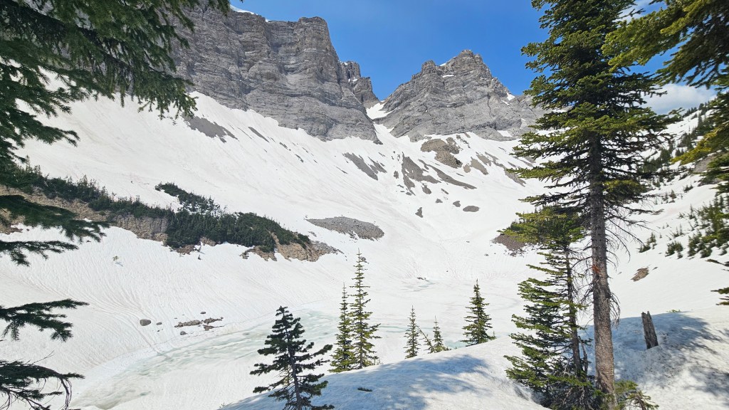

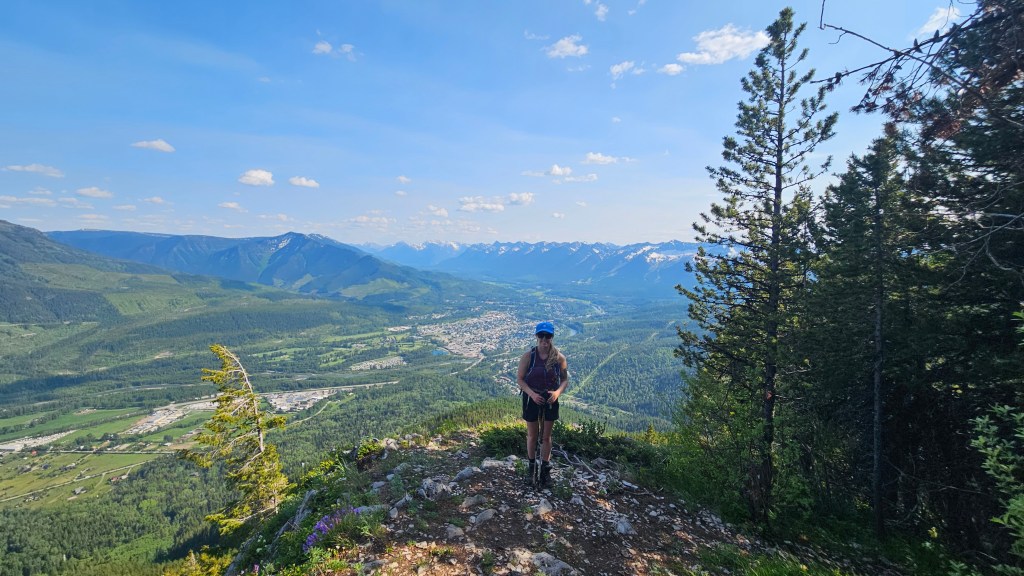
Needless to say, we were very much over the post-holing at this point and quite relieved that the summit ridge was mostly snow free. We ruled out returning via Fairy Creek Falls and had read online that the remainder of the loop was reportedly snow free. This proved to be correct and the hour long stroll to Mt Procter’s summit was a leisurely affair in comparison to earlier.
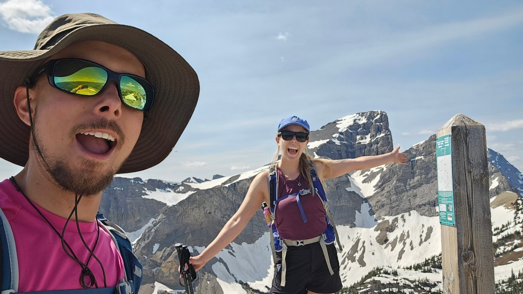
We reached the summit at 3:45pm and had the view to ourselves, though noticed a lot of flying critters darting around the register. Upon closer inspection, there were THOUSANDS of lady bug beetles crawling amongst the summit block talus. I don’t usually “get the ick” with bugs but this was a bit unnerving so we doubled back to a bench underneath the summit block to enjoy the views.

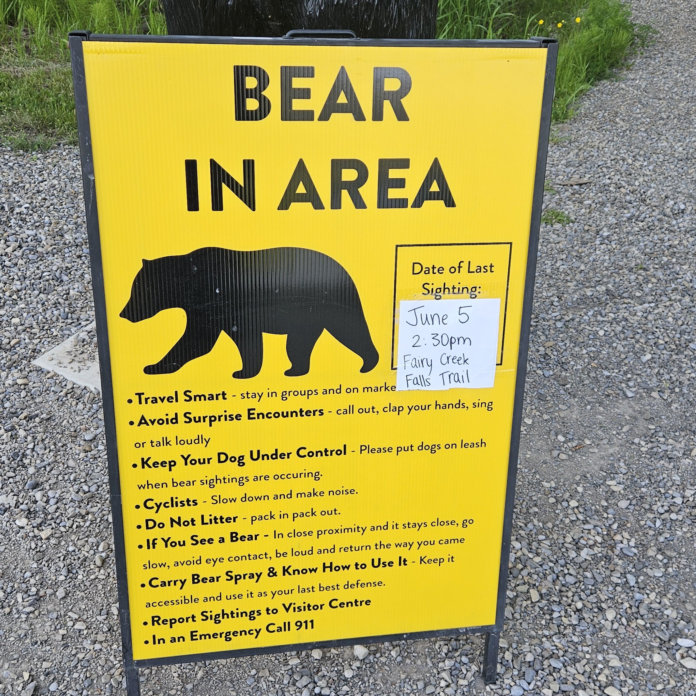
From the summit, we still had half the loop’s distance to hike out. It was a faster paced effort travelling downhill the entire way in snow-free conditions. A little over three hours saw us back in the info centre parking lot, the final 20 minute push took us through a spiderweb of different cycling and walking trails. We managed to stay on trail through this section but acknowledged that it would have been easy to get side tracked. To our surprise upon returning to the parking lot, there was a new bear-in-area caution sign for the Fairy Creek Falls trail we had used for our approach earlier in the day. Good thing we didn’t double back and completed the loop!