June 19th – 20th, 2019. Tongariro National Park, New Zealand.
Round Trip: 8.5 hours (split into two days), Elevation Gain: 1000m approx
Mountaineering F+ (guided)
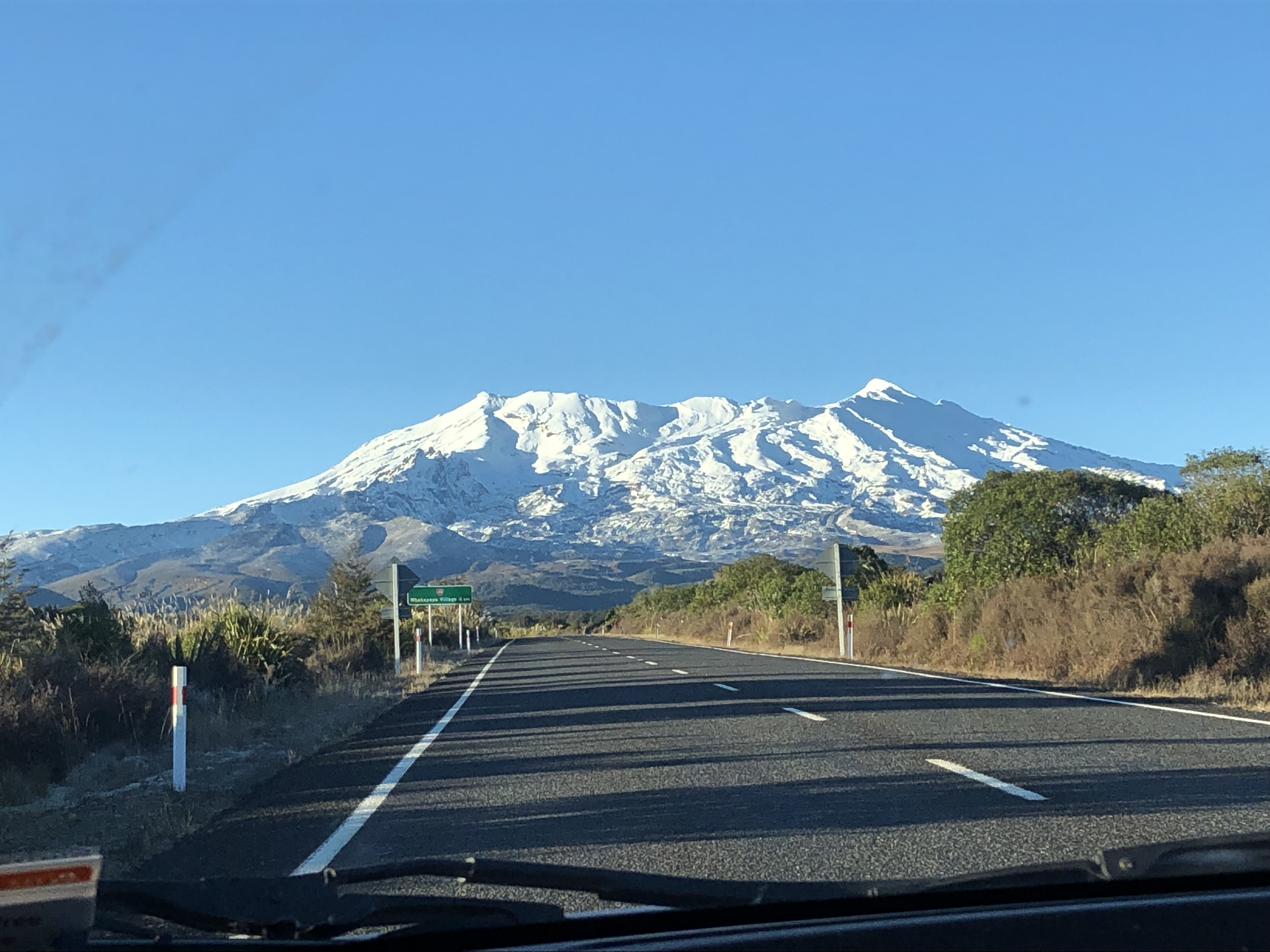
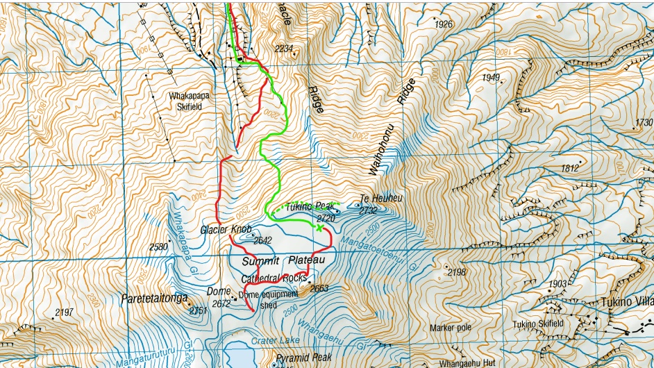
Mount Ruapehu stands as the mighty high point for New Zealand’s North Island, its highest point Tahurangi being 2797m above sea level. Our trip took us up the northern slopes west of pinnacle ridge following underneath the ski lift towers and an overnight on the summit plateau. On day 2 we took a gentler route down starting behind the Glacier Knob and sidling back across to the ridge used on ascent from day 1. On technical terms given the icy conditions this trip fell into the category of easy mountaineering with a few brief sections approaching 40 degree angles.
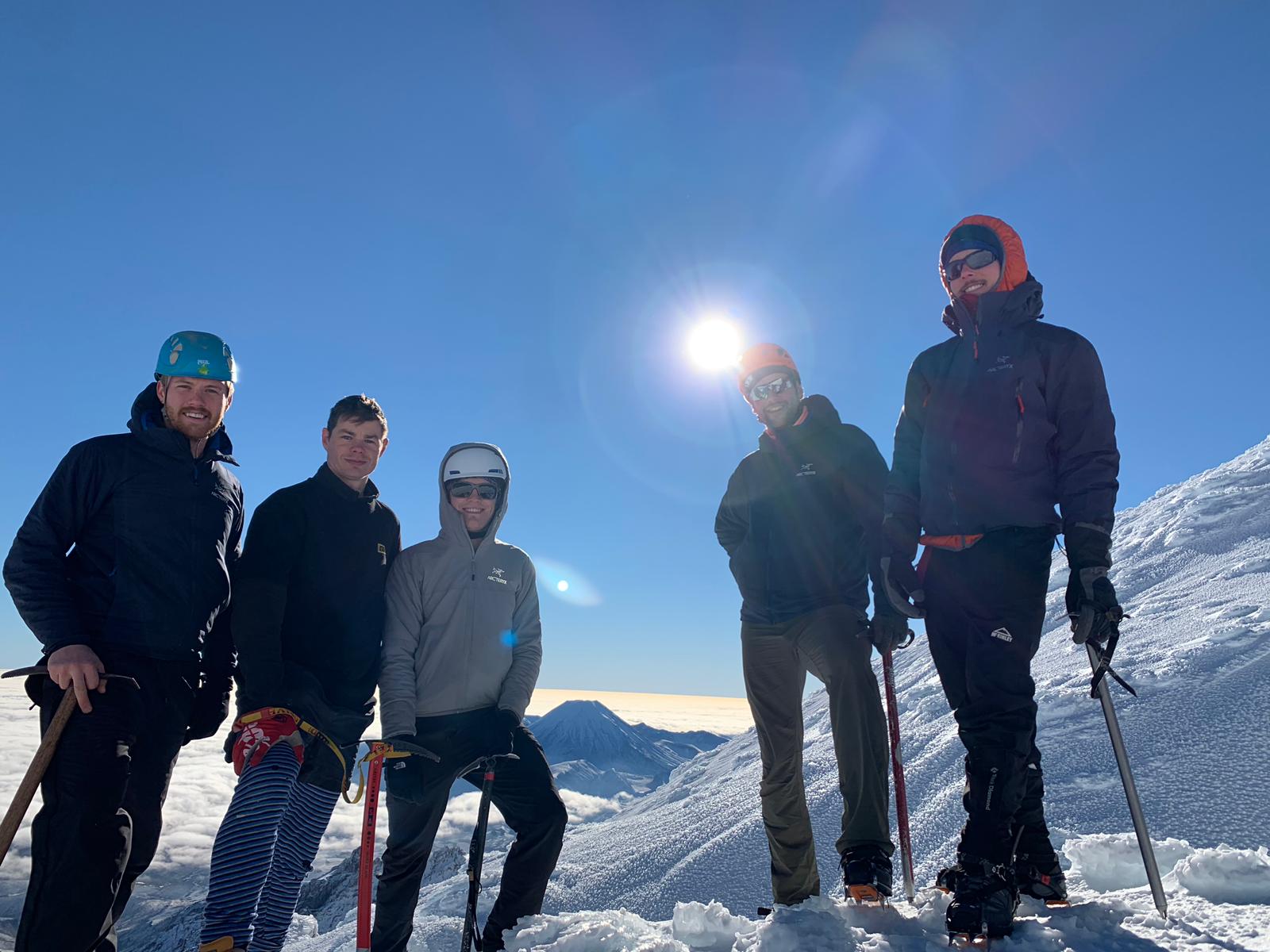
This was my first guided trip here in New Zealand, and first technical ascent in New Zealand as well. In total our party consisted of five – four of us workmates from Bivouac and a friend of the guide. Our workmate Sam had previously ascended Ruapehu on numerous occasions and was both our group organizer and guide up the mountain. We set out to camp underneath Tukino Peak up on the plateau for both sunset and sunrise the next morning. The weather window was near perfect and both solar events did not disappoint!
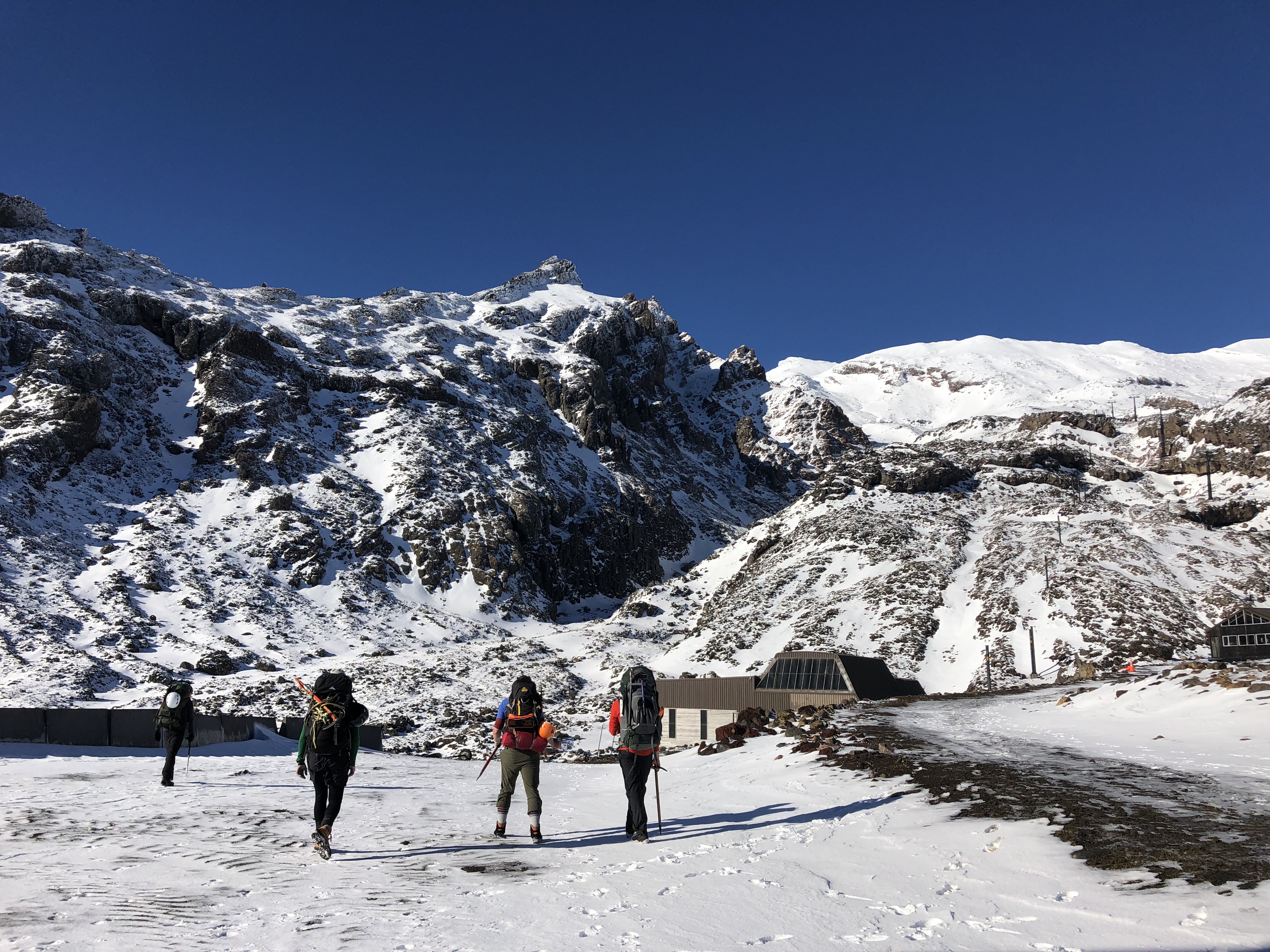
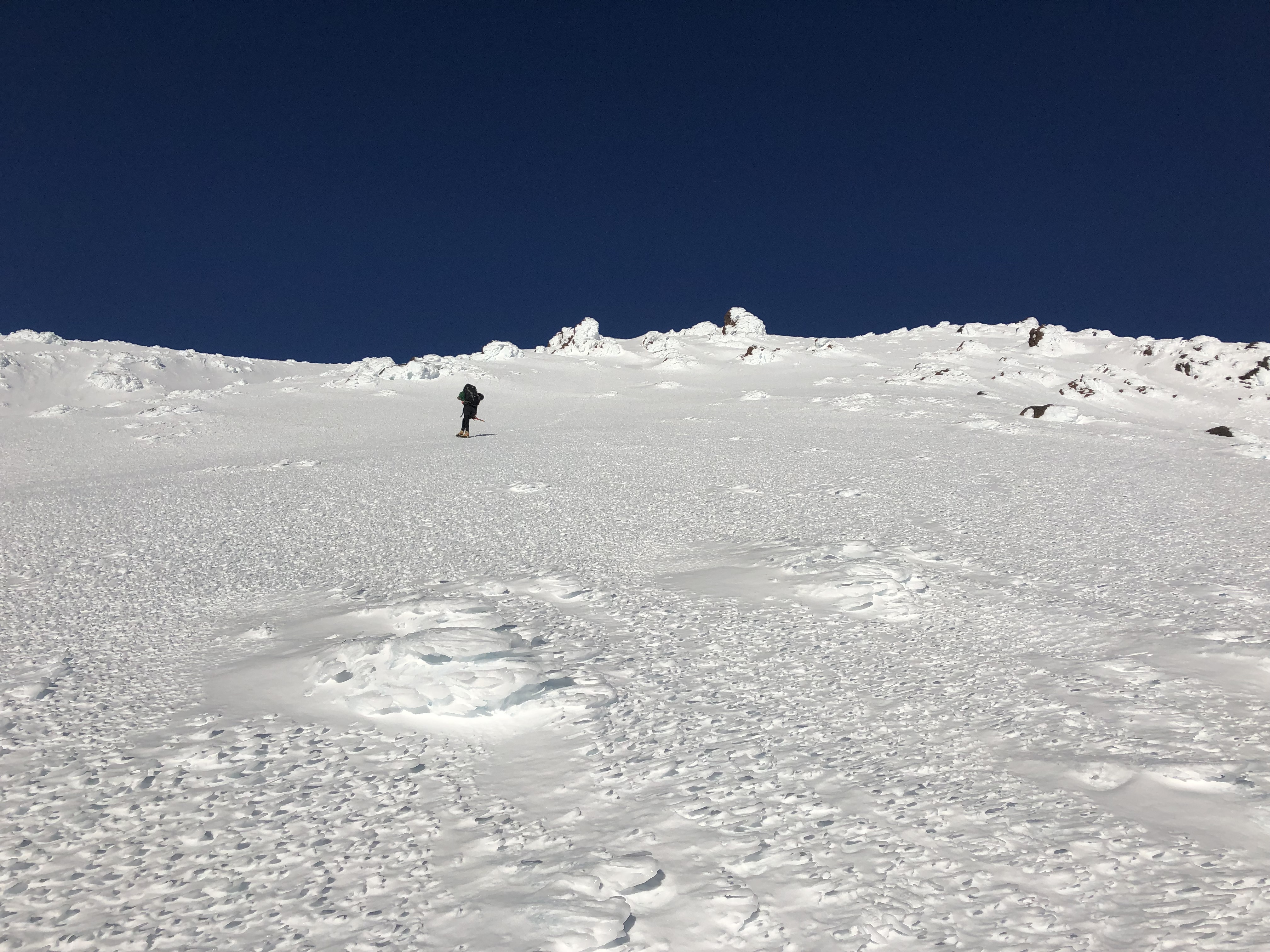
The initial approach was relatively straight forward. We followed the chair lifts (not yet in service!) and got the blood pumping. Already at lower altitudes the snow crust was becoming increasingly slick, though we waited till we were above the construction areas before lacing up the crampons. Perfect blue bird conditions meant for full visibility and allowed us to shed a few layers early on.
Very early on in the ascent, we started encountering ice. While slick the angles were not overly steep but sooner than later we found that the ice was becoming harder “bullet proof” ice as Sam put it. Crampons and Ice Axes were heavy relied upon for the remainder of the day. The effort was relatively straightforward up till the end of the chairlifts at 2245m, which we reached around three hours into the trip at 1:10pm.
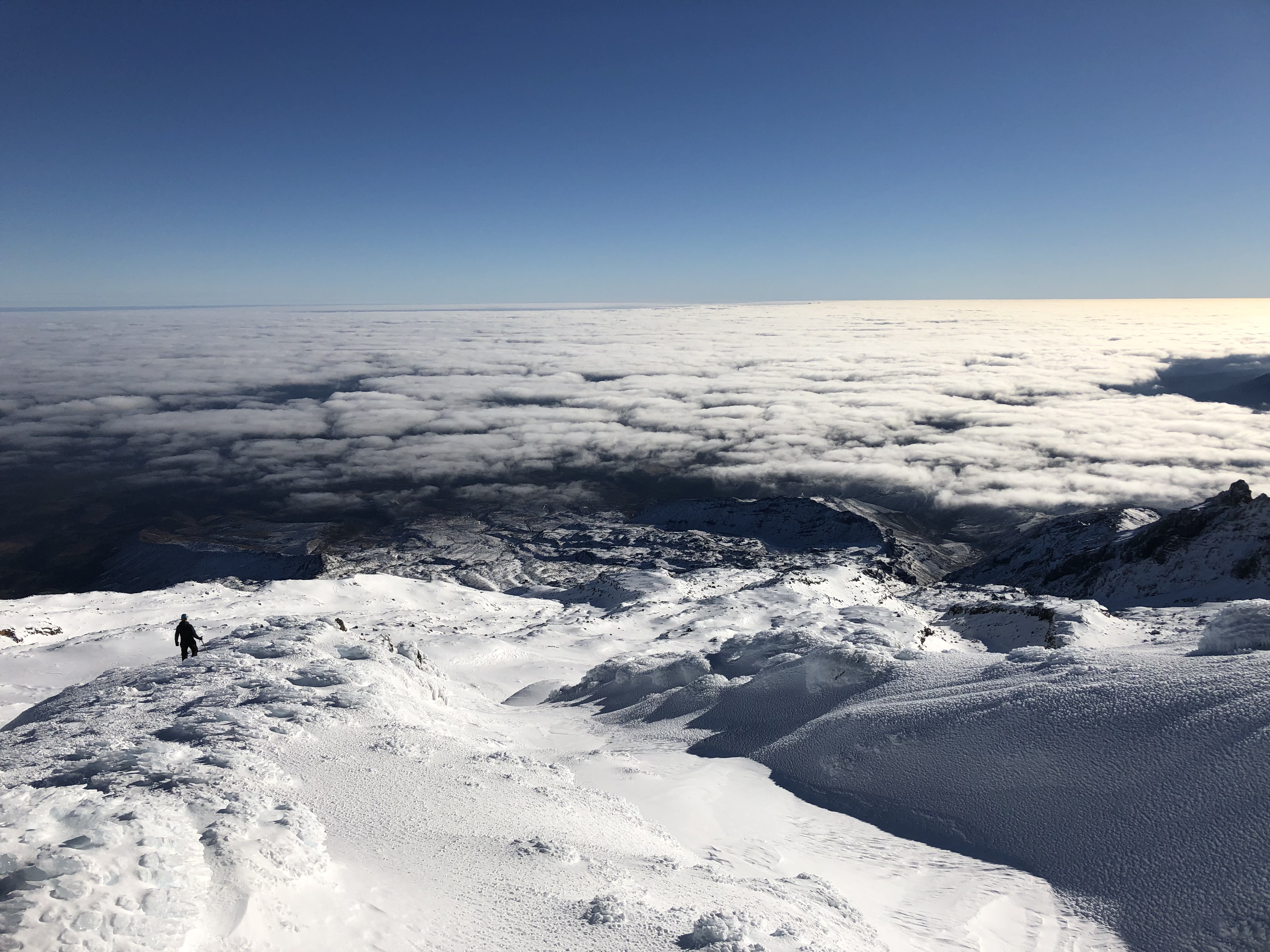
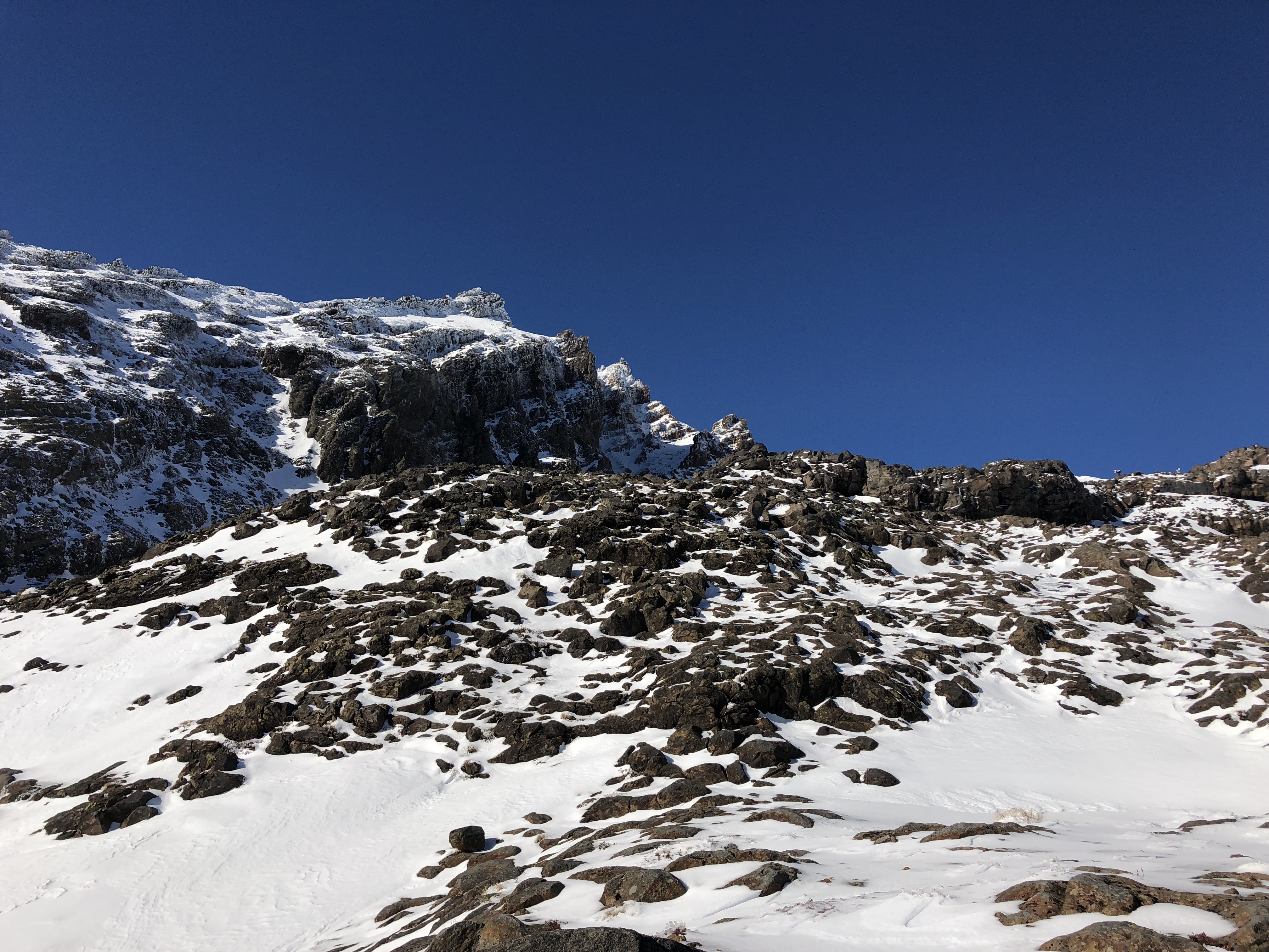
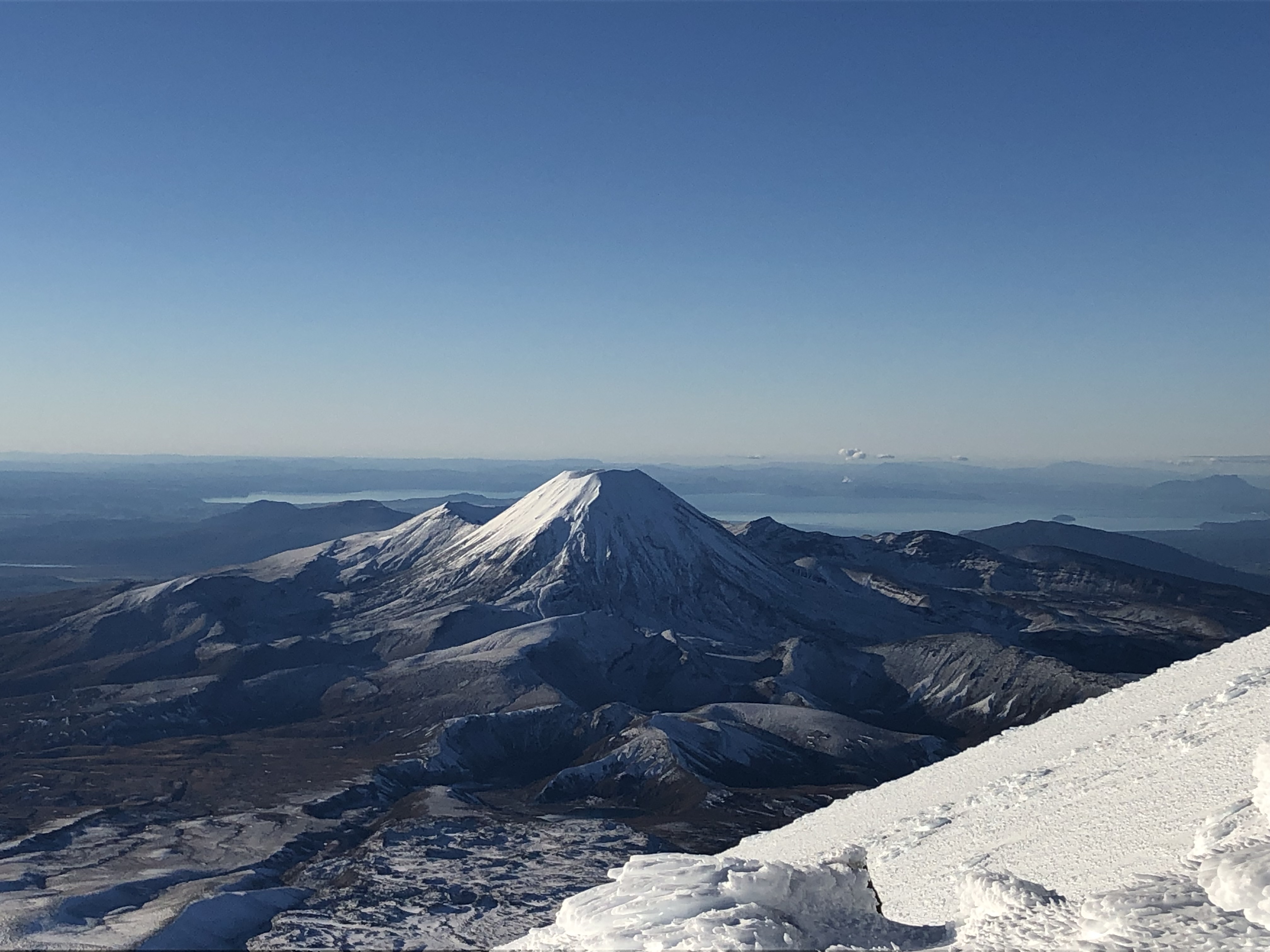
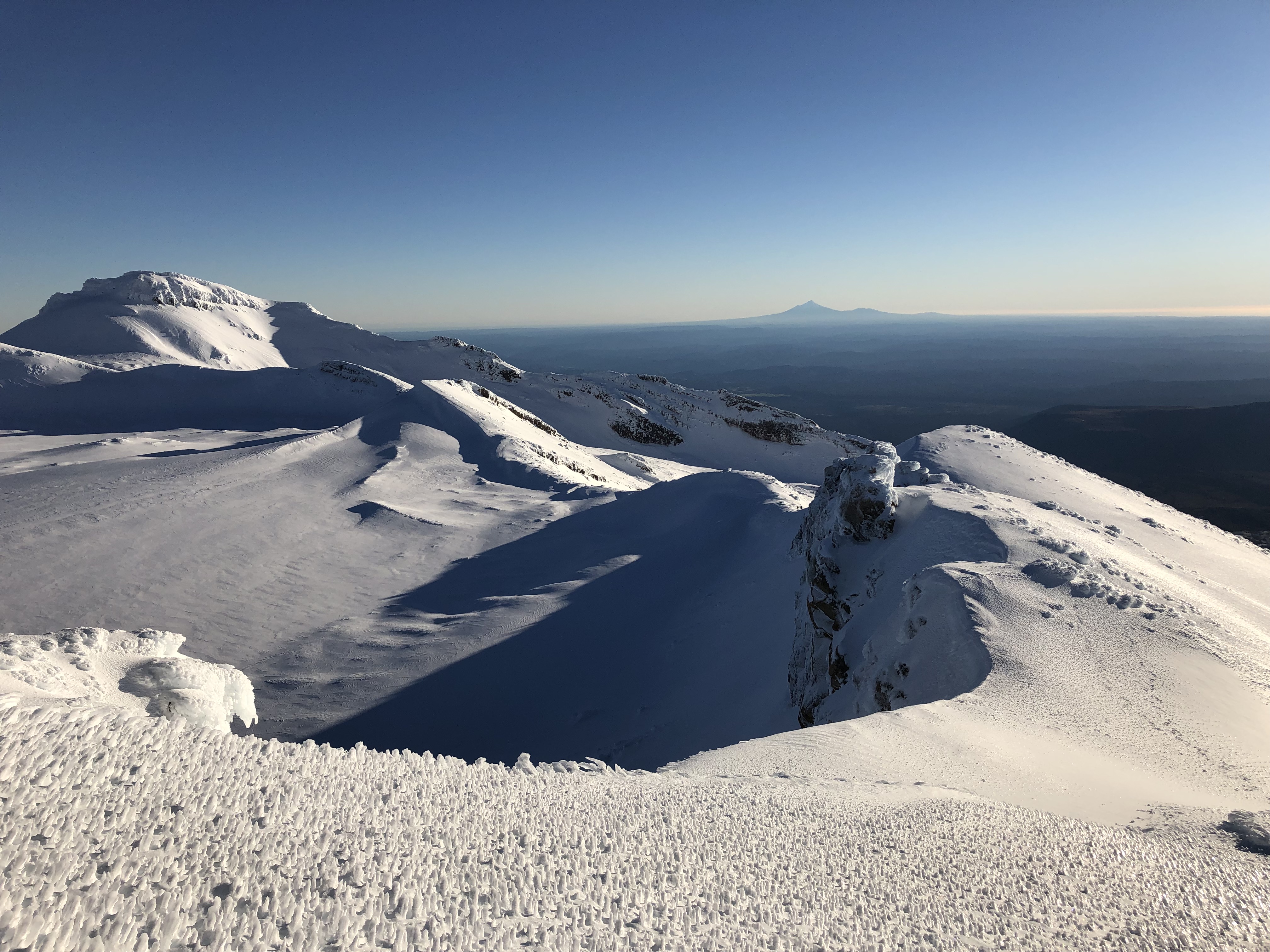
Already we had gained a bit more than half of the total elevation and were spoiled with our first glimpse over the Pinnacles at Ngauruhoe and Tongariro peaks. This also marked the end of the “easy” going bits as the steep angles became much more sustained between here and the summit crater ridge.
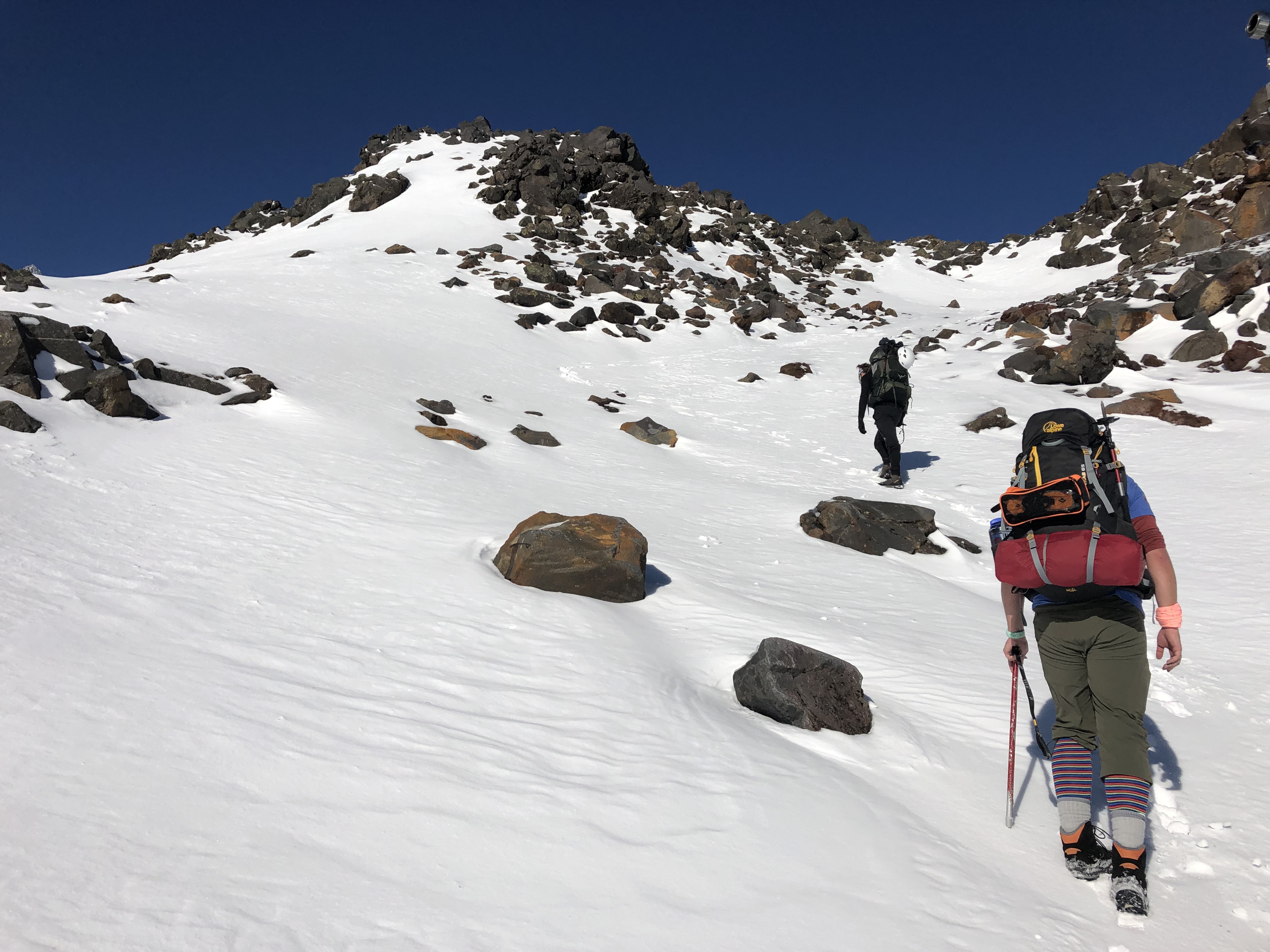
Above 2245m we briefly descended into a small valley before picking up the slopes again. We started zig-zagging our way up steeper ice approaching more sustained angles of 30 to 40 degrees, veering slightly west from our original line up. Admittedly I slacked off on the footwear department for this trip by wearing hiking boots instead of proper mountaineering boots – which made front pointing near impossible on the ice. Some extra time was taken to carve steps.
No one really opted for photo breaks during the final 250 metres or so up as this required full concentration. Damn how I regret leaving the Sabre Tooth crampons in Canada… our hired gear was well used and dulled down a fair bit but nonetheless got the whole team up in one piece – albeit with a few spicy moments along the way!
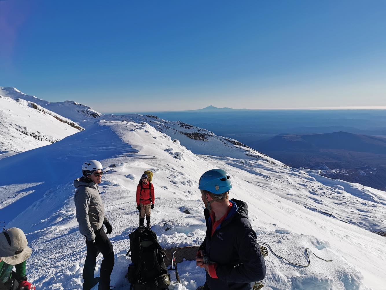
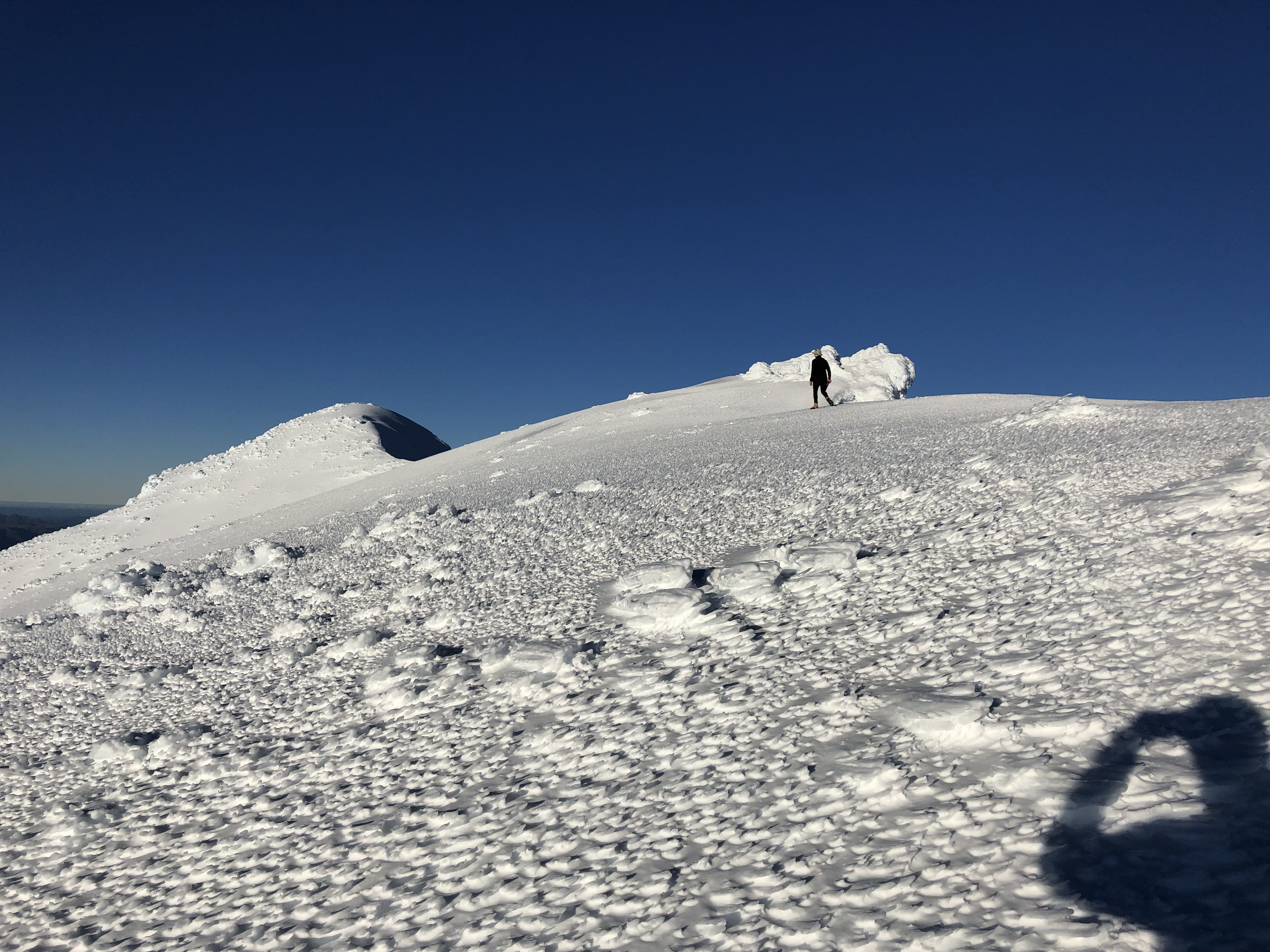
After a final push up, we reached the summit crater rim around 3:40pm clocking in at five and a half hours. The trip was however far from finished. Tukino Peak appeared to be nearby so Oli and I opted to explore the summit rim and see how far we could get in the remaining daylight. Meanwhile Sam, James and Gordon resisted the peak bagging urge and instead descended onto the summit plateau. From there they traversed underneath the shadow of Tukino Peak to start setting up camp.
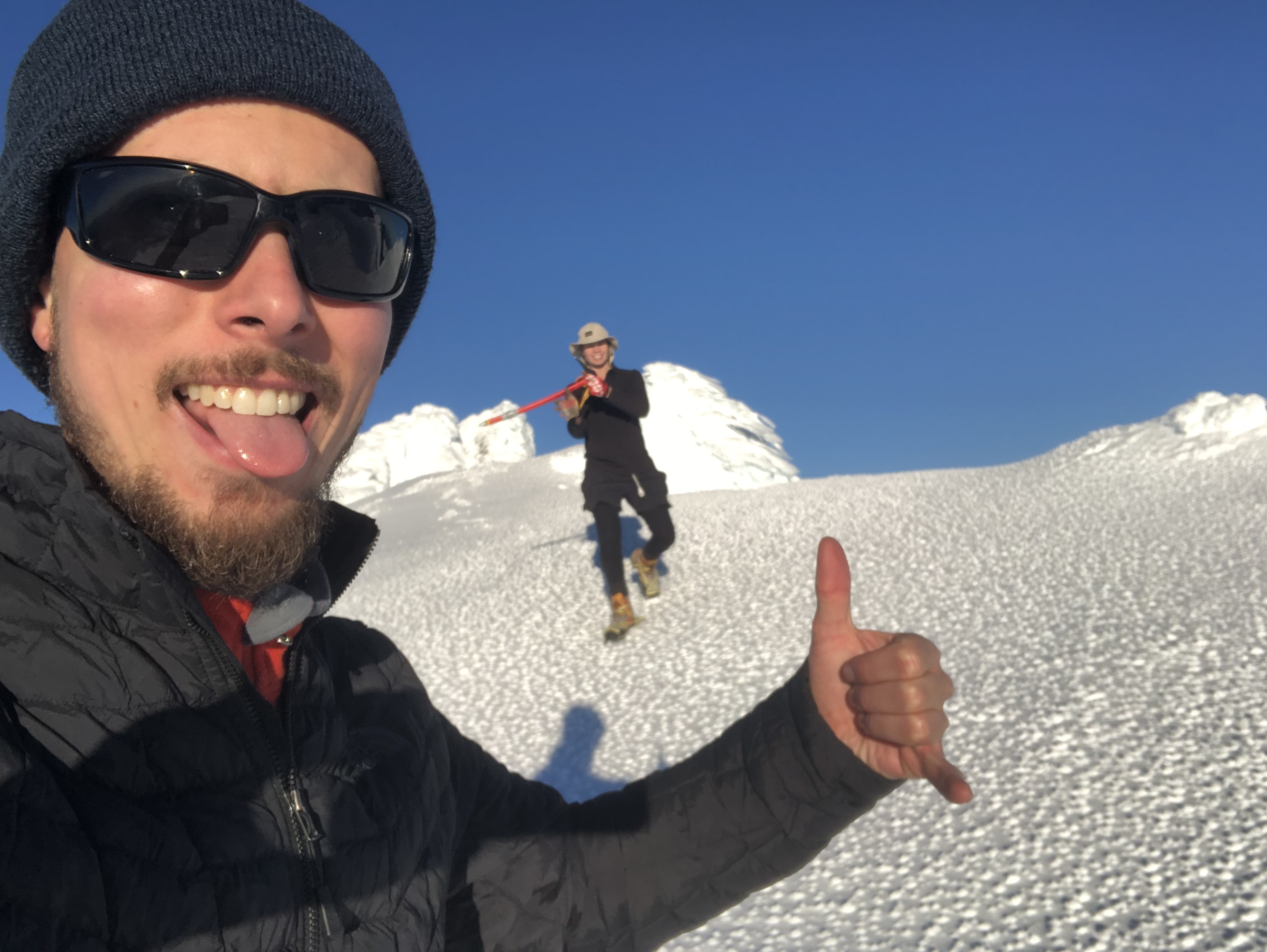
Oli and I spent the next half hour cautiously exploring the rim up towards Tukino Peak which sits at a height of 2720m. We ended up stopping a few metres shy of the peak’s highest point partly due* to sketchy ice cornices and also due to the limited amount of remaining daylight. The ridge walk up Tukino was much easier than the slopes leading up to the summit rim, however the exposure was a bit more moderate as a fall from that ridge would have likely ended in a free fall down onto the summit plateau below. We snapped a few pictures along the way, including an “almost summit selfie” then called it a day and raced back down to where the team had split up earlier.
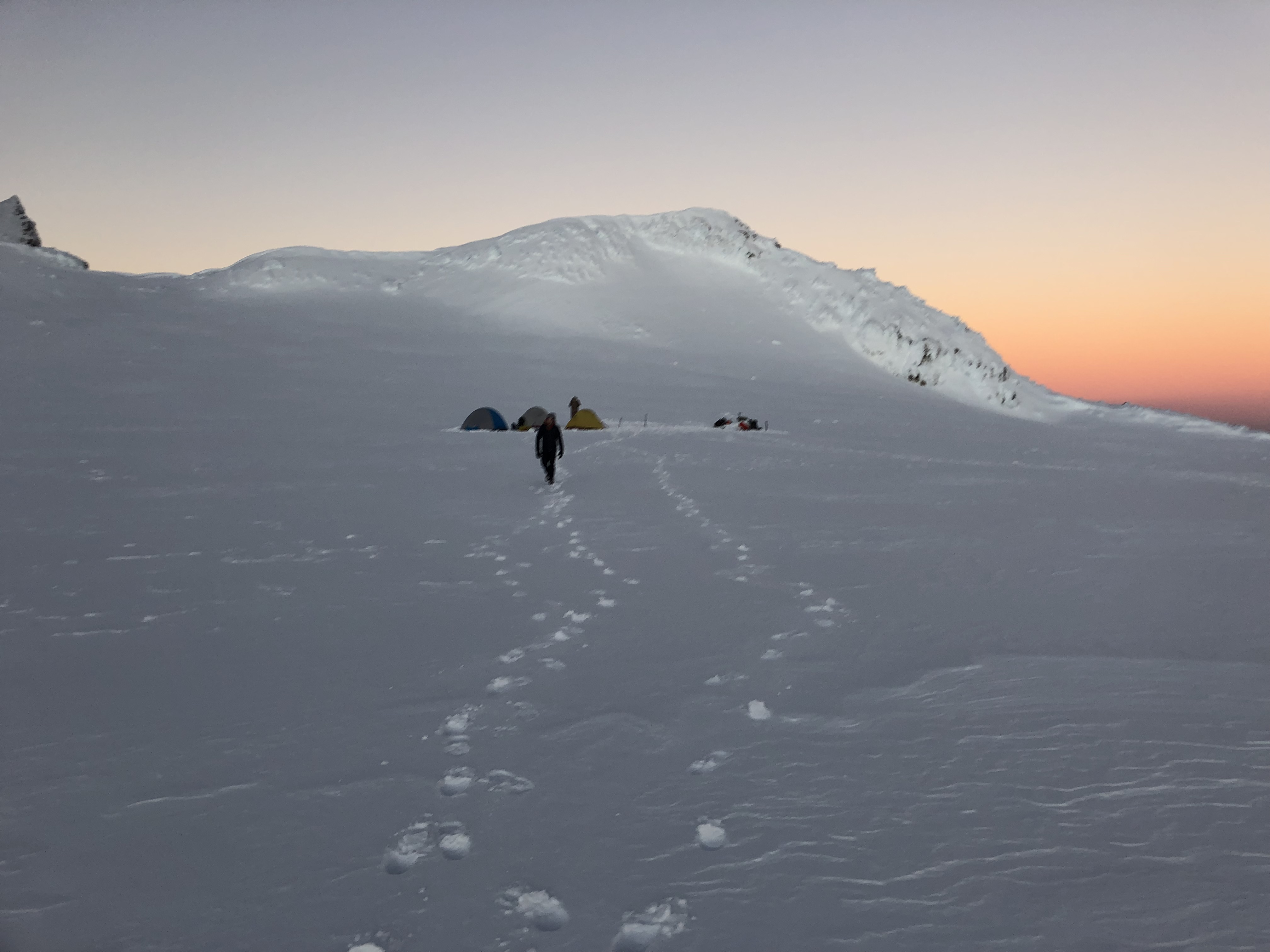
We had to hustle back down in order to achieve our team’s goal of setting up camp and watching the sunset. Luckily the saddle we used for accessing the plateau was a very gentle angle and we were back to the campground just in time! In the shade the temperatures were dropping fast and all the layers shed early in the ascent were quickly added back on by everyone.
Between the five of us, there were three tents and three stoves. All of us (except Oli) had been relying on 1L Nalgene water bottles and had drained most of our water during the day. While we had been adding snow to aid in melting water, this was turning into slush in our packs. We cycled between setting up each others’ tents and melting snow into drinking water as the sun started setting. Having set up the tents, we opted to watch sunset first and continue with cooking afterwards. Well worth the decision!
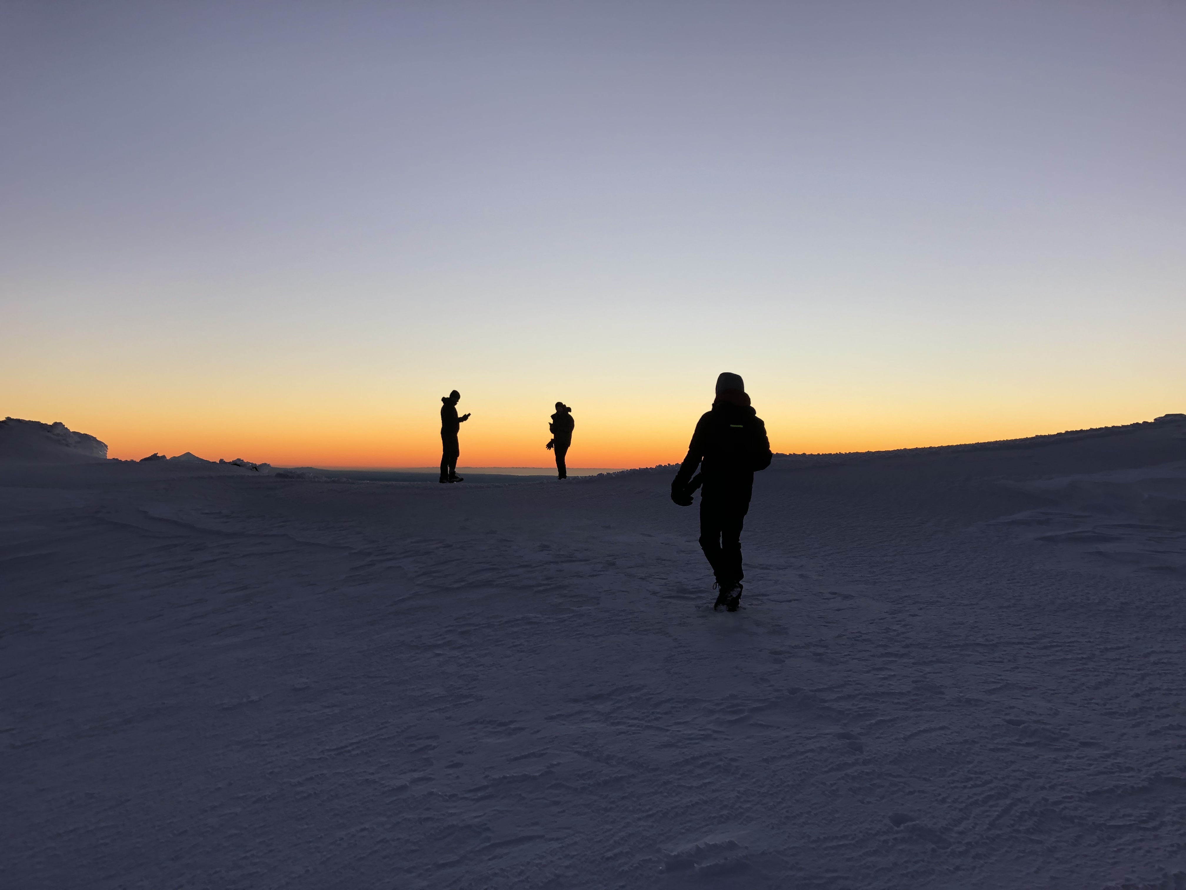
We watched the sunset for a good long while before the numbing cold caught up with us. The temperature was dropping fast and by the time we reached our camp it was likely near -10C. Cold enough that we took turns keeping the gas canisters warm while boiling water. This ended up being an evening long task as there were 5 dehydrated meals to revive and 5L of water/snow to boil down. The boiled water was stored in the Nalgene bottles to keep us warm at night and also to have drinking water ready (and not frozen) for the next day. With all the water stuff sorted, we started dropping like flies with fatigue and were all in bed by 8:30pm.
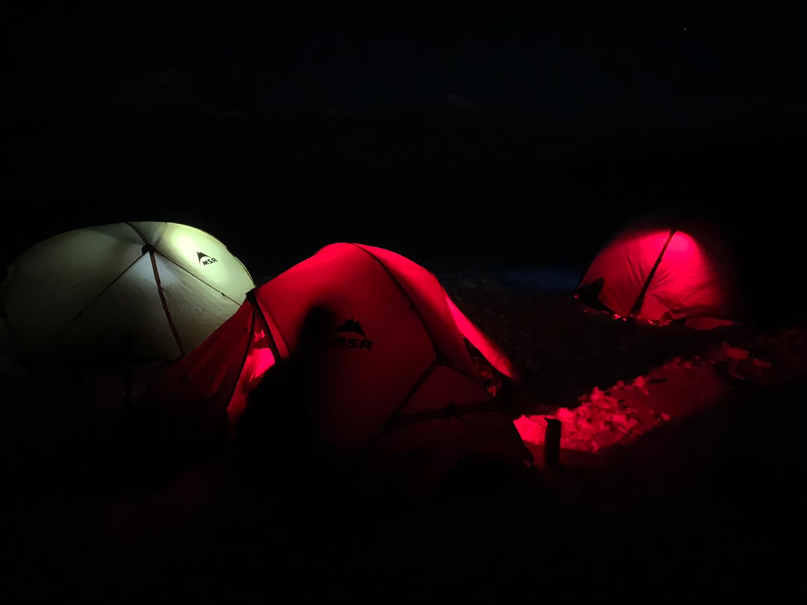
The night was far from restful. While we had scored a gentle warm blue bird day, the night was less forgiving. A brisk steady wind whipped across the plateau around 10:30pm and lingered for several hours. It wasn’t necessarily gale force, but was strong enough to keep us all awake and alert. A frosty spin-drift managed to break into our tent under the fly – I woke up covered in an icy dusting more than once. In our fatigued state it seemed a bit worse than it (likely) was. Once the winds subsided around 2:30am it was somewhat easier to sleep. My Marmot Sawtooth bag is still going strong in its forth year of use and abuse!
We collectively gave up on sleeping around 6am and resumed our snow melting into water mission. It was a frosty start to the day. Stars were still out as we thawed out some breakfast. Opposite of sunset we ventured east of our campsite to watch the sunrise. It was as spectacular as the sunset before it and made every freezing moment worth the while!
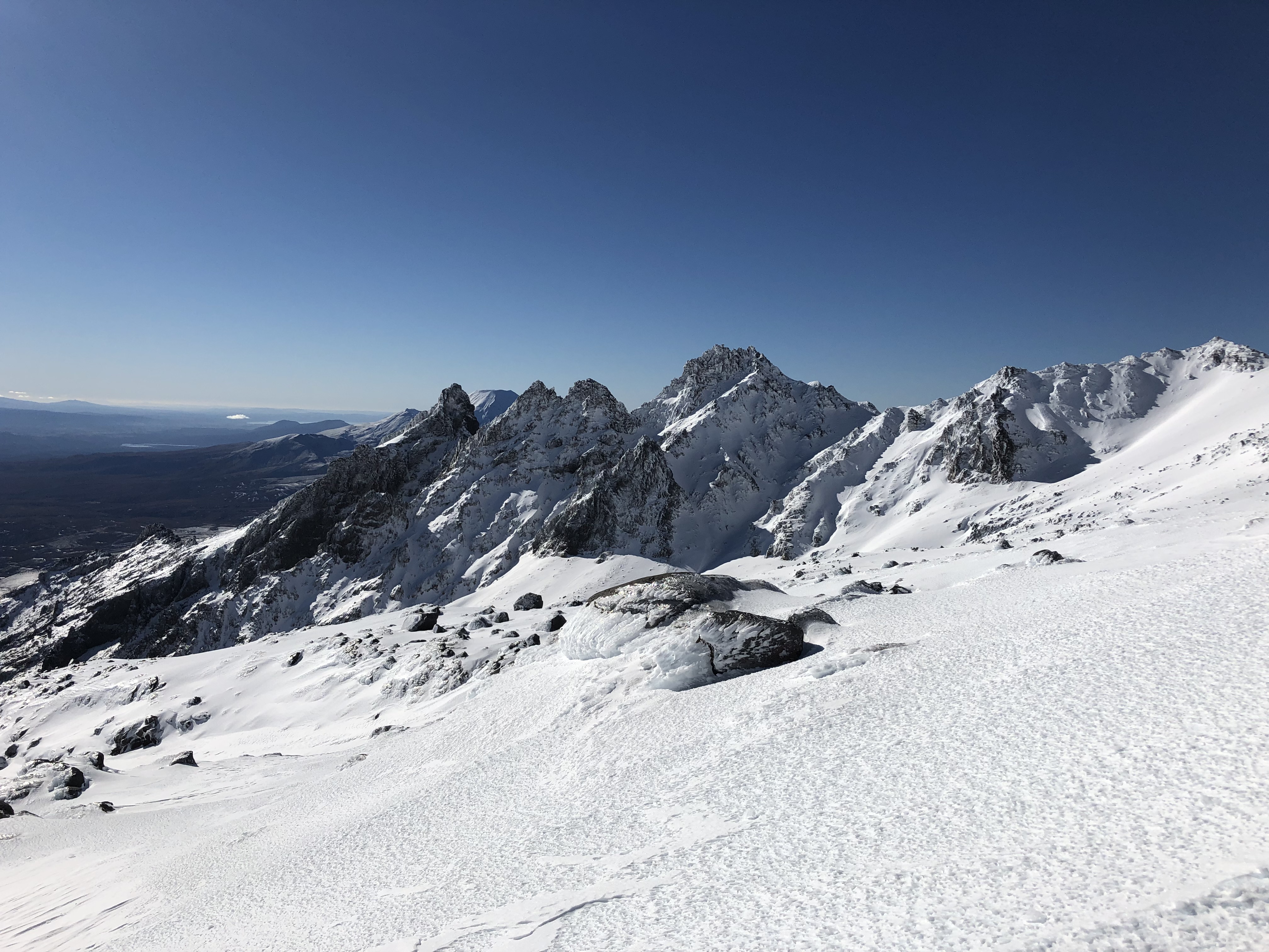
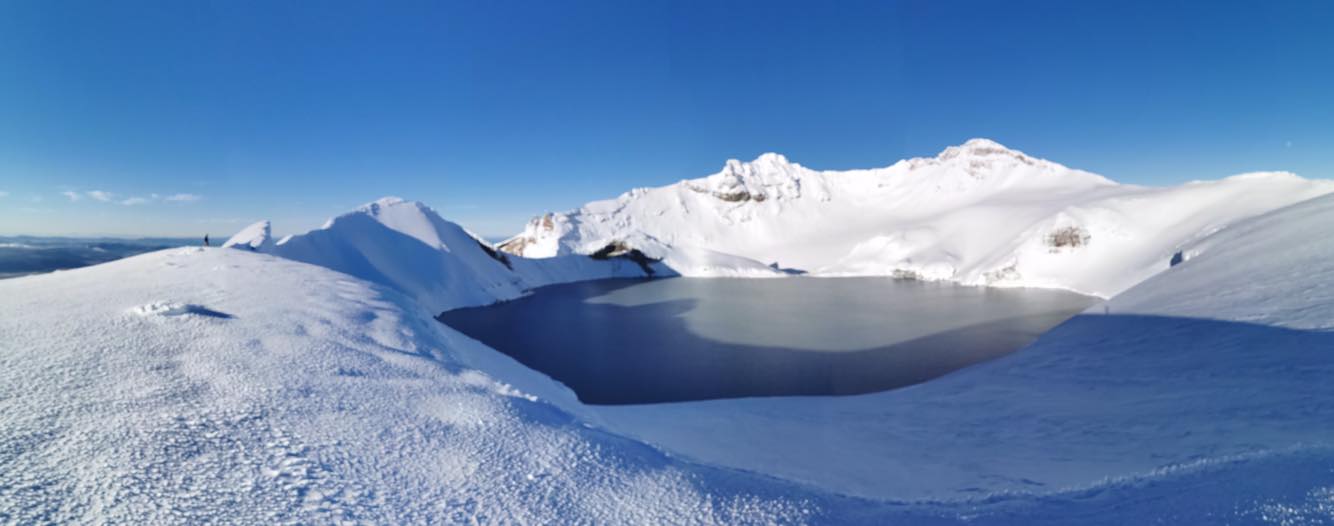
As for the remainder of the day there had been a few ideas put forward the night before. There had been talks of re-doing Tukino as a group and possibly venturing further to Te Heuheu Peak. There had also been talks of traversing the plateau and exploring the crater lake – evidence of the volcano’s ongoing activity! We opted for the crater lake, though in the end it was Oli, James and Gordon who went all the way (outlined in red on the map at the start of this report). The ice was a bit steep for my comfort level and Sam simply chose to save his strength for the journey down.
Once regrouped from the crater we traveled across the remainder of the plateau and around the Glacier Knob to access a gentler ridge west of where we had climbed up the day before. The only snag came at the start with a brief 3m down climb which had the whole team front pointing. Lacking the proper footwear, I had to borrow a second ice axe off of one of the other chaps and use both picks to tool my way down. Lesson learnt, don’t leave your kit at home on the opposite side of the globe!
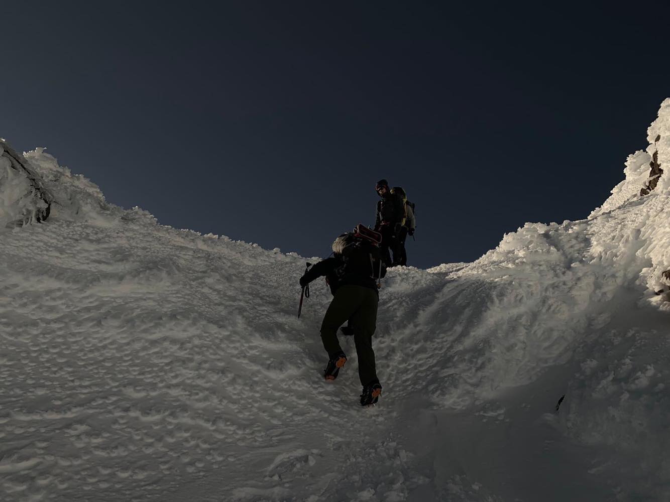
Beyond the “crux” it was a straightforward descent back to the chair lifts. This particular ridge we took was far less icy compared to the first day, instead we merely walked down a crisp snow crust. A few steep sections saw us sidling again but nothing in comparison to the first day. Just above the highest lift line we stumbled upon another team’s tracks which we used to guide us back down. All in all, it took us as a team 7.9km from the crater back to the parking lot, and from the summit ridge it was just shy of 3 hours to complete the descent.
We caught a second lucky break that day as well. Forecasting models and the word of two search and rescue workers who we had met the first day both warned of a weather system expected to make landfall that afternoon. While we certainly encountered a blanket of cloud cover at 1800m we never experienced any adverse weather conditions and had a clear drive home all the way to Wellington. Even treated to a second spectacular sunset – though its hard to make a comparison after seeing the last one from a summit.
Overall: Solid two day trip with a solid team in solid conditions! We could not have done it without everyone’s ongoing enthusiasm and Sam’s guidance. Even in those two days the slope conditions strongly varied between solid ice versus crunchy snow crust, and its easy to see how others have gone wrong in the past. Haven’t smiled this much since doing Mt Wakefield back in January 😀