
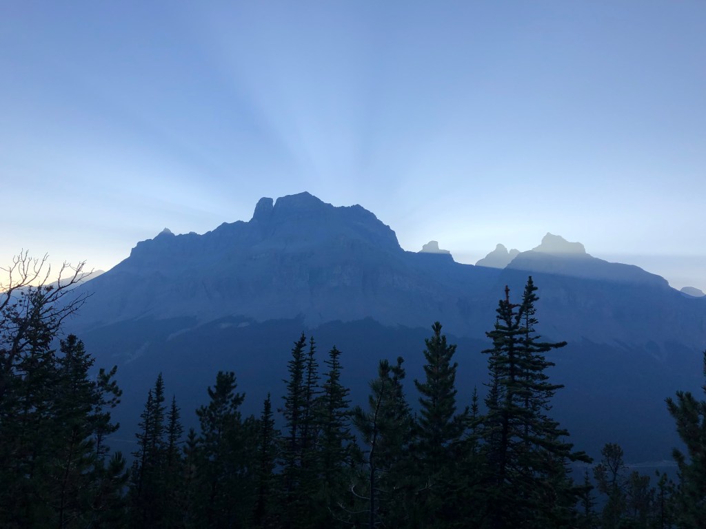
August 28th, 2023. Icefields Parkway, Alberta.
Round Trip: 11 Hours, Elevation Gain: 1630m
Difficult Scramble
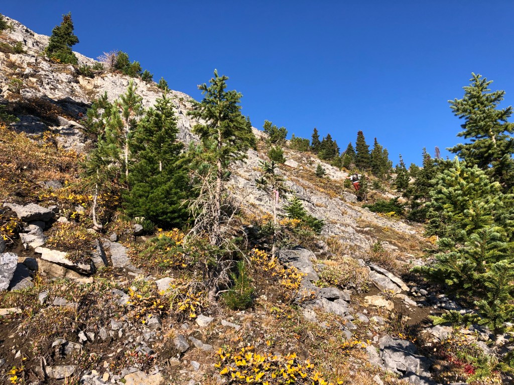
Big day with Scotty! We followed the route from Kane’s (2016) Scrambles, as well as an online trip report by Steven Song. Taking the Sarbach Lookout trail past the old fire lookout spot, we continued along a beaten path through the trees and through sub-alpine meadow, switch-backing up mossy ledges. Lots of flagging and cairns. A rubbly slope between treeline and ridge crest provided us with moderate scrambling and was easy-ish to follow up given the abundance of cairns. Likely more than one route for accessing this ridge, and possibly the rock clearing before the old fire lookout could be used to access the very start of the ridge.
After a brief overnight in the car, we started out from the Mistaya Canyon carpark at 6am following the Sarbach Lookout trail. It was a cold dark start that morning, and as we neared the old lookout the sky brightened up and showed signs of becoming a clear mostly-smoke-free-day. We reached the old fire lookout around 7:50am, and would reach the lower ridge crest in another hour from from the lookout.
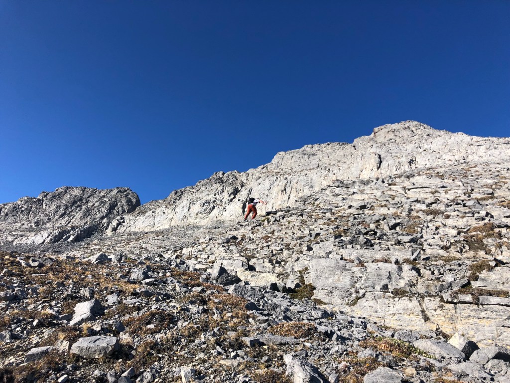
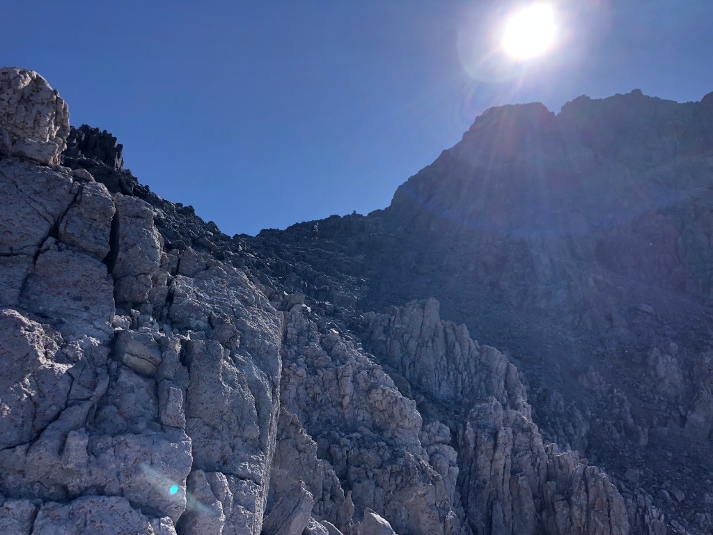
We crested onto the lower shoulder of the ridge just before 9am. Ridgeline was a mixture of slogging up scree and rubble, with moderate to difficult to scrambling through the two notches mentioned by Kane. The first notch feature was a moderate scramble on the journey in but proved challenging to down climb on the return journey: small holds on down sloped ledges with a fair bit of exposure.
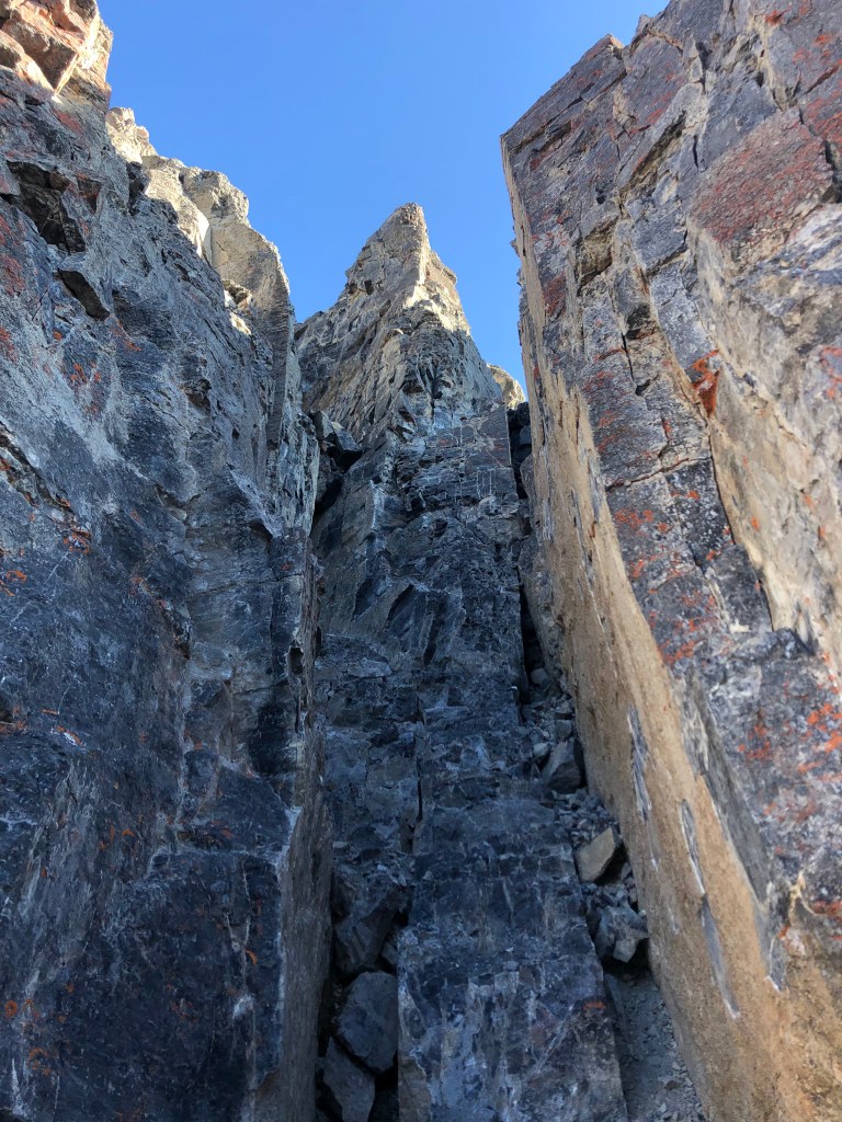
The second notch, as warned by both Kane and Song, proved to be one of the two cruxes that day. Well marked with cairns, the second notch involved a steep down climb via a 10m chimney filled with loose holds (difficult scrambling) and quite a bit of exposure underneath. A few pressure hold moves against the chimney walls helped a bit, luckily there is a wide step roughly halfway down allowing for a quick breather and vantage point to problem solve the last few metres of downclimbing. This second notch stumped the party behind us into discontinuing their attempt. While nasty on the downclimb, the chimney feature felt much easier on the exit journey as an up-climb. I certainly agree with a difficult scramble rating for the notches but personally found the second crux, the final few metres of the summit ridge, to be more daunting.
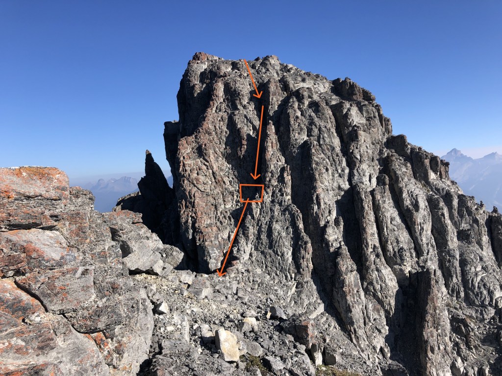
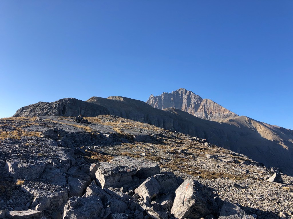
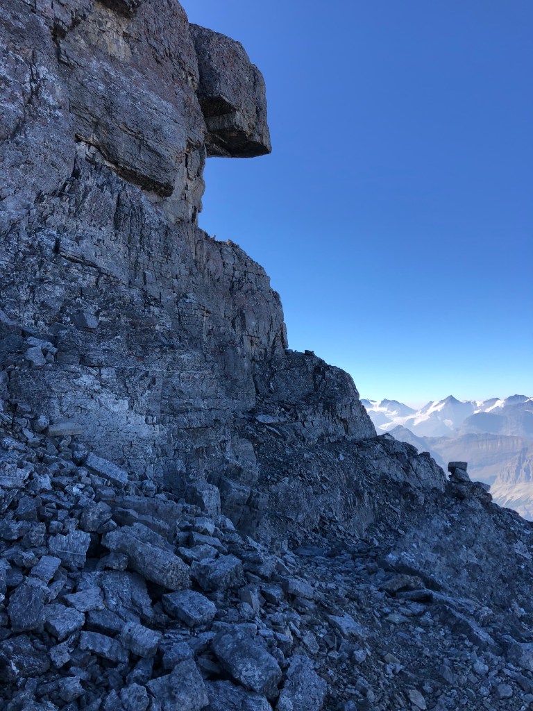
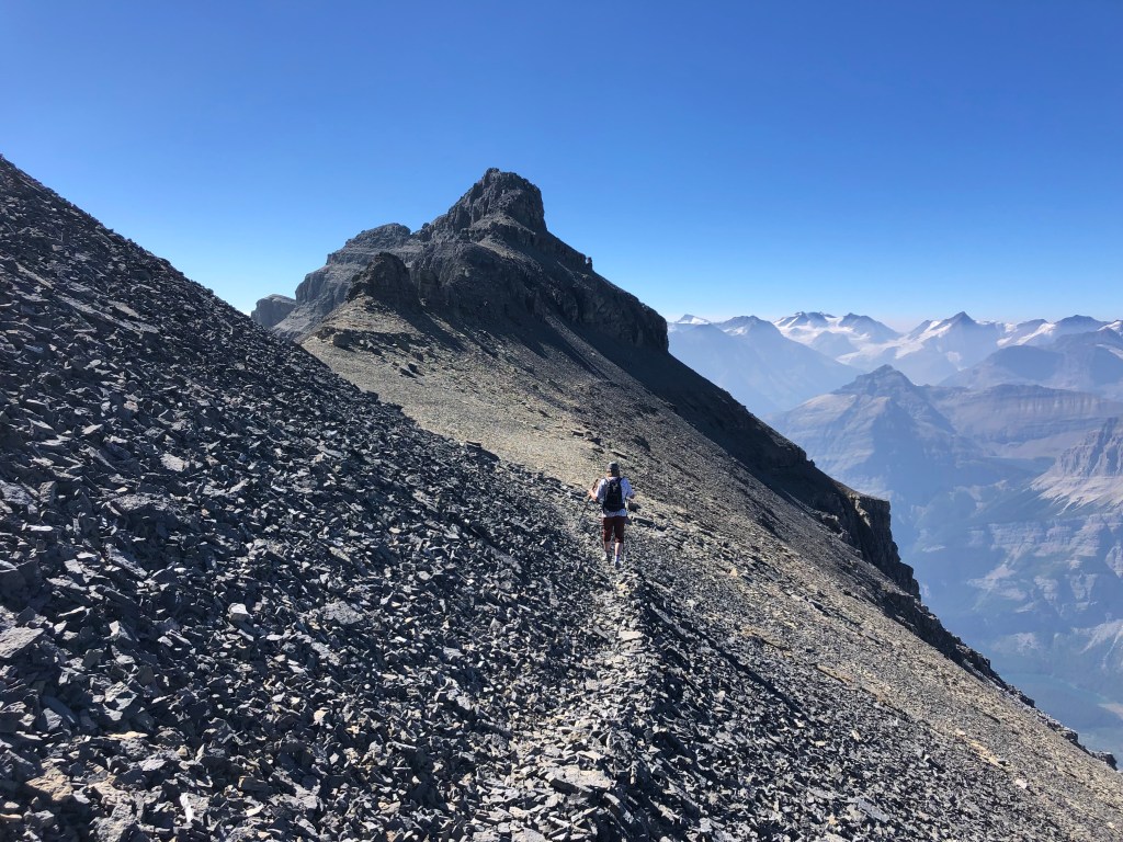
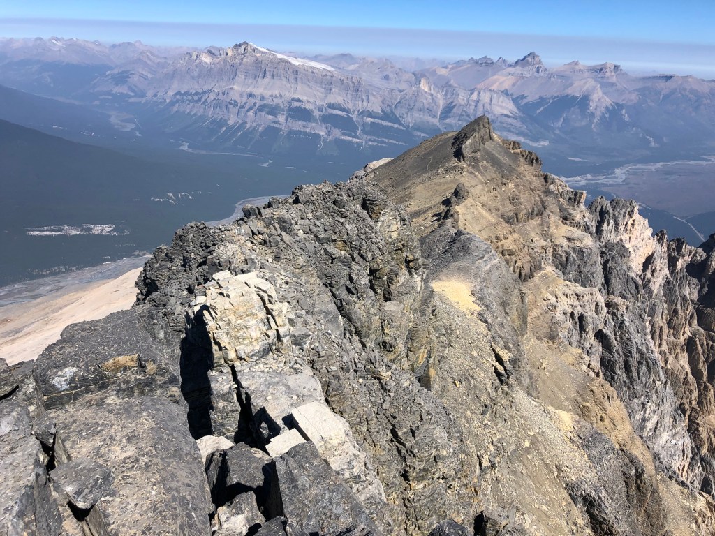
It would still be another 3 hours from the second notch before we reached the true summit that day, making this first crux our halfway point. After the second notch there is a brief easy-moderate scramble leading to a broad flat “plateau” portion of the ridge, which felt like a gentle stroll in comparison to everything else that day! Eventually the gentle-wide-flat ridge steepens and angles southwards up a rubbly slope towards the false summit (moderate scrambling). From underneath the block of the false summit there are two options for continuing. One can do as we did and stay under the false summit traversing across an exposed ledge that leads almost to the true summit. Or, one can scramble up the false summit via some switchbacks and traverse the crest of the ridge. Both options are well defined and well cairned.
We did a slight combination of the two. Under the false summit’s switchbacks the same footpath branches to the looker’s right underneath a distinct overhang feature. At first this looks like it will lead nowhere until you round the corner of it and from there can continue traversing under the ridge. We followed across this route for a few hundred metres eventually getting bored and cresting the ridge. Scotty & I scrambled up at different points before regrouping on the last portion of the ridge crest, which proved to be an easy walk across to the summit block.
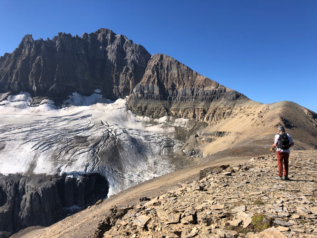
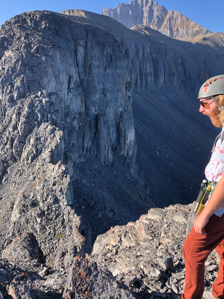
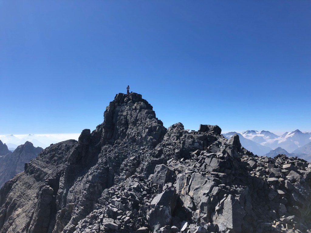
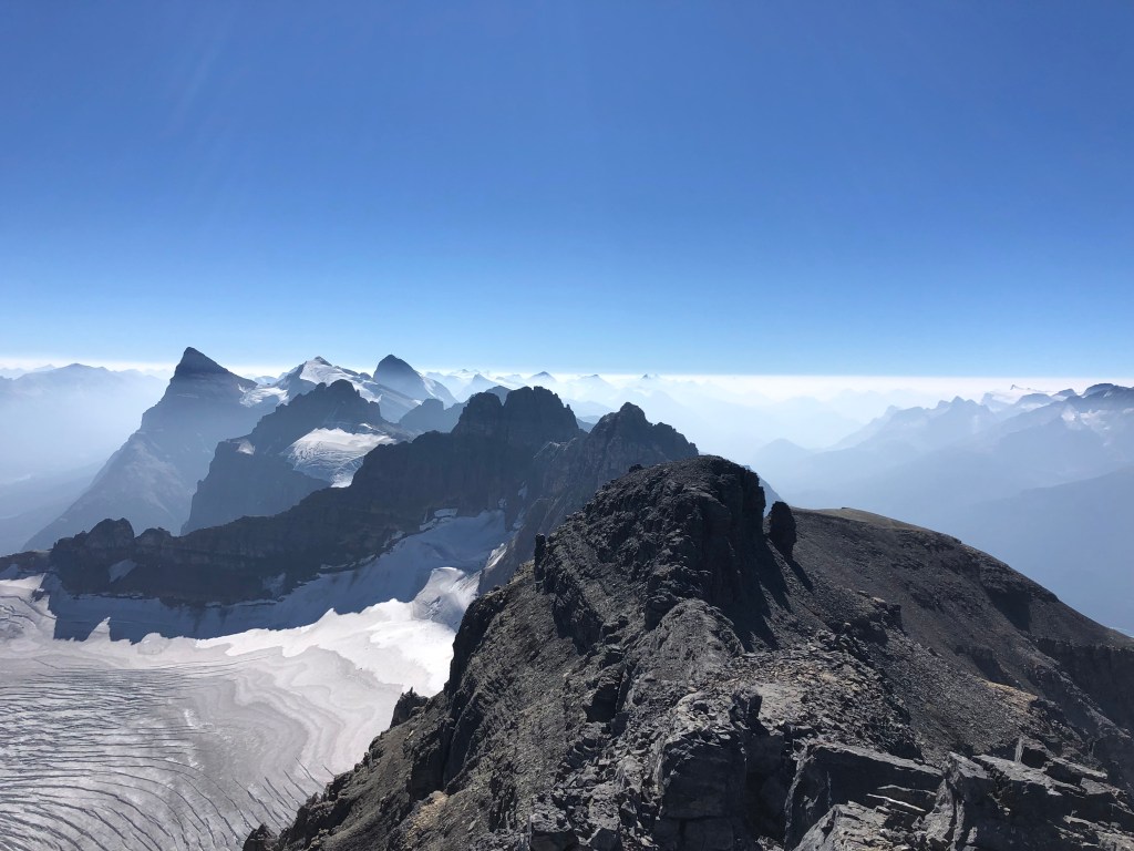
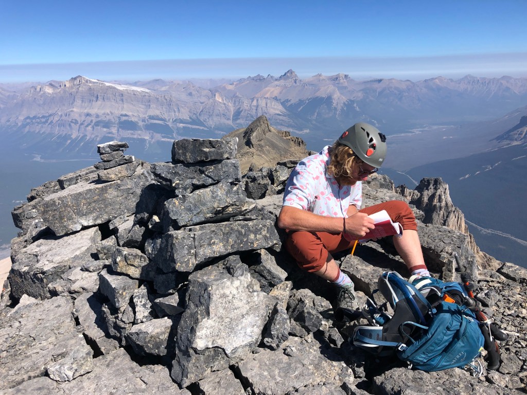
The summit block initially involved a short moderate scramble towards the top, then imposes the second formidable crux. A short 12-15m of narrow ridgeline leads to the summit proper, however these final few metres are wickedly exposed and the latter half of the ridge is especially narrow. If one is immune to vertigo, you can carefully walk across. I for one, opted to crawl across as a fall from here would certainly be fatal. The narrowest point in the ridge, a mere step away from the summit, is barely pillow-sized. Small toe holds on the east side of this narrowest step allowed me to side-rail across. Scotty has better balance and managed to walk across with minimal effort, though acknowledged the exposure had him fully focused on his footwork. We took a much needed lunch break sitting next to the summit cairn, were very lucky to pick a smoke-free summit on an otherwise bad smoke day for elsewhere in the Rockies. Our horizon was still quite smoky, making for eerie inversion-like views, however the immediate views of Mount Forbes to our west and Mount Murchison to the east were crystal clear.
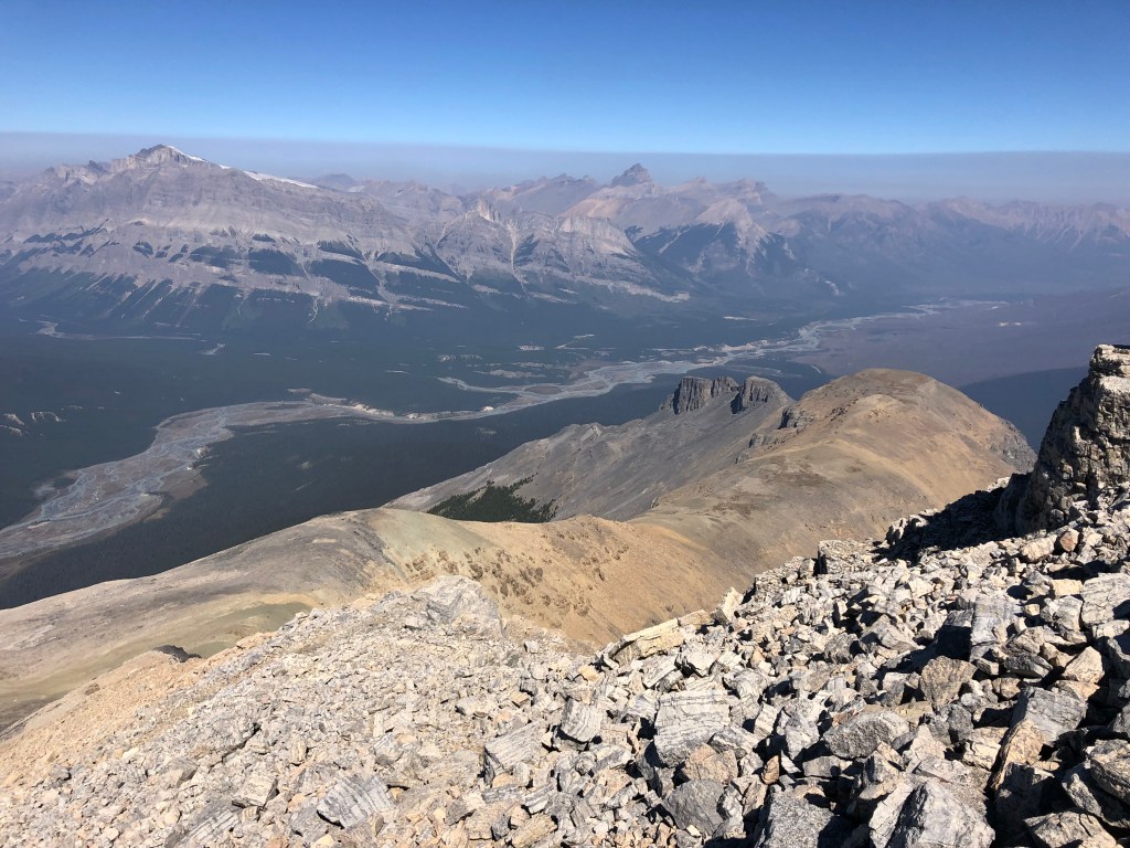
Crossing the summit ridge crux on return was as challenging as on the way in, again a very brief (under 5 minutes) but daunting scramble. Following the ridge crest back towards the false summit the footpath was plainly defined and easy to follow. We followed the ridge crest until nearing the false summit, and then downclimbed a gully near the overhang feature observed earlier. As we downclimbed the false summit’s lower slope and hiked back along the plateau-like portion of the ridge, we saw that another party was stopped above the second notch and feared that there could be trouble. Turns out there wasn’t any, they had just picked a very inconsiderate spot to stop for the day and hangout.
Scrambling up the chimney on the return journey felt much more moderate in technical nature, and we breezed through that spot. However, the smaller notch after the chimney, which wasn’t notable on the journey in, felt very difficult on return! Exposed, down-sloped, with small rubbly holds, made for a nasty downclimb into the ‘first’ notch before returning to easier terrain on the other side. The remainder of the journey was comparatively easy, and based on the number of different cairns, seems to be a variety of route options for retuning to the Sarbach Lookout trail. We stuck to Scotty’s downloaded map despite being tempted to follow the lower ridge further down, and retraced our exact steps from the morning. A very big day overall, and the parking lot beers I had left in the car were well earned (and still cold)!
Overall another epic journey, with at least 3 spicy scrambling sections: the second notch’s chimney downclimb, the summit ridge, and the downclimb back into the first notch. Asides from those spots, there are long portions hiking and less-technical scrambling. All things considered I agree with Kane’s route description and rating of this being a difficult scramble. Not recommended for novices. For intermediate-level scramblers, I would recommend Mount Daly and Mount Carnarvon first before attempting Mount Sarbach. Oddly enough, we did this round trip in exactly 11 hours.
