July 26th 2016. Moraine Lake, AB.
Round Trip: 7 Hours 15 min, Elevation Gain: 1660m
Easy/Moderate Scramble
A throwback trip report from the pre-SteepSheep days! Hard to believe this was already from a decade ago. From 2015-2018 I had lived and worked in the Lake Louise area, including a few summer seasons at Moraine Lake Lodge so quite literally had Mount Temple in my backyard. This trip report is from a solo effort up the Southwest Scrambling route in 2016, which ended up being the second of four trips total to this iconic summit. Recently inspired by some old journal notes from these earlier adventures, I’ve decided to add this one to the SteepSheep list. Needless to say, quite a lot has changed since the time of this report, namely the means of accessing Moraine Lake and the sheer volume of mountain traffic in the area.
A few things to note before diving into the report. Alan Kane’s (2016) Scrambles in the Canadian Rockies in my opinion still contains the most accurate description for this route. Parks Canada at the time had scrambling pamphlets for the route which were also very helpful (unsure if they still offer these). Outside of these two sources, there is a mess of information online around this route offering a wide variety of difficulty ratings. I have no desire to set the record straight and am merely sharing my own personal experience to those willing to read about it. I’ve assigned this an Easy/Moderate Scramble rating, as most of the route is an easy scramble (hike) with the two rock band sections involving moderate hands-on scrambling with brief exposure. The best way I can sum it up is this: as a hiker you will find this ascent challenging, if not from the scrambling from the +1600m elevation gain, and as a scrambler this is a fairly straightforward effort.
In 2016 I was living and working at Moraine Lake Lodge and had scrambled up Eiffel Peak on July 24th. From Eiffel’s summit I observed Mt Temple’s scrambling route was now snow free, so I knew I wanted to try Mt Temple again soon after. I had previously been up Mt Temple for sunrise in 2015 and while that was an epic outing, I now wanted to complete the scramble in daylight. The day-of ended up being a somewhat spontaneous decision, which also led to it becoming a solo effort. I had slept in till nearly 10am expecting poor weather conditions on the 26th. However, I woke up to clear skies and when I checked Mountain Forecast the would-be thunderstorms had been pushed back to after 5pm. I knew it was a short weather window and 5pm wasn’t a guarantee, so I promptly rolled out of bed to get started.
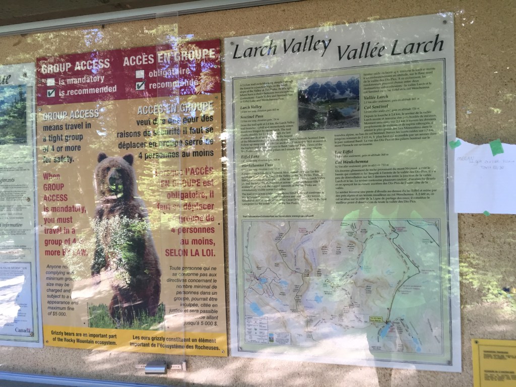
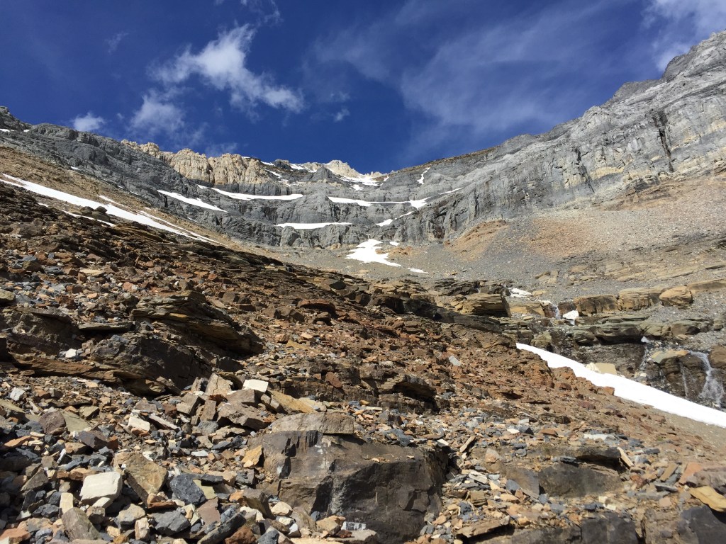
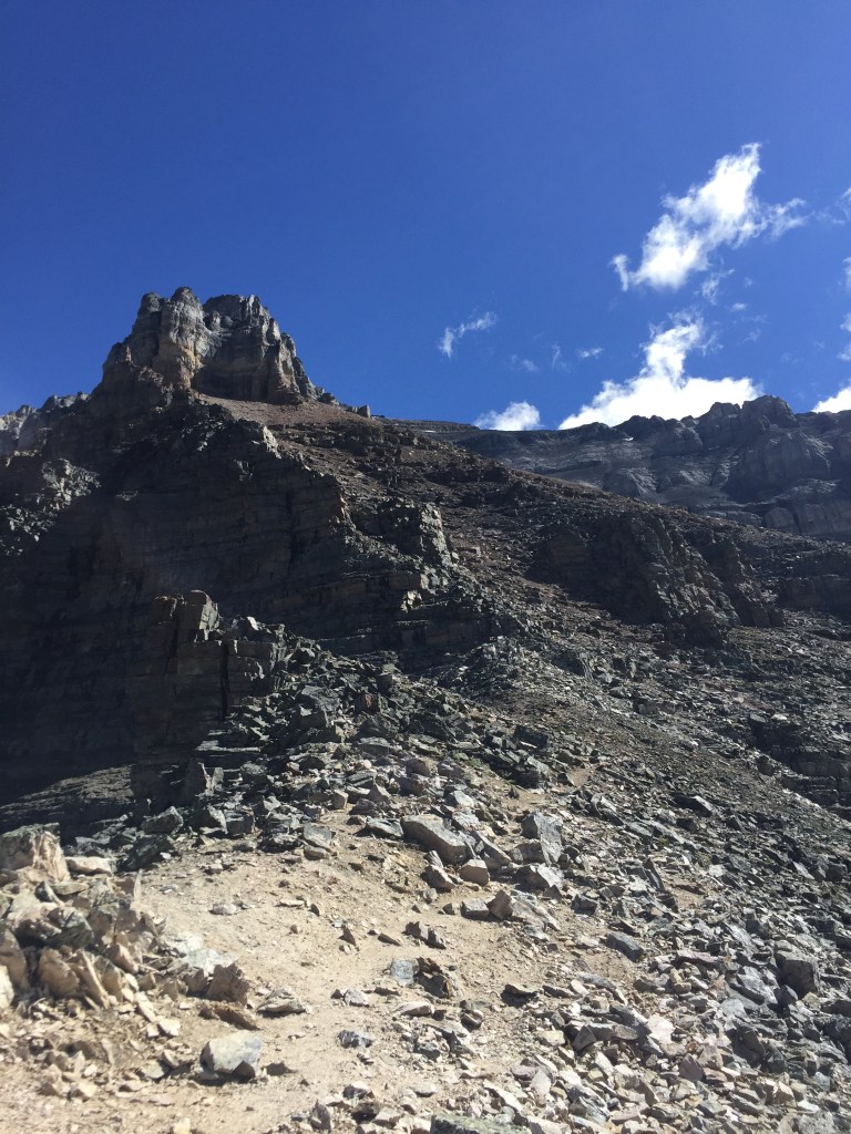
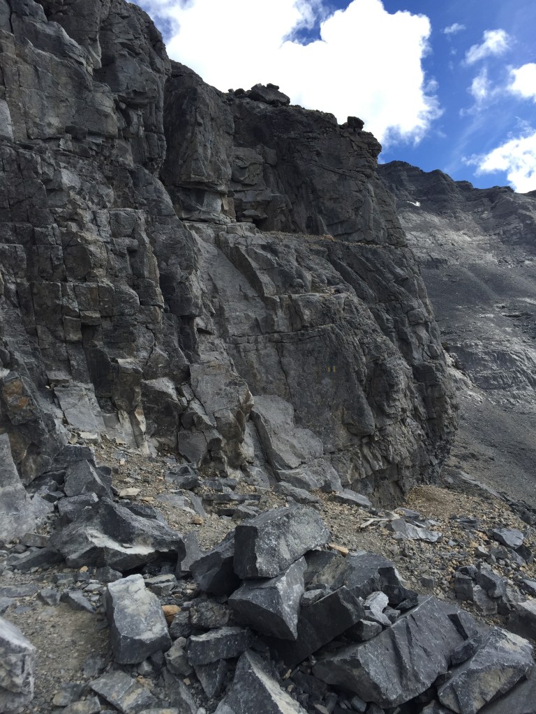
I clocked myself in at the trailhead by Moraine Lake at 10:16am and ran up to Sentinel Pass, taking an hour and fifteen minutes to summit the pass. Larch Valley was busy that morning but the pass itself only had a few people on it. The scrambling route begins from the pass’s right (east) side and is well marked with cairns appearing almost as a trail extension. It is steep rugged hiking from the start with poor footing but barely a scramble until you encounter the first of two rock-bands.
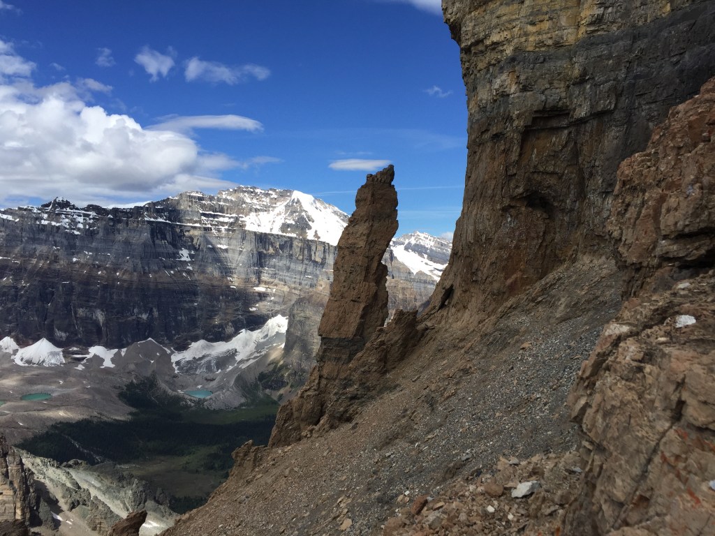
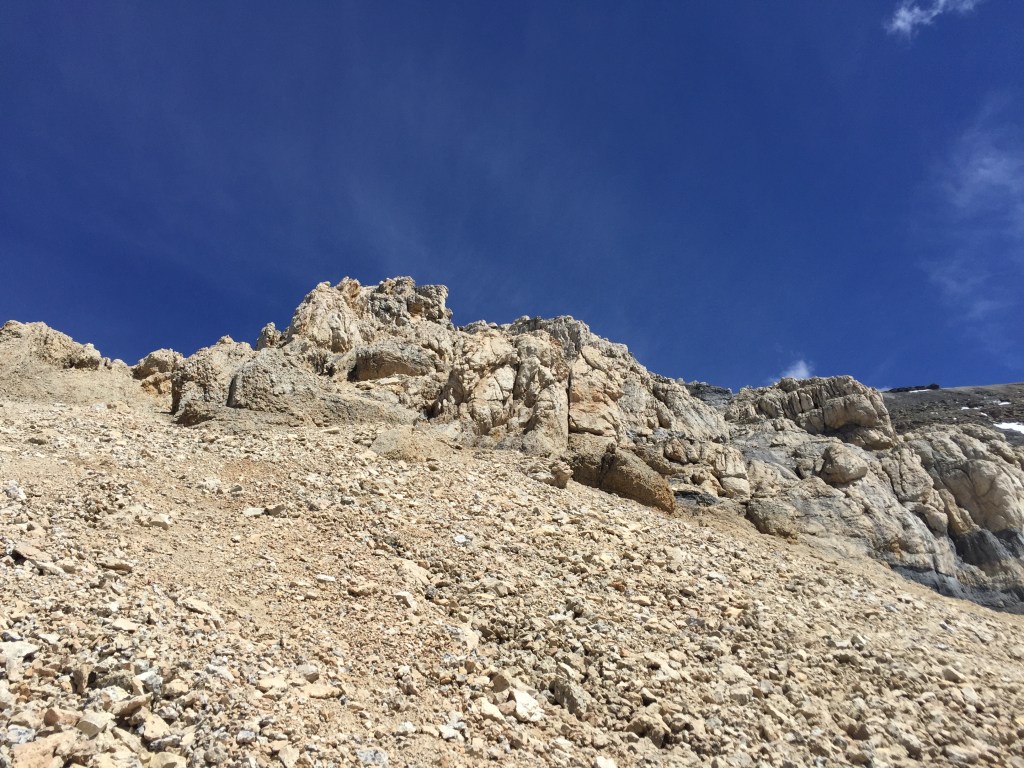
I reached the infamous pinnacle an hour above Sentinel Pass, a landmark that serves as the halfway point for the ascent. Shortly after the pinnacle I came up to the first rock band, which offers moderate scrambling with minimal difficulty. Seeing it in daylight for the first time, it appeared more exposed than I remembered it being from 2015’s sunrise ascent. I took a light breather after this first rock band and pushed on another 15 minutes, arriving at the crux (second rock band) around 12:35pm.
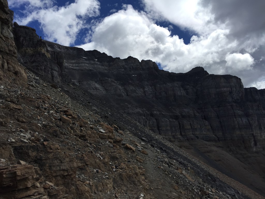
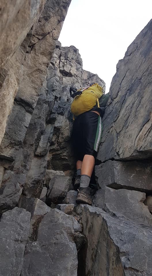
I had maintained a pretty consistent pace up until this crux section and admittedly was a bit stumped on how to next proceed. There are a couple faint spray paint markings of where to scramble up over a weathered ledge, however this ledge is exposed and is so well travelled that the holds were unnaturally smoothed. I had second thoughts about continuing up through here. I decided instead to scout out an alternative way around the crux, hoping to find something more grippy. I knew from my previous outing that further to the right was not an option so considered looking to the climber’s left.
After humming and hawing for fifteen minutes I decided to attempt the gulley to the crux’s left. Rather than kicking steps in the snow (very steep) I clung to the rock on the climber’s right-hand corner of the gulley, and scrambled over difficult but stable rock with numerous small holds. Arguably this was just as exposed as the original crux and even a technical grade harder, almost low fifth class, but offered the more tactile rock to grasp. I committed to a few sketchy meters before reconnecting with the more worn-in path upwards.
Later in 2018, Bri and I would watched another group scramble up a crack in the rock band halfway between the crux and the gully offers another alternative way up. Had we not seen the group ahead of us use this crack, we likely would have missed as I certainly did not notice this feature in 2016. The crack offers more protection versus the other two ways, though involves a few committing hands-on moves especially when downclimbed on return. I suspect that I may have downclimbed this feature on return from the summit on this solo trip but at this point cannot clearly recall.
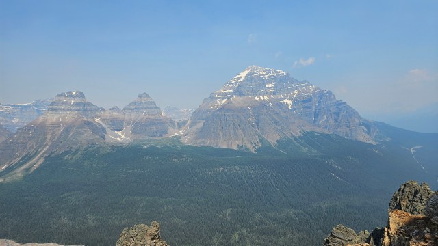
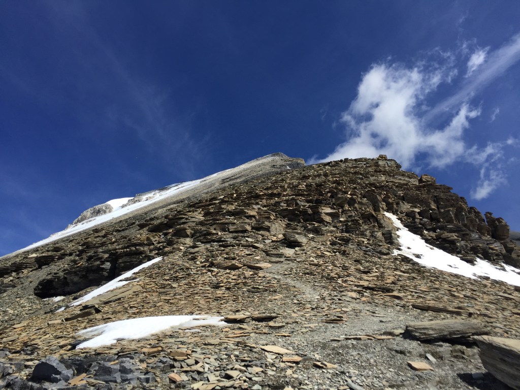
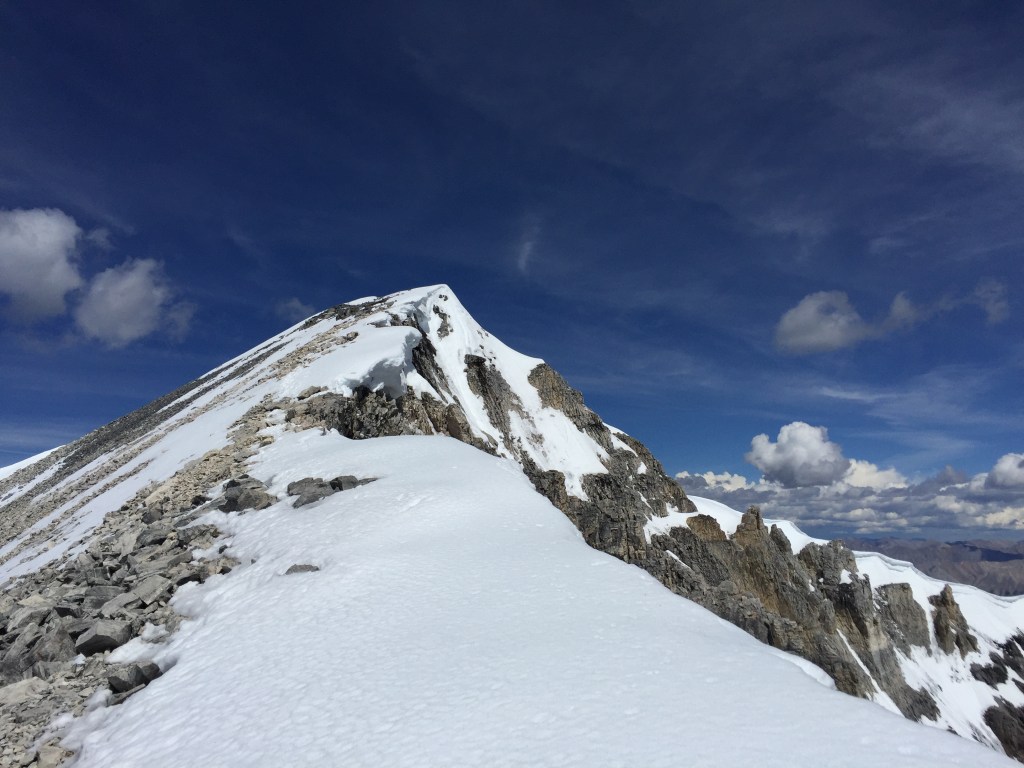
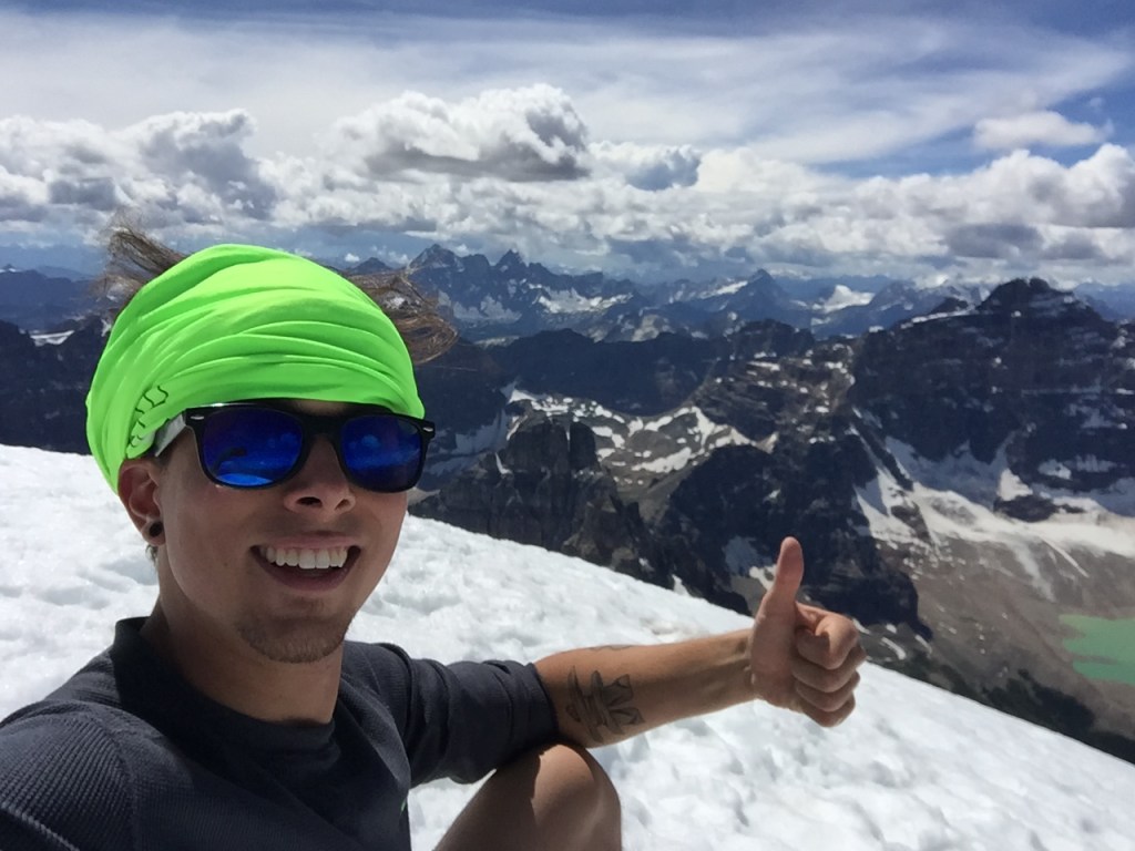
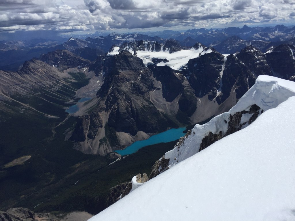
I had barely stopped up until the crux and after scrambling up the gully’s right side edge was feeling my energy fade. I stopped at the last light-brown rock band under the summit’s scree slope for a wee – and of course that was the one time I encountered another scrambler! He too was on a solo mission and told me I was likely another 45 minutes to the summit. It ended up taking me an hour to plod up the final summit slope, summiting just before 2:30pm. To my surprise the summit was substantially more snow-covered compared to the 2015 visit. The weather remained clear and conditions were stunning, save for one menacing storm cloud to the south. I checked the time and noted it had been 4 hours 15 minutes since I started, a little slower than I had wanted but good timing nonetheless. Said dark cloud appeared to be creeping slowly northwards so I kept the summit visit brief capturing a few photos and video before the descent journey.
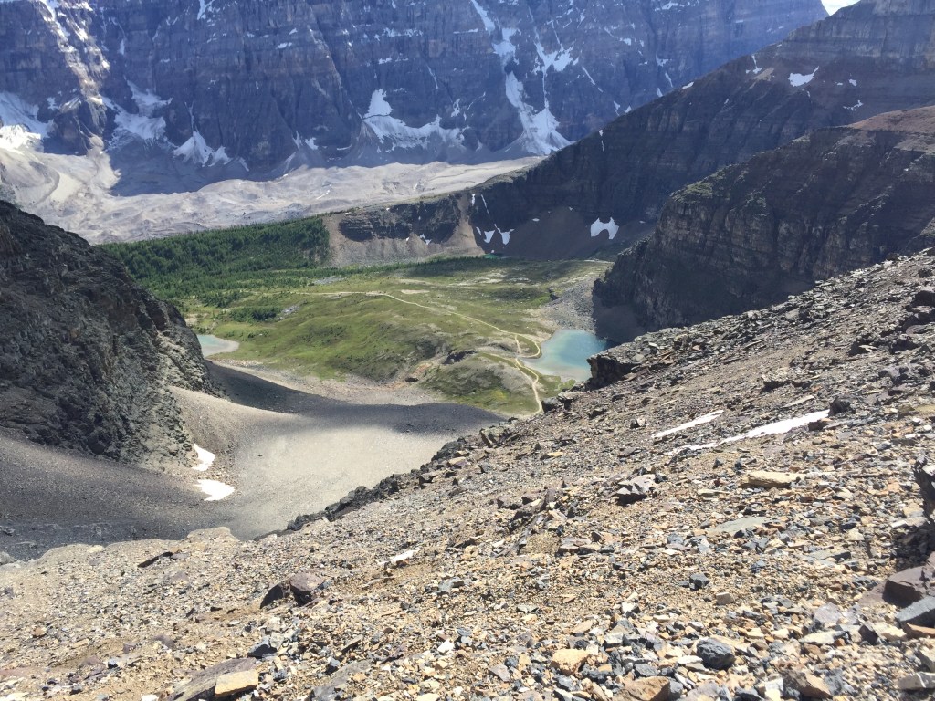
Ironically, I encountered another party in almost the exact same spot as where I had met the other solo hiker during my ascent. I warned them of the weather system I spotted, and encouraged them to move quickly if they were to summit in calm weather conditions. While downclimbing through the lower rock band, I dropped my pack and it bounced down to the skier’s left eventually landing in a slide path. I had already lost a pack the previous year and dared not lose this one, so I followed it and continued down the slide path all the way to the base of Sentinel Pass’s switchbacks. I downclimbed a few moderate ledges during this variation, but noted that they were optional and that I could have stuck to the scree the whole way down.
This proved a great bypass of Sentinel Pass and also provided a water refill opportunity part way down the slope (I had run out of water at the summit). I made it back to the trailhead around 5:30pm, making for a 7 hour 15 minute return trip time, and had completed the trip in stable weather. The storms I had seen from the summit never fully rolled in, according to my notes it did end up raining later that evening. All-in-all a great outing and certainly my fastest round trip time for Mount Temple. I returned a few weeks later for a group sunrise trip in August 2016 and again with Bri in August 2018 for a daytime trip. Can’t imagine going back now with how overrun the Moraine Lake area has become!