
January 29th 2019. Aoraki/Mt Cook National Park, New Zealand.
Round Trip: 11 hours. Elevation Gain: 1300m
Moderate/Difficult Scramble
Mount Wakefield is a low altitude ridge in Aoraki National Park that divides Tasman Valley and Hooker Valley. The ridge line hosts several peaks listed at heights of 1566m, 1827m, 2012m, and 2058m according to the 1st edition (2013) NewTopo map of Aoraki Mount Cook. Don’t let the low altitude dissuade you – this is an awesome ridge line and a proper scramble once past the first peak. While we didn’t reach the true summit, reaching the lower summit of 2012m was itself well worth the effort.
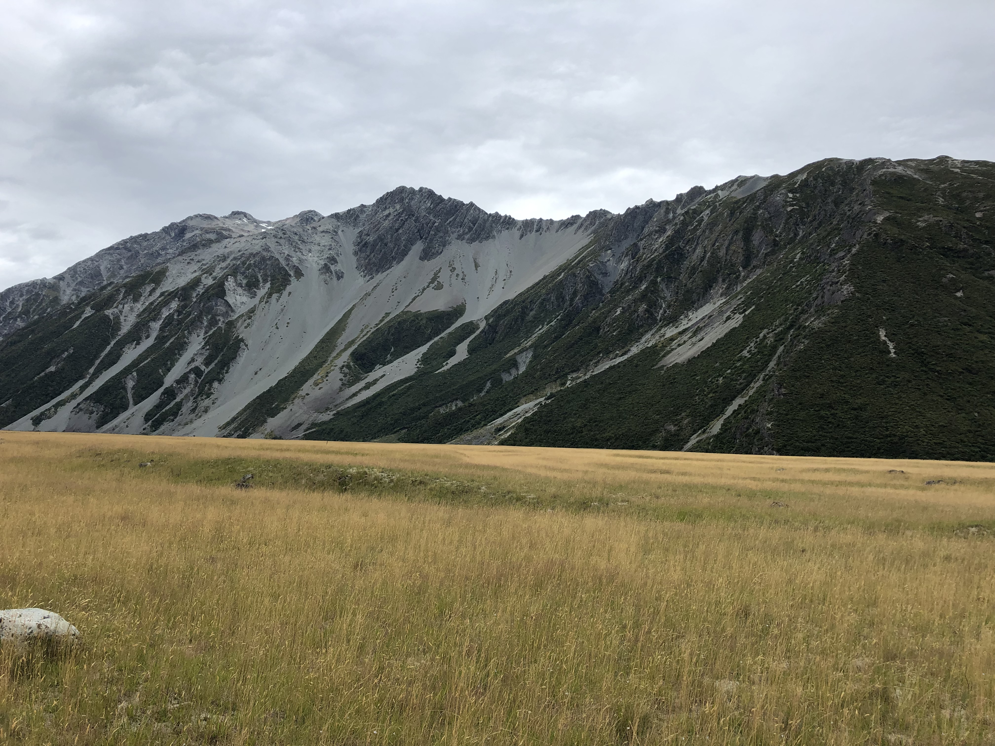
The route is seemingly straightforward. From the access point a well used footpath snakes its way through the vegetation and gains you access to the ridge’s shoulder. Following up the shoulder the footpath is easy to follow and more of a hike than scramble. Once on the ridge crest, the scrambling gradually picks up and the foot path fades. The route as a whole is generally a moderate scramble though there are undoubtedly some difficult sections higher along the ridge.
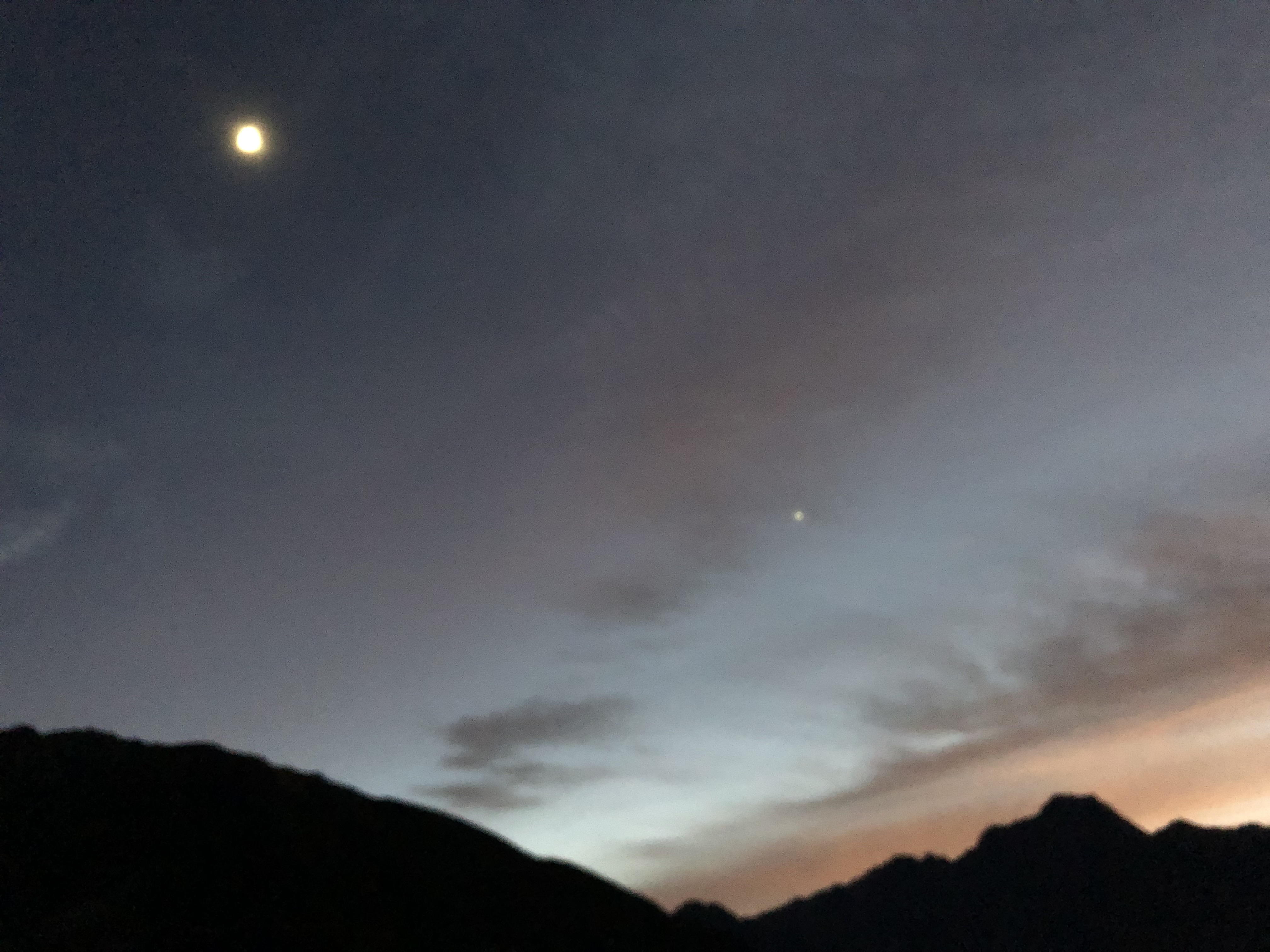
It was forecast to reach 30C the day we went up. Bri and I were anticipating a full 8-12 hour day in the heat so we opted for an early start. The access point for Wakefield is near the Hooker Corner Bridge which meant we had a 45 minute walk from our flat. No problem – not only did that warm up the legs but we were treated to a spectacular sunrise 🙂
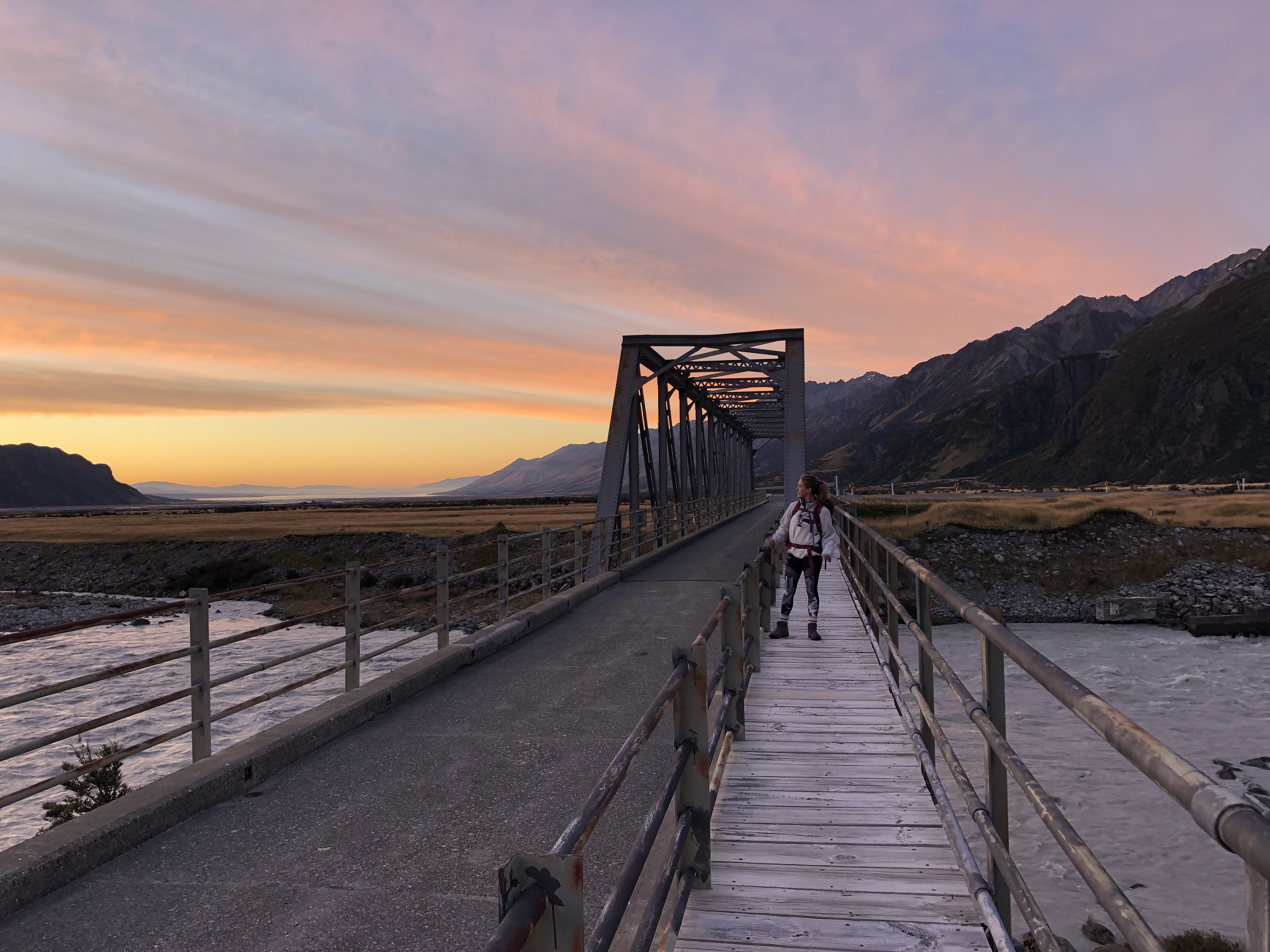
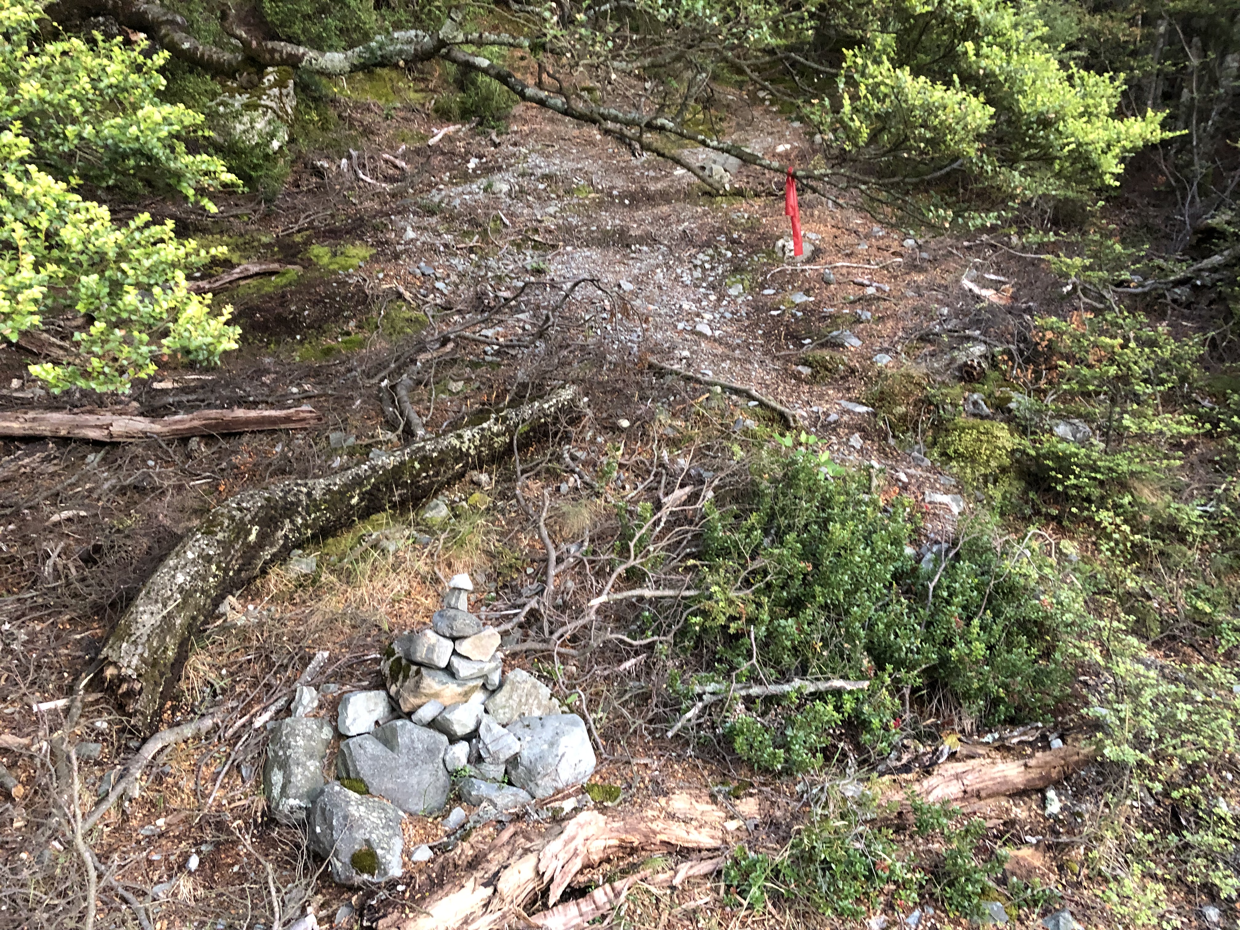
We reached the access point and started the ascent right at 6:31am. Past the bridge is a small parking lane with a “no camping” sign. Behind this a cairn and some red flagging tape mark the trail head access. It doesn’t appear like much of a route, nor does it waste any time with gaining elevation. The vegetation is thick and thorny (I suggest pants and hard-shell jacket through here). Luckily the footpath is well worn in and easy enough to follow up despite the bush thrashing. The views are immediately satisfying however it was hard to linger at the start given the swarm of ravenous blackfly.
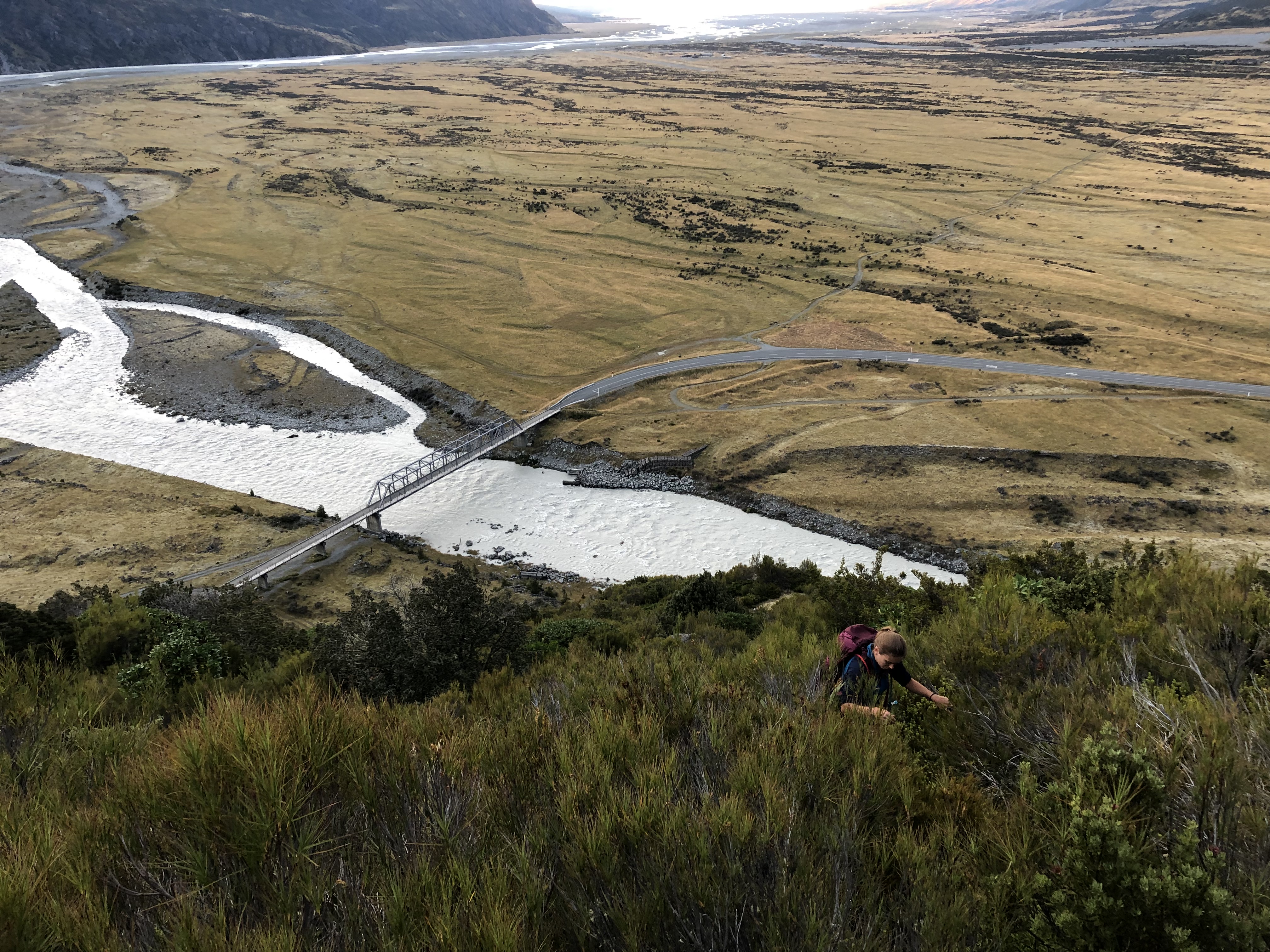
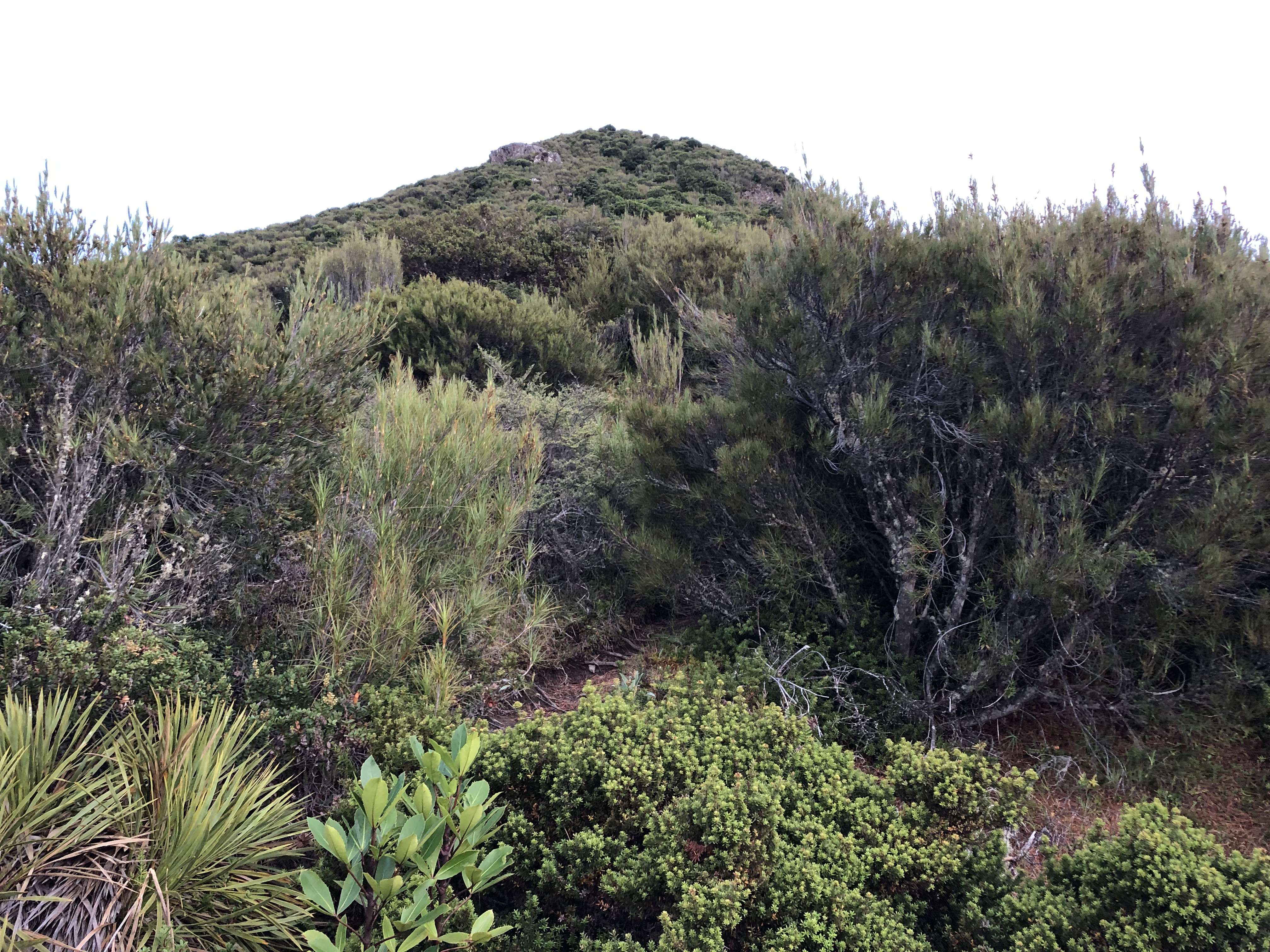
The bush whacking eventually ended 50 minutes into the trek. We admittedly loss the path once or twice along the way. Several small cairns aided in regaining the correct route. For most visitors of Mount Wakefield the shoulder summit at approx 1450m is likely the turn around point. The foot path becomes much more faded past the shoulder and the route progresses into more of a scramble.
We met another back packer on the shoulder summit who also lived/worked in the village, and was a colleague of our new flatmate. Small world / small village. That was the only other hiker we encountered the entire day. Sure as hell beat the crowds we experienced up to Mueller Hut. It had taken us two hours from the trail head to the shoulder summit. Even then at 8:35am the heat from the sun was intense. Thankfully brought 50 SPF sunscreen lotion with us!
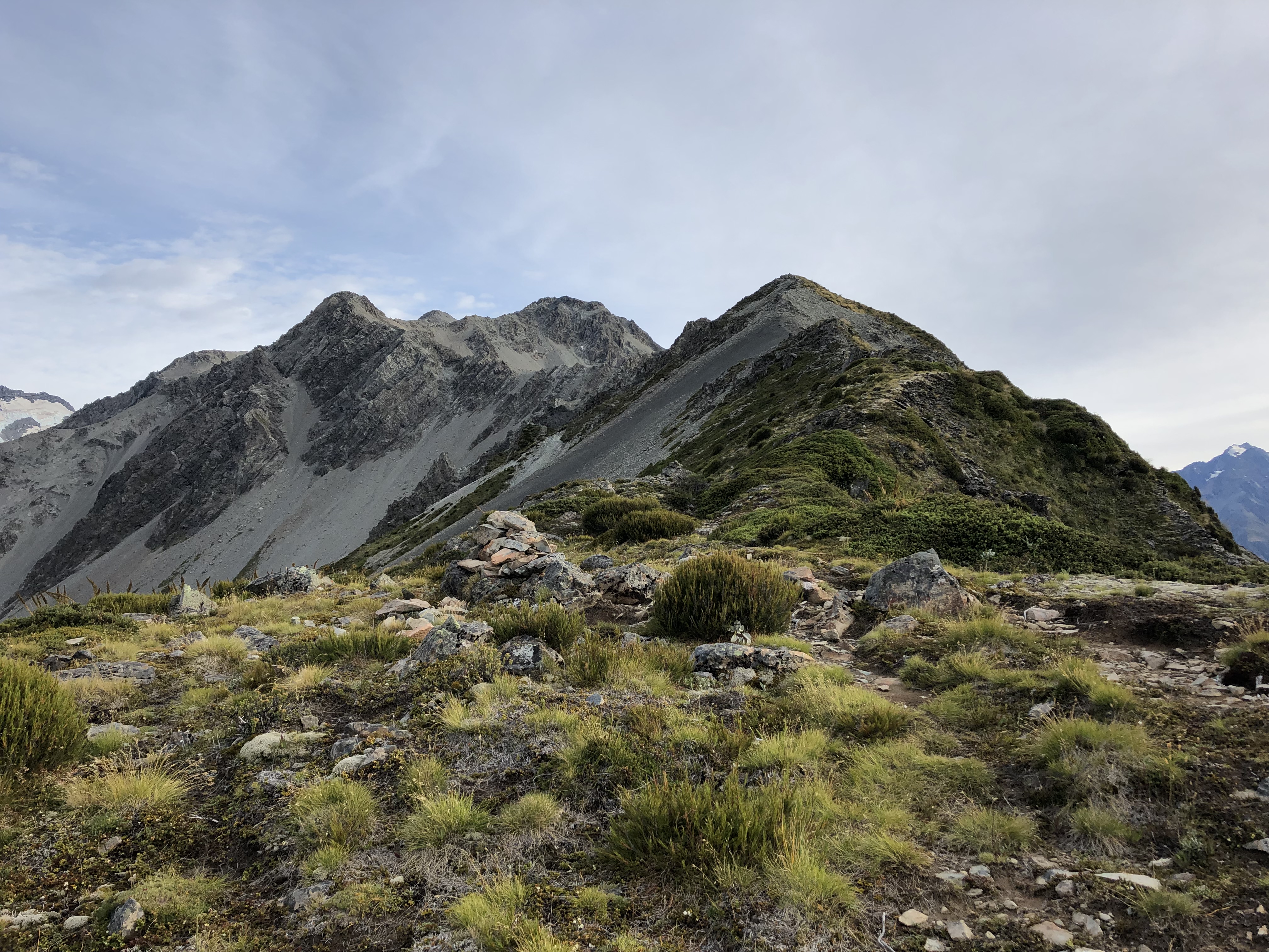
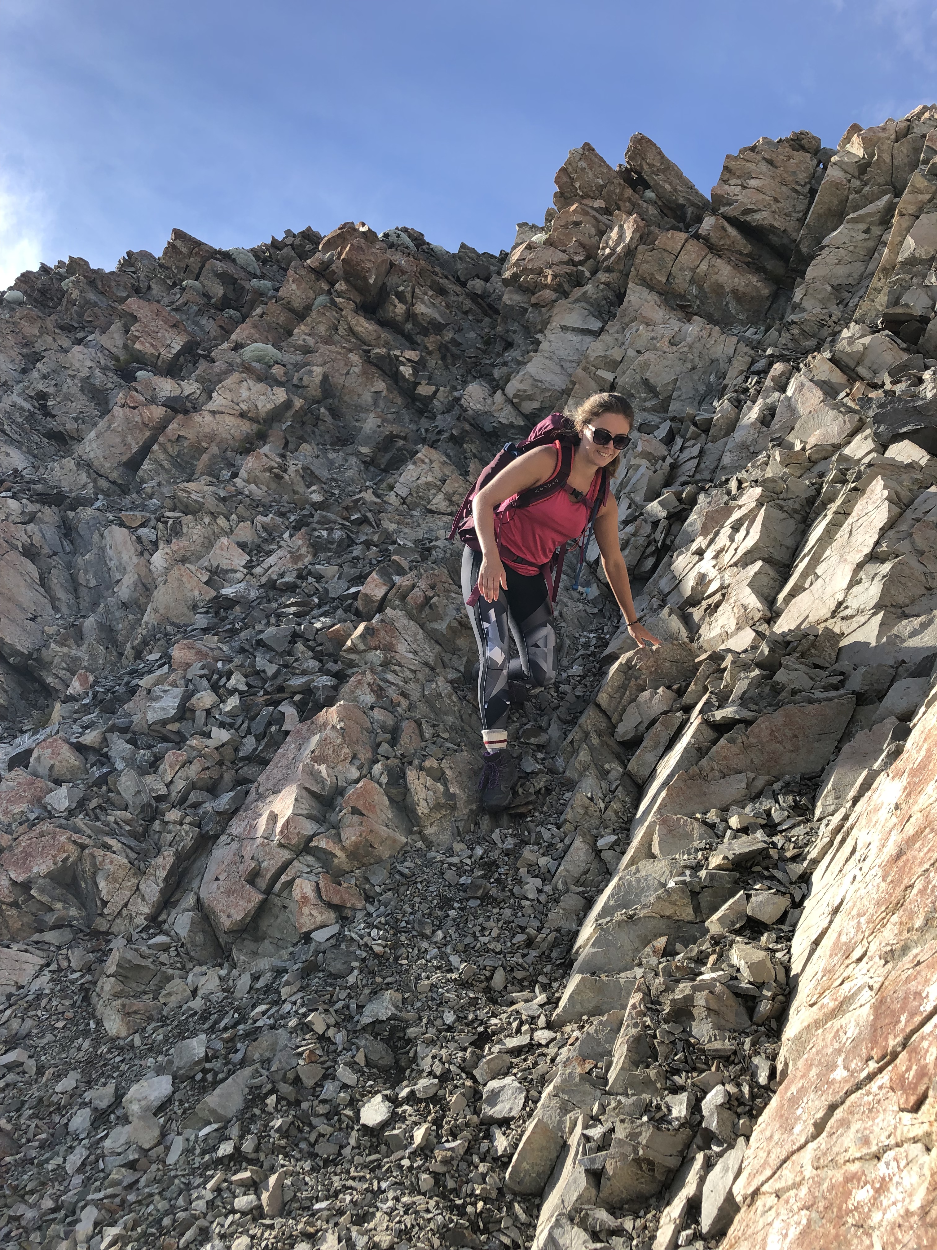
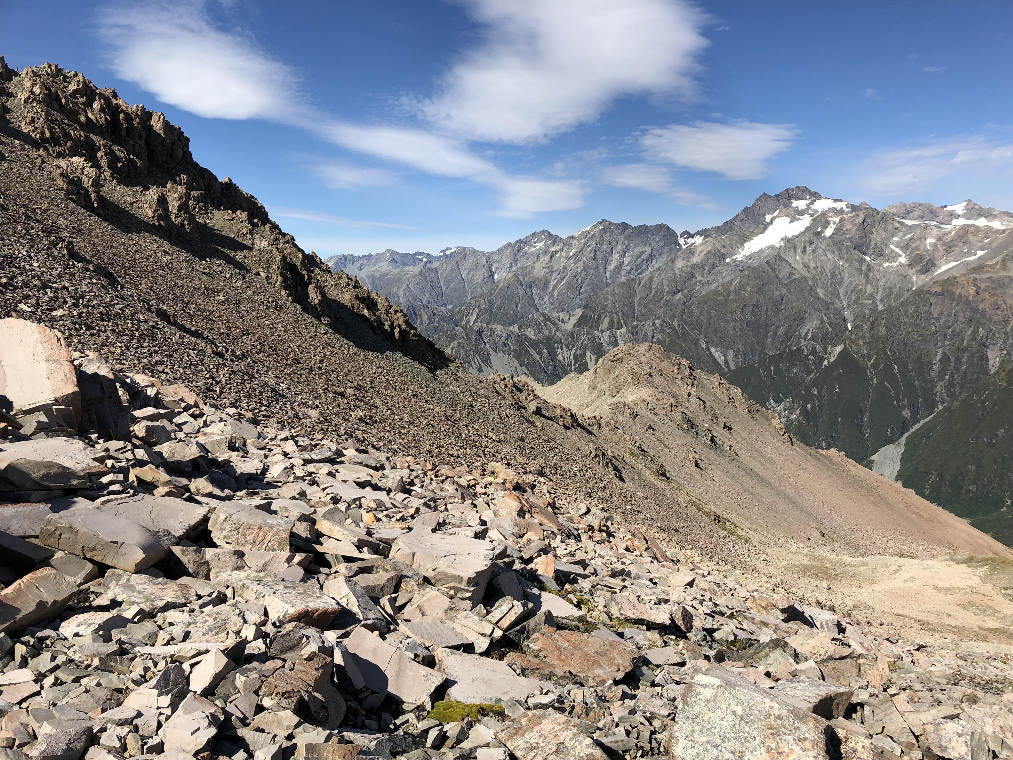
Continuing along the ridge we worked our way up to past several “peaks” along the way. Some had cairns and others didn’t. Staying true to the ridge crest often resulted in very exposed difficult scrambling. Other times we found ourselves side-hilling on steep talus slopes having abandoned the ridge crest altogether. We loss and regained elevation on a regular basis throughout the day as to avoid the more exposed areas.
The next major point is literally a turning point in the ridge located half way between the labelled points of 1566m and 1827m. We reached this point at 9:45am and measured it around 1700m. One section just before the 1700m point had involved very exposed scrambling – we side-cliffed underneath this section which wasn’t any better: the section we chose was comparable to Mount Whyte in Lake Louise. On the return journey we saw that it was easier to lose an extra 20m and stick with the talus below.
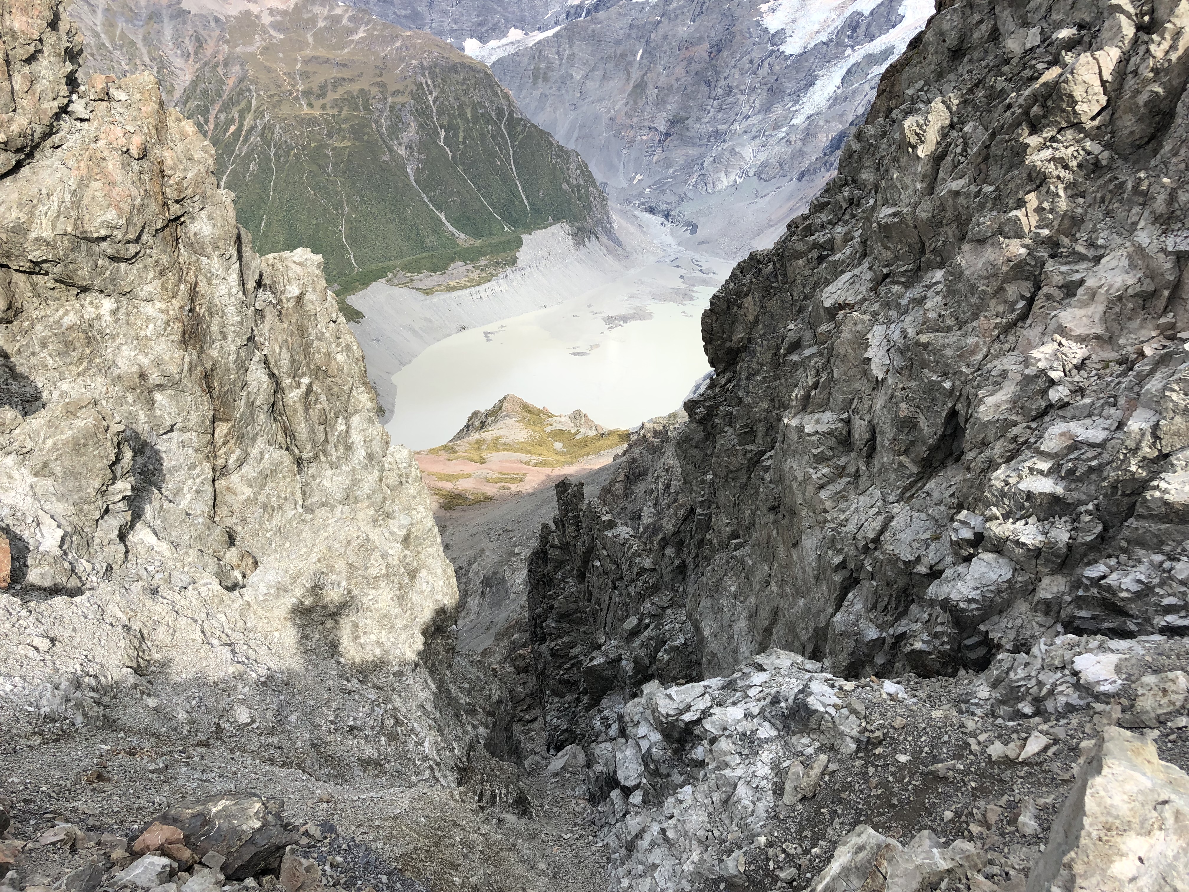
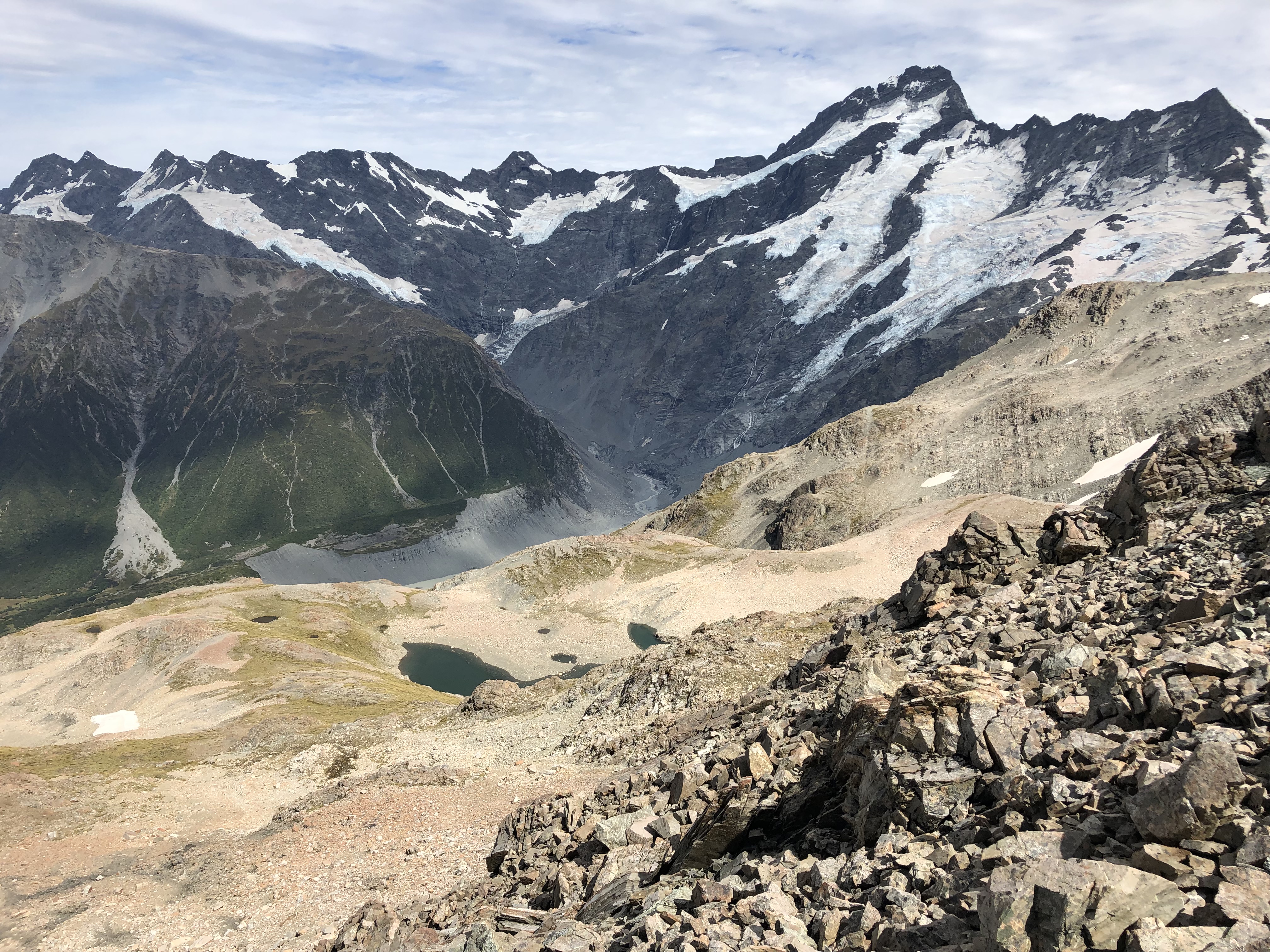
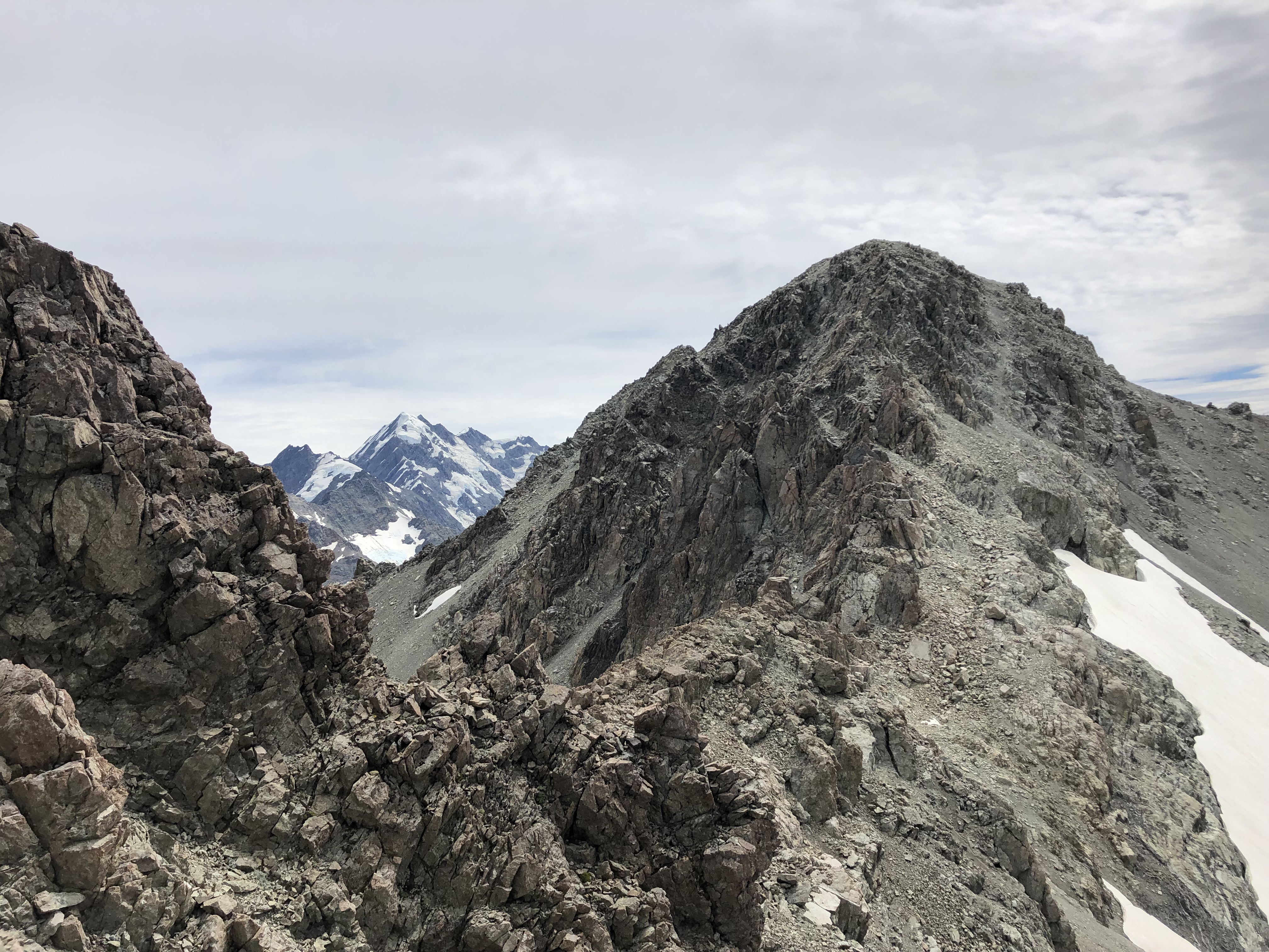
Onward – From the high point of 1700m you can see the remainder of the ridge and lower summit of 2012m. We initially stuck to the ridge, mostly moderate scrambling. However the exposure became unsettling and we ended up side-hilling around until we were above a bright blue tarn. This tarn is present on the topo map.
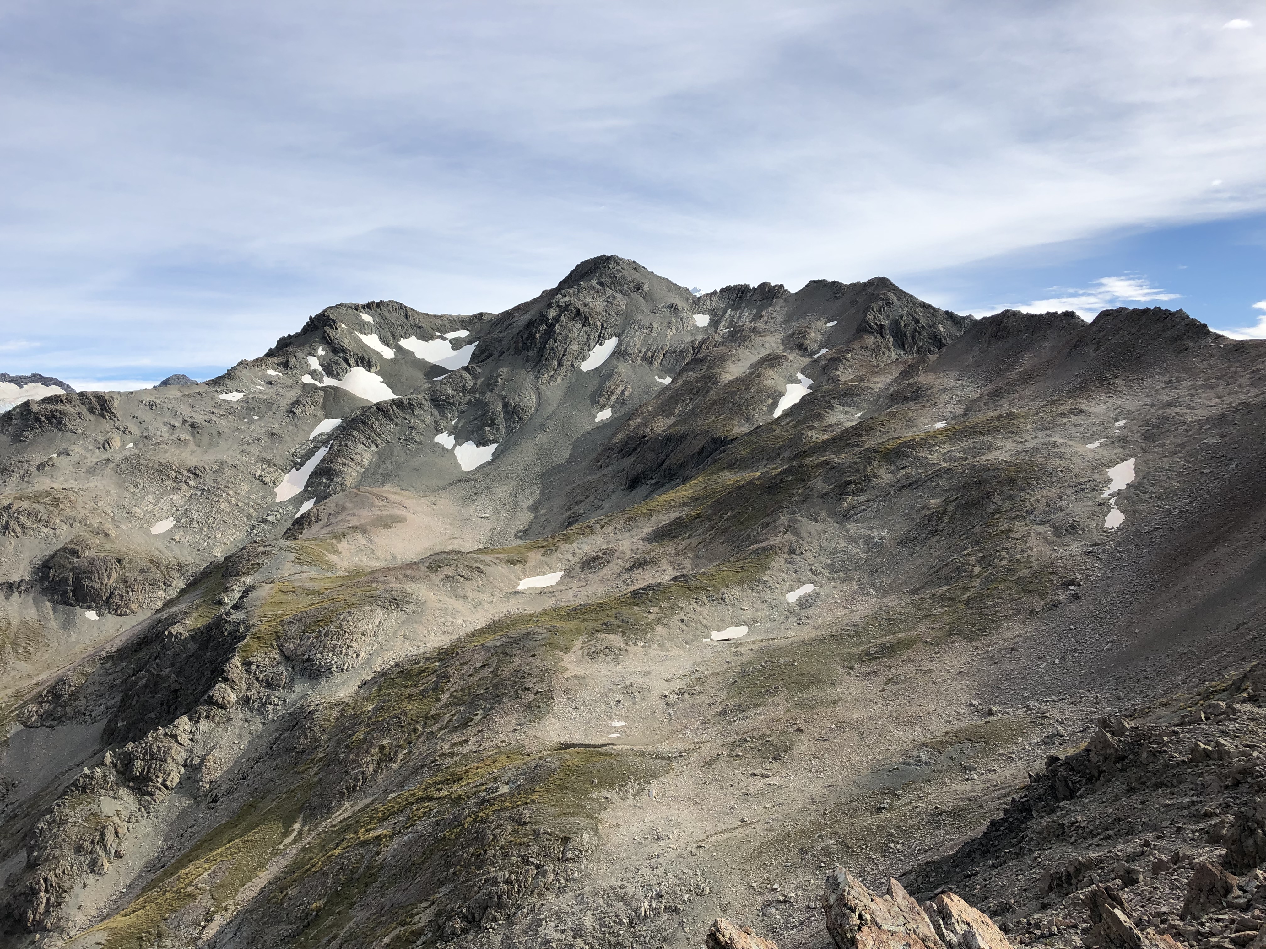
In perfect hind sight – it may have been faster to descend from the 1827m point across the plateau until directly under the lower summit (second from the left in the photo above). We opted not to lose such a drastic amount of elevation and instead toiled along the ridge line. More moderate scrambling along rotten rock and with brief spots of no-fall-zone exposure. Eventually the exposure got to Bri and she decided to call it a day shortly after the 1827m point. She opted to visit the tarn while giving me just over an hour to push on before a turn around time of 12:30pm.
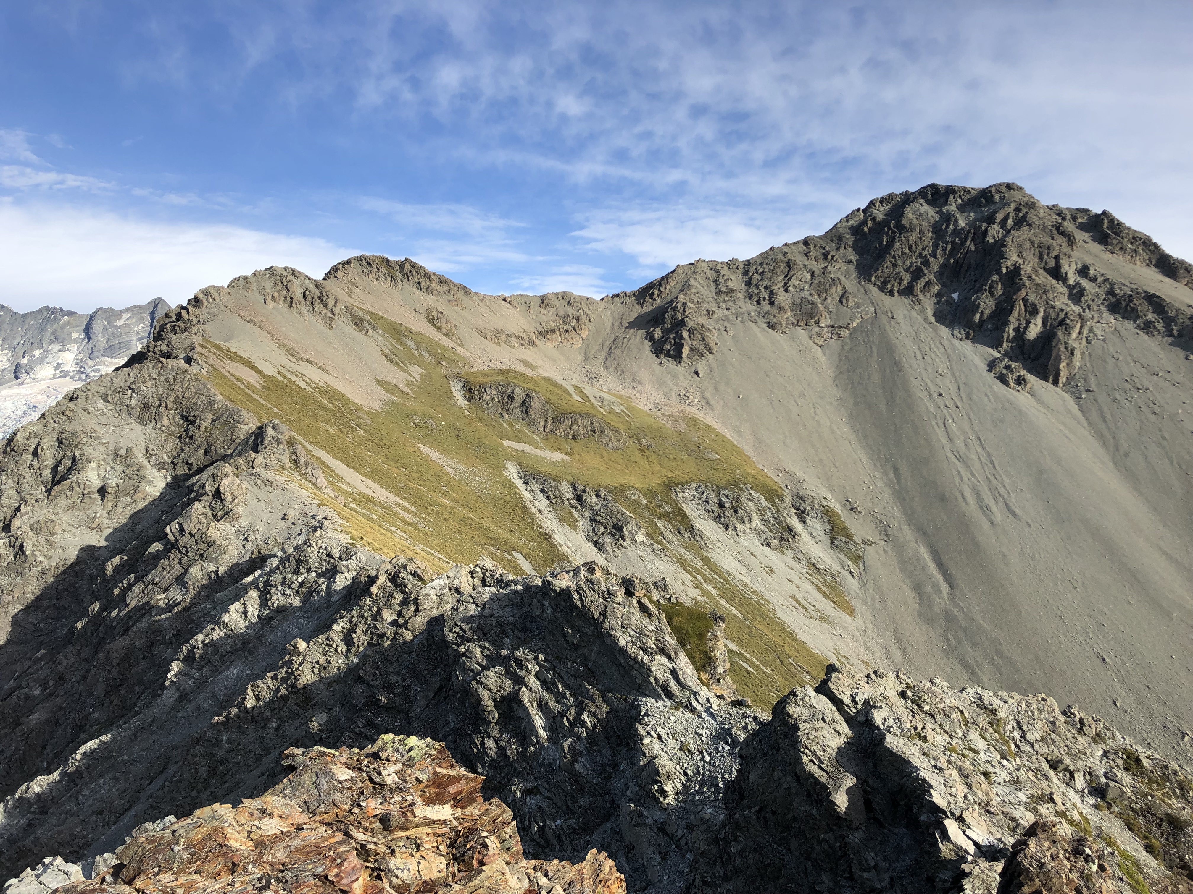
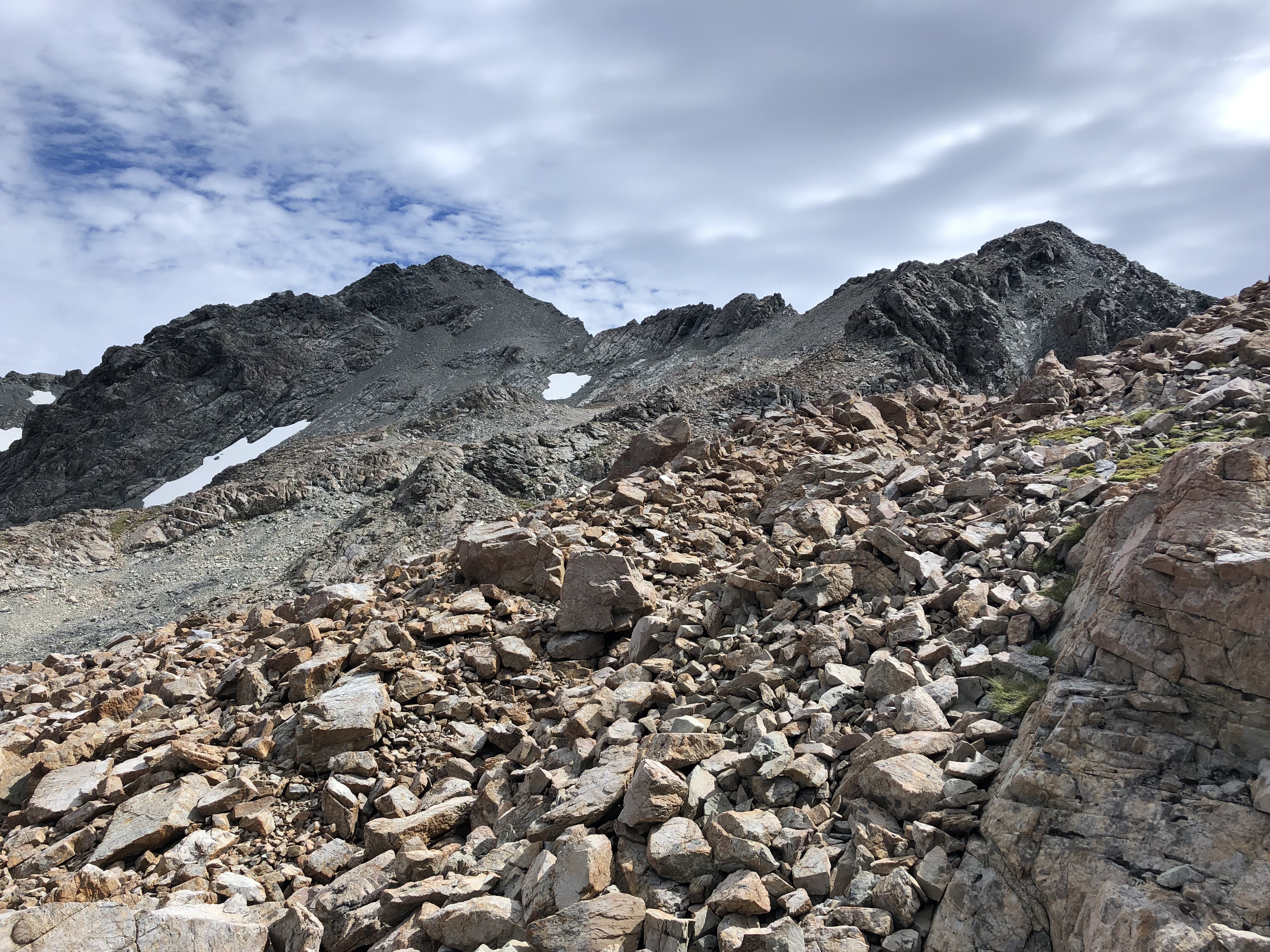
I carried on as a solo ascent past the tarns. I had no idea that what I was aiming for was merely the lower summit of 2012m. The ridge crest leading towards it was not as exposed as the lower sections but the rock quality was horrendous and worsening – everything moved to the touch. At one point I was on the Tasman side and at another point back on the Hooker side. I again ended up side hilling across near two snow patches before picking an obvious slope to slog up. Directly above the latter snow patch required some route finding up downward angled ledges. The slope itself while rotten, was far less exposed compared to the ridge crests.
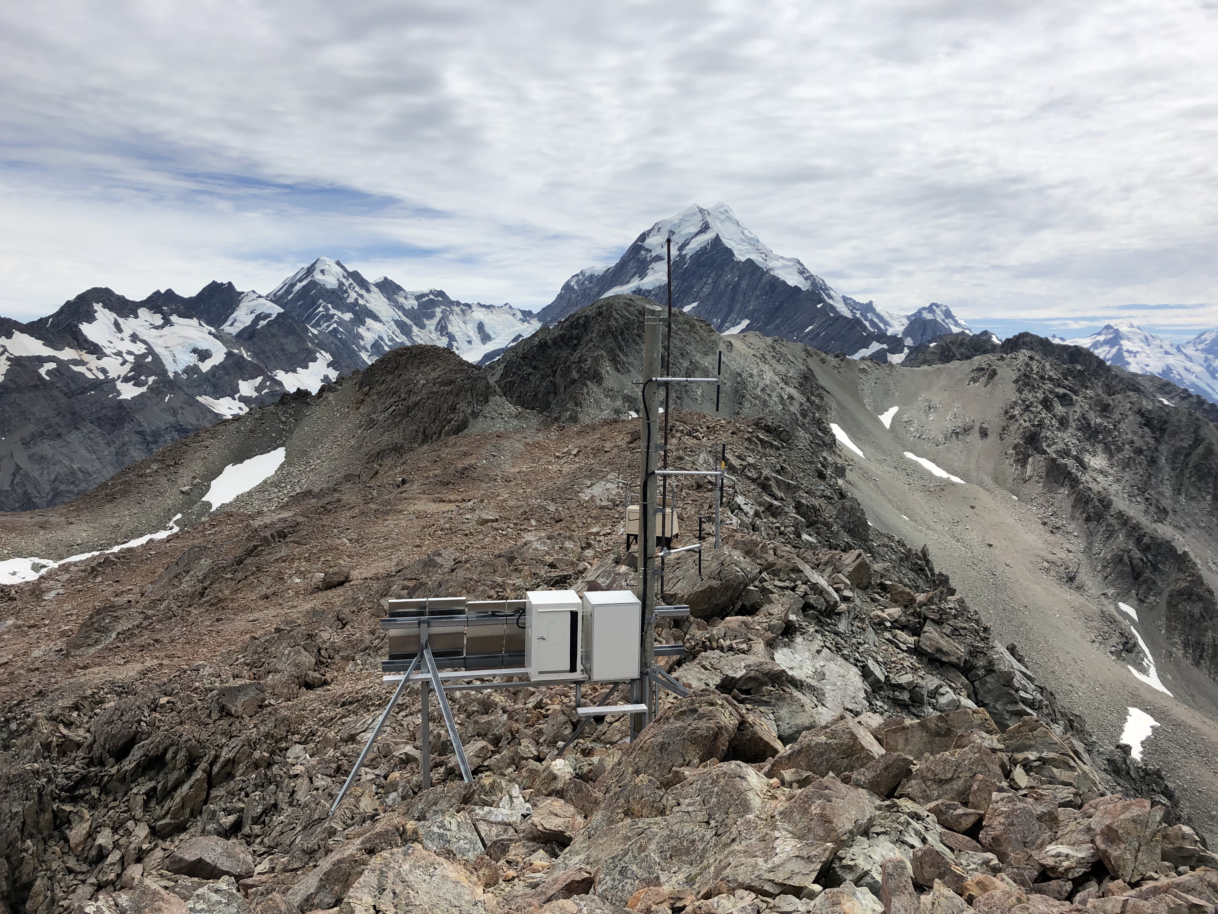
At the top of the lower summit I was greeted by an awesome panorama including Aoraki and some solar panels (presumably satellite receivers) . Next to a cairn was an empty flag pole base, so I assumed this was the summit. A quick elevation check and I was at an approximate height of 2020m (most likely the 2012m point). However after re-examining the ridge I noticed at least two more high points. The first appeared to be a similar height but the second was definitely higher. Most likely the real summit. I was running out of time, and after having wasted 10 minutes taking photos I made a mad dash for this higher summit.
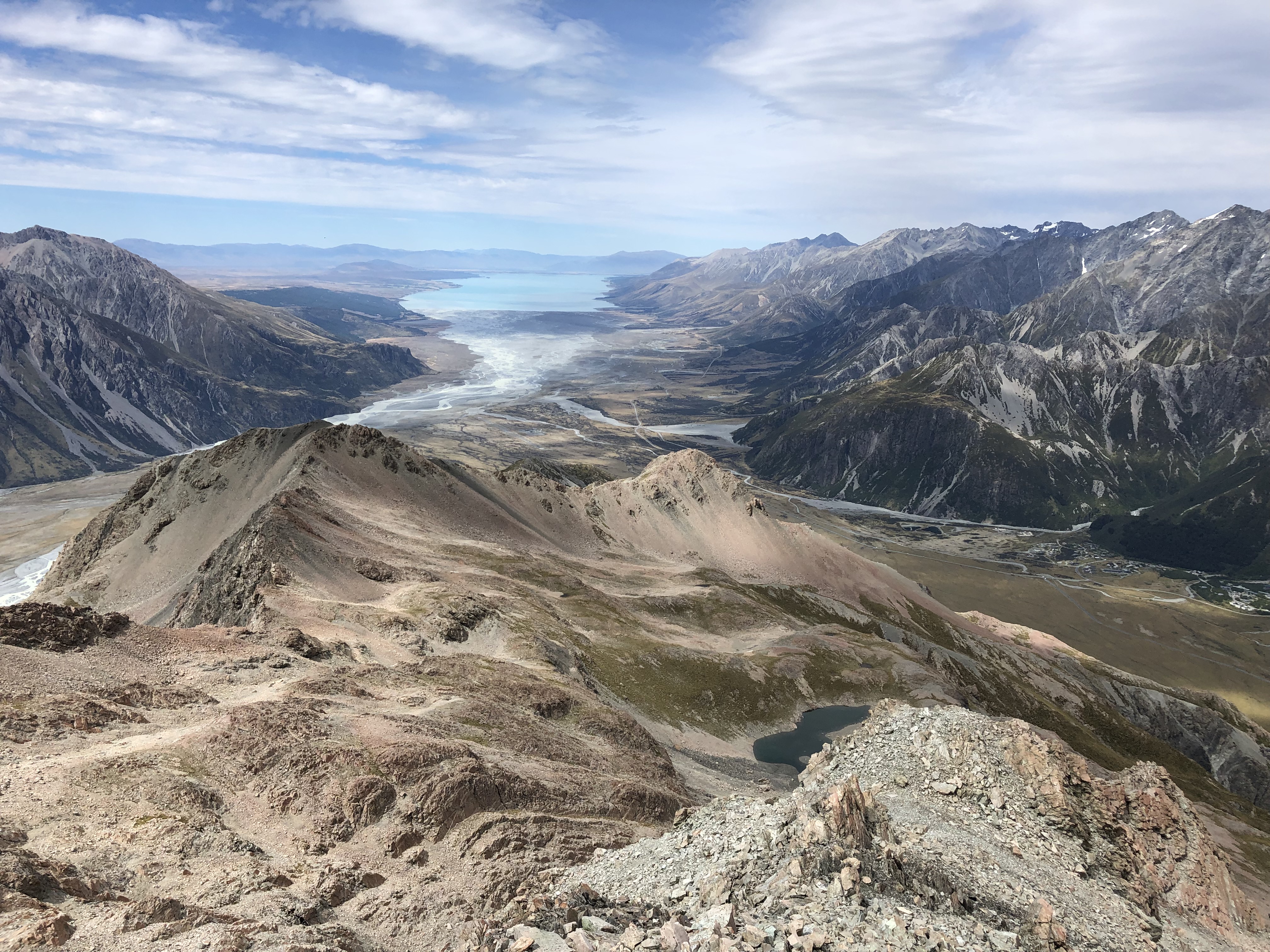
The area behind the solar panel station was quite flat: I was able to run across most of the way over to the next “bump”. This was easy enough but I was down to 15 minutes before the 12:30 turn around time. I skipped on topping out on the “bump” and resumed side hilling across towards a small saddle below true summit. Very quickly I found myself in rotten steep terrain, and felt foolish for not bringing a helmet.
Just above the saddle my phone rang. Bri called to make sure I actually stuck to the turn around time. I check the time Somehow my fifteen minutes had vanished in the steep down climb to the saddle. I glanced ahead at the summit slope across and above me. As close as it was, it would have likely added another 45-60 minutes to an already long day. It was surely tempting, but I refrained and stuck to the turn around time.
So the main summit wasn’t reached. It was still an awesome day, and while a bit more than we bargained for in terms of exposure, it was a really fun scramble. The views alone made it all worth while. Plus topping out on the 2012m peak was rewarding enough.
A few after thoughts worth considering for those looking to scramble up Wakefield:
1) Anticipate 10-12 hours if aiming for the true summit
2) From the 1827m abandon the ridge altogether. Drop into the moraine below but stay above the tarns. Side hill directly across towards the slope of the 2012m peak.
3) If going up in a larger party wear helmets. Numerous areas were composed of rotten loose holds, especially beyond the 1700m point.
4) I drained my 3L bladder pack by the time we returned to the access point. The only place to refill would have been the tarns. Either bring heaps or factor a side trip down to the tarns into your plans
