
July 18th 2018. Lake Louise, Alberta.
Round Trip: 8 Hours. Elevation Gain: 1350m
Difficult Scramble
Mount Whyte is one of the many majestic peaks immediately around Lake Louise. It’s summit can be seen from Lake Agnes, which also is the access point for the route. For full route details, please refer to Kane’s (2016) Scrambles. The scramble up from Lake Agnes to the Niblock-Whyte Col is mostly a moderate venture. However the scramble up from the col to Whyte fits the classic definition of a Difficult Scramble: sustained route finding, fatal no-fall zones, and limited holds. Not recommended for novice scramblers.
I teamed up with Scott for this trip, which was actually a back-up trip. Earlier that morning (2am) we had attempted trekking up Lake O’Hara Road to access Cathedral Mountain. Between the pouring rain and bush whacking, we bailed on our Cathedral efforts around 4:30am. Having returned to Lake Louise around 6am we still had enough time for a full day mission and opted to try Mount Whyte. I had previously been turned back from Mt. Whyte by stormy weather in 2016 while up on Mt Niblock with Blake McIntyre.
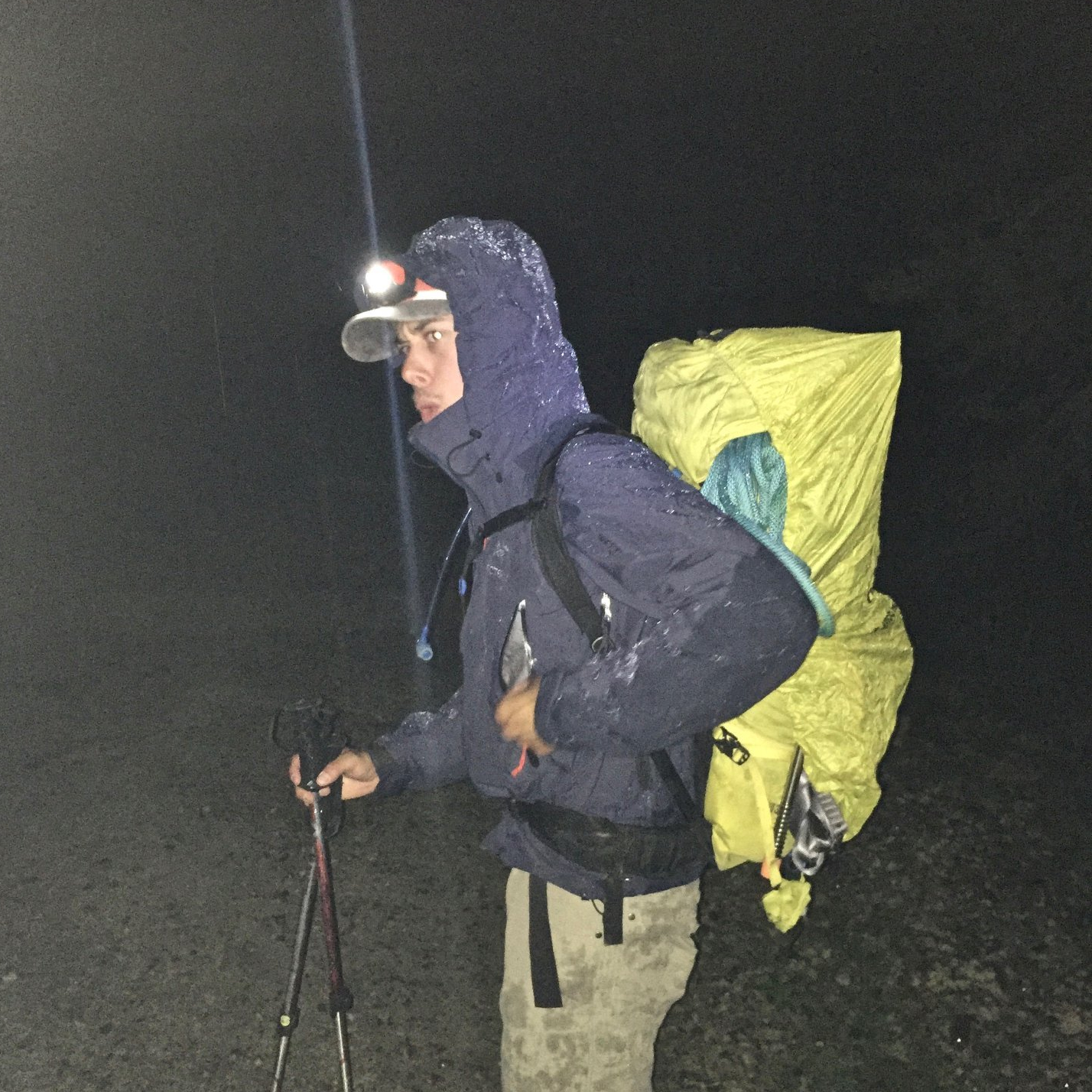
To top things off, I had the misfortune of dropping my Iphone off Mount Whyte’s summit block. I had just taken it out of my pack for the first time all day to get a video-pano from Whyte’s summit. When placing the phone into my chest pocket I missed the pocket seam and the phone slid out of my hand, bounced off the ridge, and toppled over 1000m down towards the Divide Glacier. Luckily Scott had his GoPro on him that day and kindly shared his photos with me for constructing this trip report.
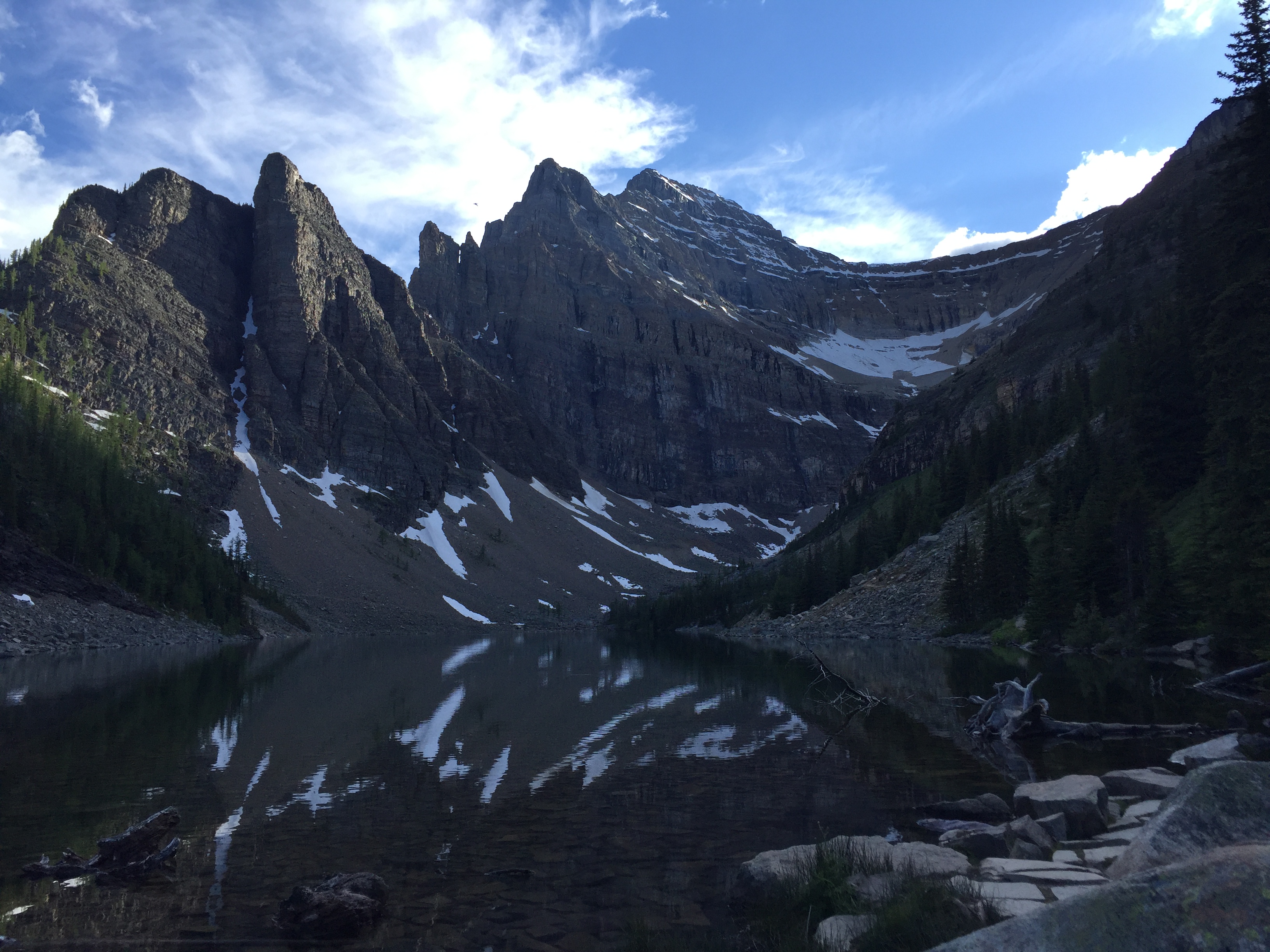
Given our late start we wasted no time taking in the scenery of Lake Louise. Already at an early hour the first horde of tourists had begun trickling to Lake Louise. Scott and I blasted up to Lake Agnes without stopping and soon were at the back of Lake Agnes.
From behind Lake Agnes a faint but well cairned trail branches off from the Big Beehive trail. This trail then works it way up two large bowls and a series of ledges leading up to the col between Mount Niblock and Mount Whyte. The initial set of ledges above Agnes follows up to the climber’s right of a small waterfall (moderate scrambling). The remainder of the ascent to the Col is a mix of easy/moderate scrambling.
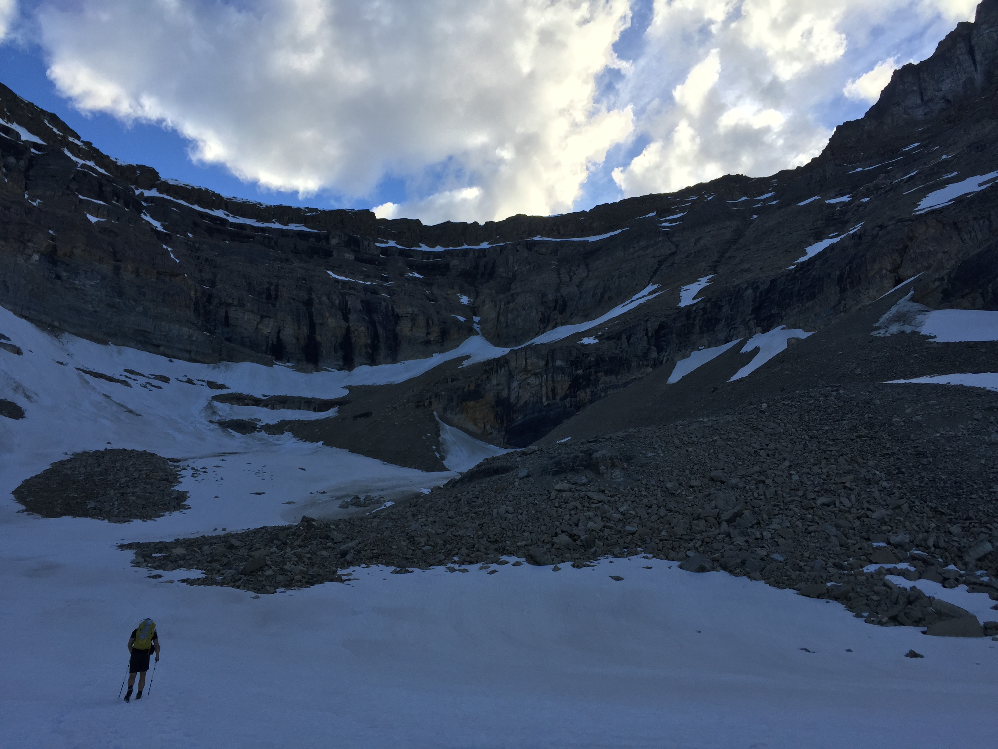
Although it had been two years since I had last scrambled up Mount Niblock, the route up was quite familiar. It appeared to be well traveled last summer and more worn in. Scott and I were also both breaking in a new pair of Lowa mountaineering boots. While a bit overkill for the scramble to the col, they sure came in handy further up on Mount Whyte. From the Col we could see the entire route up Mount Whyte before us. We took a short break and enjoyed the views knowing that this was the end of the easy parts.
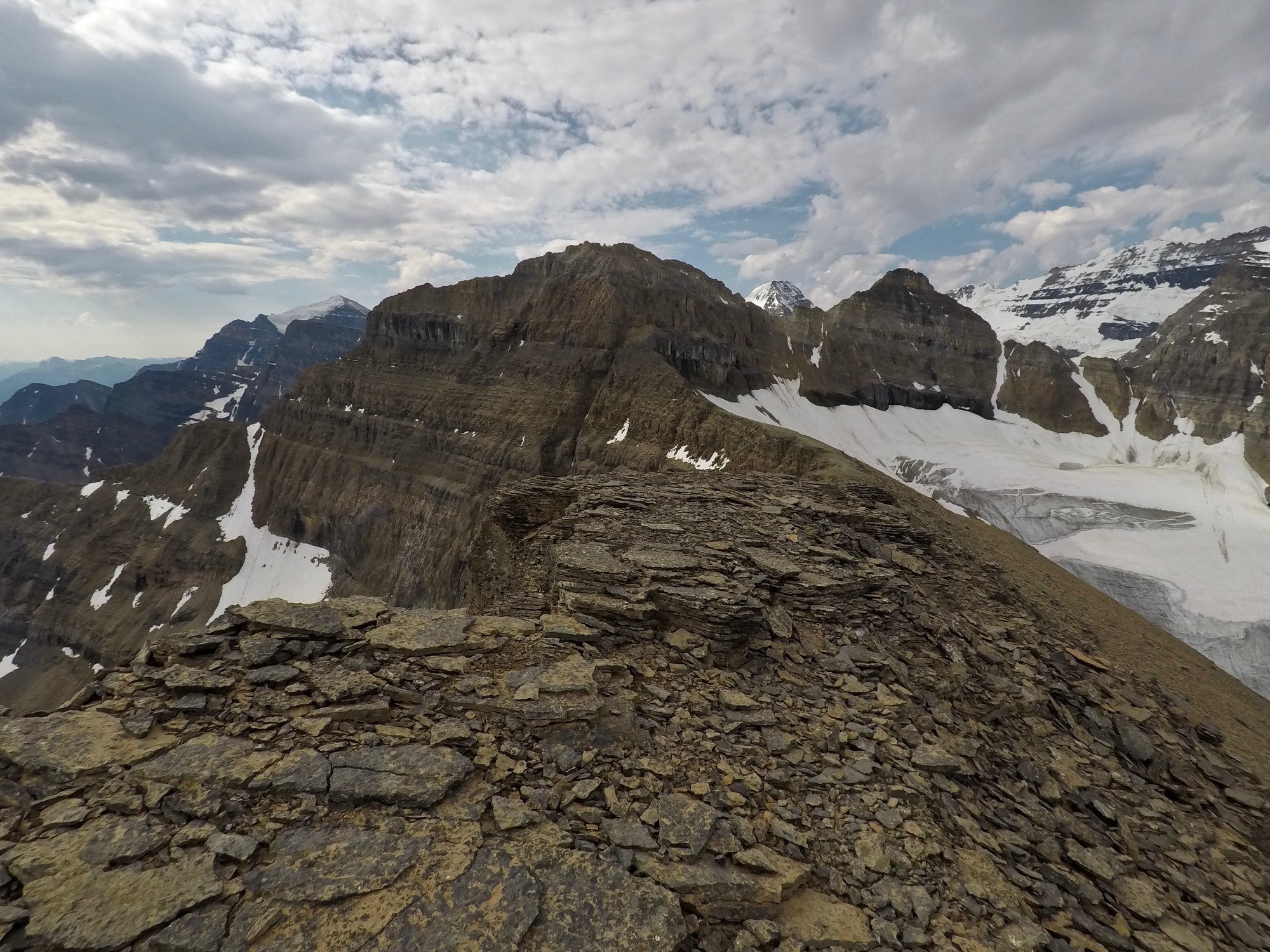
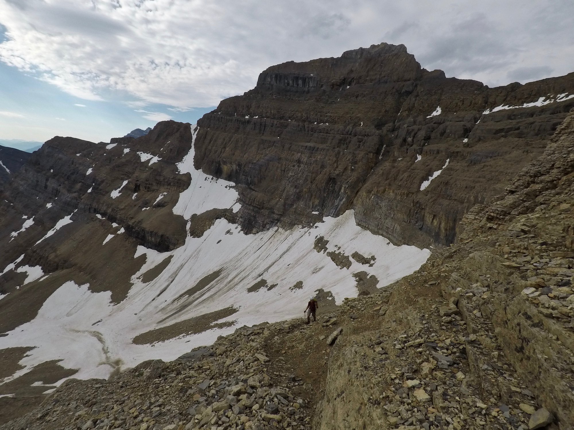
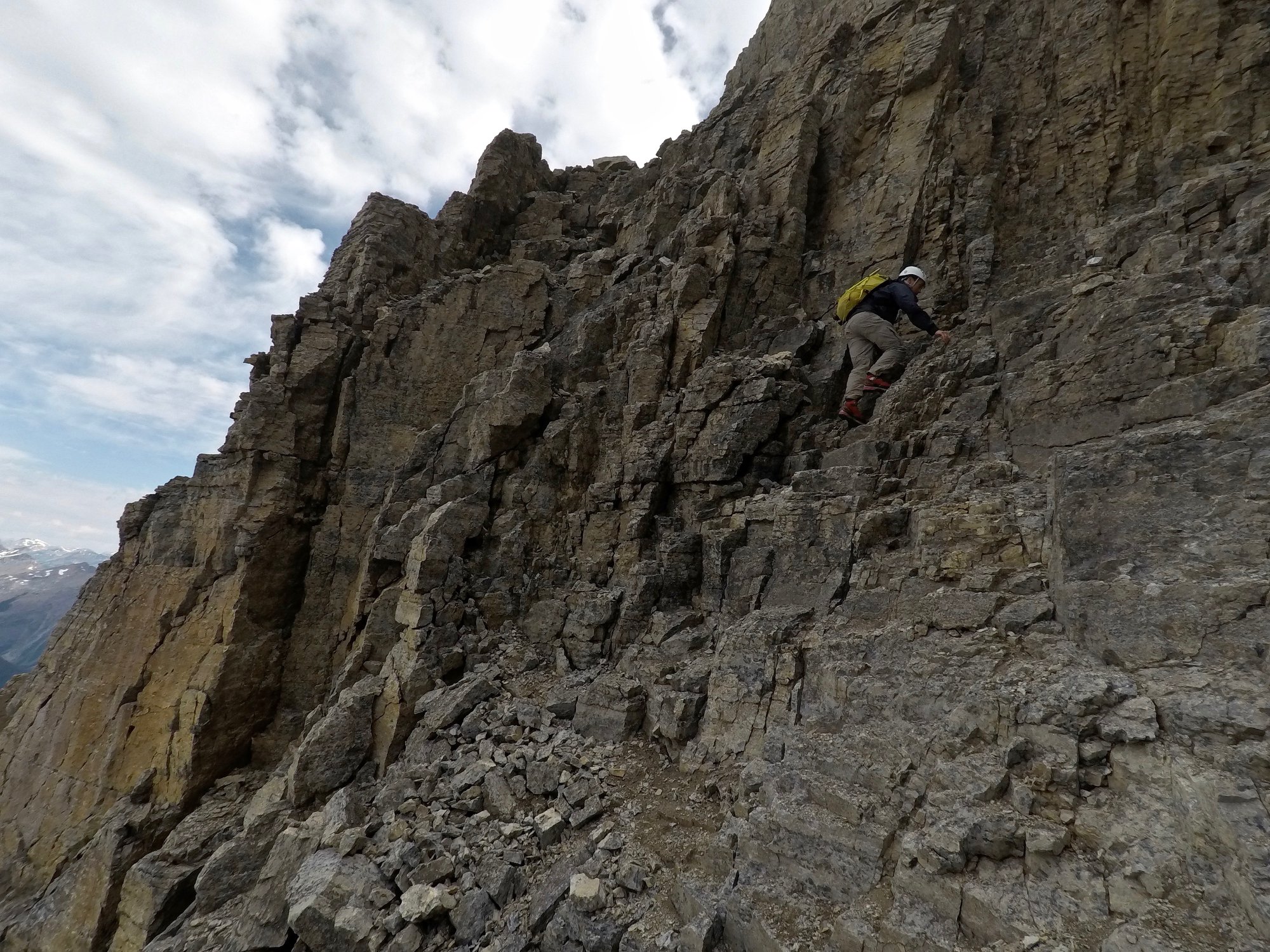
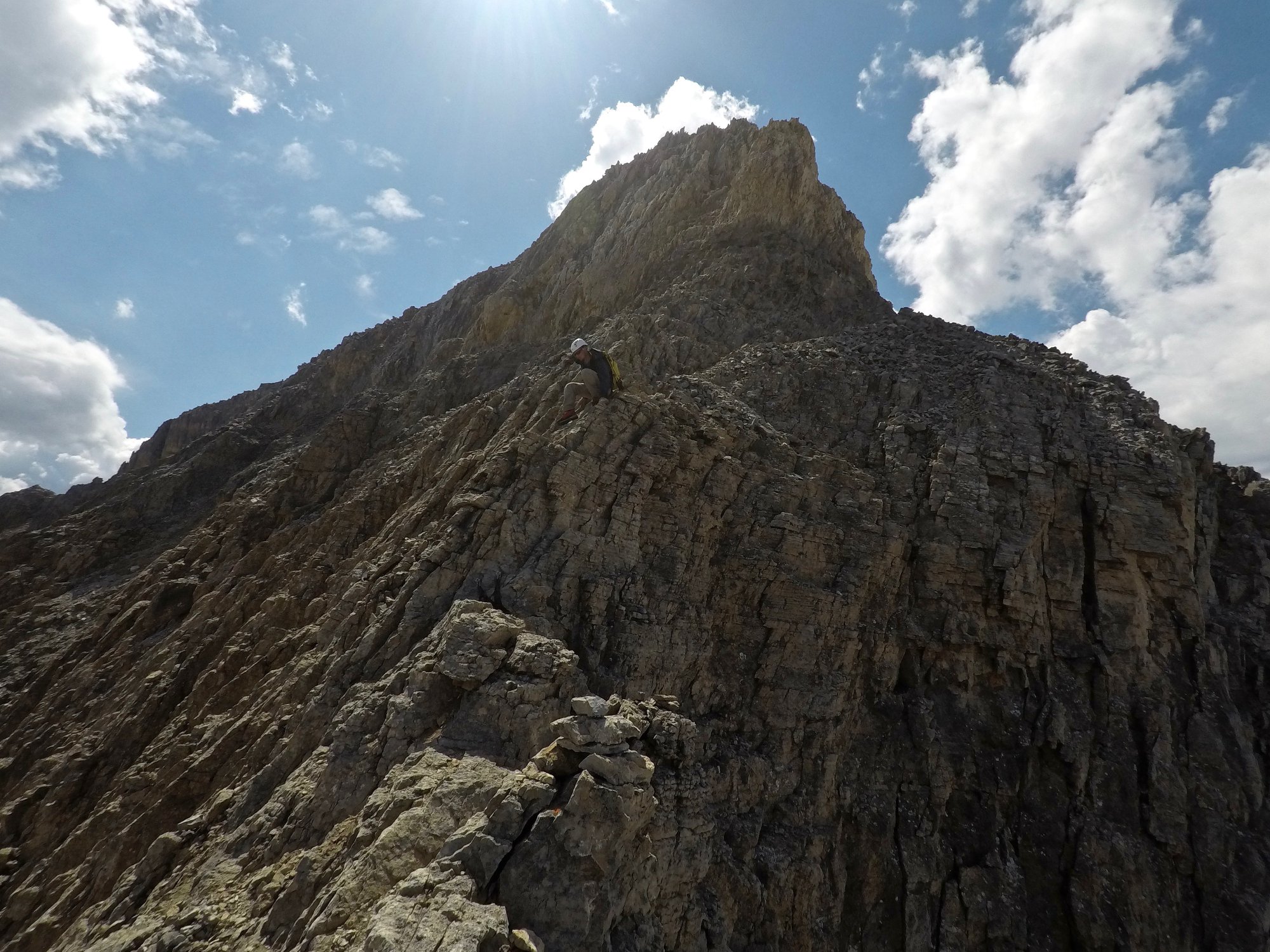
The scramble up Whyte is sustained in Difficulty and requires sufficient route finding skills. As warned by Kane, the route is littered with cairns indicating incorrect routes from other scramblers. We had no troubles with the route up in terms of staying on route. The exposure is sustained the whole way up, the areas on the Lake Agnes side being particularly exposed. The gully Kane warns about is especially exposed given the downward angled rock in that area.
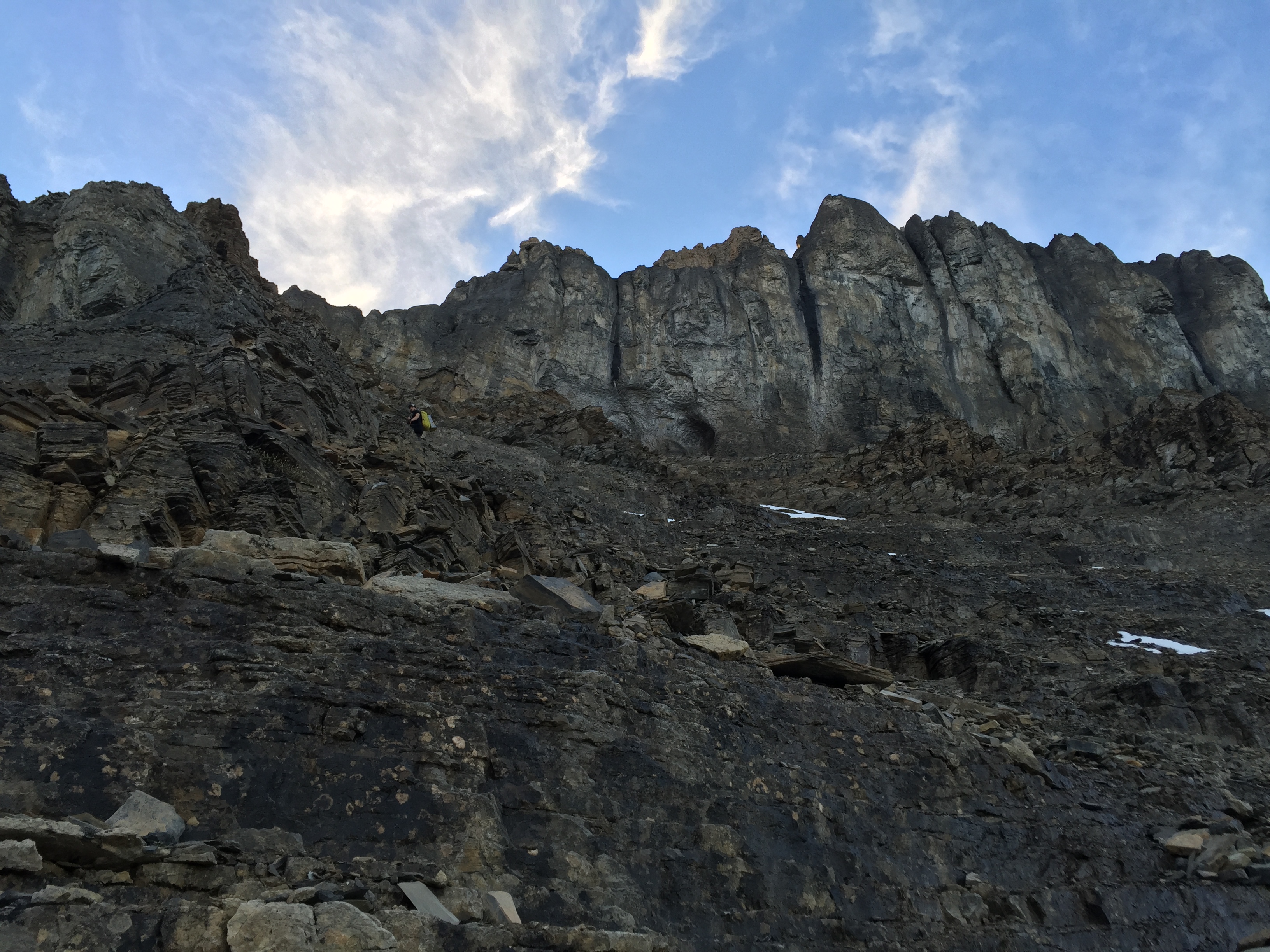
There is one area above the gully where one has to venture slightly right before continuing upwards again. While expossed, we found this particular area (on the Divide Glacier side) to be the most challenging spot for route finding. We managed to deviate off route through here on the way down which made things quite spicy!
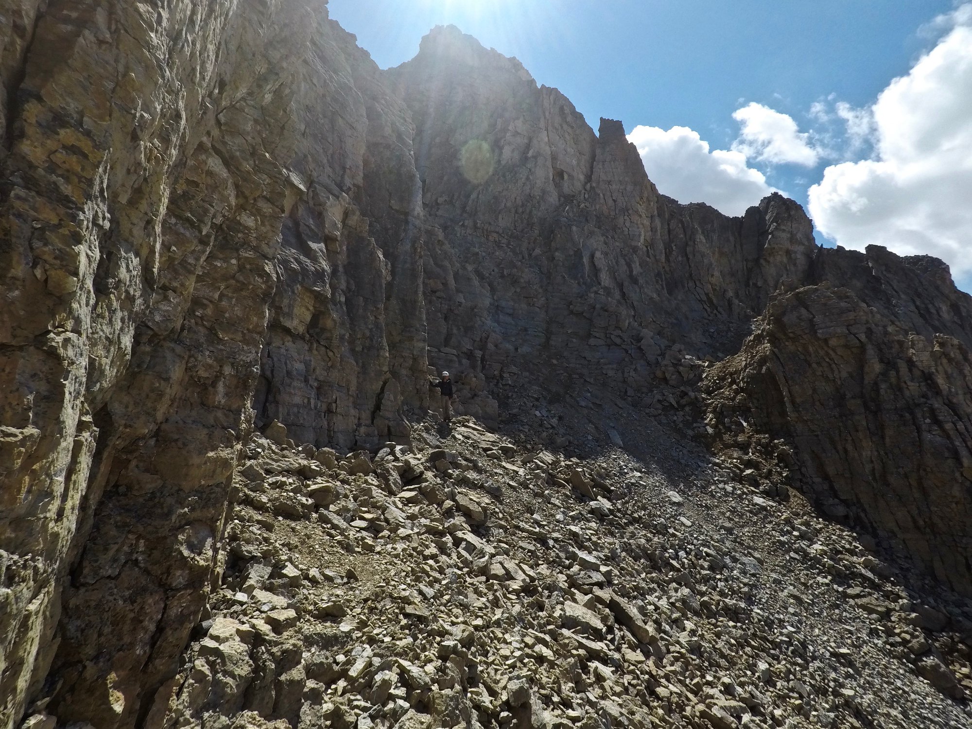
Once up and out of this grey rock area we found ourselves on a crumbly and narrow ridge. This leads to the summit block, which involves side cliffing around before accessing a weakness to scramble further up.There is a bolted anchor station along the ridge section before the side cliff part starts. Clearly some have felt the need for a rope likely on descent. We could see why as the climb back down from the summit was pretty nerve wracking, however the route finding was much easier on return!
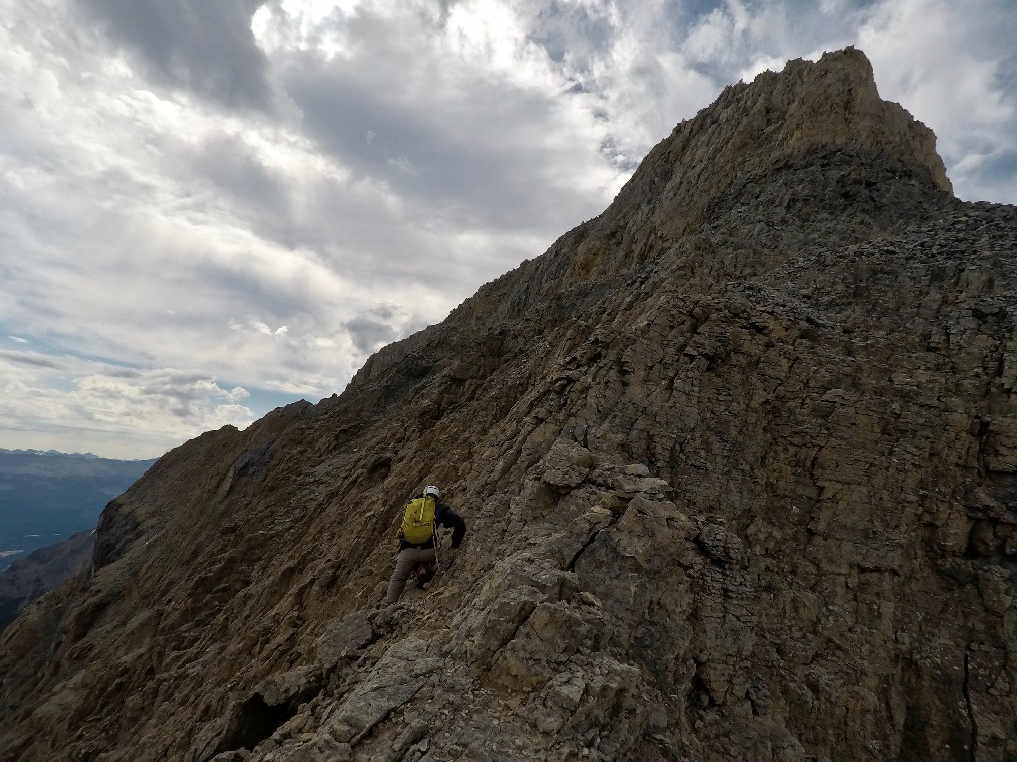
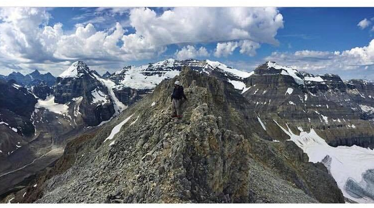
The summit itself is little more than a narrow ridge. The loss of my phone demonstrated exactly how exposed this mountain and its summit truly – as mentioned it tumbled over a 1000m vertically down towards the Divide Glacier. It was a very frustrating moment to have lost that phone but as Scott pointed out – “thank f*** it was just the phone that fell!”
The grey rock area was a bit messy on return. Its quite rotten here compared to the rest of the mountain and we struggled to stay on route. A friend of ours nearly got cliffed out in the same section a week later. Fortunately he was okay and climbed safely back up to the correct route, returning home in one piece. We managed to stay on route the rest of the way down. The other area of significant exposure was the gully again that Kane warns about in Scrambles. On descent we found that staying far to the skier’s left / climber’s right kept us away from the most exposed spots, though footing was notably poor. Once away from the gully things eased up and before we knew it we were back at the Col.
Sure enough just as it had two years previously, a rouge storm blew in as we begun our descent from the col. We had to make a dash back down to Lake Agnes as it was thundering loudly and hailing enough that we kept our helmets on all the way to the tea house. What a day!
After Thoughts: Mount Whyte is a serious scramble. Having now done both Mount Whyte and Mount Niblock I’d say do both in the same trip, but do Whyte first. Niblock is considerably easier and you will want the extra strength/energy for scrambling up Whyte. Wait for snow free conditions to do Mount Whyte. Also be careful of which cairns you follow, while most mark the correct way there are definitely outliers that get put up by semi-lost scramblers.
