July 21st, 2022. Lake O’Hara // Yoho National Park
Round Trip: 12.5 hours; Elevation Gain: 1150m (summit not obtained)
Moderate Scramble with long approach; bushwhacking and route finding
Further Reading: Scrambles in the Canadian Rockies 3rd Edition (2016) Alan Kane
We grossly underestimated the effort needed for this one. Despite it being the third week of July, this was actually our first real summit effort of the season given the extremely late lingering snowpack in 2022, and ultimately it proved a poor choice as a season opening scramble. A very long approach from the Lake O’Hara carpark paired with bushwhacking and sustained route finding made for an extensive day. Kane’s (2016) estimate of 6-10 hours seems understated, I would predict that even fit parties would want to allow minimum 8 hours for this venture. We also made the mistake of dragging a first-time scrambler up this route, in hindsight the likes of Paget Peak would have been much more first-timer friendly. All-in-all, this trip took us by surprise by length and difficulty, and we did not have the time nor energy to reach the true summit, turning back approximately two false summits early.
At 2974m Narao Peak sits near the continental divide and near the Yoho and Banff National Park boarders, and is accessed via the Lake O’Hara Road parking lot. There are two ways of approach, we went with the Ross Lake approach as to follow along foot trails instead of the hard packed road. In hind sight, there is a lot of hind sight from this trip, I believe the road approach would have been more direct and would have involved less bushwhacking versus the route we took.
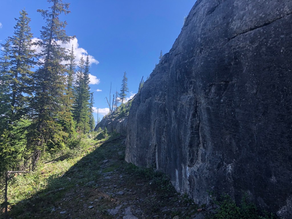
From the parking lot you follow the trail first to Sink Lake, followed by the Ross Lake Trail. Just before Ross Lake, the trail forks left (west) back towards the Lake O’Hara Road. We followed this and noted the steep cliff face at the back of Ross Lake that undercuts the start of Narao’s long ridgeline. Once past this steep feature we took a little while agreeing on what the most direct line up would be: we did not want to too far west as the map showed a thicker forested section and thus more bushwhacking, nor did we want to start too early east and risk encountering the steep cliff face.
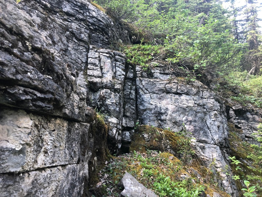
Our line was likely shy of 1km west of Ross Lake, and we failed to see any flagging tape whatsoever. It wasn’t until we were an hour into the uphill bush-thrash that would see faint traces of past travel, including a discarded pack at the base of one of the scramble bits. We encountered a few cliff bands that while easy to navigate, often meant traversing to pick an easy scramble route.
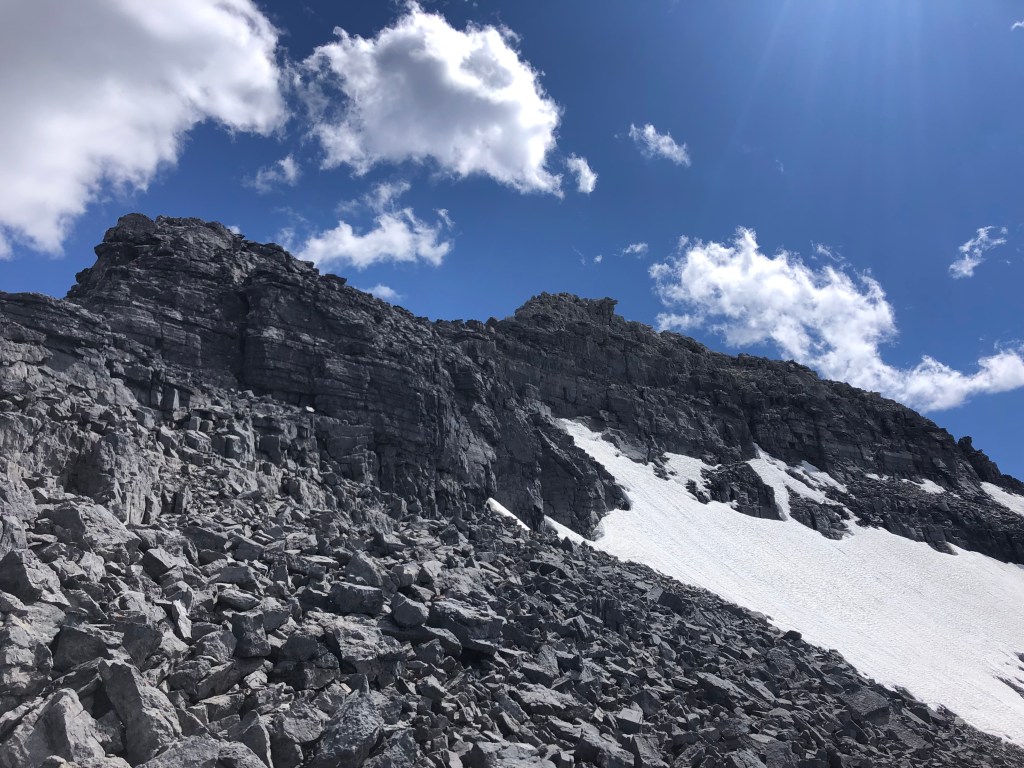
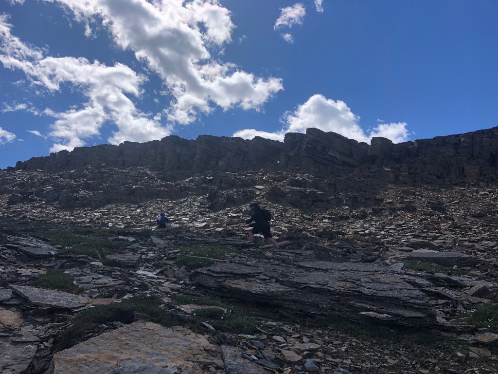
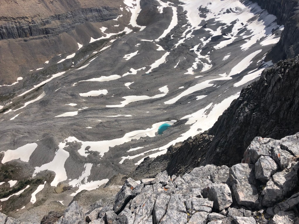
Once above the trees things briefly became easier as we were reprieved to no longer be bush whacking. The ridge crest while more direct looked a little daunting so we initially opted to side traverse under the ridge following up and across the talus slopes. While technically easier, it made for a slog and eventually this route hooked us back onto the ridge anyway. We likely sidled the first kilometer before truly scrambling up to the ridge crest and this proved to be very time consuming. If viewing the ridge on the Gem Trek topographical map of the area, just south of Narao Lakes latitude there is a thin section of slide path that juts out 250m or so wester than the rest of Narao Peak’s alpine lines; this was quite visible to us from where we had sidled the western slope and was our landmark for where we crested the ridgeline. Sadly, I was not in trip-writing mode that day and failed to take adequate photos of said landmarker.
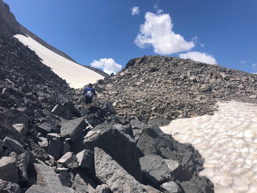
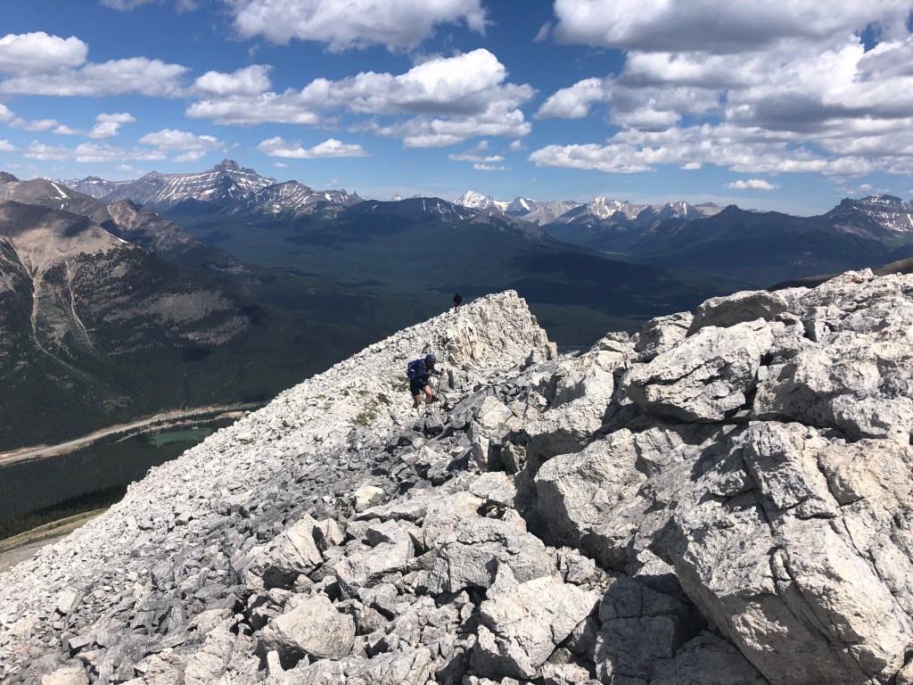
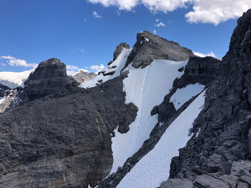
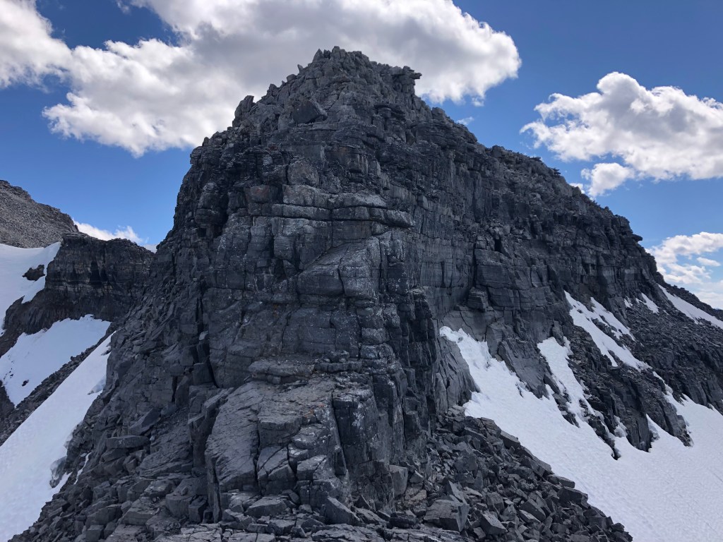
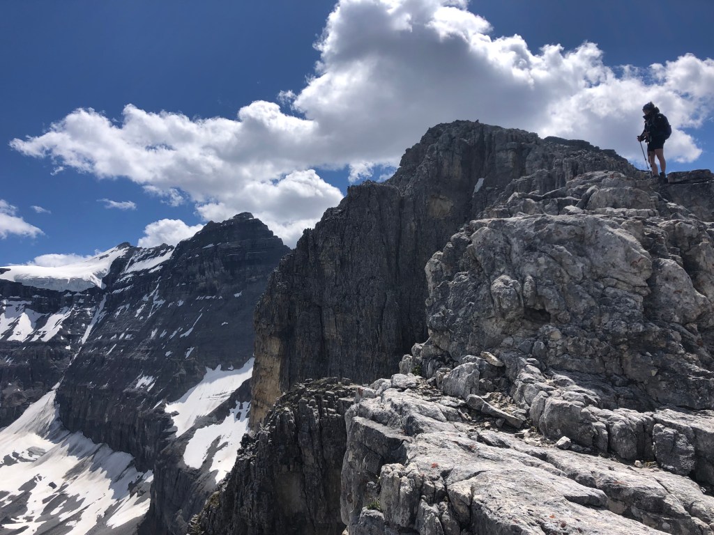
By the time we had abandoned the lower slopes in favor of the ridge crest, it was nearly 2pm and 2 hours since we had broken tree line. Unknown to us at the time was that we still had half the ridge to traverse if we were to reach the summit proper, and the real scrambling had only just begun. The scrambling itself was mostly moderate, though the east side of the ridge posed a decent amount of exposure. Any time we felt too exposed, we would briefly detour west back towards the slope and pick away at the ridge’s scrambling when feasible. Notably, after scrambling up the first of what turned out to be several false summits, we had to detour west under the ridge again finding our away along a series of narrow ledges. This was one of the few areas that was actually quite well marked out with cairns, though it did take some concentration to pick out which ones were false leads and which lead the path of least resistance.
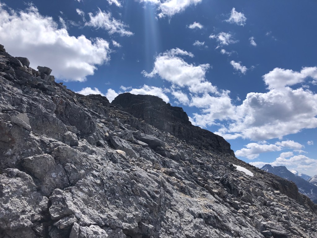
By our third false summit, it was already 3:15pm and that should have been our turn around time (again power of hindsight), we decided to push another 30 minutes but were deflated when we realized we still had another 2 false summits to surpass before reaching the real deal. We had started out from Golden that morning and needed to drive back through the construction at Kicking Hose Pass before the nightly closure at 10pm. We opted for an additional 30 minutes as we had been tucked in on the west side of the ridge again and misjudged how close we were to the summit, but instead ended up scrambling yet another false one. I imagine we still had another 45-60 minutes round trip had we continued the push forward, and no one was for it. Myself included.
This is twice now in the Lake O’Hara area that we’ve set off for a scramble that has ended up being much more demanding than anticipated. The South Peak of Mount Yukness similarly thwarted Bri and I in 2018, having turned back probably half an hour from the summit proper. Just like with Narao, Yukness proved to be longer than expected and its ridgeline of false summits felt never ending.
In backing away from Narao at 3:45pm, it still ended up taking us six hours to return to the car. We had debated about following the slide path down to Lake O’Hara Road and then following the road out (approx. 4km of road walking) but decided against it, and opted to return the way we came. We descended the ridge crest via the slope down to tree line and were able follow the edge of tree line south to where we had emerged from earlier in the day. I had left a series of orange flagging tape during our morning bush thrash which made navigating marginally easier on the return trip. Yet despite the short cut and flagged route down through the trees, we still took too long and missed our chance to drive directly home. Instead we had to drive the long way through Kootenay and Radium.
Adding insult to injury, the kitchens in Lake Louise were long closed by the time we stopped in for gas; and due to a power outage earlier in the day they were only accepted cash as their internet had not been restored. It was a very long drive home fueled by energy drinks and jerky. Needless to say, not our grandest outing and it took a few easier hikes before any of us had the itch to scramble again.