July 3rd 2025. Icefields Parkway, AB
Round Trip: 8.5 Hours, Elevation Gain: 1200m
Moderate Scramble
This was Bri and I’s redemption trip from 2024’s unsuccessful attempt at Noseeum’s difficult route and instead bagged Bearskin Peak (Noseeum 3). It ended up being our first 3000m peak of the season, and conveniently its height in More Scrambles is listed at exactly 3000m. Going up the moderate route was much easier than what we had encountered the previous trip and navigating much easier thanks to all the photos we took in 2024. Plus, we had refreshed ourselves on the description from More Scrambles. Nathan, who essentially led the large group up Copper Mountain on our previous outing, was the only one who joined us for this trip.
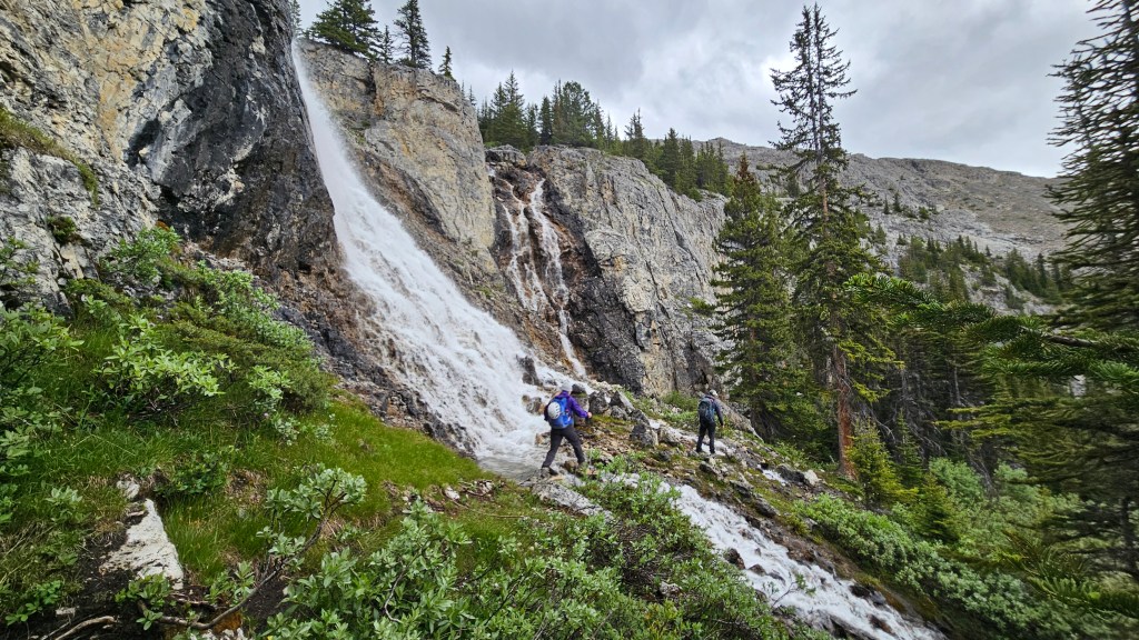
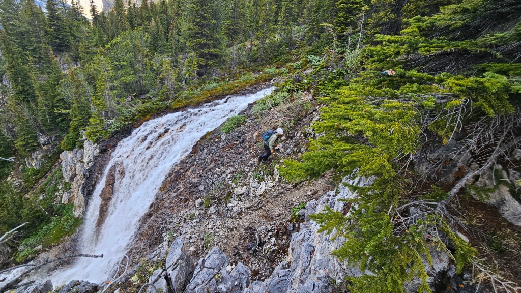
Retracing our steps from 2024, the three us set out at 6:30am making a fast hike along Noseeum Creek to the waterfalls at the headwall. This time around we aimed somewhere between the main middle waterfall and smaller one to the looker’s right (east), scrambling up a brief set of moderate ledges. Had we snooped around a few metres further to the left we would have noticed a well beaten footpath with minimal scrambling. Oh well, sometimes its more fun to go the adventure route!
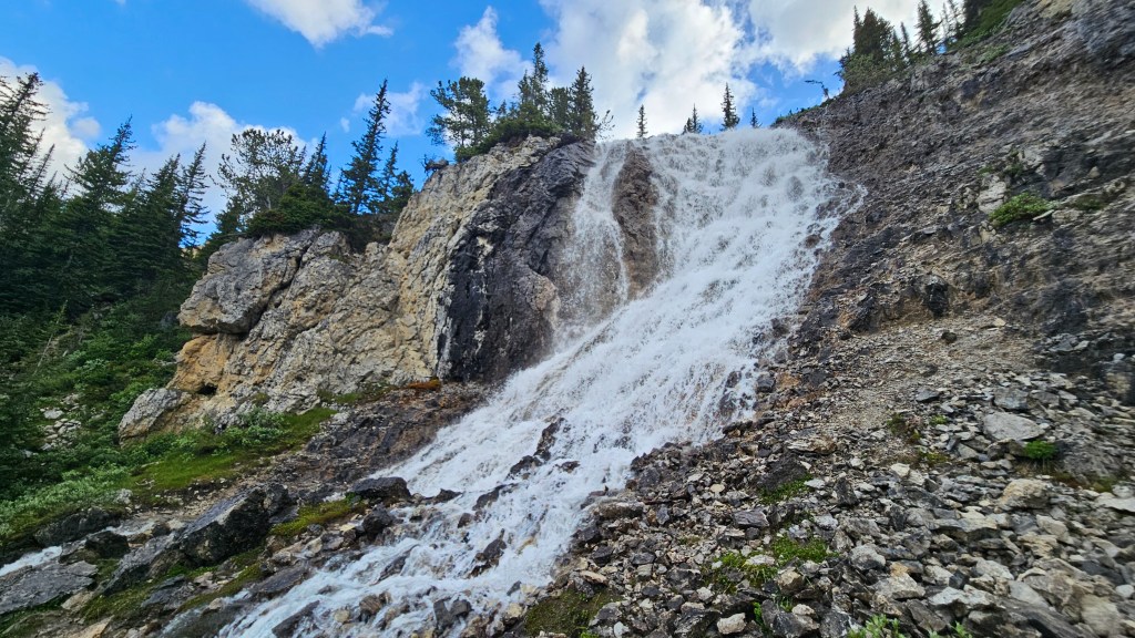
I had saved the GPS track on my Garmin watch from the 2024 trip to Bearskin Peak which shares the same approach, so we continued upwards along that route for another 20 minutes to the second, Upper Waterfall. There are several well-travelled paths weaving through these treed sections, best advice is to pick the most obvious one and ensure it’s gaining you up hill. The trail does briefly overlap with a small creek, I left some flagging here and later noticed that there were several cairns, so the way should be somewhat obvious. At the second waterfall, we scrambled up the climber’s right side just as we had the previous year, though as noted from 2024 you can hike a little ways further to the climber’s left (west) and bushwhack up a broken cliff face (easy scramble) that offers more protection should you find the waterfall in high flow.
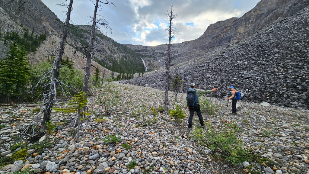
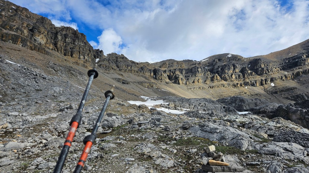
Above the second waterfall the path continues through the changing eco zones as the forest shrinks into sub-alpine tundra and soon after a second headwall rises above the vegetation. Again, multiple options exist through this section. We positioned ourselves somewhat in the center of the plateau knowing that our scrambling route for the day would be on the northwest side of Noseeum Lake. A notable landmark when looking back from the second headwall is two out-flow creeks that converge just above the second waterfall. The views here are already worth looking back at, and believe or it not they only get better the further in you go. It took us a little over 90 minutes from the car to reach the second headwall.
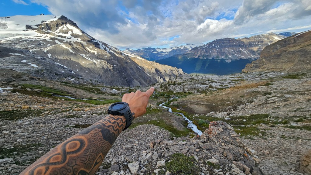

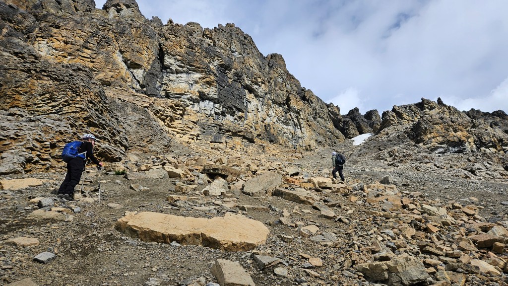
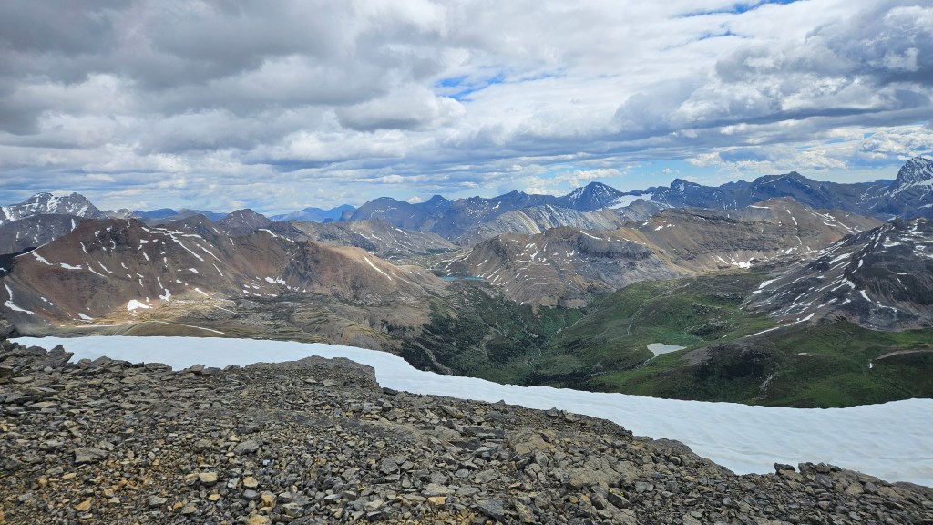
The second headwall from afar looks more intimidating than it actually is. Once at its base, it is little more than a crumbly cliff band that is easy to scramble up through. From up top, you gain your first unobstructed view of Noseeum’s crater-rim-like summits with the namesake lake only a few minutes walk away. We reached the southern edge of the lake at 8:26am and decided to take a decent 20-minute break there before b-lining it for the moderate scrambling route to the lake’s northwest. While the weather was holding, we could some moody dark clouds overhead and I have a history of being chased off Icefields-Parkway summits in stormy weather, so after the breakfast break we maintained a brisk pace.
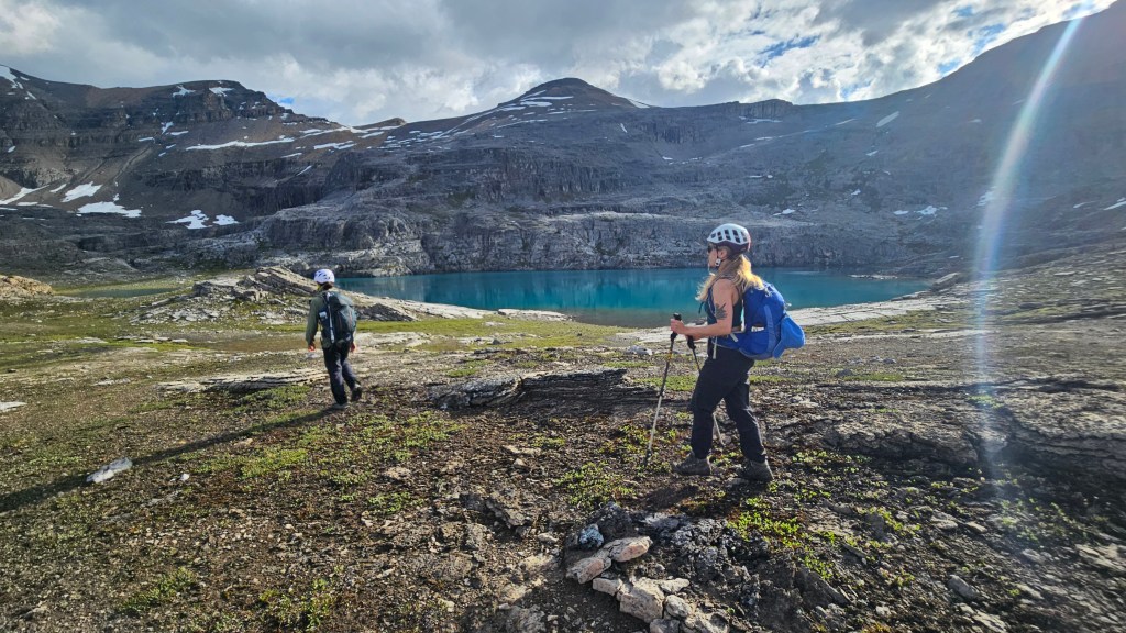
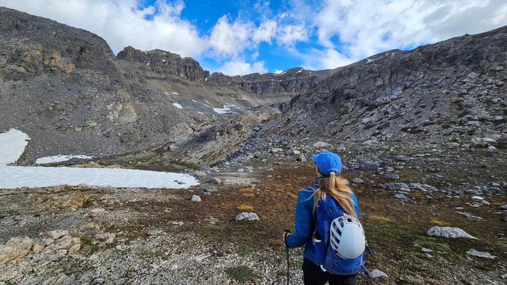
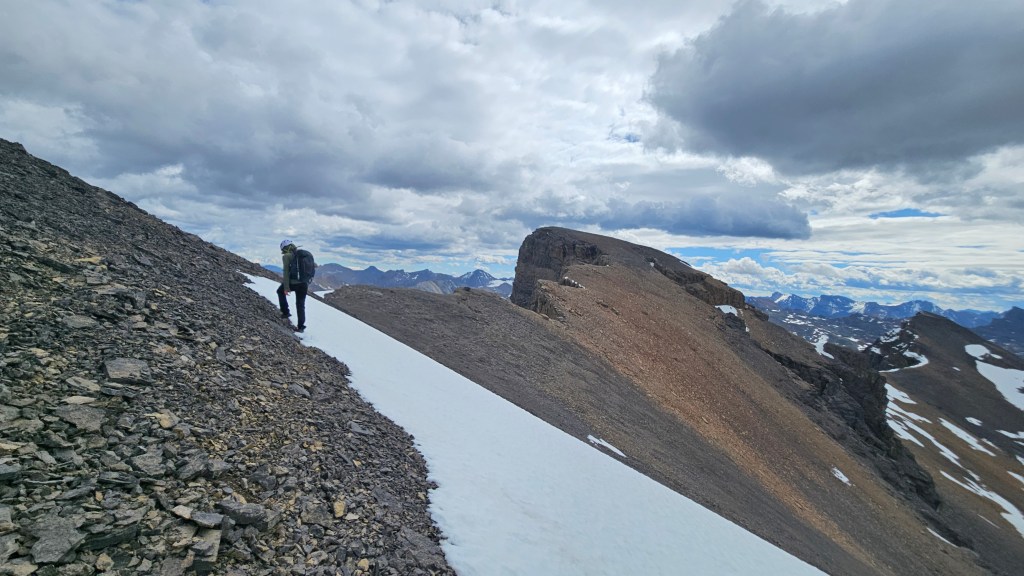
The goal with the moderate route is to aim for a distinct scree-ramp that heads up to the ridgeline. The previous year when traversing above Noseeum Lake, Bri and I misjudged the ramp by taking one gully too far north but had approached from Bearskin Peak (Noseeum 3). From Noseeum Lake, it’s quite obvious where to go and the route from the lake to the ramp is well marked with carins. The landscape between the two is quite “shattered” with cliffside features and moraines, making for some excellent photos along the way. We followed the series of large cairns to the scree ramp with minimal difficulties but occasional elevation loss/regain.
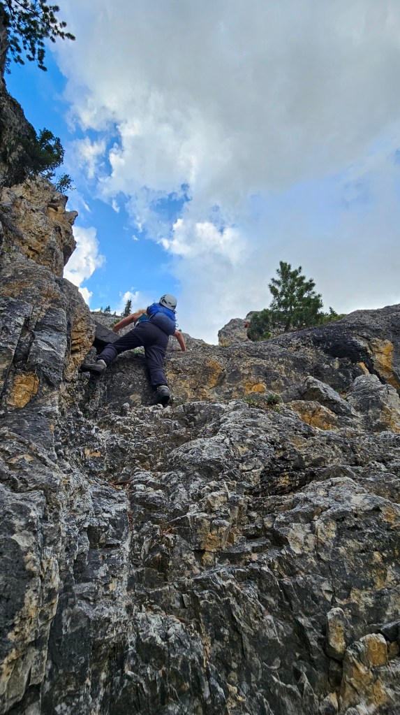
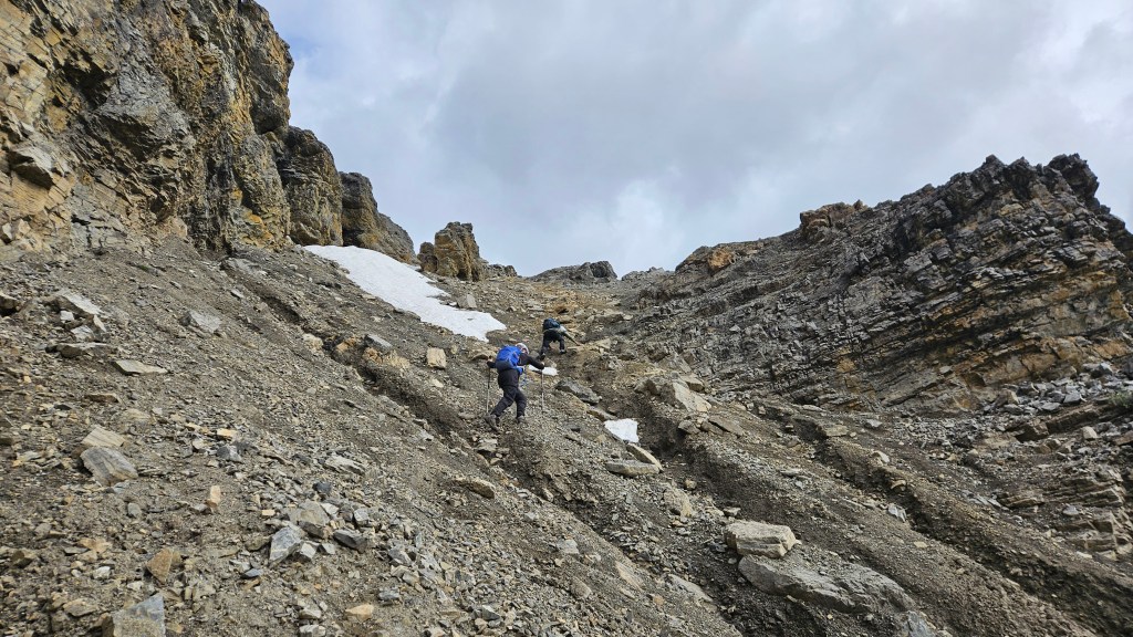
The ramp itself, as warned in Nugara’s (2017) description, is a tedious treadmilling effort to scramble up but is nontechnical. Hiking poles certainly came in handy, and the rock was loose enough that we had donned helmets for this section. The initial ramp was mostly talus, though near the snow patch the ramp shifts slightly to the climber’s right becoming much steeper and grainier. We briefly got hands-on plodding up this higher section of the ramp before intercepting the ridge crest. From the bottom of the first section, it took us around 25-30 minutes to reach the ridge and were immediately greeted by +40km/hr winds with a biting wind chill.
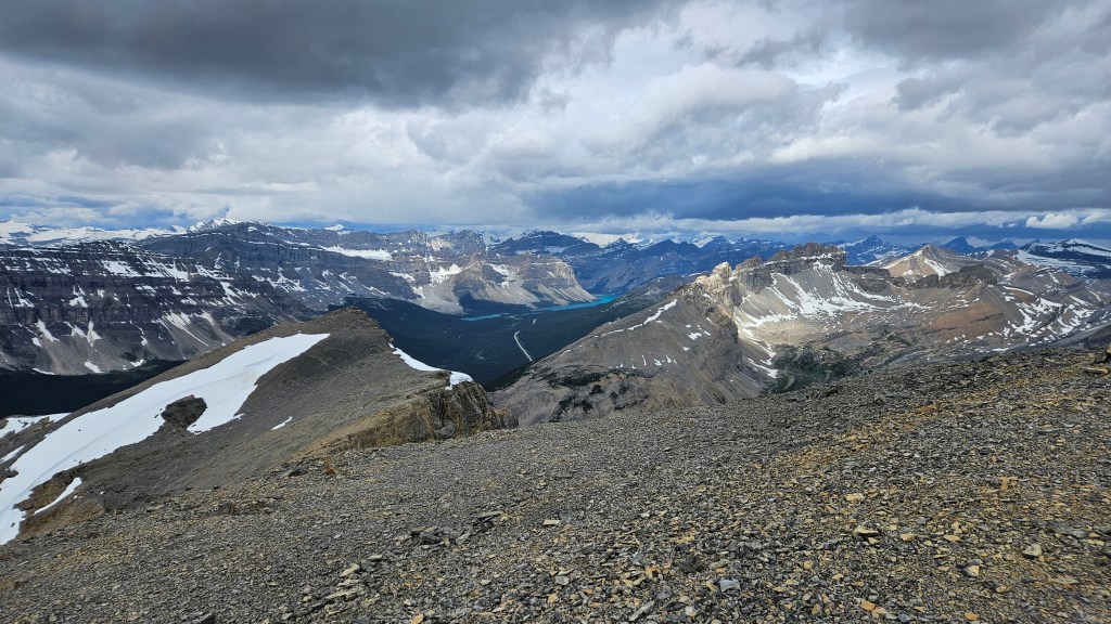
From the top of the ramp, it took us nearly an hour to trek across to the summit. The winds were sustained most of the way there and felt as if they were dipping into negative temperatures, so we layered up before traversing across. The footpath remained relatively well defined on route to the summit. Initially there is some exposure along the ridge crest, notably on the north side above Mosquito Creek. While somewhat exposed, its fairly easy terrain to traverse with minimal scrambling past where the ramp tops out. Closer towards the summit the ridge broadens as the footpath crosses back onto the less exposed south face, and then lastly crests again on the broad summit hump of Noseeum Peak.
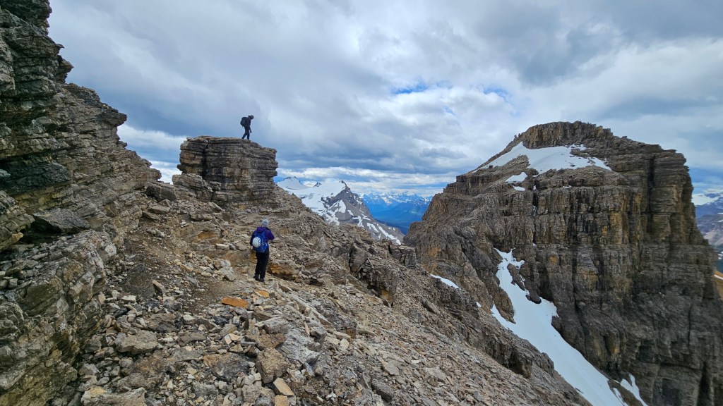
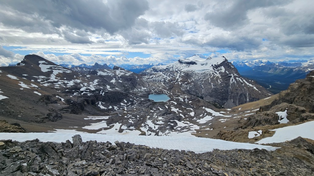
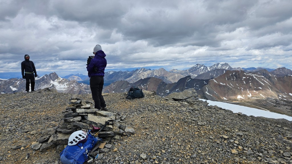
The views from this one cannot be understated, they are grand and are the only ones I’ve had (in the same area) that rival Crowfoot Mountain. According to my watch we had made it from car to summit in 4 hours 19 minutes and despite the freezing wind our stoke level was still at a 10/10. The views south of neighboring Andromache and Hector’s glaciated north faces stood out against moody skies, with Noseeum Lake’s glass-like pale blue surface centered in the foreground. I often use the analogy that Noseeum is shaped like a collapsed volcano cone, with the lake being the centre of a crater… I wonder if there is any volcanic history to this peak? We signed the register, which was a struggle in the wind, and helped ourselves to a celebratory sip of the fireball in the pink registry box.
After a frigid visit to the summit with our backs to the wind facing east for most of it, we closely followed our footsteps back to Noseeum Lake and down to the second headwall. Fortunately for us, the weather held despite the darkening clouds and it eventually got warmer as we returned to the waterfall sections. For the larger upper falls, we retraced our steps from 2024 aiming for the shattered green cliff band to the west side of the falls and easily scrambled down this to the trail used earlier in the approach. We nearly got lost at the second headwall having first positioned ourselves too far west but luckily caught the error and easily found our way back on route.
The hike back from the Upper Waterfall was almost uneventful, we followed the flagging I had left in the morning to a well defined footpath that led us right back down to the first waterfall section. It avoided the “fun-way” scramble from first thing that morning but instead took us down another instead! This section would have been easy to spot had we looked for it in the morning, and made for a nasty little downclimb to end the day with. A few moderate hands-on moves with brief exposure saw us back on solid ground above Noseeum creek. We navigated across the braided streams to the south side of the creek where we picked up the main trail back to the highway. The hike back we finally felt warm again and carried our enthusiasm back to the car with us, where post-summit beers awaited! It ended up being 8.5 hours car to car, covering 14km round trip. A solid outing.
In summary, a modest moderate scramble with big views throughout the entire journey. A must-do in clear conditions, as the scenery far outweighs the enjoyability of the scramble itself. We categorized this effort as a “plod”, but even in saying that I would highly recommend this peak to anyone already considering the Bow Lake area for an adventure.