September 20-21st, 2021. Kootenay National Park, British Columbia.
Trip Time: 9 Hours*, Elevation Gained: 1400m
Easy/Moderate Scramble, mostly hiking.
Numa Mountain was an add-on to our trip to Kootenay’s infamous Rockwall Trail, and was actually Bri’s idea for a peak. Scott had likewise read up on it on All Trails and we settled on camping at nearby Floe Lake, with the intention of possibly scrambling some of the unnamed neighbouring peaks southeast of the lake. In the end Numa was our only ascent on the two day trip and a brisk one of that, with early winter conditions rolling in from the west. The ascent was mostly a steep hike with one moderate down-step scramble from the false summit down onto the proper summit’s ridge. *Our trip time of 9 hours was measured from the carpark to the summit and back down to the Floe Lake campground.
With the scheduled closure of Highway 1 east of Golden, we set our sights on Kootenay National Park, in part to check out the infamous Rockwall Trail, and also in part to snag a late summer scramble. Bri and Scott had both suggested Numa, as a quick search on All Trails revealed that it was mostly a long steep hike, with a solid 1400m of elevation gain from the Floe Lake Parking Lot, not including the elevation loss and regained between Numa Pass and Numa’s false summit.
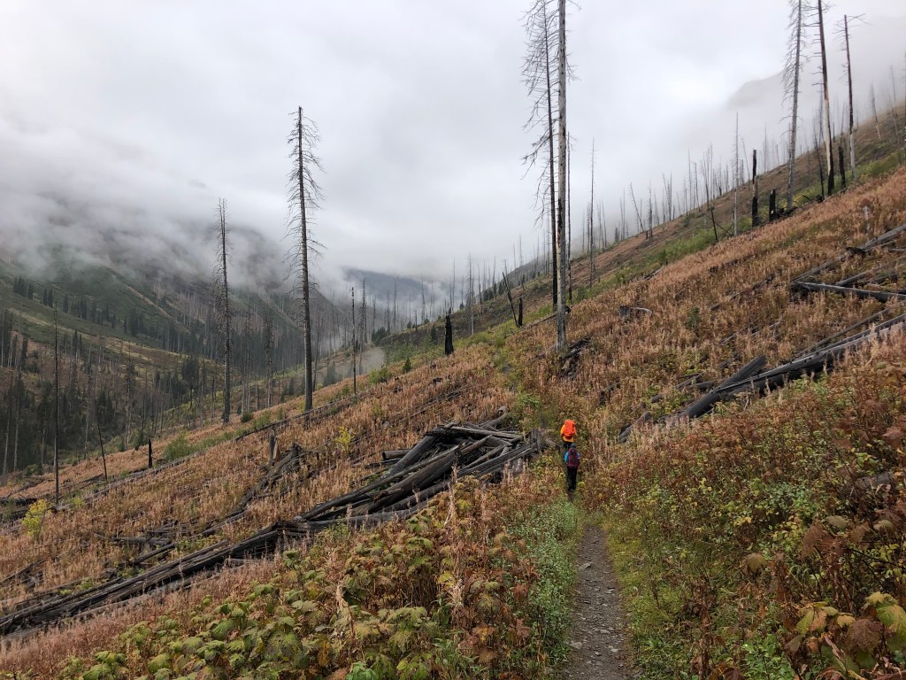
We managed to start the hike in from the Highway 93 Floe Lake Parking Lot at 8:50am, the trail being well maintained and offering a dramatic display of new growth juxtaposed to the dead burnt giants from past forest fires. Adding to the scenery was the low lying fog banks lingering throughout the valley.
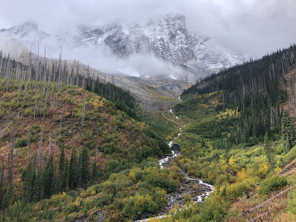
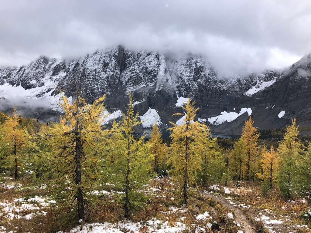
Including a few brief photo breaks, we reached the Floe Lake campground after 3.5 hours of hiking and happily shed our overnight kit at the cache lockers. To our pleasant surprise, there were a number of larch trees nearby and just starting to turn gold, with the mighty impressive peaks dusted with fresh snow. Truly a magical time of year in the alpine! After a few more photos we geared back up with lighter packs and continued the hike over to Numa Pass, from there we ascended the rampart northeast of the pass to gain the lower ridge of Numa’s false summit.
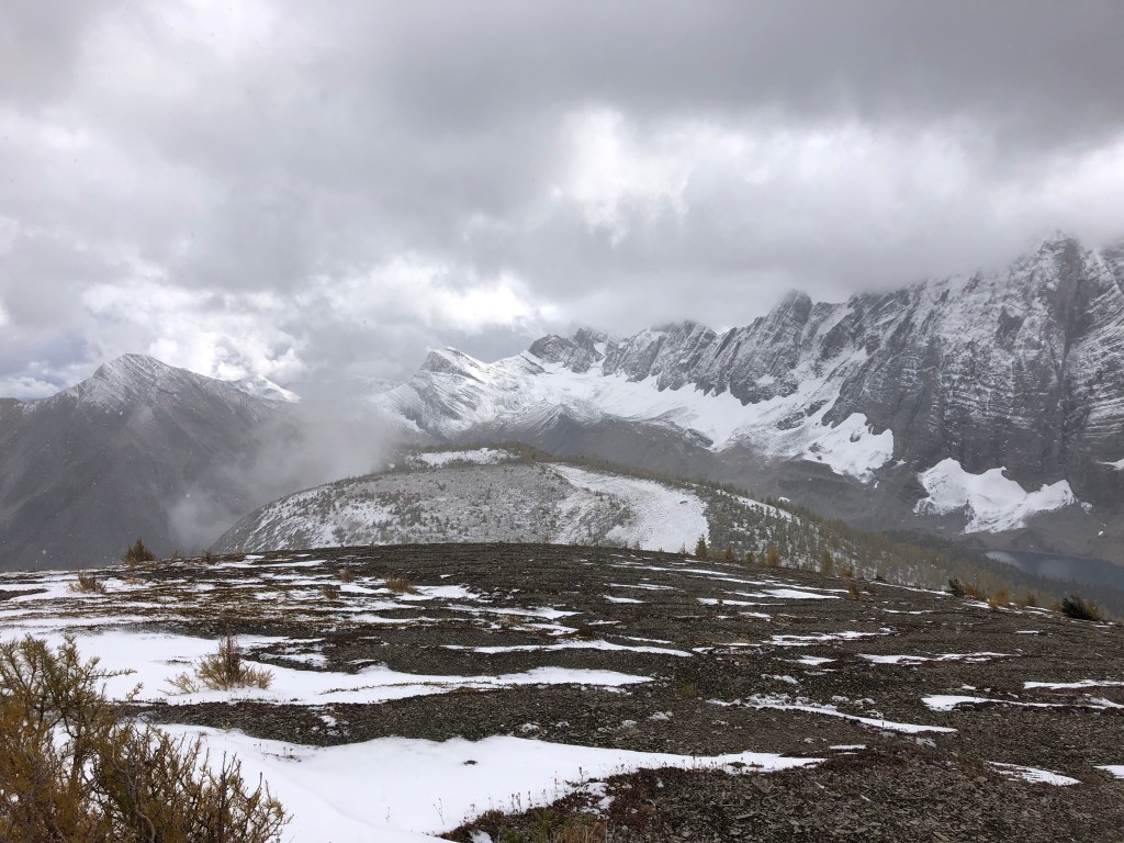
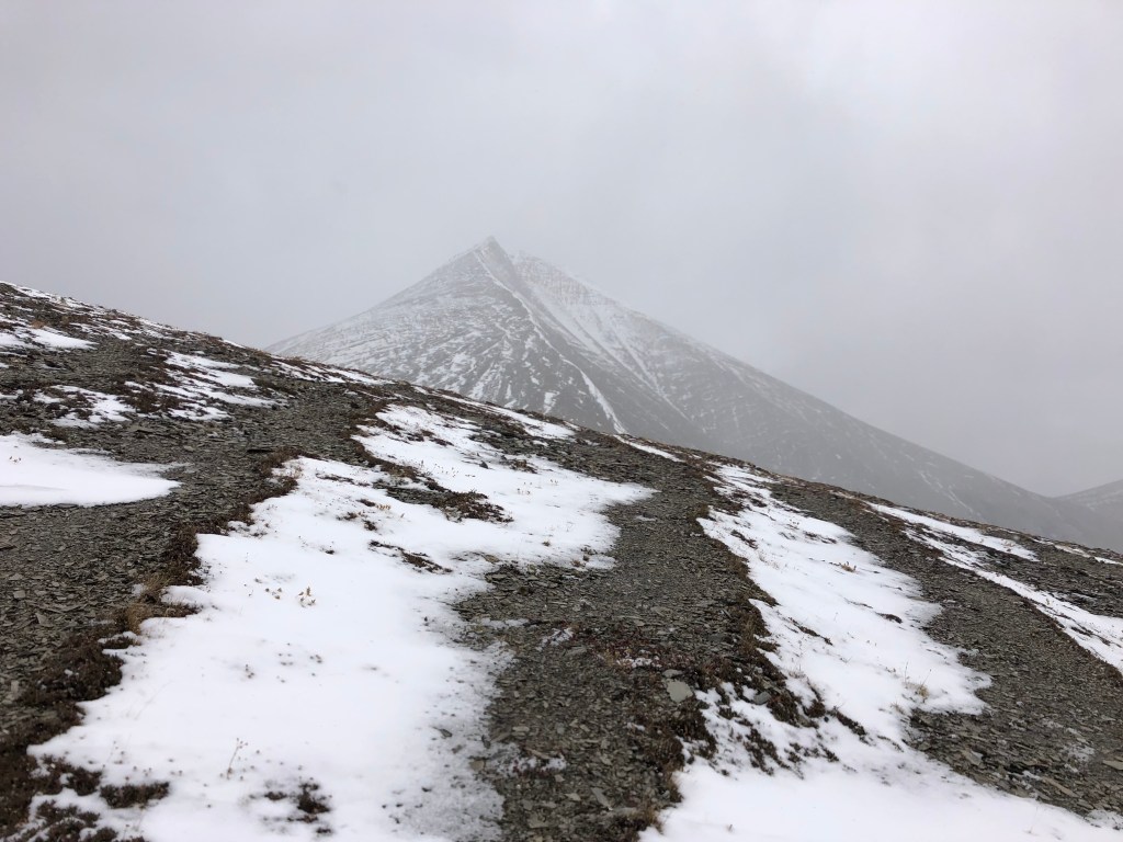
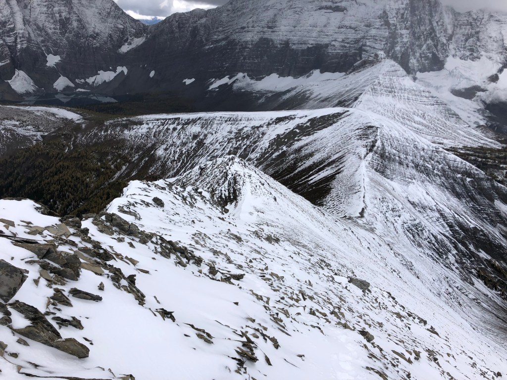
The trail is relatively straight forward, the ramparts run parallel to the Numa Pass Trail before narrowing and ascending up a low ridge. This ridge is where we first encountered the brisk and steady winds that day, forcing us to layer up early on. Snow drifts had already formed though not quite enough to warrant gaiters. The lower ridge drops around 50m or so before picking back up to the southern slope of Numa’s false summit, which again was little more than a steep hike up a slippery shaley slope, requiring some route finding as to avoid the slick spots.
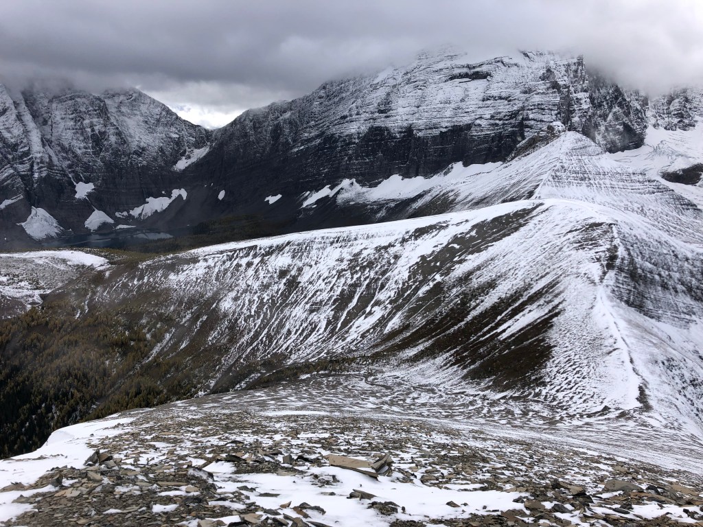
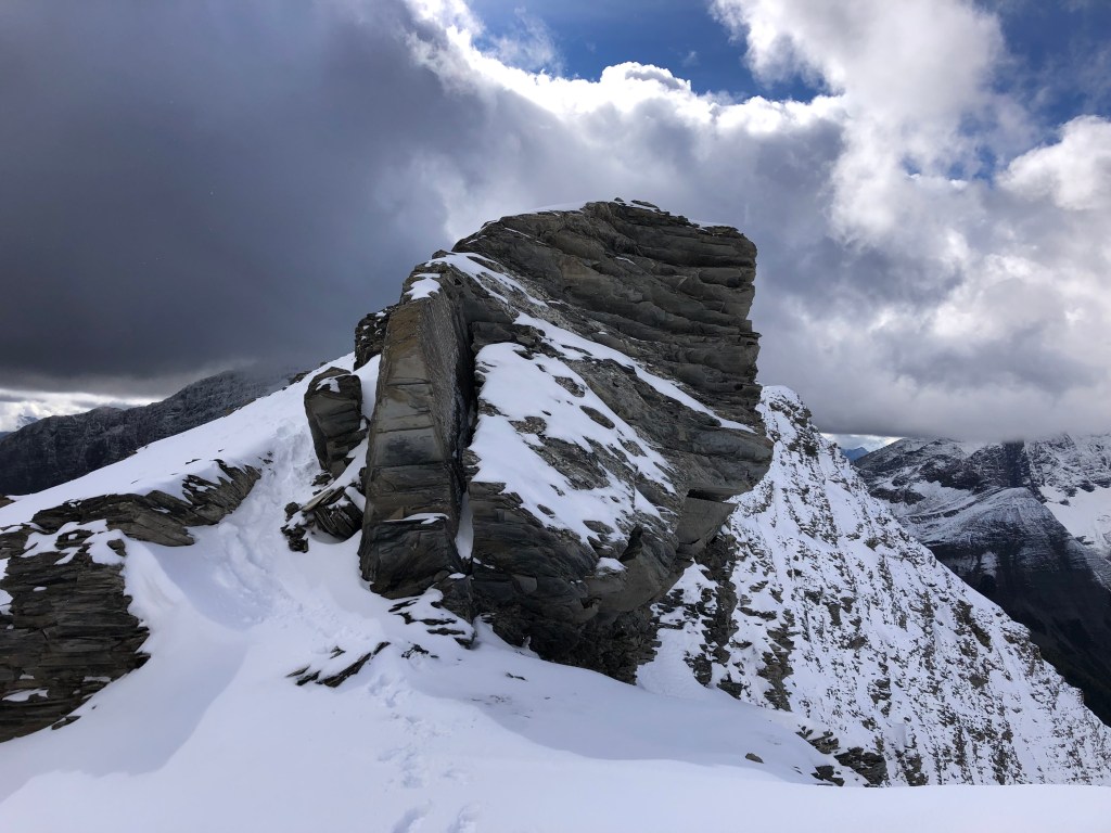
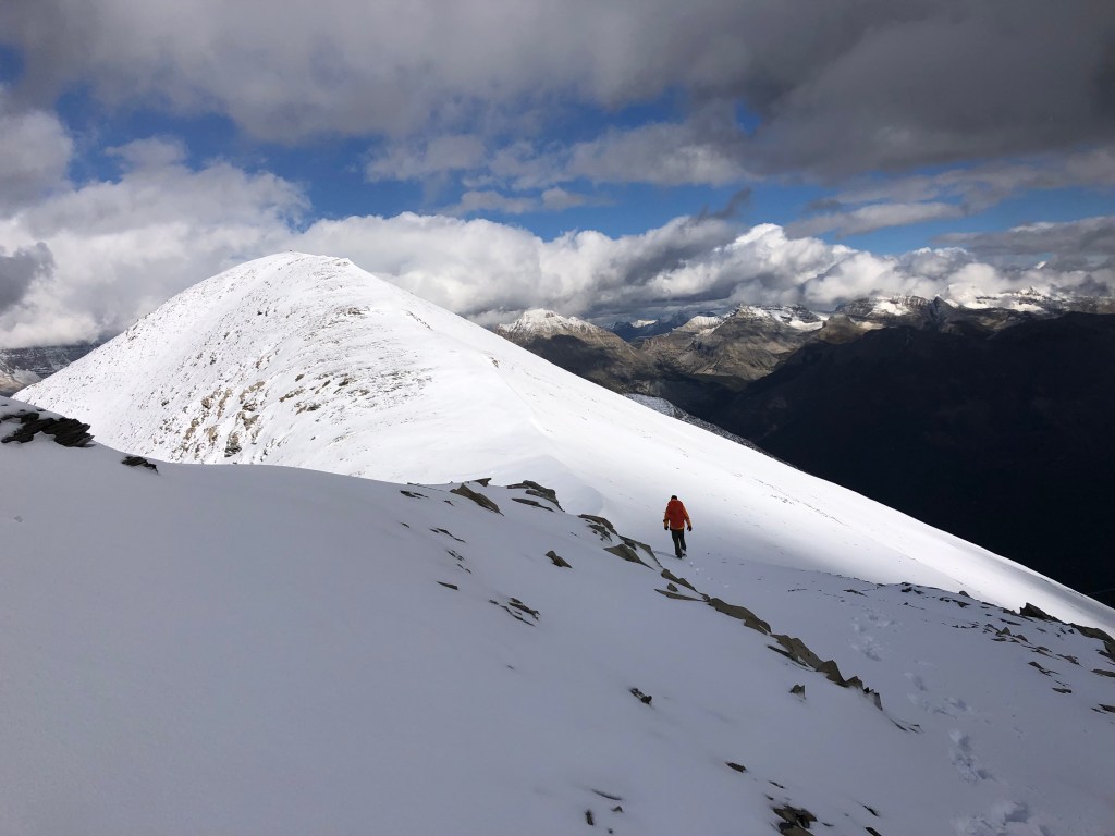
Above the slope the ridge narrows again, and the exposure increases, though the scrambling is minimal with the hands-on sections being avoidable if one desires to keep this as a hiking route. The exposure off of the ridge’s east side made for some great photos along the way to what we originally thought was the summit – you can imagine our disappointment when we realized the true top was still a little ways away, paired with the return of the wind gusts once we topped the false summit.
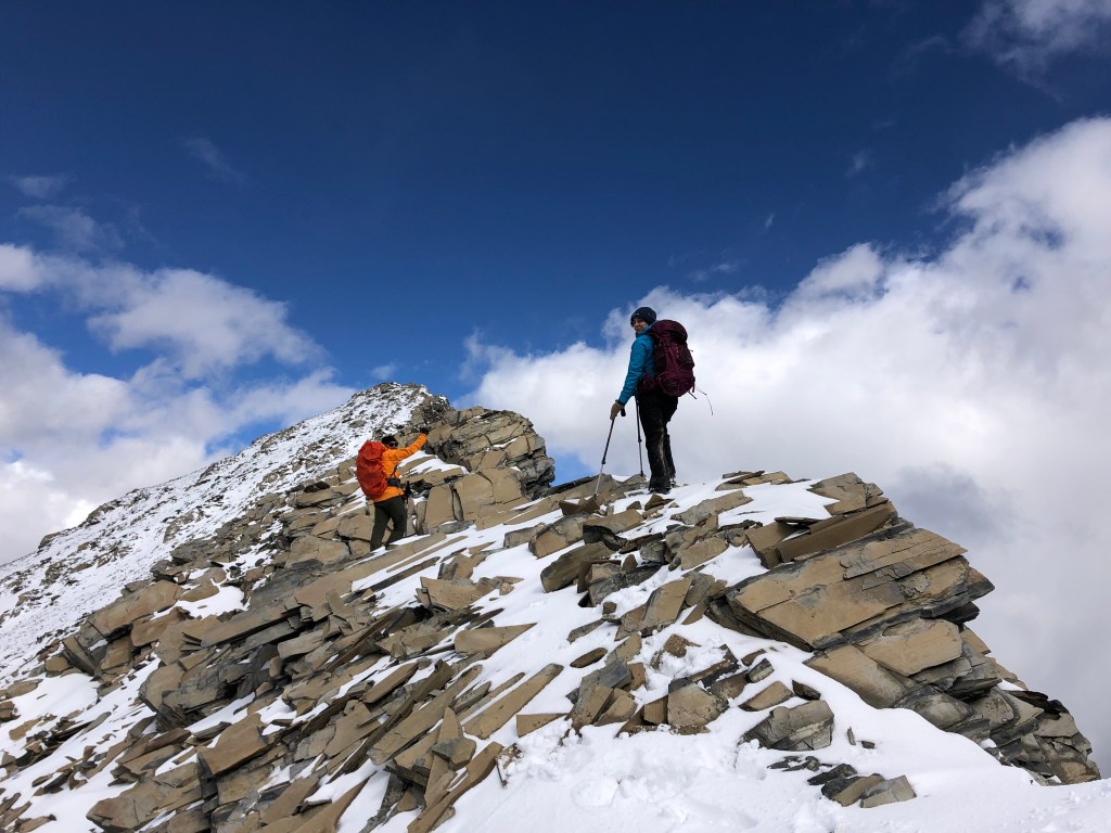
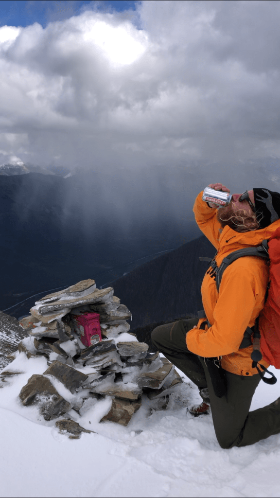
The summit proper turned out to only be another 10-15 minutes past the false summit, and was partly snow covered, with the final few meters being nearly knee deep in spots. This final ridge was again mostly hiking, minus one brief section of exposed down climbing. In dry conditions this would have been a moderate scramble but with the snow each step had to be very carefully placed, making for a few spicy moments. Scott and I reached the summit cairn just after 3:30pm, and while taking Scott was taking a pano-video of the summit vista, I managed to plant a Smirnoff Ice next to the summit register… he was not overly thrilled but couldn’t resist a chuckle when he discovered I had carried that the whole way in.
Our descent back to camp was rushed but felt long due to the steady bombarding windchill, the forecast of a clear afternoon being completely blown. We managed to return to Floe Lake just before 6pm and were in bed by 8:30, saving the 10km hike back to the car for the next day. Other than a strong wind gust waking us all up at 11:30pm, the overnight was a pleasant and uneventful occasion, with the sun eventually making an appearance the next morning on the hike back to the car. We sight numerous scrambling options in the Rockwall area and will eagerly return there next season!