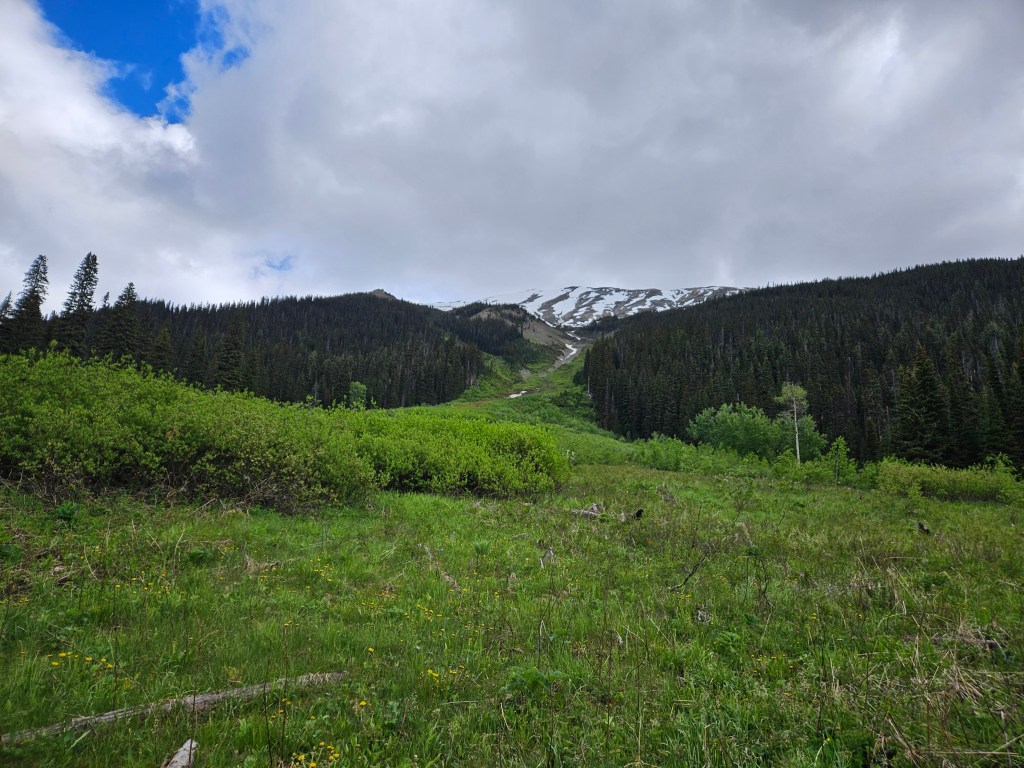
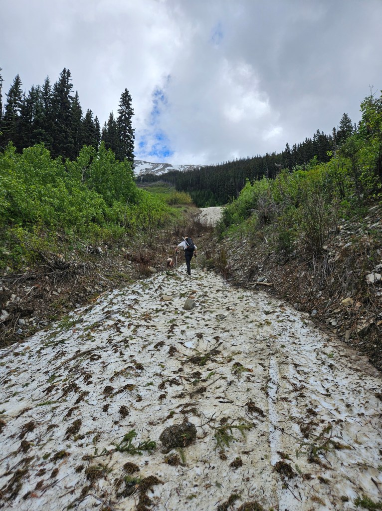
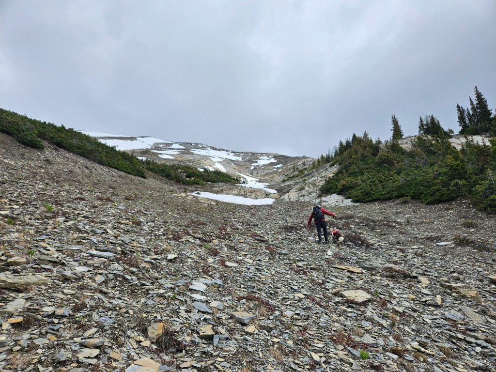
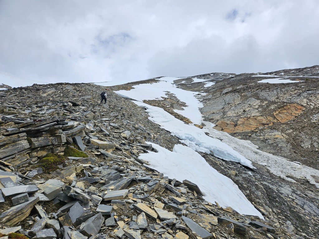
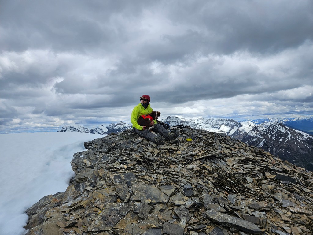
We followed Andrew Nugara’s (2017) route in More Scrambles for this outing. I teamed up with Ben who brought Rosie along for her second summit of the season. The SW Slope is a direct route up from Ochre Spring Creek trail, accessed via the Paint Pots trail in Kootenay National Park. From the creek trail, we briefly bush whacked across an avalanche slope towards a snowy drainage, and essentially followed this drainage up to the summit’s lower shoulder. Ben and Rosie decided that the lower shoulder was good enough, I continued to the summit proper post-holing in surprisingly sturdy snow. Above the drainage there is some brief easy to moderate scrambling though rubbly cliff bands, the worst of which is avoidable. This route, similar to our adventures up Mount Tegart and Willowbank Mountain, is more of an intense hike than an actual scramble. The views are spectacular, amongst the finest I’ve had in Kootenay National Park, and I wouldn’t be surprised if this peak becomes more popular in the coming years. Super straightforward and super scenic. Likely can be done in 5-6 hours if snow free.
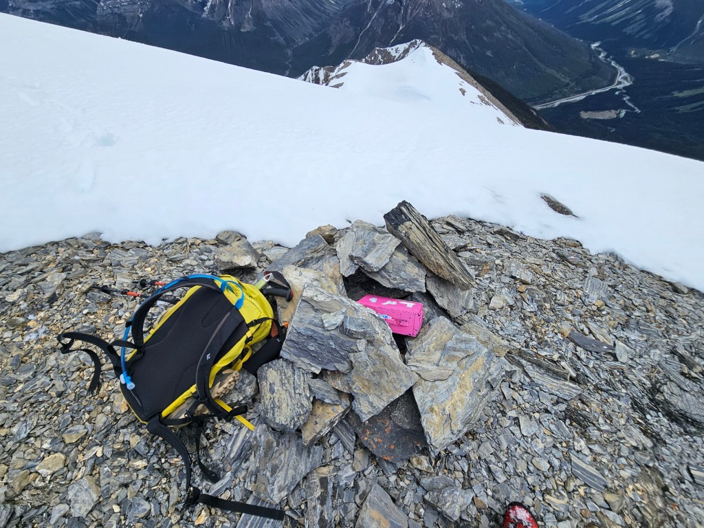
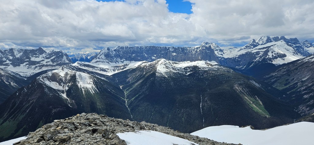
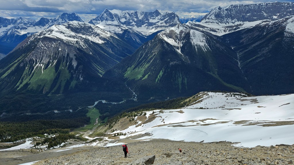
A straight line up from Ochre Spring Creek trail. We followed the avi path up and stuck between the two snow patches (looker’s left of drainage) to reach the false summit. Ben and Rosie enter the drainage after a brief bush whack. We more or less followed this up, occasionally taking to the slope for easier footing.Topping out of the drainage towards some gentle-ish cliff bands.We stuck slightly to the looker’s left along a dry rib in effort to avoid the snow. Still another hour from here to the false summit… good old foreshortening. Ben and Rosie staying warm on the sub-summit. In all fairness, the view from here is already fantastic and the main summit was a frigid post-holing effort to ascend.It looked further away than it actually was, and the rock patch provided a safe line of travel… towards the top I did sink in waist deep a couple times. Big fan of these pink “lunch” box summit registers. The lower sub-summit can be seen underneath, where apparently Rosie got very anxious over my explorations. Looking west towards the northern portion of the Rockwall Trail, including Wolverine Pass. Wish I got more summit photos but it was too dang cold on the fingers that day! Thoroughly enjoyed the view heading back down the towards valley bottom.