
June 6-7th, 2016. Moraine Lake – Banff National Park
Round Trip: 7 hours, Elevation Gain: 1000m
Moderate Scramble
Panorama Ridge lies parallel along the west side of the Trans Canada Highway just south of Lake Louise. There is a brief description in Kane’s 3rd edition of Scrambles of the ascent route which he grades as an Easy Scramble. I went a different route that was more fitting of a Moderate Scramble.
I opted to ascend a gully situated above the moraine that splits upper and lower Consolation Lakes. This was done as a solo scramble after work and as such I ended up descending in the dark. I’m still not fully sure where exactly I came down during the descent. It may have been somewhere between the two routes highlighted below.
First challenge is to access Moraine Lake’s parking lot. Fortunately for me I was employed at the lodge in 2016 and therefore lived within walking distance of the trail-head. As of 2018 it is absolutely crucial to arrive before 5am if you wish to secure a parking spot – otherwise you’ll be limited to an 8-4:30pm private (yes, paid) shuttle.
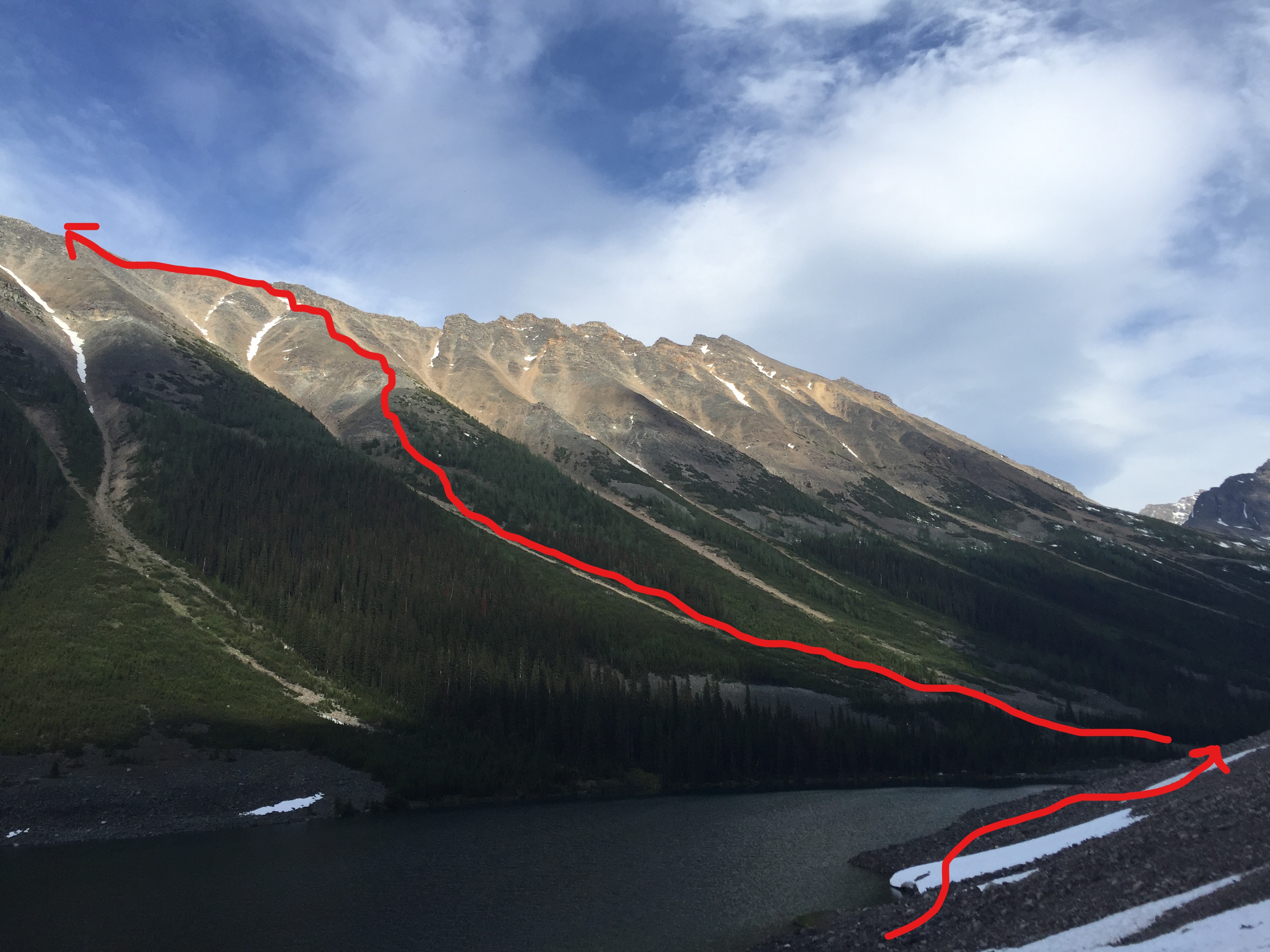
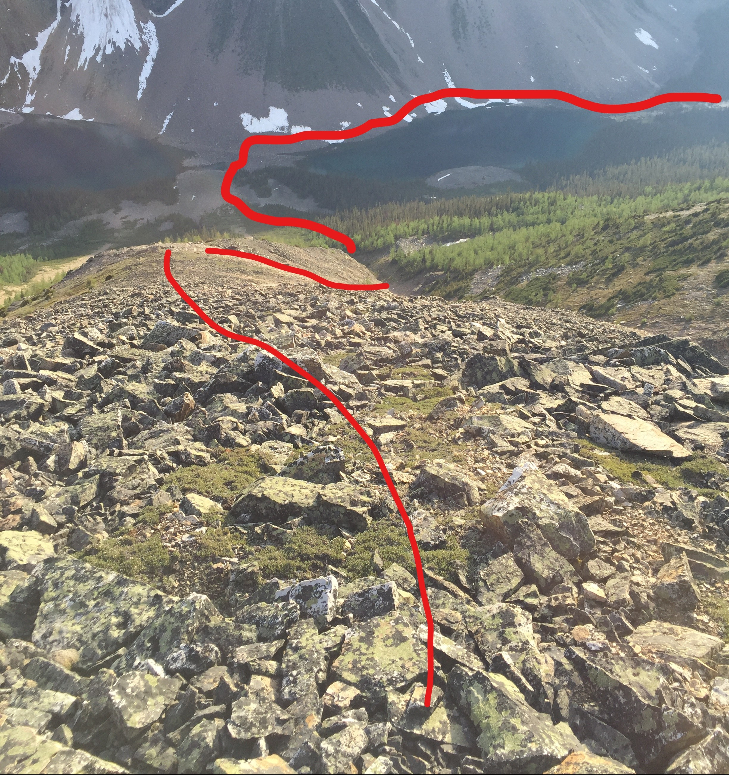
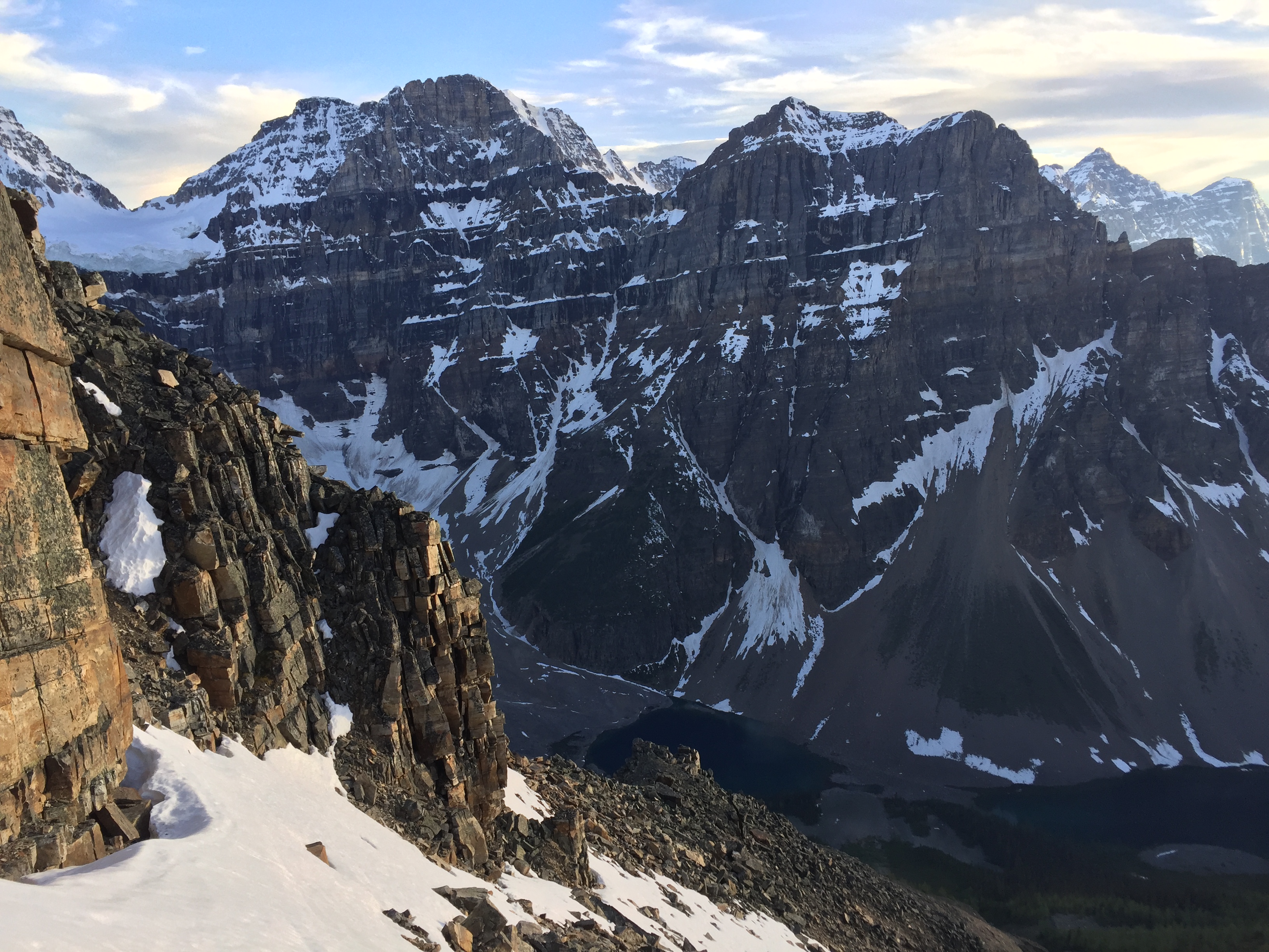
From the parking lot hike the popular trail to Consolation Lakes. You will then need to boulder hop your way around the looker’s right-hand side of the lake shore until you reach the moraine that divides the upper lake from the lower lake. Note: in early season the lake shore is within striking distance of ice and rock fall from both Mt Babel and Quadra Mountain! Pay close attention to the conditions above you!
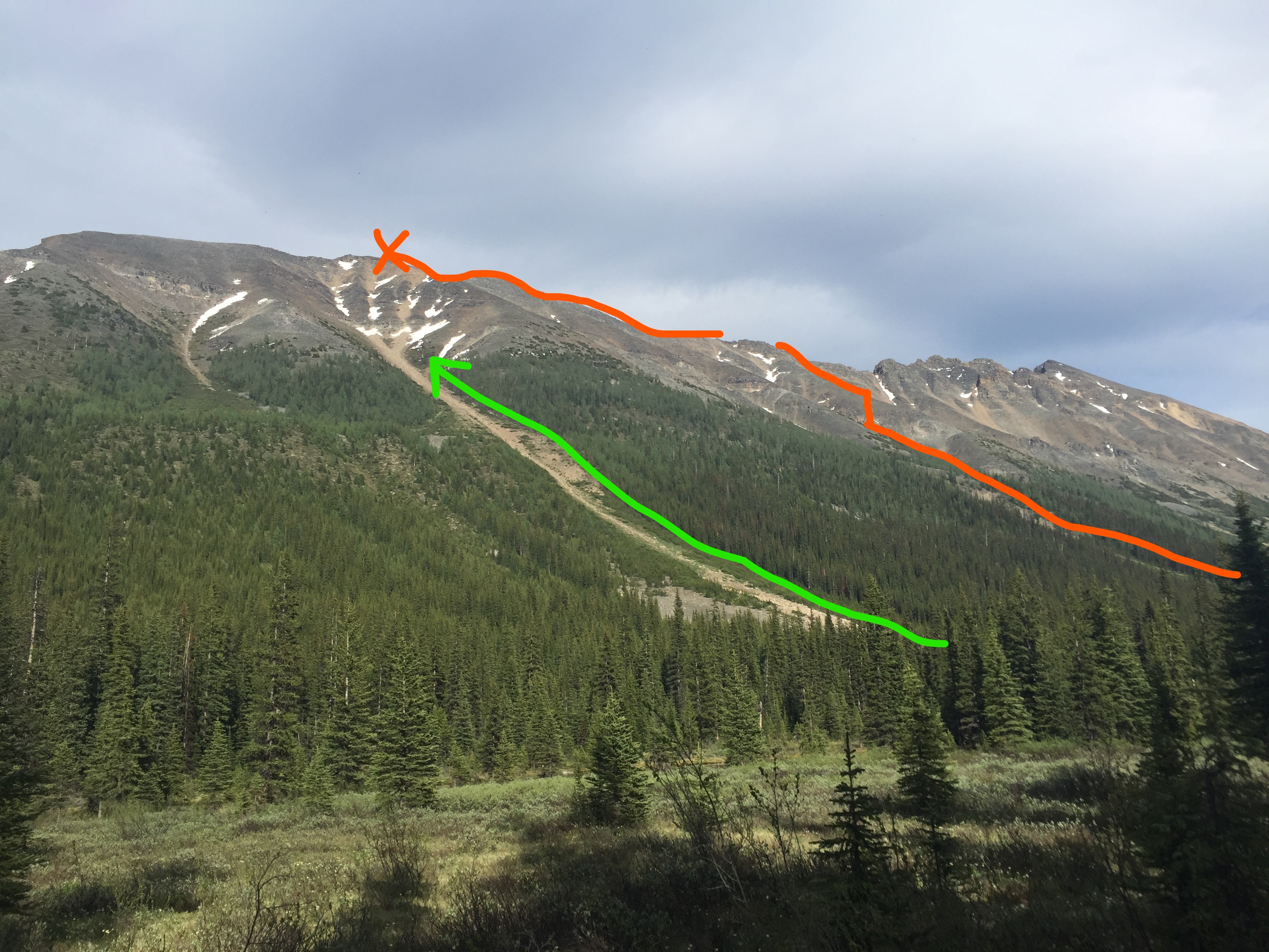
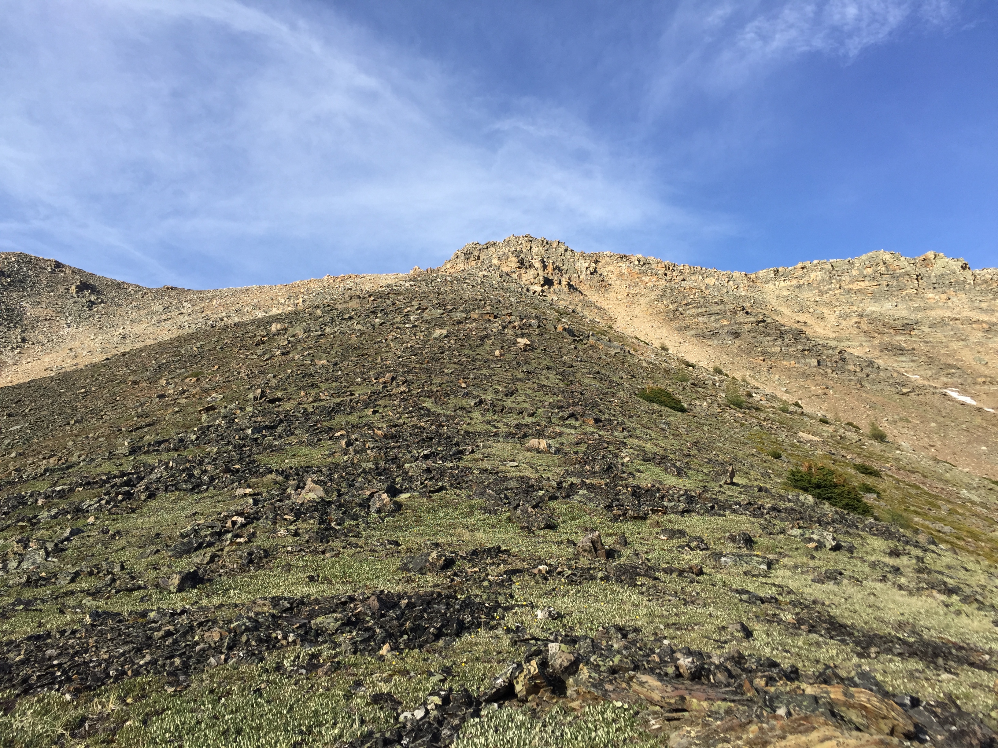
In 2016 it was an early start to the scrambling season and lucky for me Panorama Ridge was nearly snow-free. However it was still early season and Consolation Creek was both deep and fast flowing – as was the flow from the first lake to the creek. In addition to the increased water levels I was hiking solo and wanted to stay dry. This lead to abandoning the idea of using Kane’s description for an ascent. Instead I hiked to the moraine between the two lakes and then chose the gully slightly to the left (north) of the moraine.
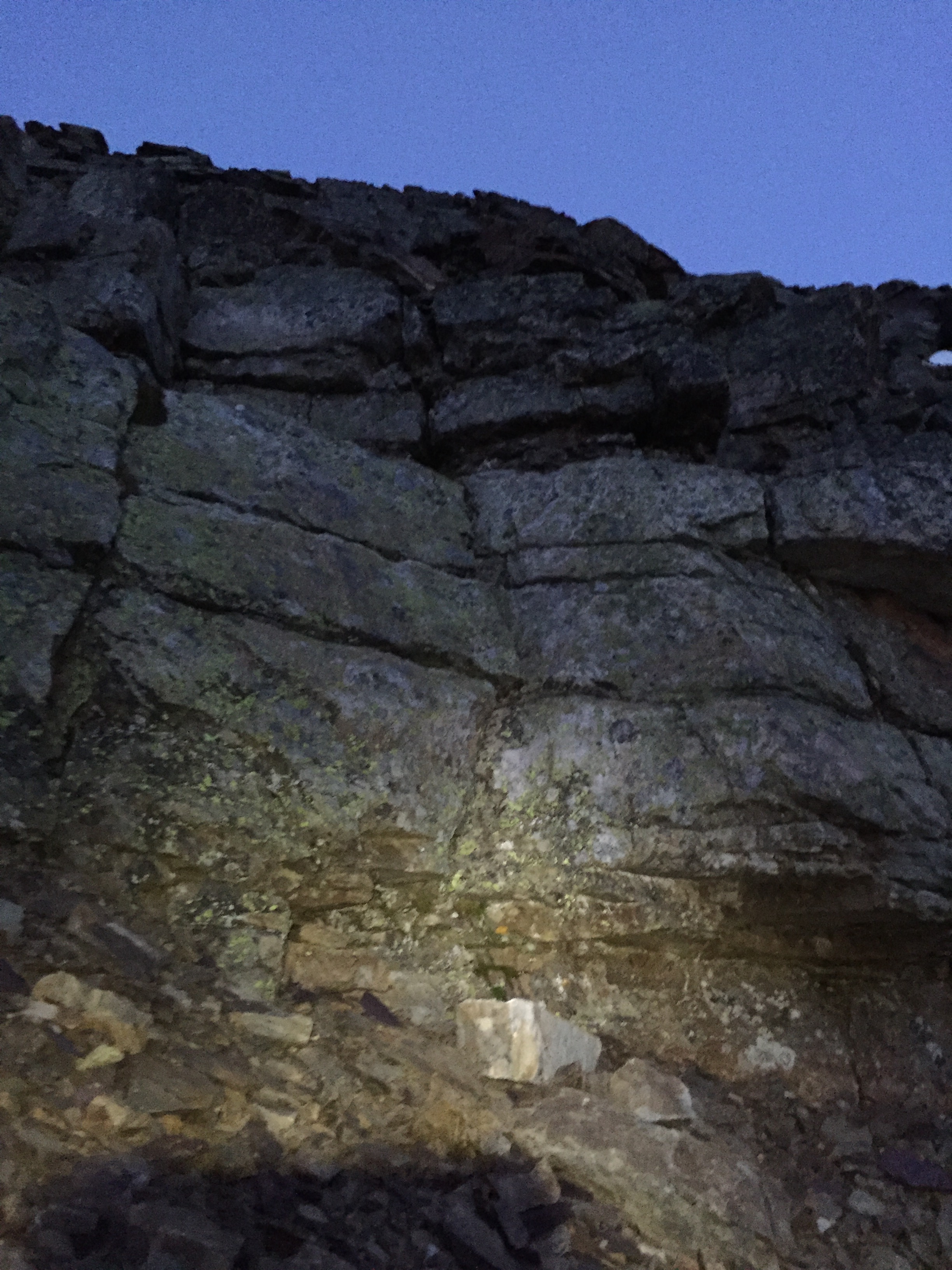
At first I stayed inside of the gully toiling up scree until nearly above treeline. A light bush whack was involved between the moraine and the scree (10 minutes). Continuing up the gully avoids further bush whacking and steeper rock bands on the banks of the gully. Eventually the scree bashing loses its charm and the gully becomes increasingly steep – I soon found the grade too much in the gully and gained the right bank (climber’s right). A brief moderate scramble to gain the bank which mellows out into a wide rib leading towards the ridge.
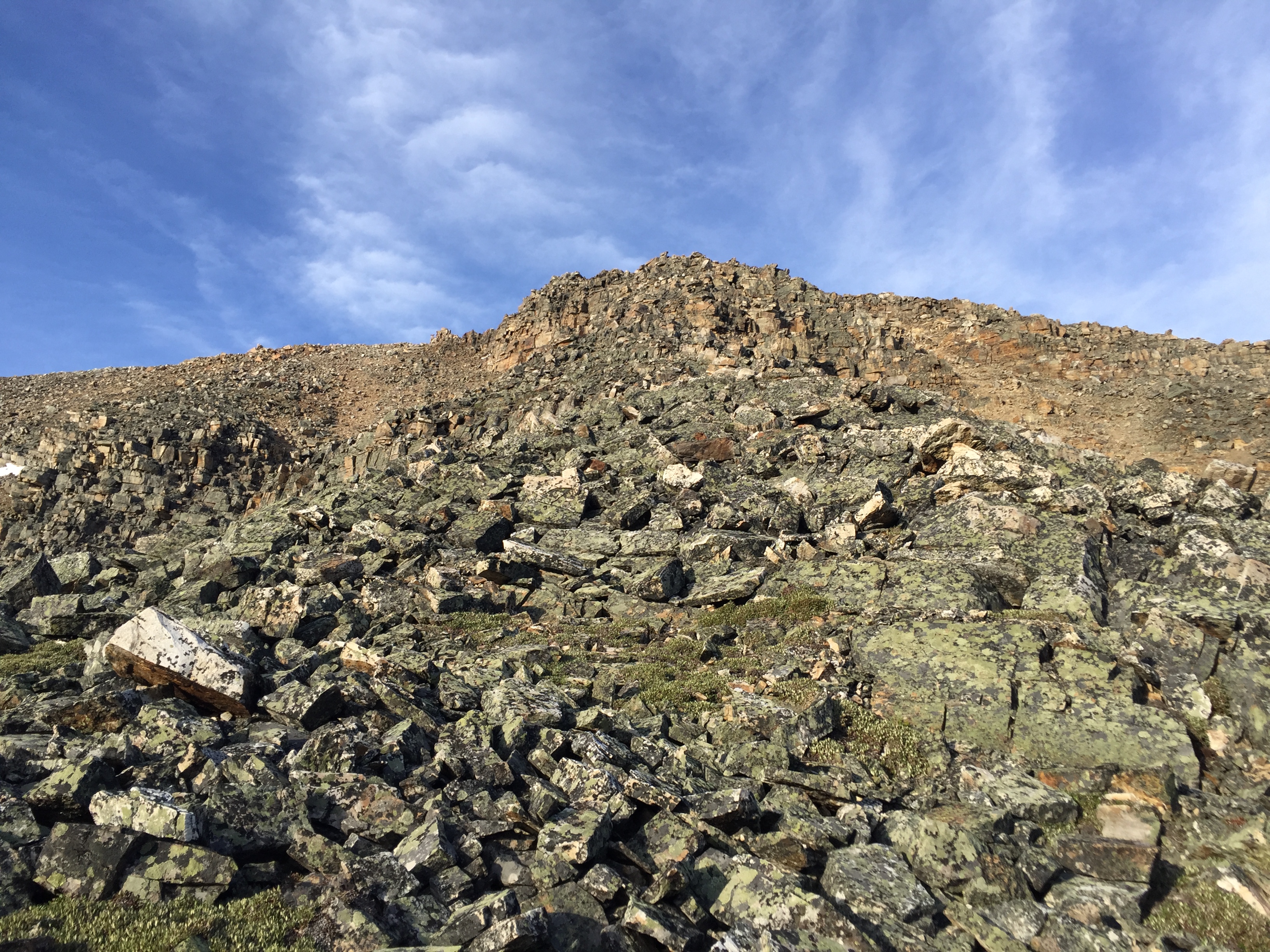
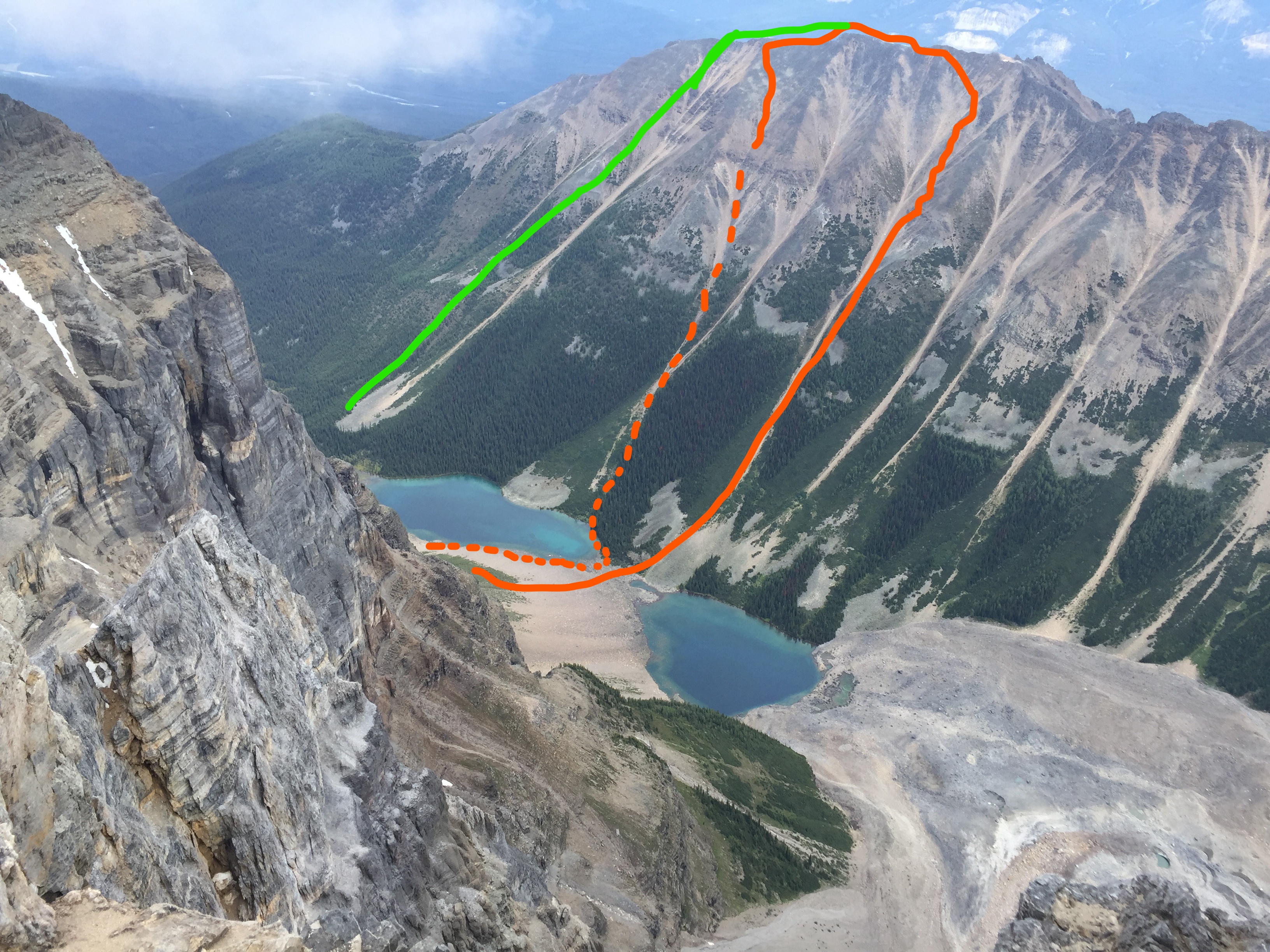
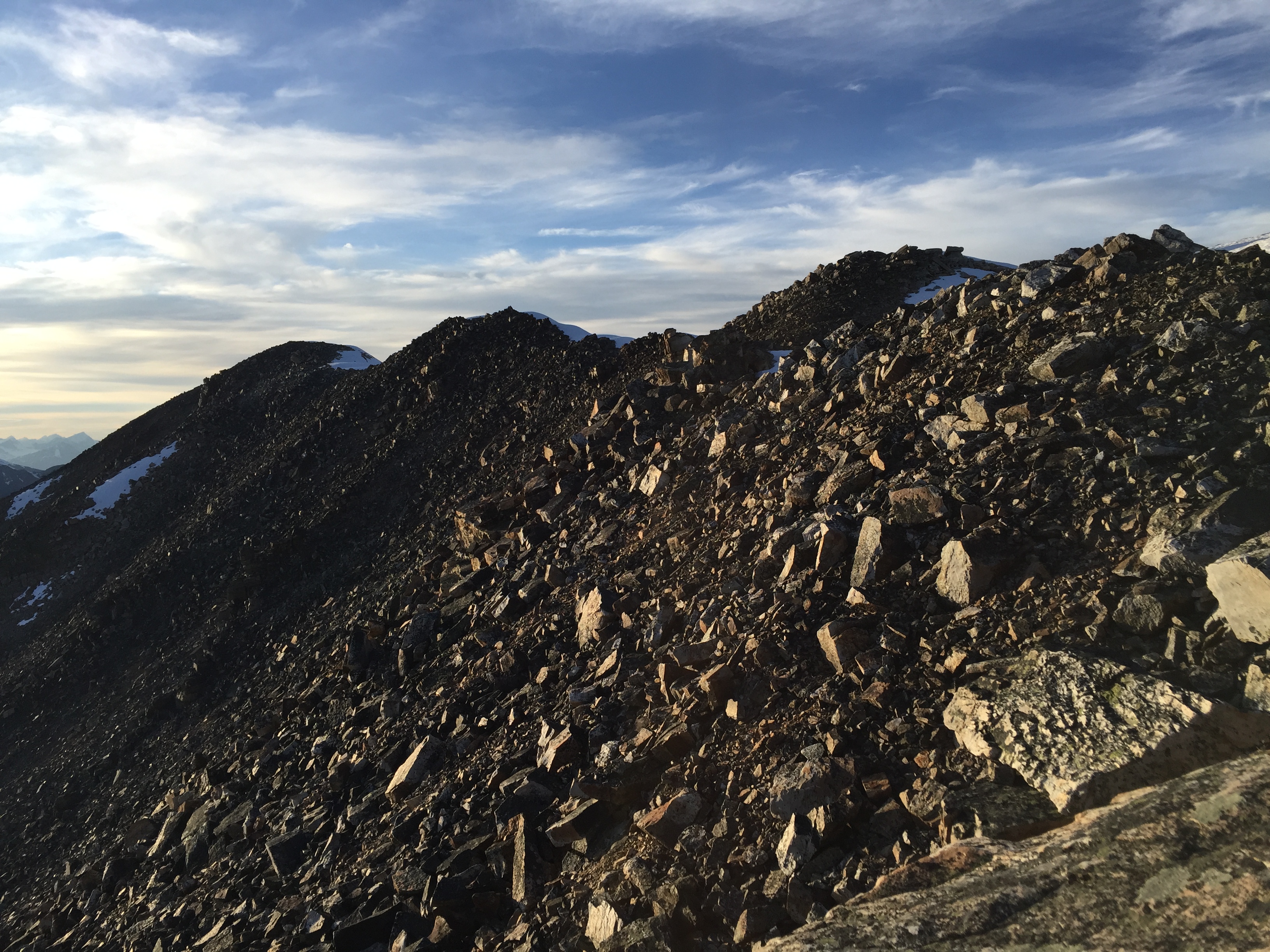
The rib itself is an easy scramble until just shy of the ridge crest. A large block-like cliff band guards the ridge if approaching directly. This section is plausibly doable as a difficult scramble but is unnecessary for gaining the ridge. I was able to bypass underneath it to the climber’s left by skirting under the cliff band above the scree & above the snow patch. This side-skirt still involved a few moderate moves and was surprisingly more exposed than it first appears. For
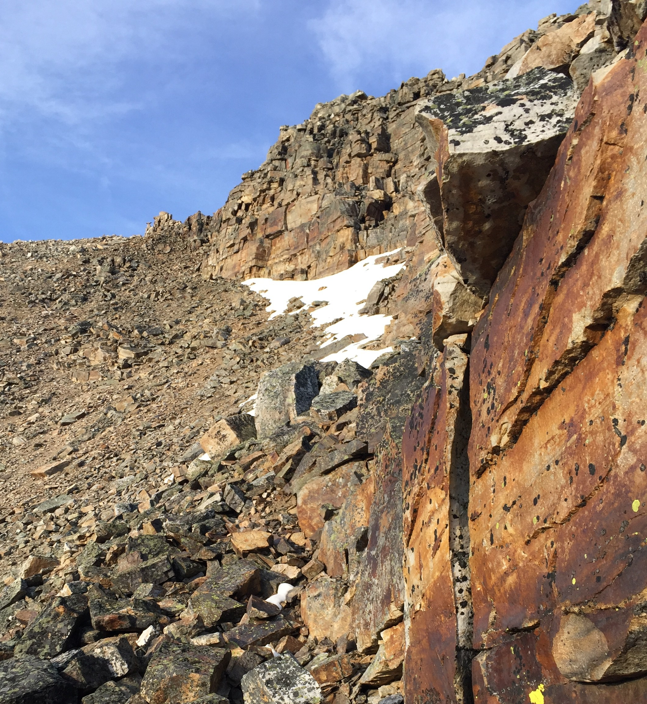
Once above the snow patch the scrambling eases as you gain the ridge crest. After taking in the aw-inspiring views of the Bow Valley and of Consolation Valley, it was time for the summit push. From the top of the rib it was approximately 15 minutes to traverse over to the “summit” of the north ridge.
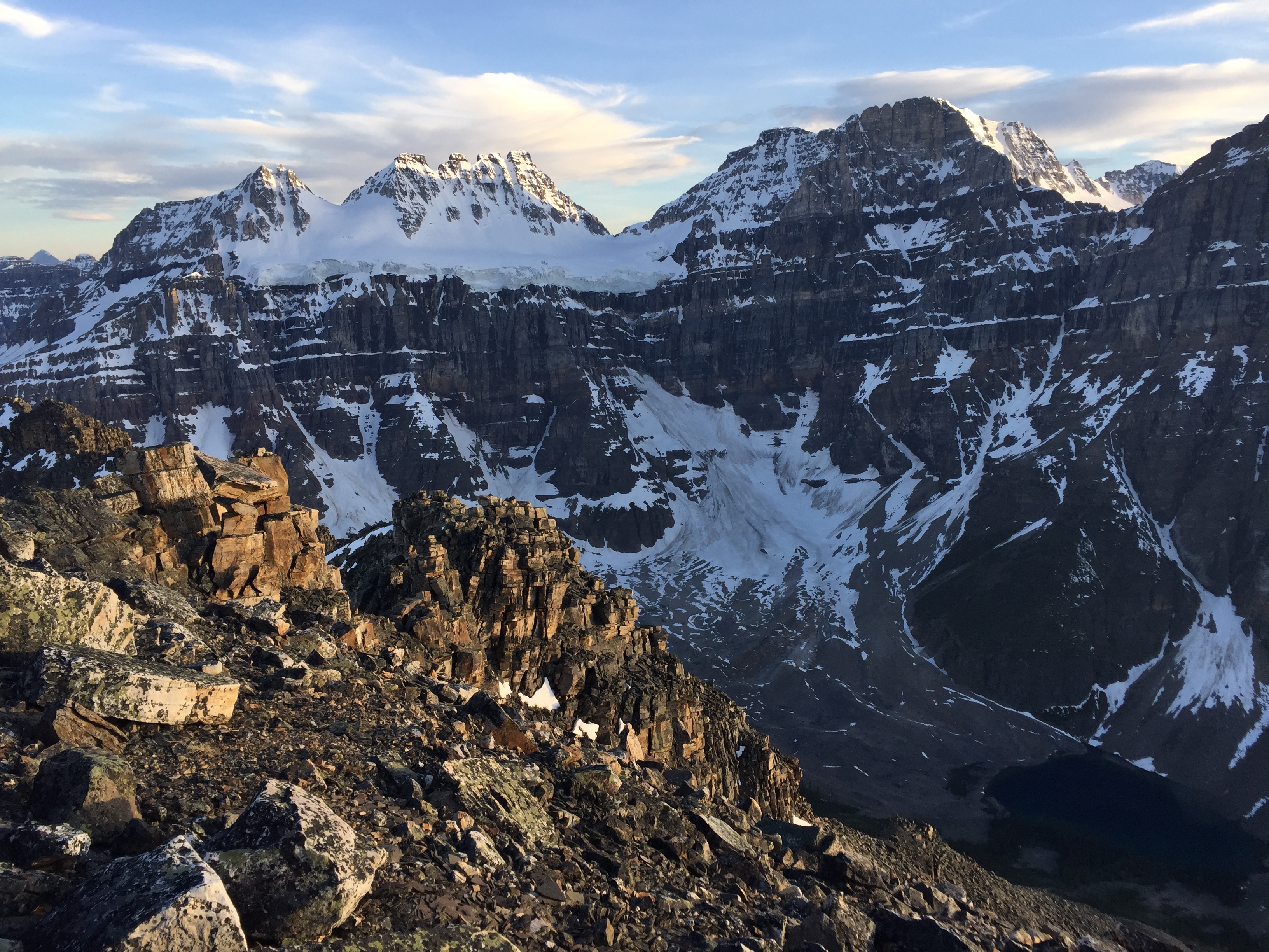
While ascending the rib a large ice-fall came crashing down off of Quadra Mountain. The echo through Consolation Valley was certainly heard at Moraine Lake and possibly as far as Lake Louise – it was bloody loud! The dust and ice crystals blew as far the moraine between the two lakes. Luckily I was nearly at the summit ridge when the ice fall occurred and no where near the debris.
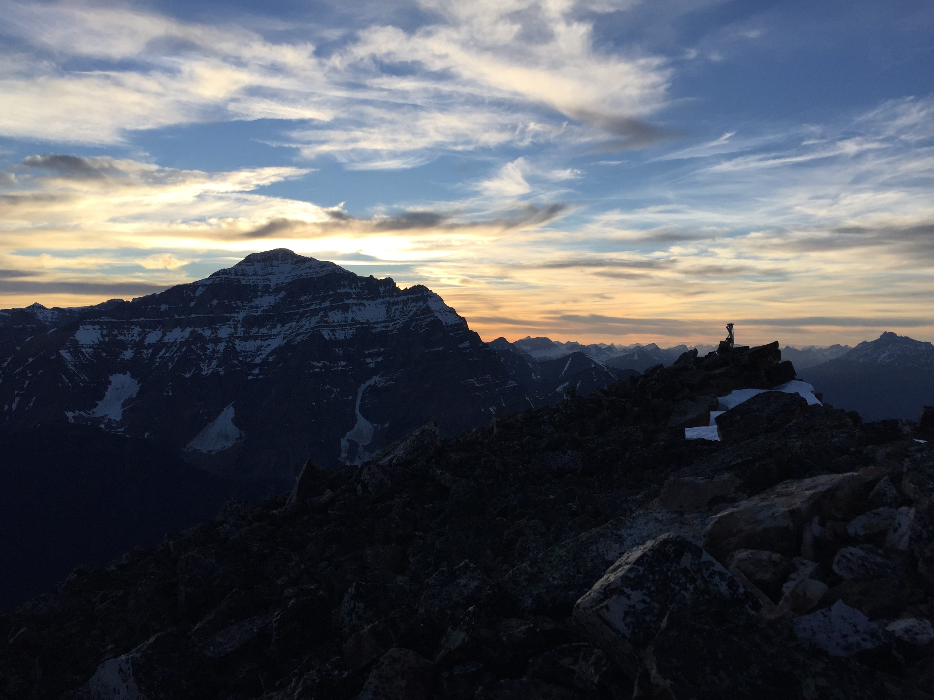
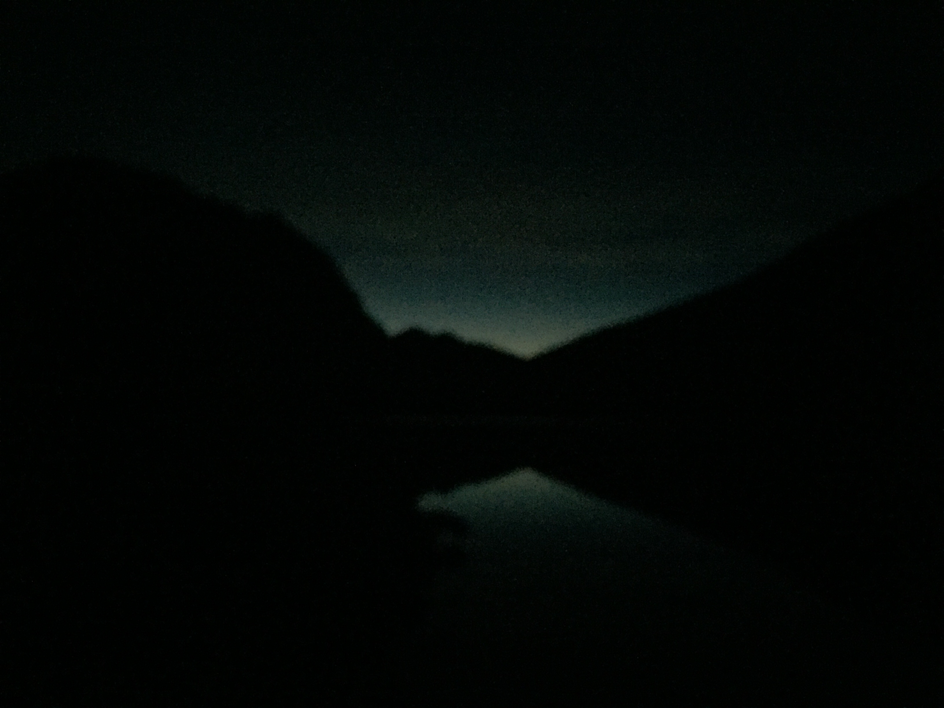
The remaining summit push was uneventful other than the fading sunset and increasingly winds. I spent a lot of time getting photos of the tinted twilight on the surrounding peaks – too much time. The sun was set by the time I opted for a hasty descent.
In hind-sight I should have brought my sleeping gear and bivied. Instead I rushed down the nearest gully under the summit. I suspect that it was the next gully immediately north of the gully I originally scrambled up. It was mostly a scree slide down between two ribs but part way down it steepened and suddenly I found my self above a few large cliff bands. This ended up being the “crux” of the day/night and took a few tries to down-climb my way to an unseen ledge.
Below the ledge the terrain eased back into a moderate scramble but required a fair bit of route finding by head lamp. As the vegetation reappeared the scrambling fully eased back into a steep graded hike into thick low lying bush. Naturally this was a bit nerve wracking – this was an ideal area and time of night for an unwanted animal encounter. Luckily that never happened, but the idea of it made that bush trash feel a lot longer than it probably was.
Unfortunately for me I had misjudged where the gully was leading. I had hoped to arrive near Consolation Creek but ended up back at the lake some 30m away from my initial ascent approach. This meant I had to boulder hop back across the moraine between the two lakes and work my way around the entire western shoreline of the first lake. Boulder hopping at Consolation Lakes is tedious enough in daylight!
Once back on Consolation Lakes trail I was pretty tired and stressed by how late it was (now approaching 1am). I distinctly remember walking with bear spray in hand and my ice axe in the other – paranoid of a late night animal encounter. The following sounds of snapping twigs did not help my case whatsoever. The snapping twigs escalated into moving branches… I dispersed my bear mace out of fright and probably ruined that poor porcupine’s evening!
