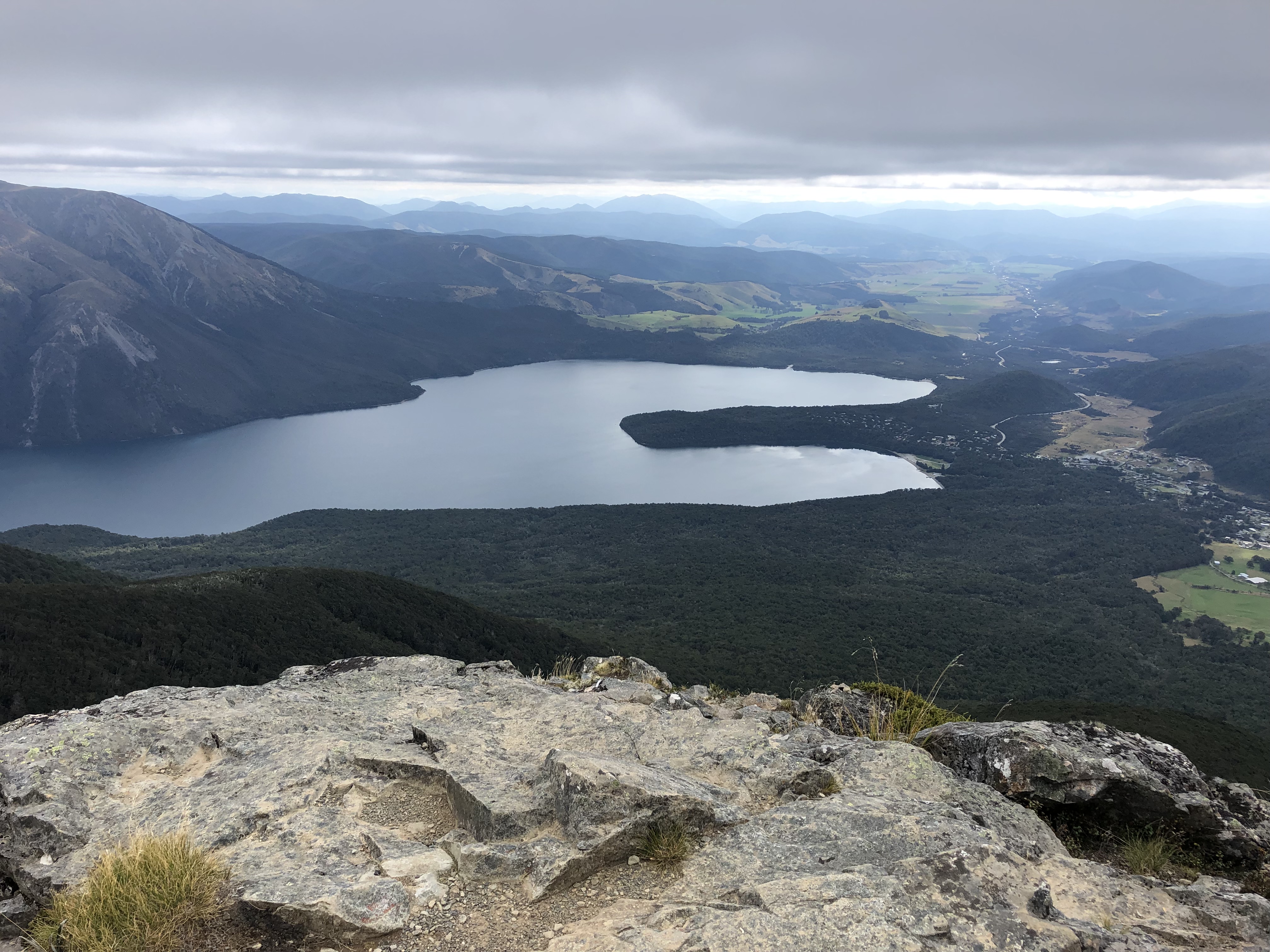
March 22nd, 2019. Lake Rotoroa (Nelson Lakes), New Zealand.
Round Trip: 5.5 hours. Elevation Gained: 1160m
Easy Scramble, mostly hiking
I hiked this one up as a solo trip, and had initially just set out for the Parachute Rocks. Let me tell you, if you’re already setting aside 5 hours for this trip (which is what DOC recommends), don’t waste your time at the rocks – they’re nothing special. Keep pushing further up and follow the ridge to this easy to obtain this high point of 1787m.
If you have the time, there is a higher point of 1810m a further kilometer or so ahead, and according to https://nelsontrails.co.nz/st-arnaud-range/ you can reach Mt McRae via the same ridge. I was limited on time with Bri waiting at the shore of Lake Rotoroa and regardless of time was turned back by deteriorating visibility.
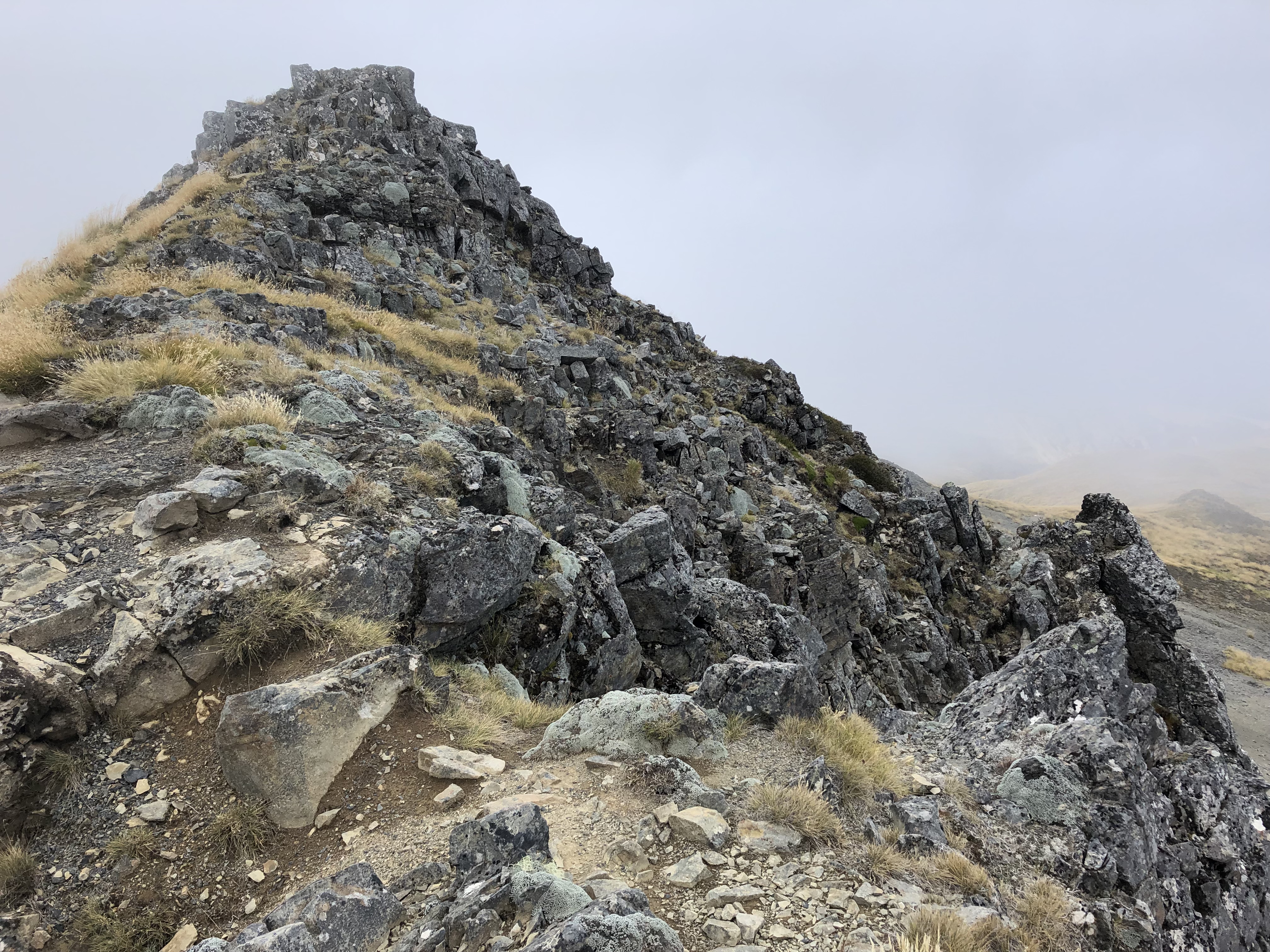
The official DOC trail leads to the ridge crest of the St Arnaud Range but does not continue further. Luckily there is a well worn in foot path snaking across the ridge continuing south (climber’s right). I followed this for as far as I could until the cloud bank became so thick that I could barely see more than 1 meter ahead at a time.
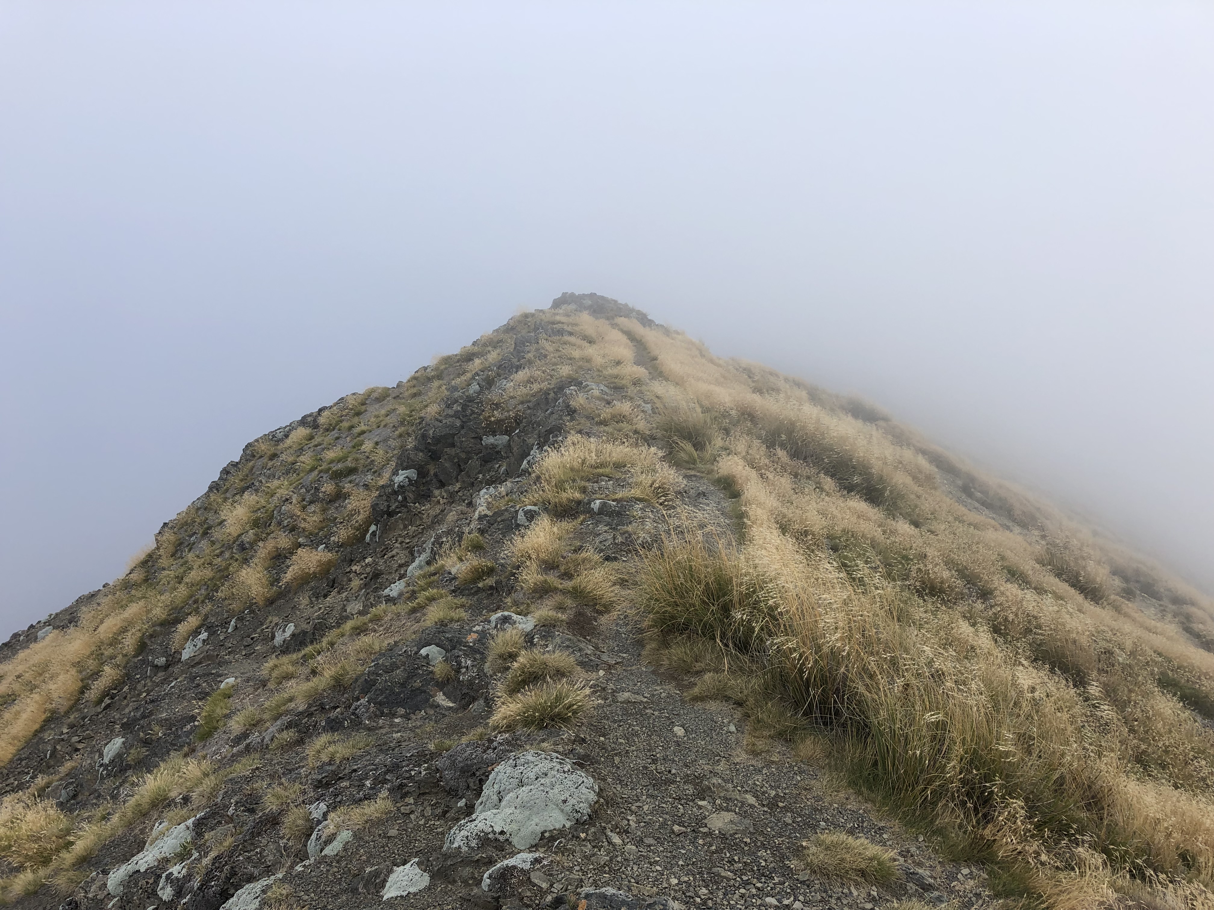
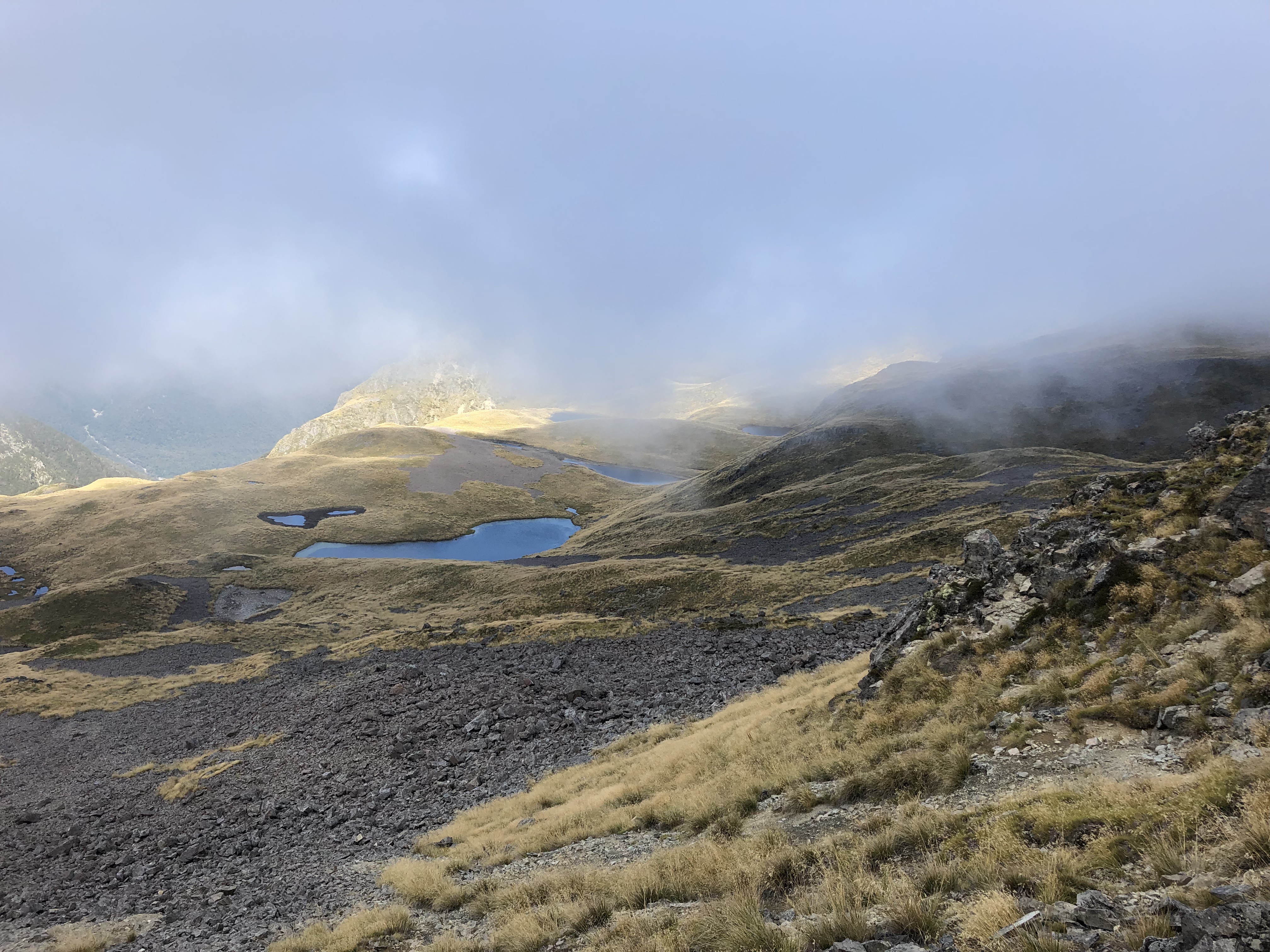
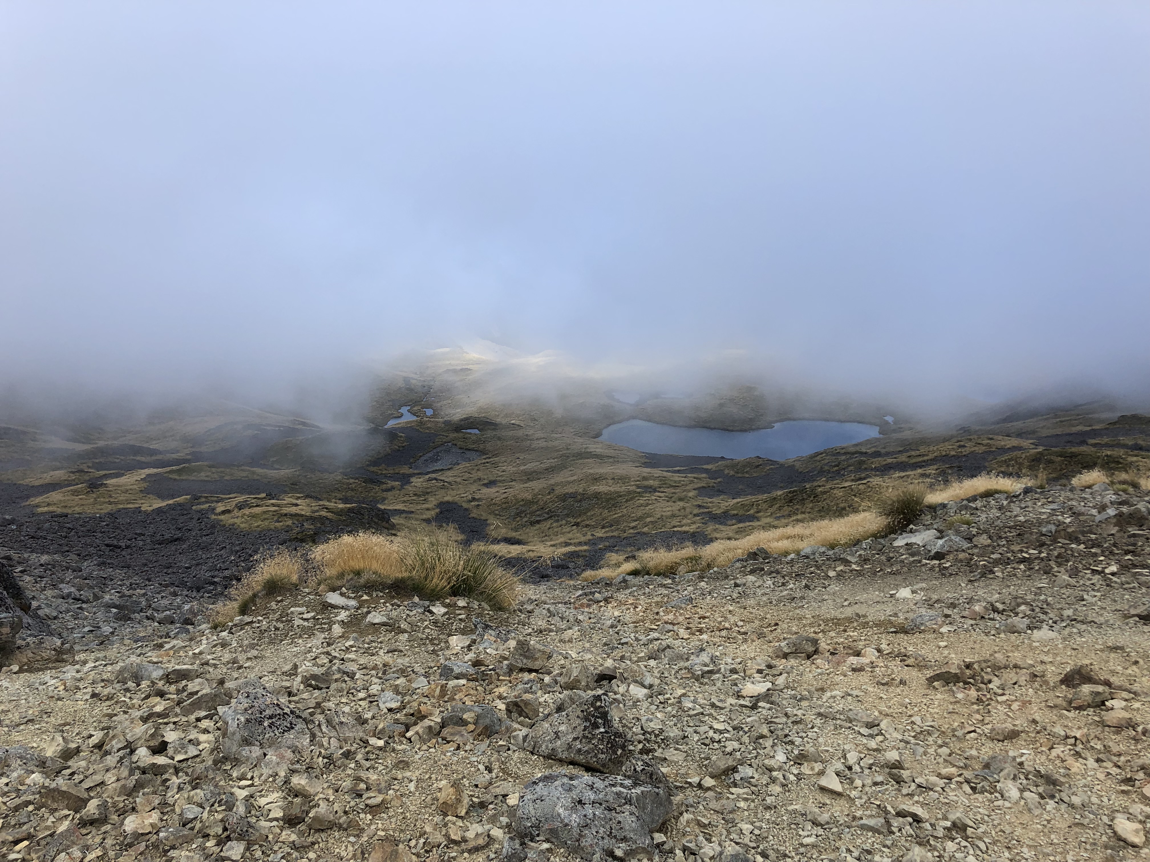
My motivation to keep continuing was two-fold. An enthusiastic American I had met earlier on the trail told me that while she was up top, the cloud bank briefly cleared enough for her to view the other side of the range (east side). She didn’t specify what exactly the view contained but assured me that it was worth going up “all the way” just in case the cloud bank lifted. I’m glad I did because the clouds eventually lifted just enough to catch a glimpse of the bright blue tarns positioned under the eastern lip of the ridge crest
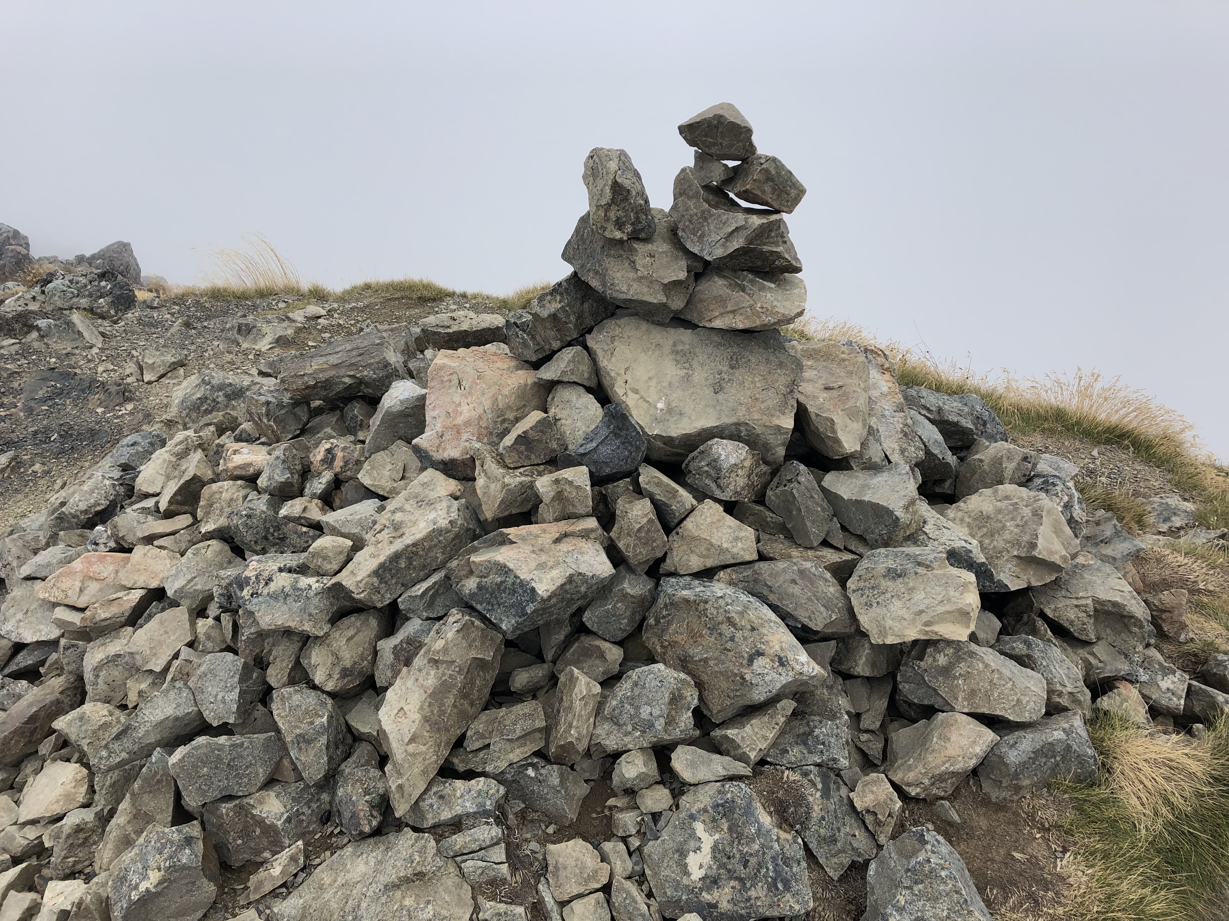
Secondly, I continued because why not? I had 5.5 hours to kill, and had blasted up with nearly 45 minutes to spare. Figured it’d be worth continuing. Little did I know it at the time, but I actually reached the designated high point of 1787m. Also unknown to me at the time was that I had gained over 1100m doing so.
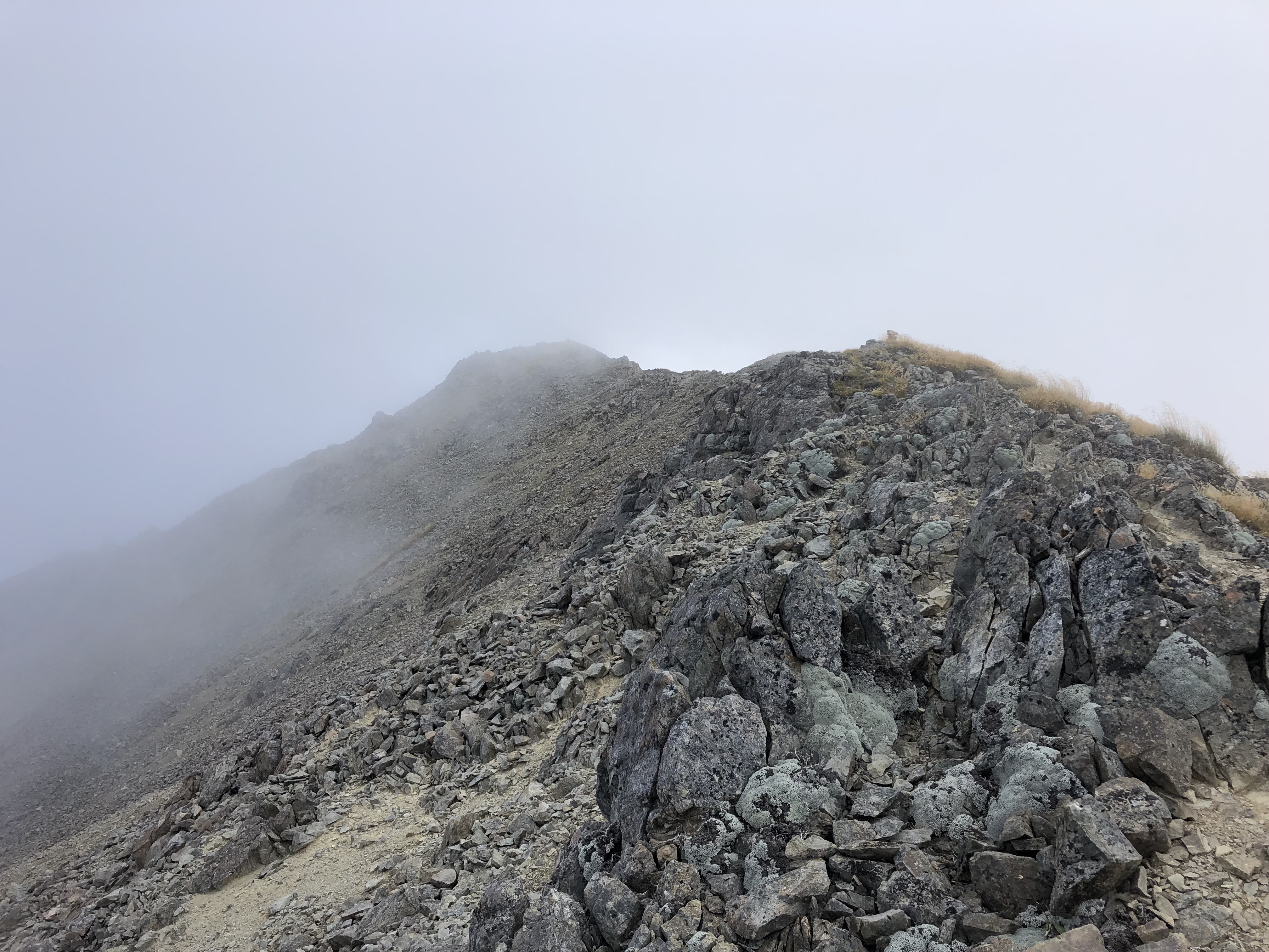
At 1787m I had reached a point in the cloud bank where I could barely see a meter in front of me. Presumably the foot path continued but I was not about to risk continuing down boulder slabs with no visual reference. Plus I had now reached my turn around time so that was enough for one day. Also worth noting was a nearly 15C temperature difference being in the clouds versus the sunny afternoon below… it was chilly up there!
While the clouds never truly lifted while up top, towards the lower slump in the ridge the visibility did improve enough to reveal both more tarns and larger sections of the range. All in all a pleasant afternoon trek with some easy scrambling up top. Probably that much better in clear conditions too!