September 1st, 2022. Yoho National Park.
Round Trip: 7-8 hours, Elevation Gain: 1280m
Easy Scramble with one brief Moderate section
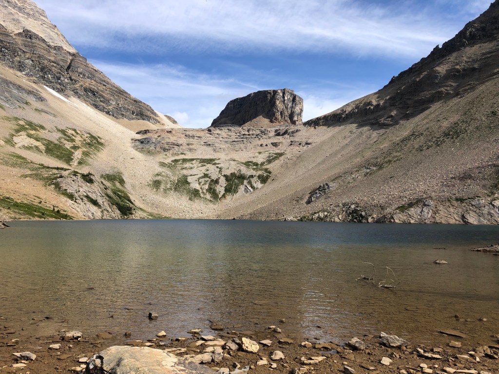
Top Hat Peak, or simply Top Hat, is an unofficial name for the small flat-topped peak at 2580m that sits directly behind Hamilton Lake. It is dwarfed by Mount Carnarvon on to the west, and its summit is only marginally higher than its eastern neighbour Emerald Peak. This was the last peak for me to complete around Hamilton Lake, having previously scrambled Emerald Peak in 2018, and Mount Carnarvon in 2021.While this route is mostly a hike with easy scrambling, you do travel under some steep rock fall zones under Carnarvon and we wore helmets as a precaution.
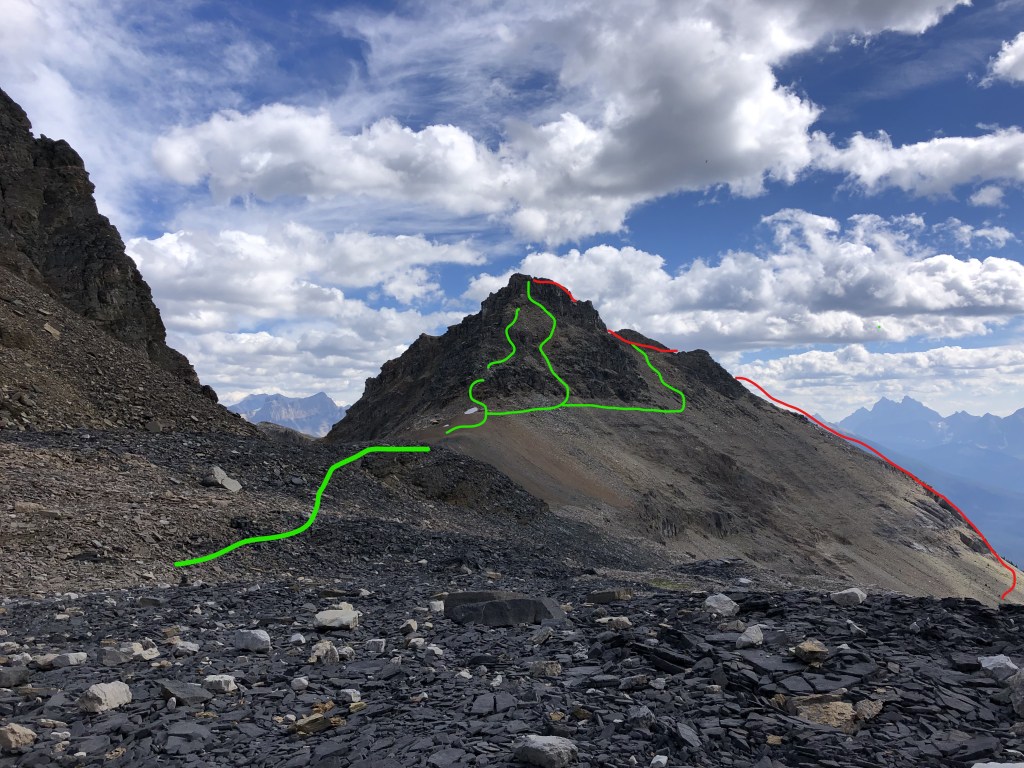
Top Hat Peak has been on my list since 2015, when I had hiked up with a group from work to the high pass situated between Mount Carnarvon and Top Hat Peak. That day our group was content with having reached the pass and we were not interested in any further venturing, unaware that the scramble up to Top Hat’s summit was merely 10 minutes away. At some point since that hike, I had read online about the scramble being brief but difficult, and otherwise assumed the route based on a few photos I took in 2015, which proved to be the correct way up. It is a brief moderate scramble up a tight steep gully, and after briefly circumnavigating the ledges it was very apparent to be the safest most direct way up.
The route is quite straightforward. You begin from the Emerald Lake parking lot and follow the well marked trails past Hamilton Falls continuing up to Hamilton Lake, as you would for Mt Carnarvon. There is no sugar coating here, the switch backs up Hamilton Lake are a grind and will get the blood pumping. This venture being my fourth time up to Hamilton Lake, I can confidently say to most readers that one should anticipate two hours to reach Hamilton Lake. Fitter parties might be able to shave this down to ninety minutes.
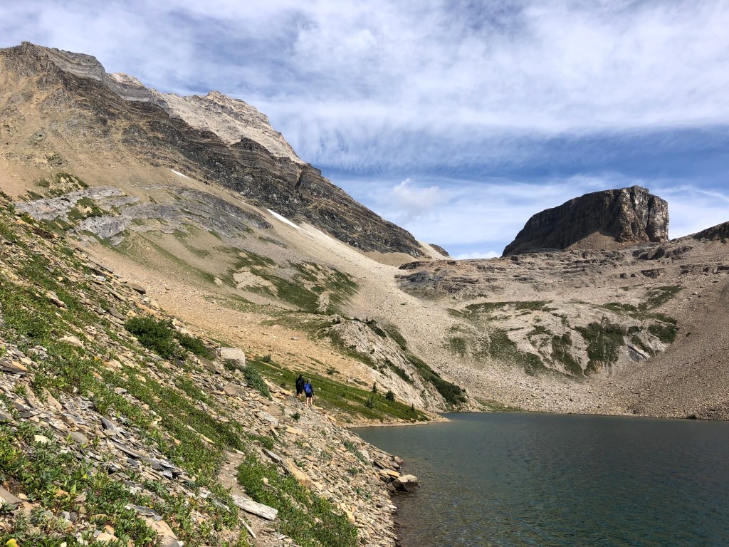
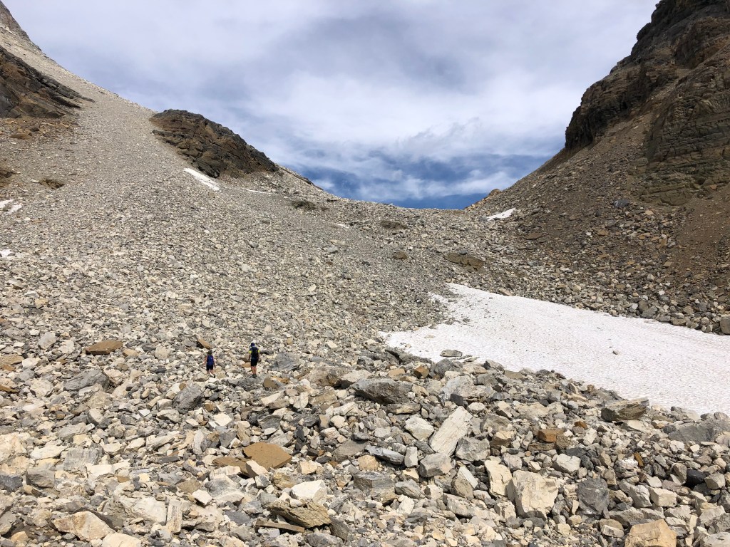
From Hamilton Lake, cross the outflow creek (looker’s left) towards Mount Carnarvon and there is a well worn in foot path that follows northwards along the lake’s western shore. It is narrow in spots but otherwise easy to follow. Continue along until past the lake, eventually the trail branches out and fades off into talus slopes. Continue north traversing across the slope, initially aiming for the high left side of the ledges as to align yourself with the high pass saddle that sits between Carnarvon and Top Hat. Minimal route finding required as you work your way up to the pass. Alternatively you can tackle the ledges earlier on, directly above the back (north) side of the lake for more of a scramble, this area being quite easy to route find through.
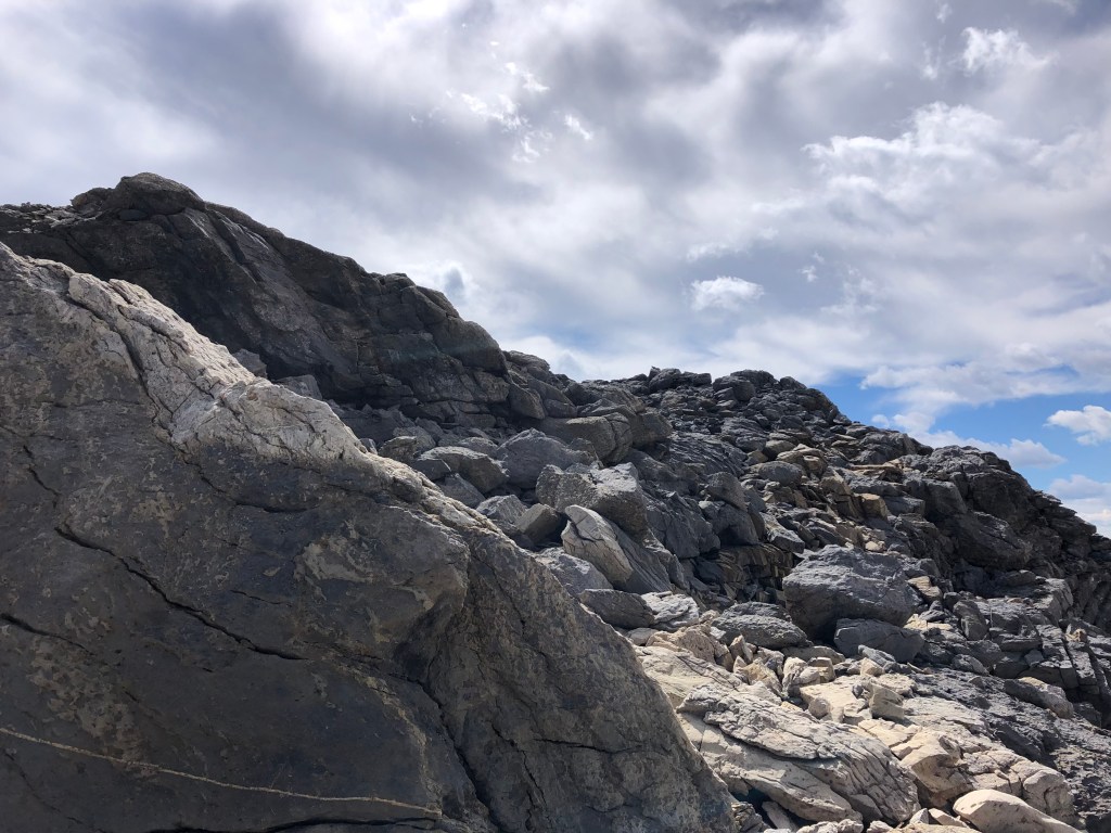
If sticking to the slope under Carnarvon you’ll eventually need to tackle some of the ledges head-on as to realign yourself with the saddle between Carnarvon and Top Hat. It is mostly a hike through these parts with occasional easy hands-on scrambling. For the saddle itself, aim for the looker’s top right as this will lead you to the ascent gully for Top Hat’s summit.
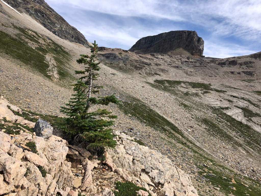

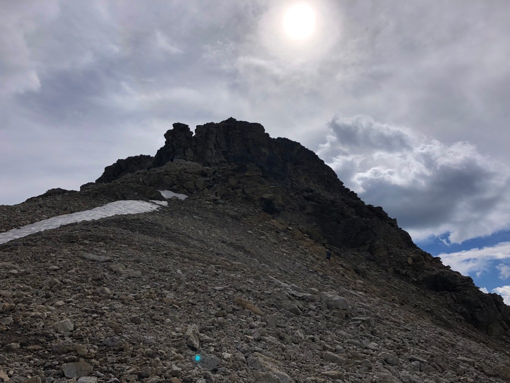
It took us 90 minutes from the creek crossing at Hamilton Lake to reach the high pass and crux of the scramble. While the scrambling is easy, the towering ledges from Top Hat and Carnarvon are a falling rock hazard and we opted to wear helmets for the final thirty minutes leading up to the pass. Once you’ve topped out at the pass, follow the saddle east (looker’s right) towards the rear of Top Hat.
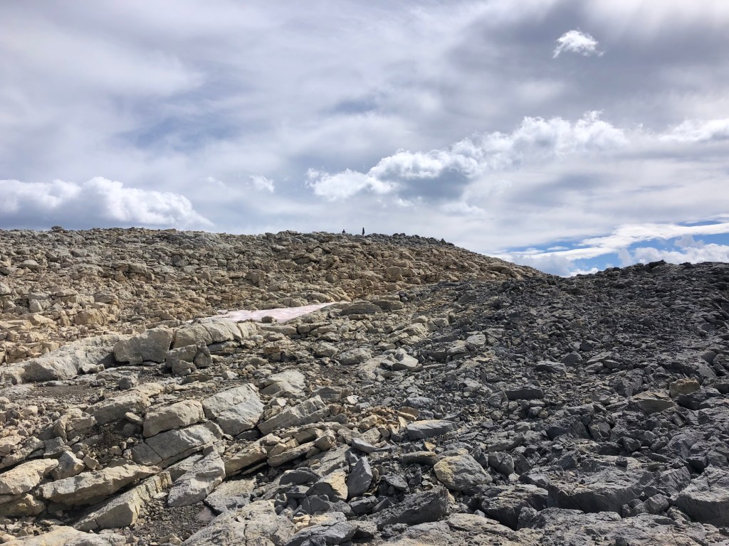
Your scrambling route through the ‘crux’ takes you up to the right of a crude blocky pillar; once close up on this feature you will see a tight and steep gully. It looks gnarly upon initial inspection; enough so that I elected to traverse some ledges on the right back towards Hamilton Lake (south) to seek an alternative. After 10 minutes or so I decided the first gully was correct and the rest of my party had already ascended here with no problems.
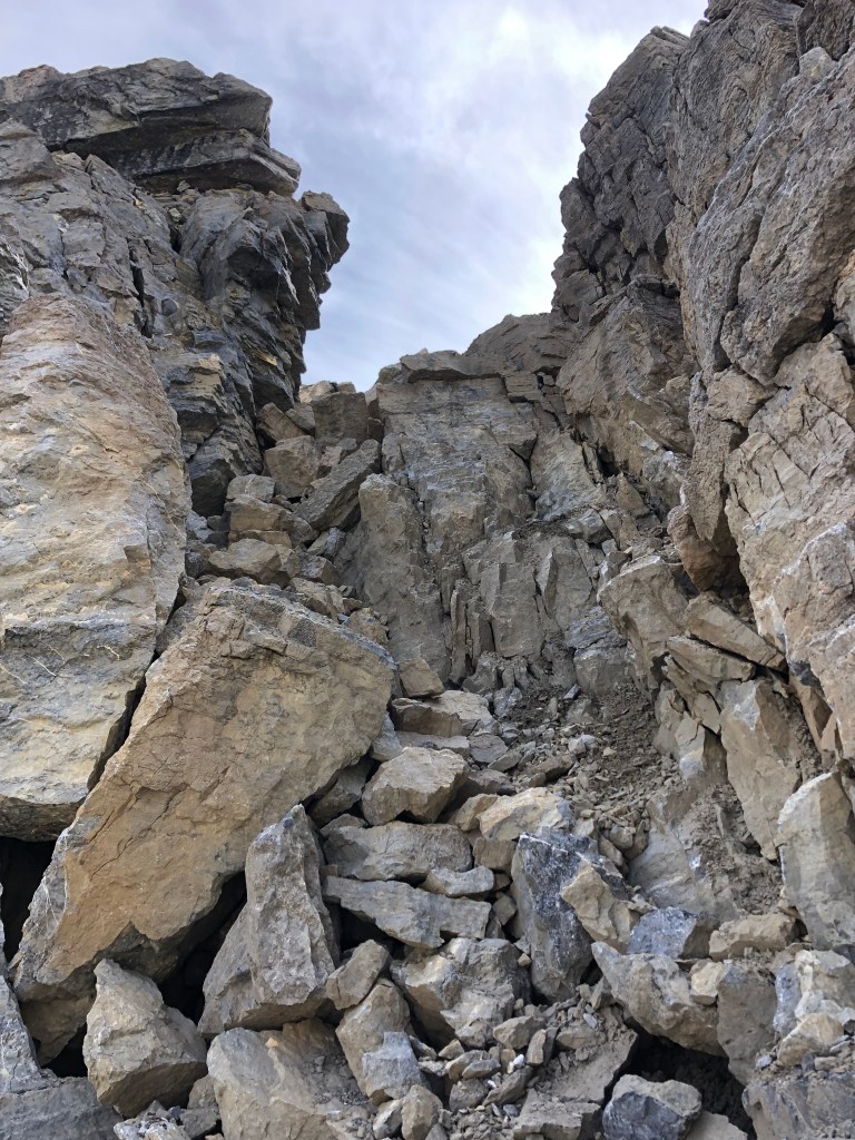
While the rock in the crux gully appeared loose, there are plenty of holds and the space quite protected. It somewhat reminded me of the crux on Eiffel Peak near Moraine Lake but this was much briefer only taking five minutes to navigate through. Once above the ‘crux’ it is an easy scramble onto progressively flatter terrain, the summit being a mere bump on an otherwise plateau of shattered rock debris.
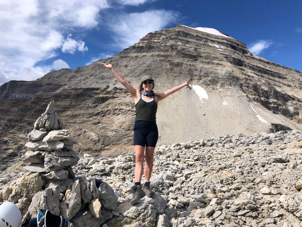
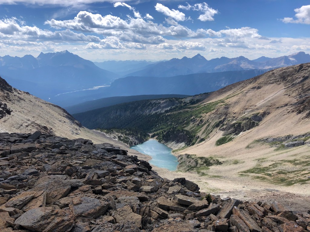
We spent a fair bit of time exploring the summit plateau, and venturing to the southern edge to get a view of Hamilton Lake. From there we also viewed a potential ascent route up Emerald Peak however it looked steeper and would involve more scree bashing compared to the route I took in 2018. To directly traverse from Top Hat’s summit would require ropes and an abseil down into the Top Hat – Emerald Col, otherwise a very scary difficult downclimb which we collectively all said no-thanks! Once under the summit block and on the Hamilton Lake side again, it looked feasible but miserable. I would say stick to the southern approach as detailed in my 2018 trip report for Emerald. Likewise for Mount Carnarvon, traversing from Top Hat looked like more of a rock climb than scramble.
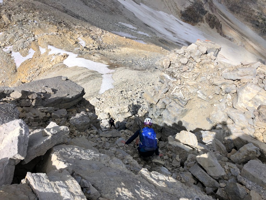
After an extensive lunch break and photo session, we returned to Hamilton Lake the same way we came, taking the down climb through the crux one at a time. It was otherwise an uneventful but scenic hike back past Hamilton Lake to the Emerald Lake carpark. The switch backs were just as relentless on the down as they were on the up. Bri has suggested that at some point with the right group, that we return to climb Carnarvon again in clearer conditions; I’m content on never doing those switch backs up to Hamilton Lake again.