June 22nd, 2021. Kootney National Park, British Columbia
Round Trip: 7.5 Hours, Elevation Gain: 1230m
Moderate Scramble
Vermillion Peak has been on my radar for a few years, and this past June I teamed up with Jules and Tash for this outing. We mostly stuck to Kane’s description from the 3rd edition of Scrambles (2016) for this route, other than a false start and minor detour on the journey down. The summit ridge offers moderate scrambling on solid rock (by rockies standards) with a fair bit of exposure – almost teetering into difficult category. The main ascent however is little more than a steep slog up a hard packed avi path, and would likely be more pleasant as a winter snow ascent.
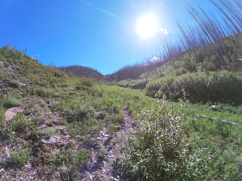
We wasted around 20 minutes following what we thought was a faint trail marked by blue flagging approximately 100m south of the No Stopping Avalanche Sign, the sign itself was the 3.8km mark from Marble Canyon mentioned in Kane’s Scrambles (2016) guide. At first there were faint signs of a footpath but within a few minutes this turned into a thick bush thrash effort, the path of least resistance venturing too far east away from the correct ascent path.
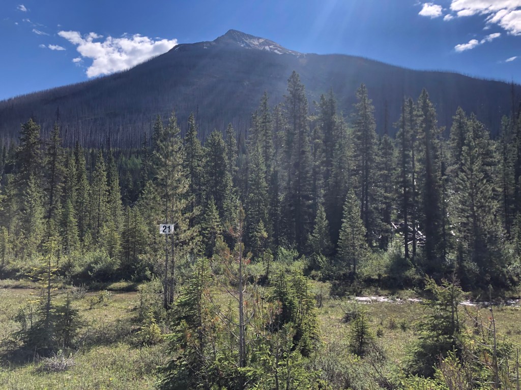
At 10:20am we returned to the car and walked north along the highway and eventually found a weakness in the trees underneath the avalanche path described in the Scrambles guide. A numbered 21 sign more or less marks the access point, avoid the puddle as best you can. It took a hundred metres of rough bush whacking across, over and under old deadfall before reaching the old highway, from here there was an overgrown but distinct footpath marked with cairns and flagging. We initially missed this first cairn and only noticed it shortly after discovering the worn in foot path.
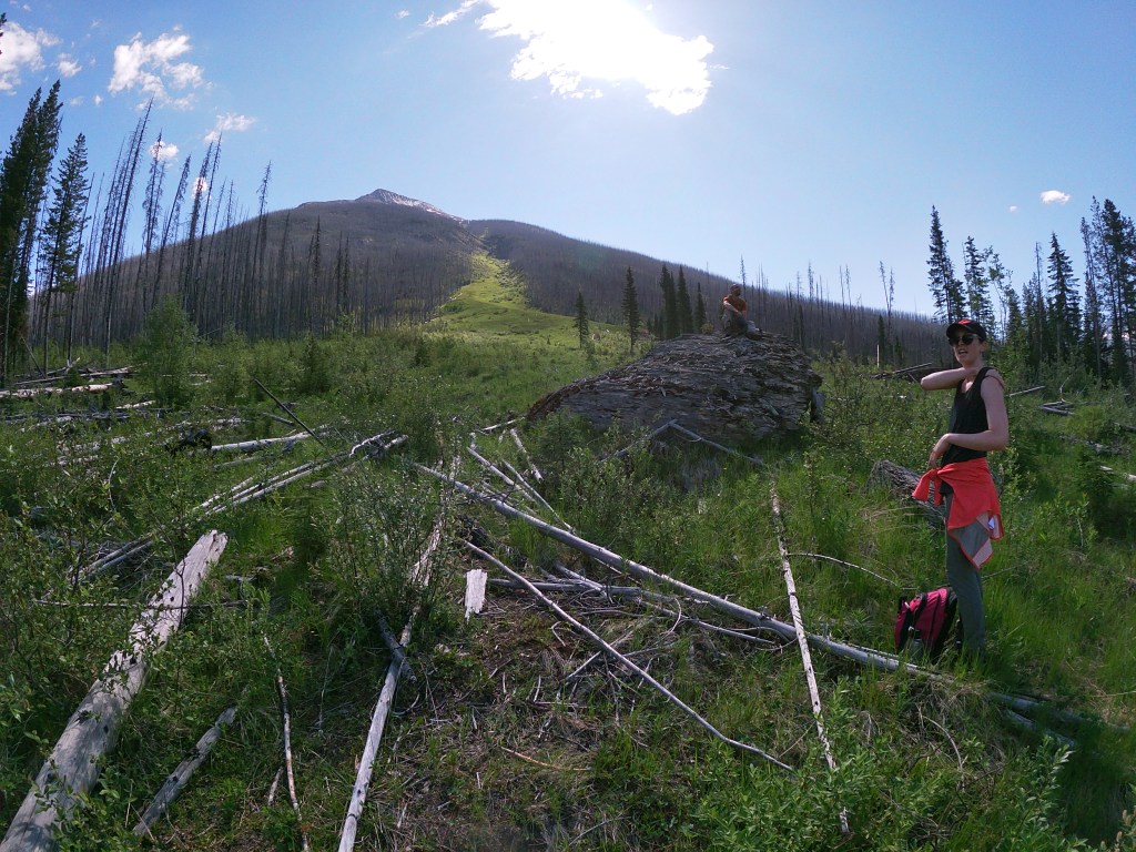
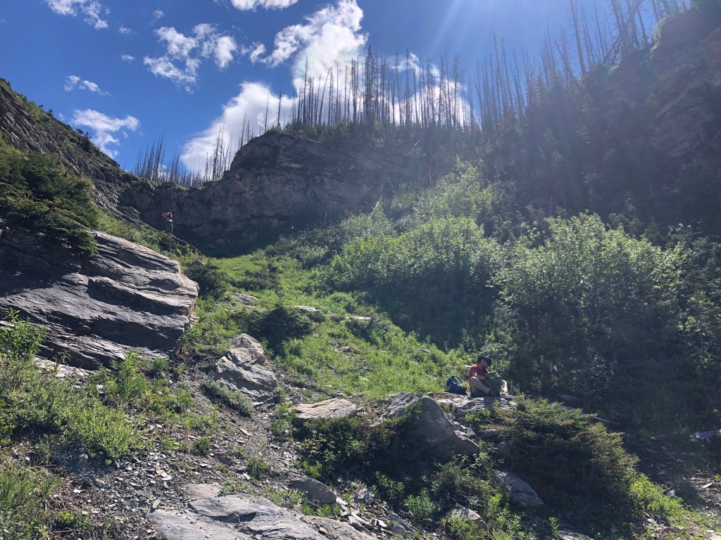
Conditions were clear and hot, no wind whatsoever until above the first rock band – this band offers easy scrambling over slabby down slopped shale. The avi path had numerous signs of past and recent grizzly activity so we made sure to hoot, holler and maintain loud conversation throughout the slog up. Other than the two rock bands, the latter not far above the first, the ascent was mostly a steep hike until reaching the shoulder of the summit ridge. Some minor route finding was required periodically through the rock bands.
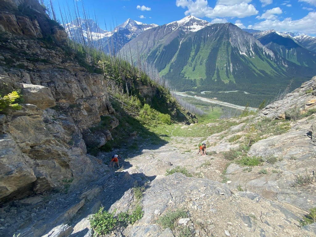
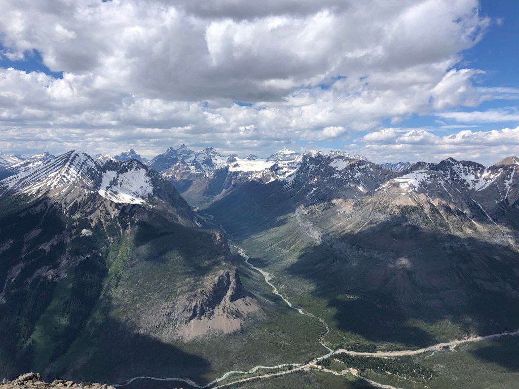
Not far above the latter rock band, the gully opens up and becomes increasingly steeper, with the shaley scree being very hard packed making for poor footing. Above treeline we misjudged the photo from the Scrambles guide and went too high on our cross over to the right (east) shoulder and ridge line – in doing so we missed a few cairns that would have made this area easier to navigate. We traversed a snowing section and a slight rock band in order to gain the ridge crest, with some minor route finding we never encountered anything more than easy scrambling at this point. For those wanting to traverse over to Mt Hauffner, this is where you would drop down into the saddle and continue east. It looked like more effort than it was worth, so we opted to stick with Vermillion that day.
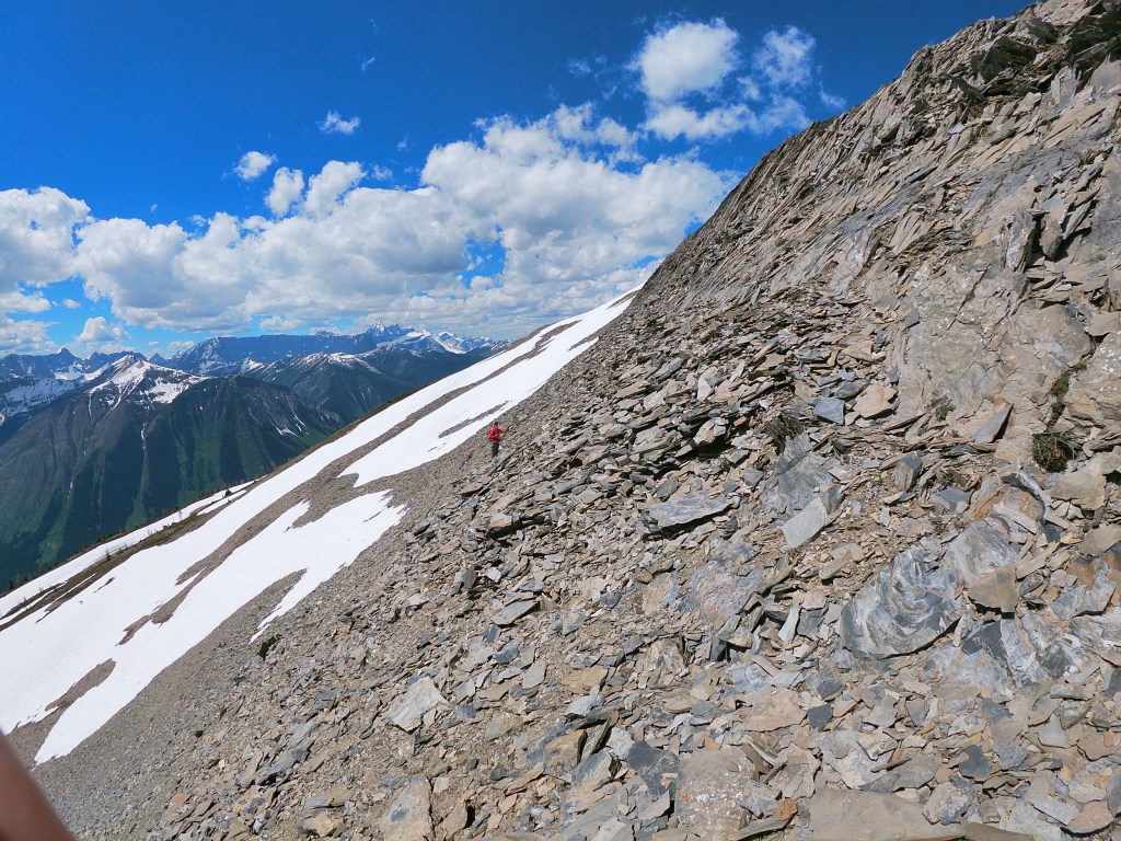
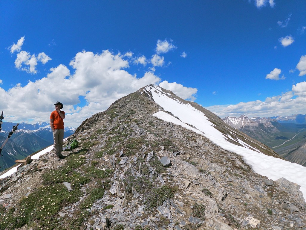
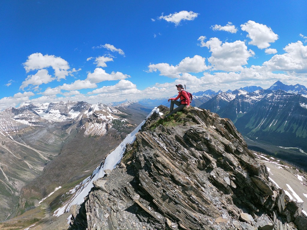
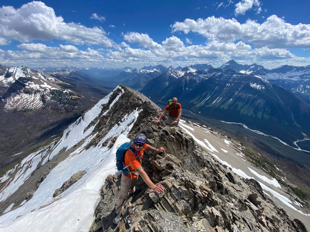
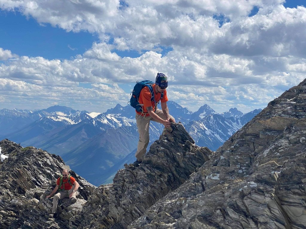
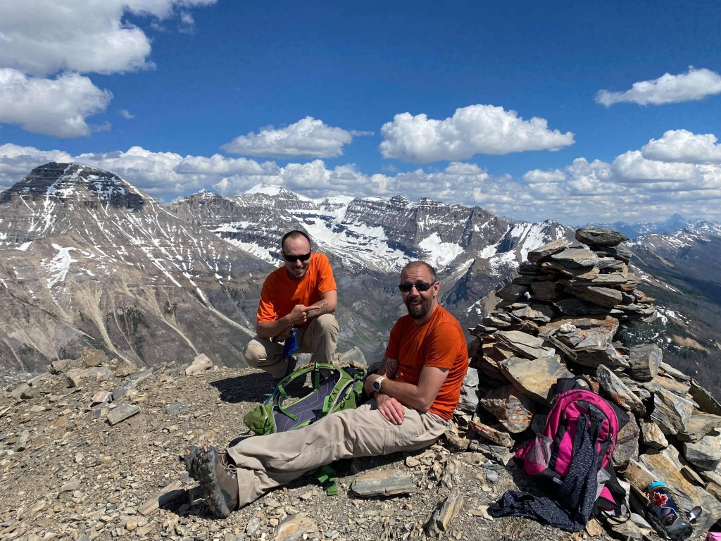
The summit ridge is straight forward and while rated “moderate” it is very exposed, comparable to the ridgelines on Lady MacDonald and Mt Daly, and in my opinion an almost “difficult” scramble. The ridge crest is knife edgy in small sections but offers ample hand and foot holds on mostly solid rock, for most of the shuffle over it was hand rail style scrambling with lots of side steps. On one or two spicy occasions we had to crab walk and shuffle over from east to west in order to maximize the available holds. Took Jules and I a fair bit of coaching from Tash to push through the final 40m of the ridgeline, the exposure being a bit daunting for such an early season scramble.
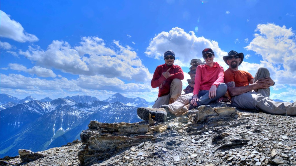
The summit was breezy but hot, and my hydration bladder had sprung a leak early on, I was relying on Tash’s water for the summit push and return journey. Lucky I came prepared with an additional 2L of water in the cooler left in the car for when we finally returned at 6:45pm. On the way down we followed a set of cairns which took us down a slightly narrower gully immediately east of the main ascent path. The footing was mildly better than the main avi path but did not help in shaving any time off the return journey – eventually it links back into the main Avi path (or rather, is close by enough to easily link back to). As for the bush whack leading back to the highway, there are no real hacks to it, and this really did prove to be a sting in the tail to an already tiring day. Eventually we did return to the car, the round trip taking around 7.5 hours.