November 6th-7th, 2025. Antigua, Guatemala
Round Trip: 24 hours (2 days 1 night), Elevation Gain: +1500m
Mostly Hiking
This was a major highlight from Bri and I’s honeymoon last November, and currently my highest peak! The two-day adventure can be broken down into three segments: the initial hike up to basecamp (3540m), the optional side-quest to the Fuego viewpoint, and thirdly the sunrise ascent of Acatenango itself. This trip was quite different from Bri and I’s usual stride in that it was guided (mandatory for access) and being an iconic tourist destination, it was crazy busy! We knew it was going to be busy, as its the go-to adventure in Guatemala, but I think we underestimated just how busy things get. Perhaps surprisingly, the sunrise from Acatenango’s summit was the only leg of the adventure that didn’t feel crowded.
A quick word on the trip’s stats. Directly from trailhead to summit is around 1530m, so I have listed the elevation gain as +1500m for this trip report. If including our side-quest trek to and from Fuego’s viewpoint, our elevation gain for the whole trip is closer to +2100m having loss/regained 300m each way. The trail to basecamp and to Acatenango’s summit is simply a hiking trail, no scrambling along the way. The Fuego viewpoint hike, while not really a scramble, is a fair bit more rugged and more committing. We saw all shapes, sizes and ages complete this trek, and I would recommend at least having a reasonable level of cardio fitness to help with adjusting to the altitude.
It’s worth noting how incredibly lucky we were to have mostly clear conditions on the trip. We met several others in Antigua who had zero visibility at basecamp in the days prior to our visit, and there were intense thunderstorms forecasted for our dates. Also worth noting that we were part of a relatively fit group overall – though very few ventured past basecamp. It’s mandatory to go guided in order to visit the area, we went with a company called Lava Trails and I would highly recommend them.
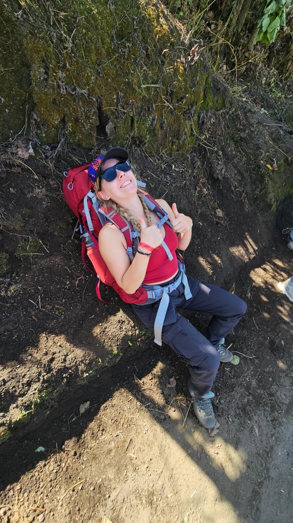
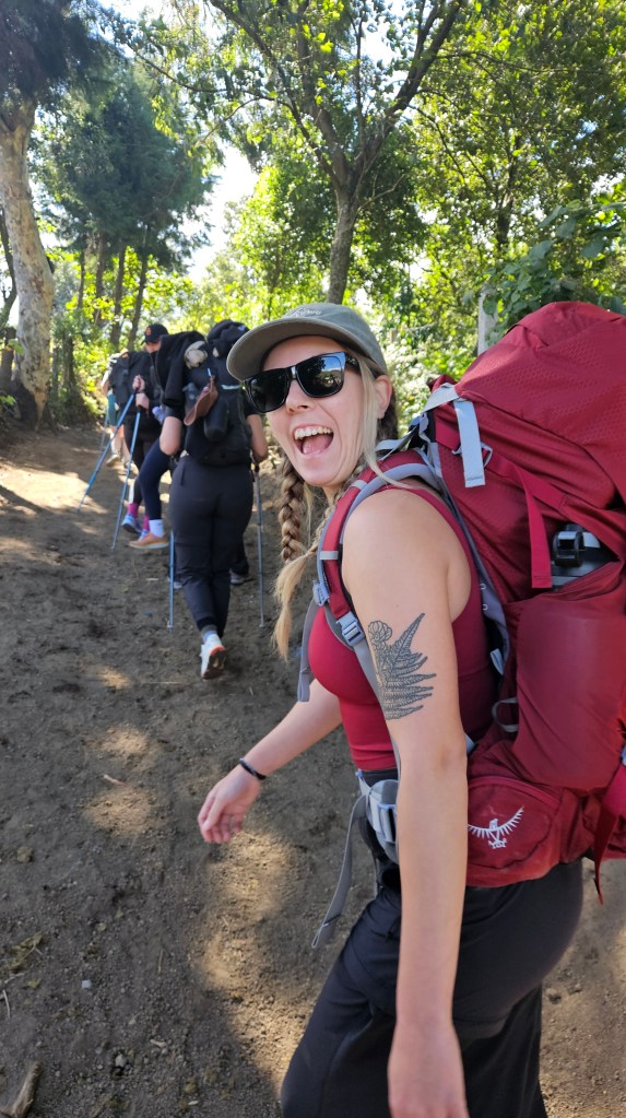
We had a very early start out of Antigua the morning of November 6th, the morning consisting of various meeting points and the logistics of getting to the trailhead. Being a guided tour, we didn’t have to carry any sleeping gear (yay) and only had to carry 1 of the 3 provided meals, so all things considered our overnight packs were relatively light. We did have to carry around 3L or so of water but thats pretty normal for our adventures. Most gear was available for rent, and in hindsight trekking poles would have been ideal, Bri and I managed without. Arriving at the trailhead was a mild shock; the number of shuttles/buses gave us Lake Louise vibes.
Once everyone was gathered at the trailhead, shoes tied and packs adjusted, we begun hiking at 10:20am. To my surprise the trailhead is already at 2440m so we were only faced with a modest elevation gain to reach the basecamp at 3540m. Being guided, we too regular and often prolonged breaks every 15-20 minutes or so. This of course was to ensure everyone could keep up, though at the earlier points in the day it felt redundant. At first it was hard to warm up the legs properly with all the frequent stops, eventually the trail’s gradient steepened enough that we were all warmed up plenty! The lower sections are pretty unmemorable other than the initial entry section following up a wide lahar formed channel. Also – if one wants to do this trek hammered, there are plenty of beer and snack stops along the trail.

Around 12:45pm we reached a large clearing at around 3150m and it was here that most ascending groups took their lunch break. While we had hiked as a steady stream of visitor foot traffic along the trail, this lunch stop was the first moment in the day where things felt truly crowded. There were also numerous stray dogs along the trail with many of them joining us for lunch, though most were friendly just wanting head scratches. A steady breeze picked up and blew misty clouds blew through the surrounding trees – the term cloud forest living up to its name as we ate lunch. We were all pretty stoked at this point, the guides had reassured us that the clouds were part of an inversion and that it was likely clear further up. Some of the group members in our group were slowly losing energy with most of them visiting from near sea-level, but nonetheless morale was still high.
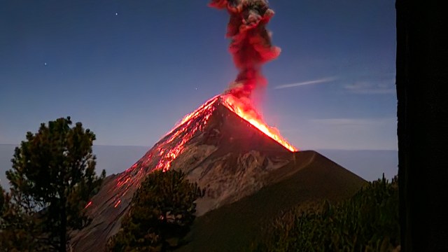
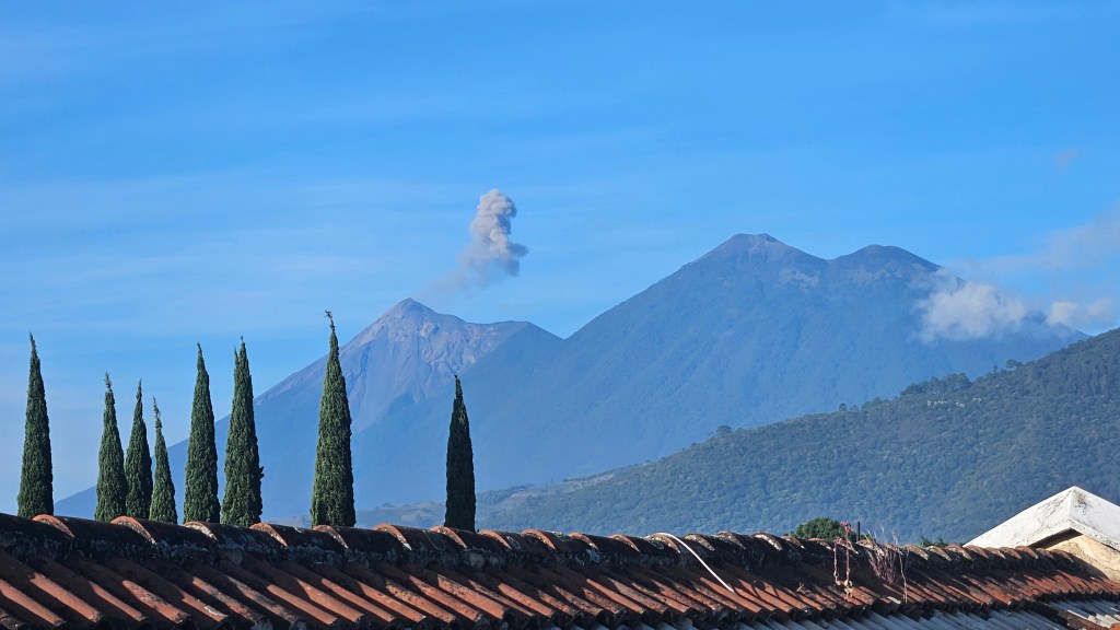
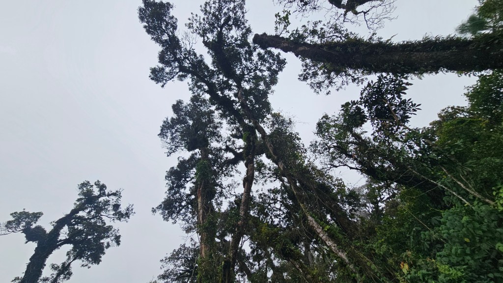
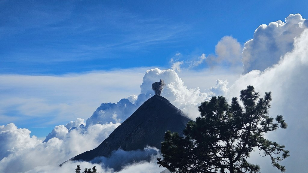
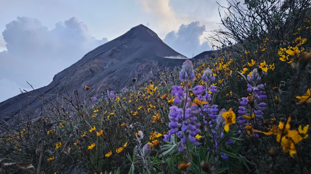
Another hour or so along the trail and we could hear the first few rumblings of the active Volcan de Fuego. According to an interpretive sign, the cloud forest ends at roughly 3200m and from there you are now in Alpine Forest. Coming from the Canadian Rockies where treeline generally ends by 2600m, Bri and I were fascinated that there was still so many trees this high up! Around 3:30pm at roughly 3500m we could finally see a break in the clouds and caught our first glimpse of the ash plume eruptions out of Fuego. We were all very excited and giddy to see (and hear) this so took a prolonged photo break while the remainder of the group caught up. From there it was only another twenty minutes to basecamp, a mecca of hut style cabins and tent sites. Our tour company owned a couple alpine styled huts (10 bunks per hut) with large panel windows so you can literally watch the volcano from bed. Decent!
Bri and I along with several others in the group paid the extra fee to hike to the Fuego viewpoint that evening for an up close view of the eruptions. After dropping some kit off at the hut and grabbing our headlamps, we left around 5pm. The trail was a bit rougher versus the main track up to basecamp, with lots of volcanic scree. The route led down a natural saddle between the two volcanoes before climbing back up (roughly 300m loss/gain one way), the tussock and thorny flowers reminding us our past adventures in New Zealand.
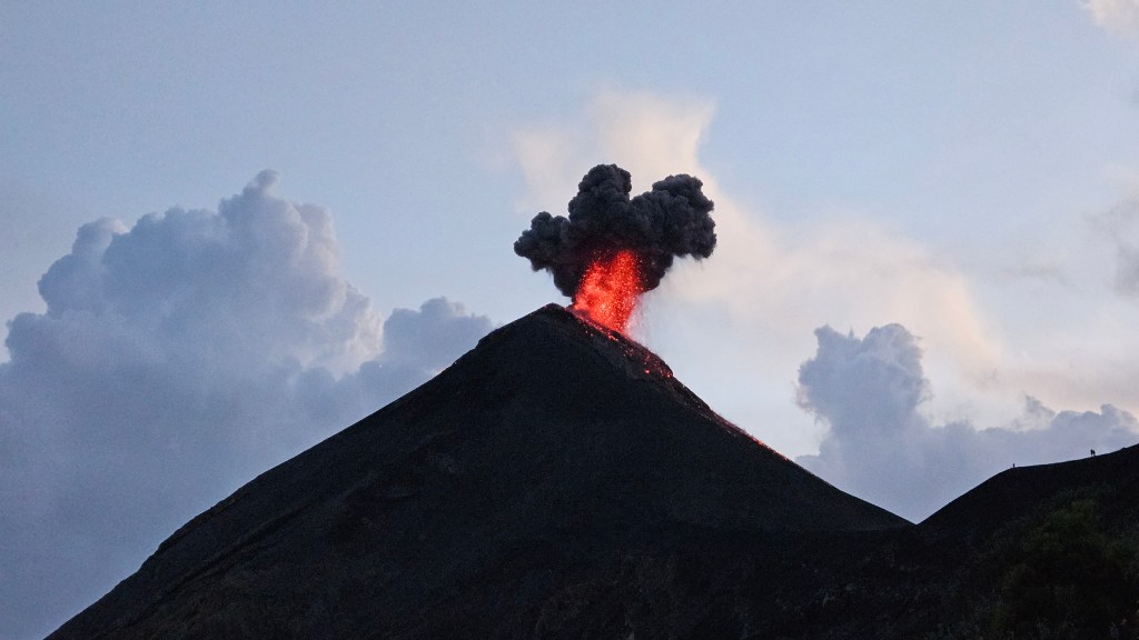
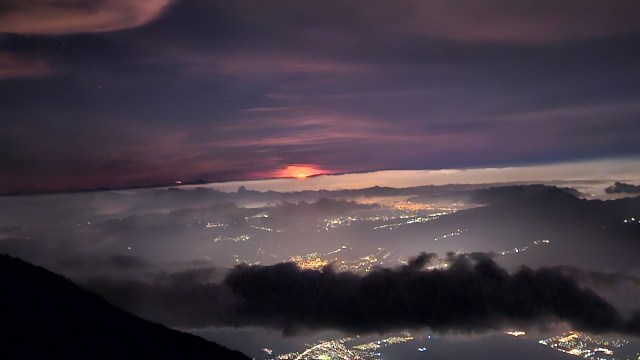
We truly lucked out. Storms rolled in during our hike to the viewpoint and it was hard to tell the difference between the rumbles of thunder versus the volcano. The weather however, skirted to to our west fully avoiding the volcano and lingered, offering a brilliant display of lightening. As the storm ramped up, the sky darkened enough that we could see the glow of Fuego’s eruptions. Our group stuck around for nearly an hour past sunset, with each eruption seemingly more colourful then the last. A third phenomena occurred when it was time to turn around for the hike back to basecamp. Behind Volcan Agua and beyond the city lights of Guatemala City, a brilliant orange light was emerging from the skyline and it ended up being a blood-orange moonrise! It was amazing to witness all three things within the same hour.

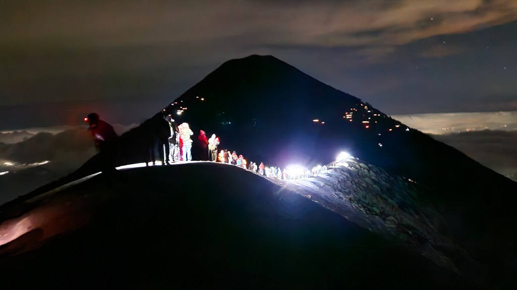
However there was one other thing in our view and it was the continuous line of headlamps back to basecamp. Of course its hard to complain about over-tourism given that we ourselves were there as tourists, but this was the living breathing definition of it and it marred the experience of the return hike. It took us over two hours to return to basecamp due to the high volume of hikers slowly plodding their way along. It felt like being in city rush hour traffic and it was impossible to overtake anyone given how congested the trail was. We didn’t return to basecamp till nearly 9pm and everyone was pretty exhausted by then, with some in the group being quite vocal about it. Luckily for Bri and I, not everyone was miffed and those still on the stoke-high sat with us to continue watching Fuego while enjoying a hot supper.
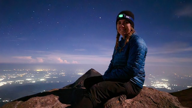
I virtually did not sleep that night. Fuego was very active, with some of the eruptions shaking the whole mountain. One eruption in particular felt similar to a magnitude 4 earthquake and physically shook the whole hut. It was a wild experience and one of the coolest things I’ve ever seen! I stayed up taking photos and video till around midnight, but would continue peering out the hut’s bedside windows every time I was woken. Not everyone shared in my enthusiasm. When the alarms went off at 3:30am to partake in the sunrise hike, only Bri and I got up, the remaining eighteen in our group opted to continue sleeping. They really did miss out on a good one, and the effort from hut to summit was arguably the easiest leg of our trip!
At first we were worried that the guides might not take us given that we were only two. Our fears briefly grew as other groups hiked past us and 4am rolled by without any sign of the guides. A few minutes later one of the guides rocked up to our porch and chuckled when he saw it was just Bri and I at the ready. We left shortly after that and being a team of three were able to power up at our usual pace. It was roughly a 400m gain from basecamp to summit, the trail meandering up through soft volcanic scree and it sure did feel like a plod. I recall feeling some effects of the altitude at around 3750m and had otherwise been unaffected till then. Thankfully our guide only made us stop once and was happy to continue at our natural pace, which led to us being the first group to summit.
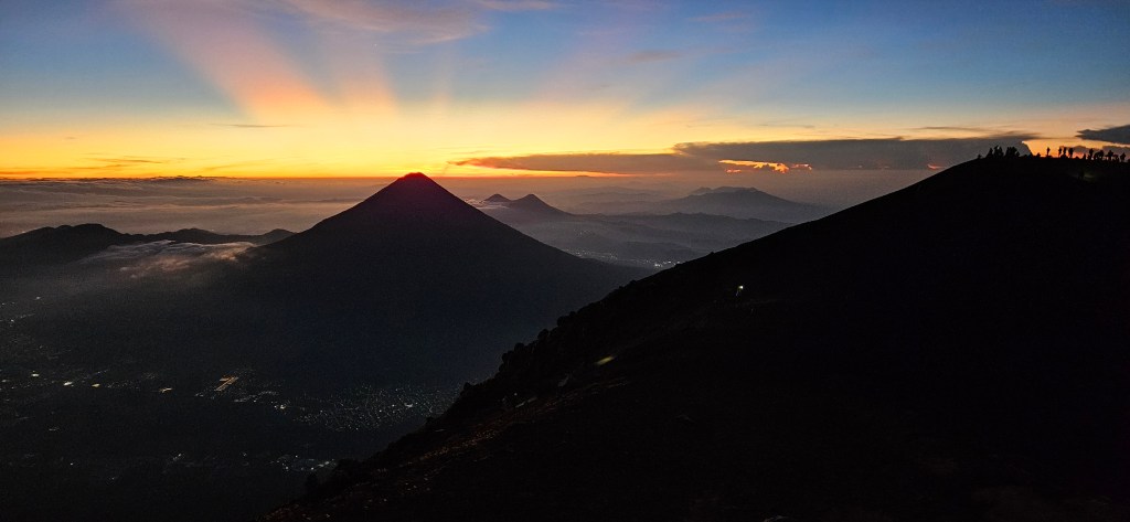
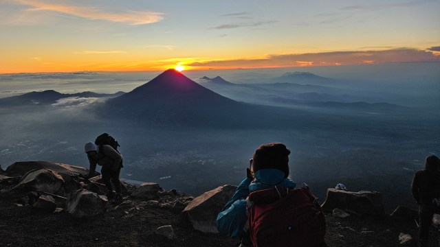
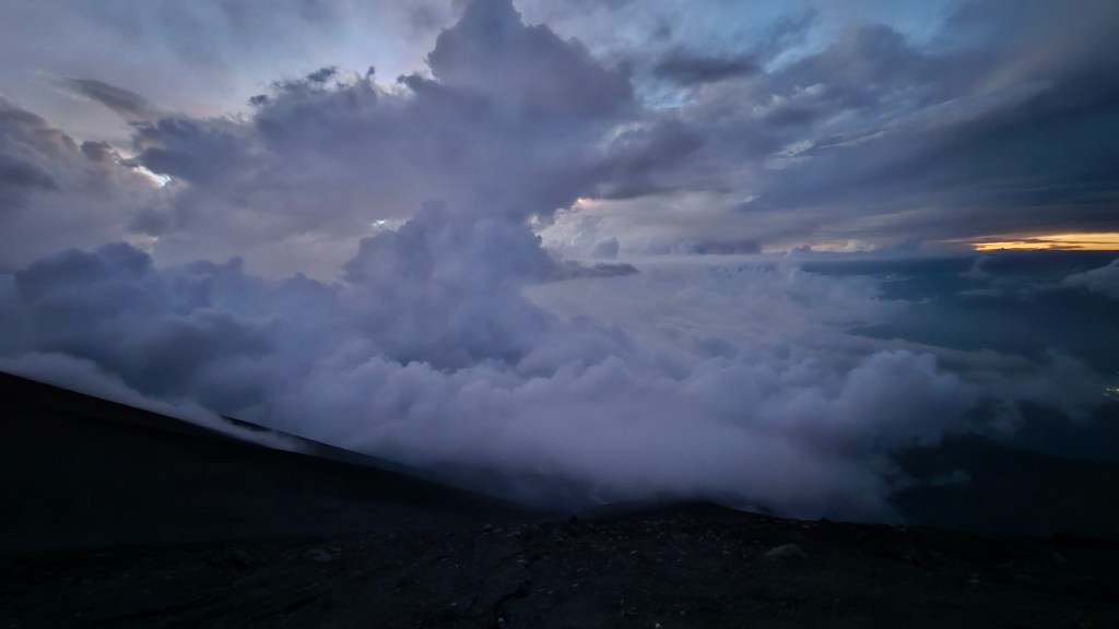
The moon was still out and we could see a sprinkling of headlamps ascending the summit rim. As warned, it was quite cold at the summit and I’m glad I brought a puffy along. Fuego was still active of course but not as vibrant in the fading darkness. Another grand summit sunrise for the books and a new height record for myself of 3976m. We stayed on the summit for nearly an hour, in which time I adjusted to the higher elevation. I briefly visited the highest point of the summit rim and snapped a few sunrise pictures from there before rejoining Bri. Compared to the crowdedness of the Fuego viewpoint, people were better spread out all along the crater rim and it was a redeeming experience in that sense. The summit was still busy but by no means crowded. After our sunrise visit we returned to the hut, had some hot oatmeal and hiked back down returning to the trailhead around 10am.
Overall, both Bri and I are super stoked that we got to experience this and would recommend the trip to others. After all, the peak itself is an easy 3900m summit and so long as you are mentally prepared for the crowds then the rest is highly enjoyable!